Circular hike: Dornbirn Haselstauden – Bödele - Fohramoos - Oberfallenberg

Hiking

© Bodensee-Vorarlberg Tourismus GmbH - Dornbirn Tourismus & Stadtmarketing GmbH

© Bodensee-Vorarlberg Tourismus GmbH - Dornbirn Tourismus & Stadtmarketing GmbH

- Difficulty
-
medium
- Rating
-
- Route
-
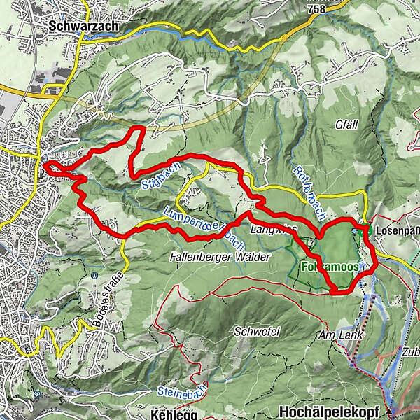
Haselstauden0.0 kmKalben1.4 kmAmmenegger Stuba3.2 kmAmmenegg3.2 kmHeilige Maria6.0 kmBerghof Fetz6.1 kmBödele6.5 kmDreiländerblick11.3 kmStüben11.5 kmDornbirn (437 m)11.8 kmHaselstauden12.9 km
- Best season
-
JanFebMarAprMayJunJulAugSepOctNovDec
- Description
-
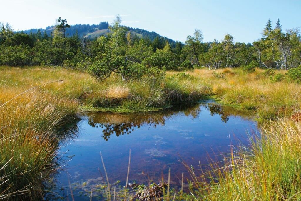
Hikers arrive via Hohlen and Fluh in Ammenegg. From there, it takes around one hour to get up to the Bödele, a pass that enters the Bregenzerwald. The hike presents beautiful views of the mountains and leads through the colony district to the Oberlosealpe (Meierei). After the Losenpass, the trail leads through the ‘Fohramoos’ nature reserve and continues via ‘Langwies’ down to Oberfallenberg. It finally returns via Stüben to Haselstauden.
- Highest point
- 1,175 m
- Endpoint
-
Haselstauden Kirche
- Height profile
-

- Safety instructions
- Public transportation
-

- Author
-
The tour Circular hike: Dornbirn Haselstauden – Bödele - Fohramoos - Oberfallenberg is used by outdooractive.com provided.
GPS Downloads


Other tours in the regions
-
St. Gallen - Bodensee
2067
-
Bodensee - Vorarlberg
1317
-
Schwarzach
460


