


- Brief description
-
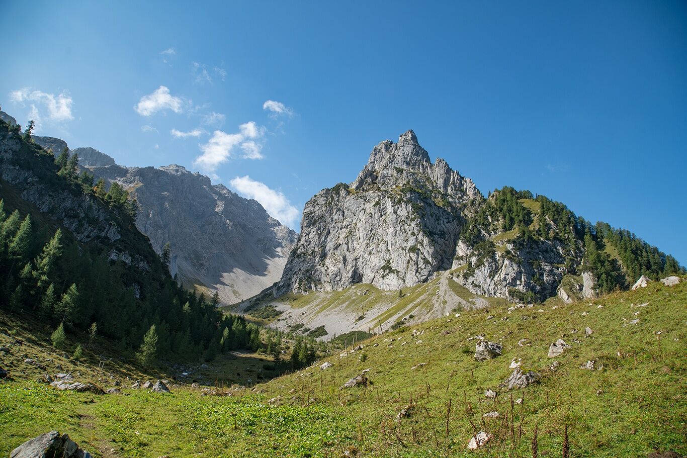
At the foot of the Zimba, the Zwölferkopf and the Gottvaterspitze lies the rustic Sarotla Hut at the end of the Sarotla Valley.
- Difficulty
-
medium
- Rating
-
- Starting point
-
Village center, Brand
- Route
-
Sarotlahütte5.5 km
- Best season
-
JanFebMarAprMayJunJulAugSepOctNovDec
- Description
-
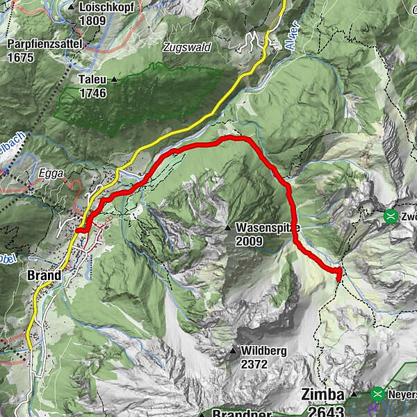
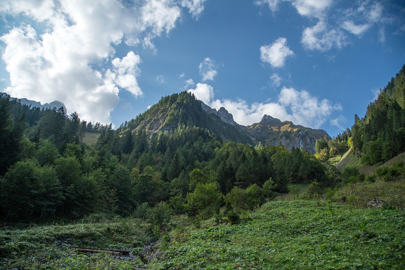
From the center of Brand, hike out of the valley along the Alvierbach trail until you reach the "Sarotla Tal - Sarotla Hütte" turnoff. The trail branches off to the right here. The well-signposted path through the Sarotla Valley climbs moderately and leads past thundering waterfalls and alpine pastures covered with mountain pines to the Sarotla Hut. After a stop for refreshments, the way back follows the same route.
- Directions
-
Village center in Brand - Alvierbachweg - turnoff to Sarotla Valley - Sarotla Valley - Sarotla Hut - same route back
- Highest point
- 1,602 m
- Endpoint
-
Village center, Brand
- Height profile
-

- Equipment
-
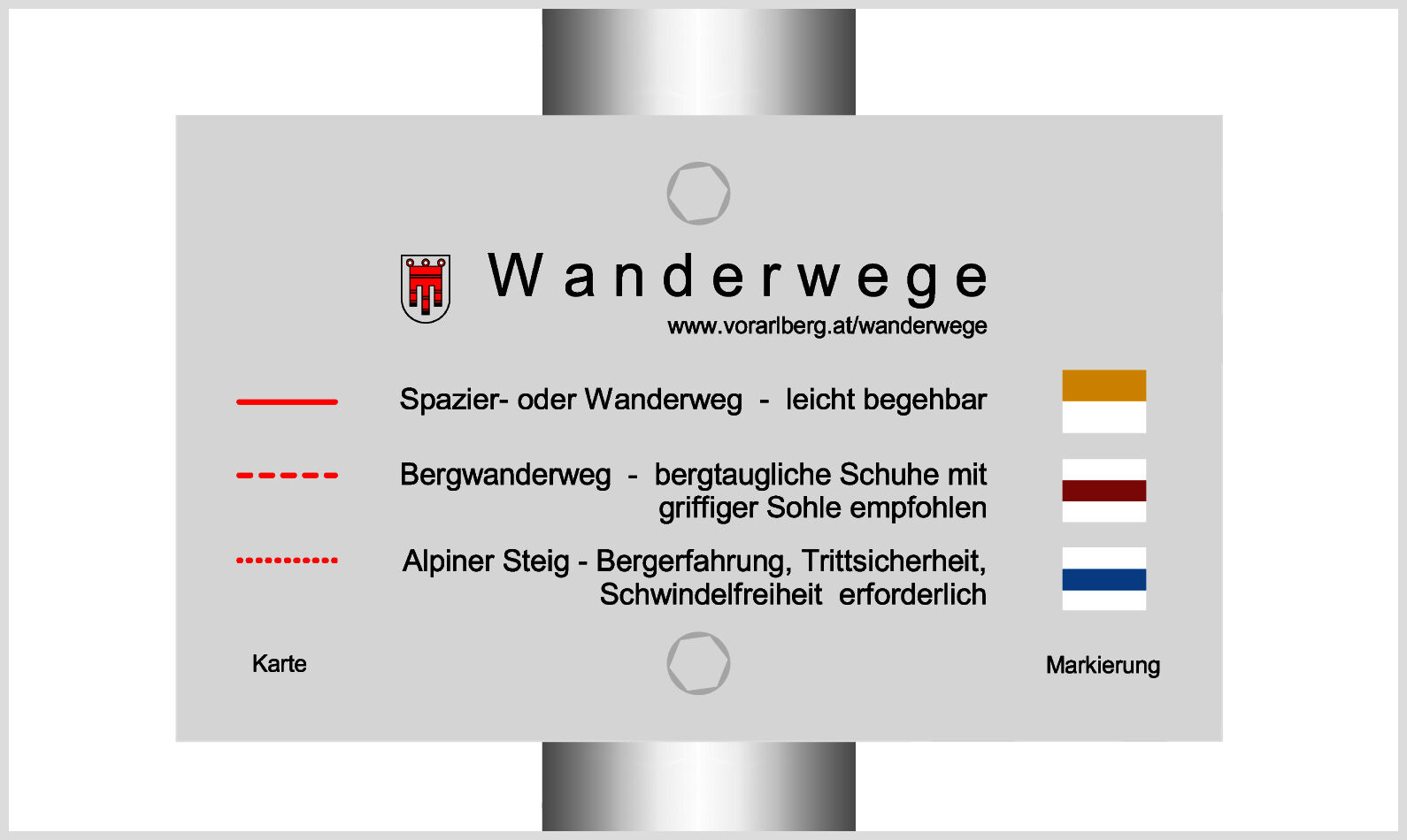
Strong footwear, warm clothing, rain and sun protection and hiking poles are recommended. Cell phone for emergencies.
- Safety instructions
- Tips
-
A stop at the Sarotla Hut is well worth it!
- Directions
-
www.maps.google.at
- Public transportation
- Parking
-
Car park at the Dorfbahn in Brand


- Author
-
The tour To the Sarotla Hut | Brand is used by outdooractive.com provided.


General info
-
Heidiland
2200
-
Brandnertal
1568
-
Brand
431


