

- Brief description
-
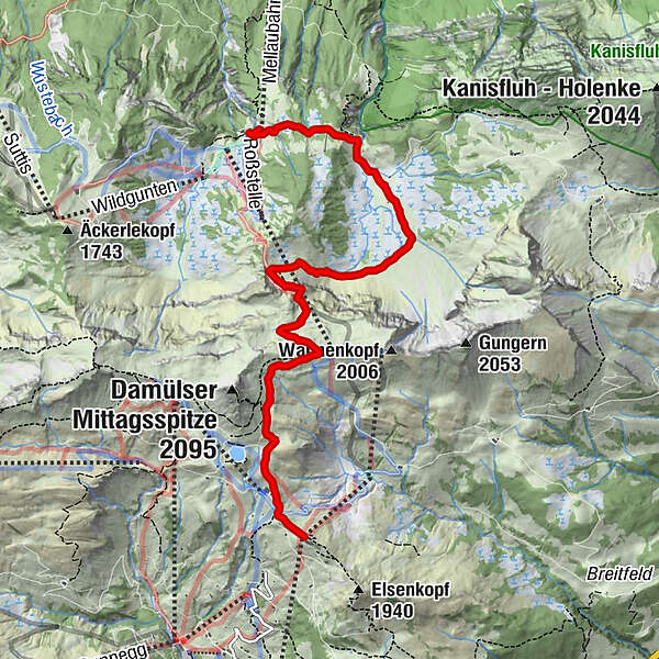
Uga-Bergstation - Uga-Alpe - Wannenalpe - Kanisalpe - Roßstellealpe
- Difficulty
-
medium
- Rating
-
- Route
-
Uga-Express0.0 kmVordere Ugaalpe0.2 kmUga Alp0.4 kmAlpe Uga0.5 kmJausenstation Kanisalpe4.9 kmAlphof Rossstelle6.5 kmRoßstelle6.5 kmBergrestaurant Simma6.5 km
- Best season
-
JanFebMarAprMayJunJulAugSepOctNovDec
- Highest point
- 1,913 m
- Endpoint
-
Mellau
- Height profile
-

- Author
-
The tour Damüls | Zur Roßstelle nach Mellau is used by outdooractive.com provided.
GPS Downloads


General info
Refreshment stop
Other tours in the regions
-
St. Gallen - Bodensee
2065
-
Biosphärenpark Großes Walsertal
2006
-
Mellau
637


