- Brief description
-
A beautiful variant of the golf round to the northeastern village border of Brand.
- Difficulty
-
medium
- Rating
-
- Starting point
-
Trailrun starting point at the Alvierbad
- Best season
-
JanFebMarAprMayJunJulAugSepOctNovDec
- Description
-
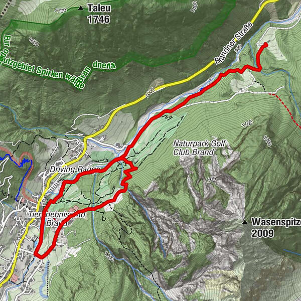
From the starting point at the Alvierbad, this trail leads past the Alvierbad and into the valley, crossing over to the other side of the river at the bridge by the Beck riding stable. From there, the trail first leads along the road and then along the green forest path out of the valley to the golf course. At the golf course, follow the path further out of the valley to Klostermaisäß - where the route ends and leads first along the same path and then along the Alvierbachweg back to the starting point.
- Directions
-
Trailrun starting point at the Alvierbad - Alvierbad - bridge - Grüner Waldweg - end of the golf course - Klostermaisäß (end/turnaround point) - golf course - Alvierbachweg - trailrun starting point at the Alvierbad
- Highest point
- 1,034 m
- Endpoint
-
Trailrun starting point at the Alvierbad
- Height profile
-

- Equipment
-
Running shoes, sun and rain protection, filled water bottle, snack (as you wish) and first aid equipment. Mobile phone for emergencies.
- Safety instructions
- Tips
-
If you don't have that much time, you can choose the short version.
- Directions
-
maps.google.at
- Public transportation
- Parking
-
At the parking lot of the Alvierbad

- Author
-
The tour Golf round with variant Klostermaisäß | Brand is used by outdooractive.com provided.


-
Heidiland
104
-
Brandnertal
66
-
Brand
25