


- Brief description
-
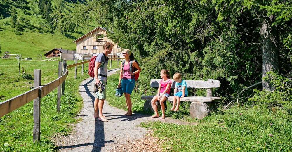
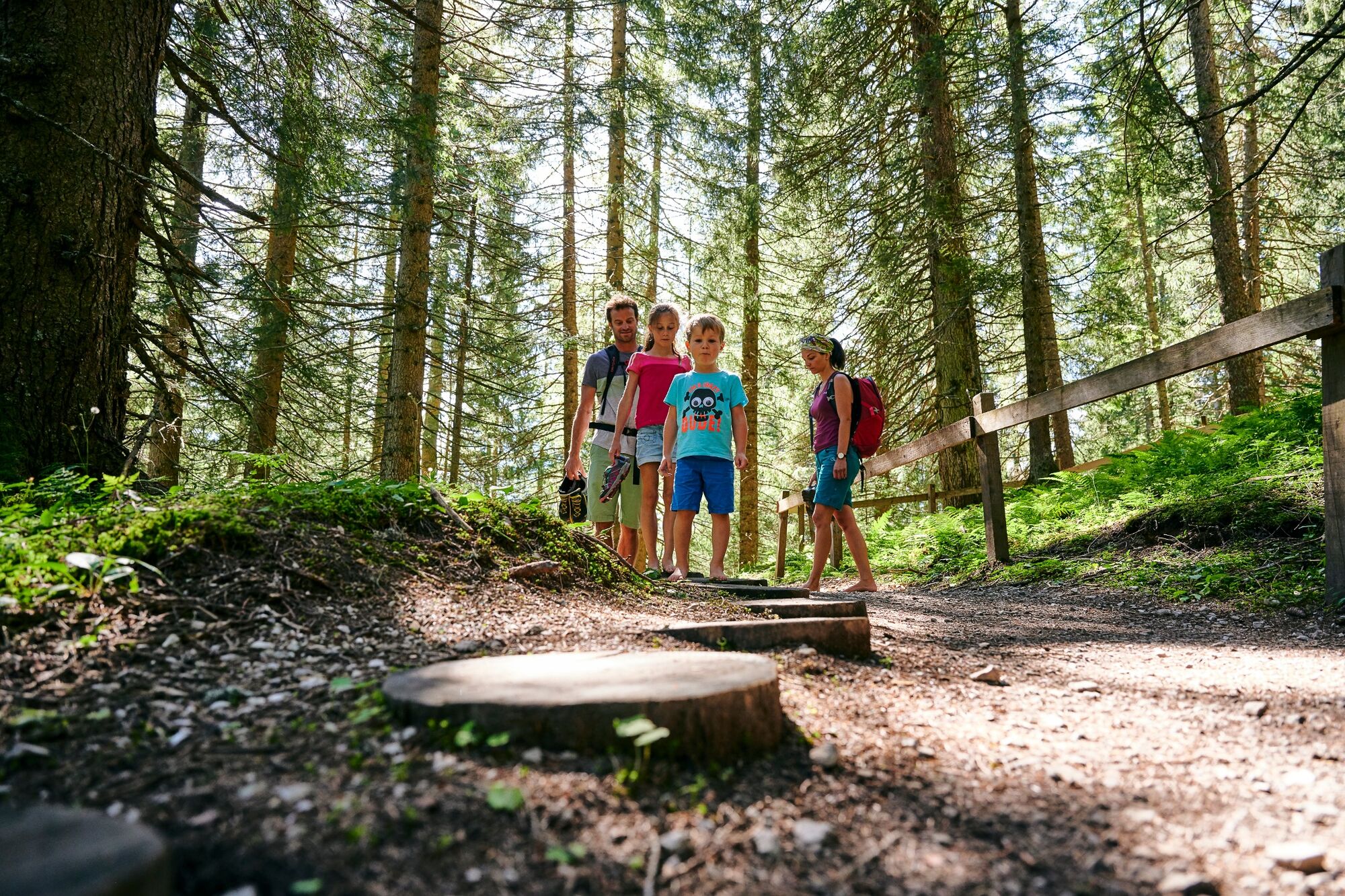
Have you always wanted to know what forest floor, moor, meadows, stones and spring water feel like on the bare soles of your feet? Then you have the opportunity to do so on the barefoot trail - it is a real experience for the senses!
- Difficulty
-
easy
- Rating
-
- Starting point
-
Dorfbahn mountain station, Brand
- Best season
-
JanFebMarAprMayJunJulAugSepOctNovDec
- Description
-
Visit the barefoot trail to the Innere Parpfienzalpe in Brand. With the Dorfbahn cable car you are at the starting point in a few minutes. From the mountain station, hike (still wearing shoes) up towards the Innere Parpfienzalpe.
After the steep, first part, it becomes a bit flatter and shortly after a pasture fence, a hiking sign points to the barefoot path. 150 meters after this turnoff you will come across benches by a stream - here you can take off your shoes! If you can't wait any longer, you can already stimulate your circulation in the clear water of the mountain stream.
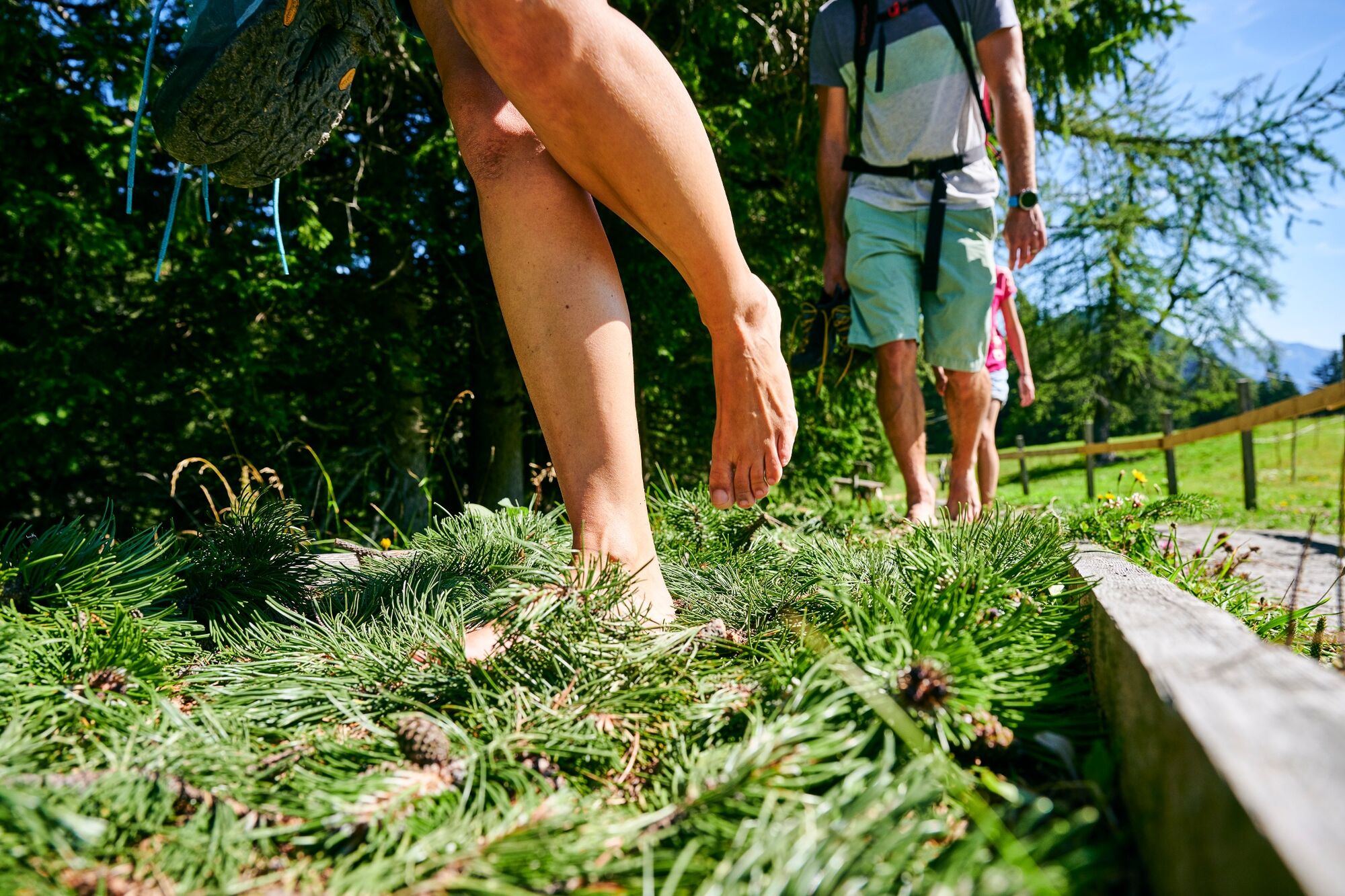
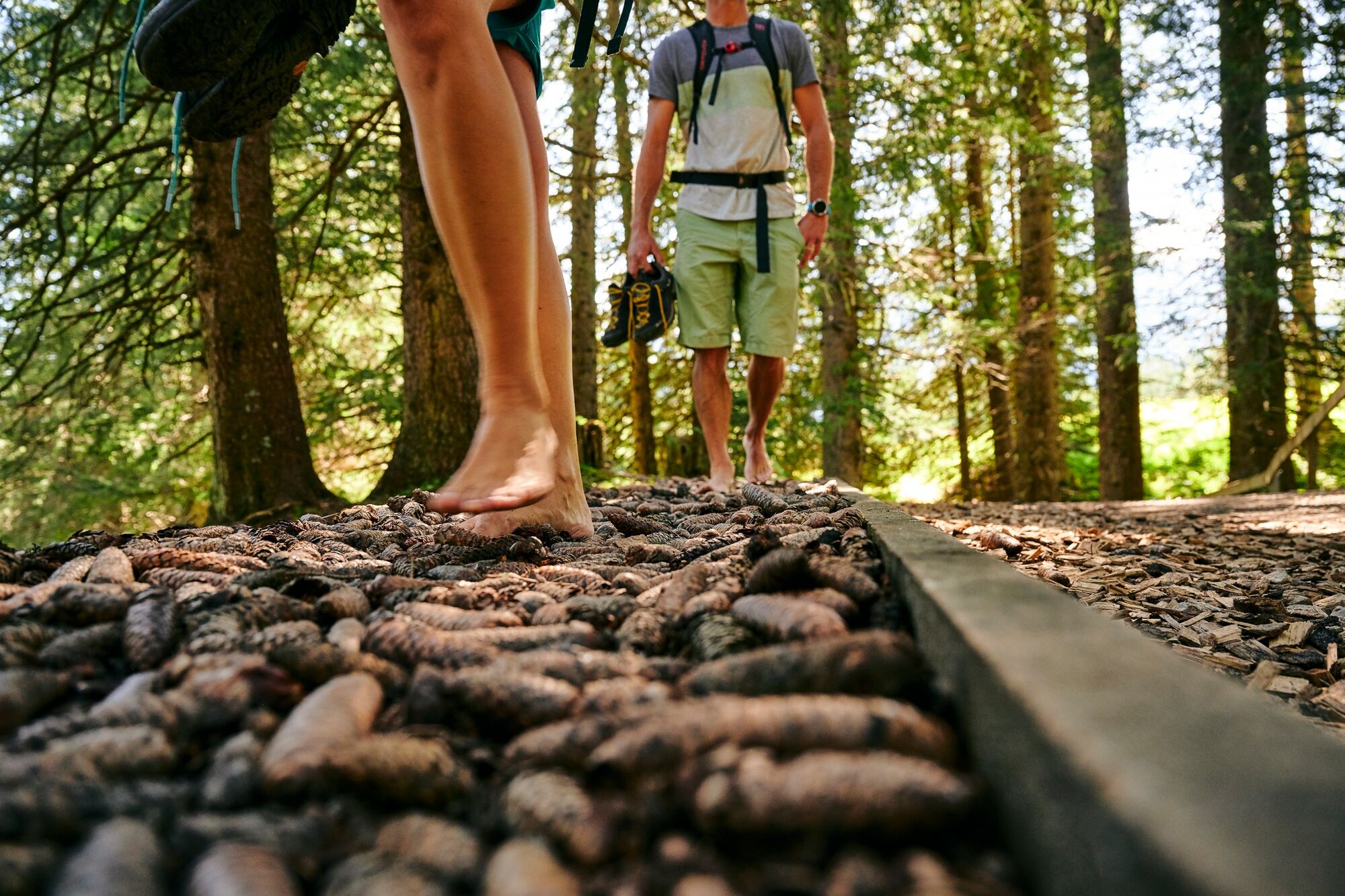
To the right of the "stroller lane" you can get started on the sandy path - you are also welcome to test out the forest floor next to it. After just a few meters, a bench with a view of a small mountain lake invites you to rest while the children explore the forest. Continue on tree trunk discs and then transition back to forest floor. Up a steep switchback is the next rest area. Here the children can have a good romp on a fallen giant tree. The pine cone station follows shortly after. Can you feel the tickle on the soles of your feet?
At the next station, you can feel wooden roundels before the forest opens up to the alpine meadow. The meadow floor is followed by a station with pine cone flour, which is pleasantly soft to the touch. On the way to the alpine pasture, you continue hiking over fir branches and smoothly polished river stones from the nearby mountain stream.
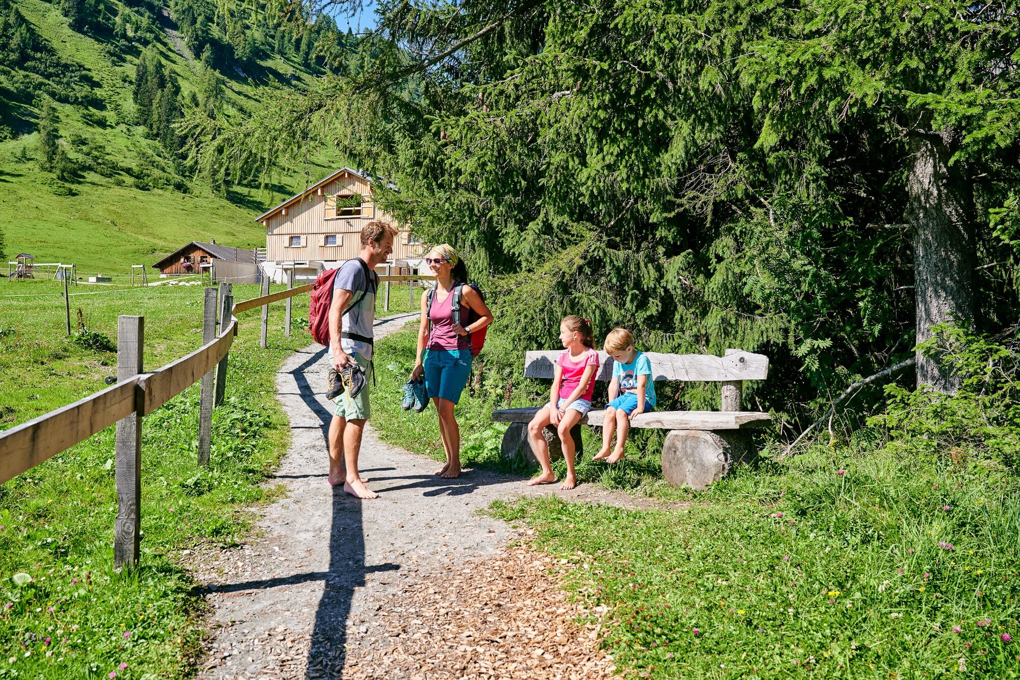
At the Inner Parpfienzalpe, the "forest section" of the trail comes to an end - opportunity for a rest with delicious alpine products. Down the valley, the 2nd section begins with the path to the right away from the lake. After a few meters, a staircase leads into the stream - there you will find a wide variety of surfaces to massage or soak your feet and then rinse them clean again. From the creek you also repeatedly reach the wet meadow of the nearby high moor.
If the route is too short for you, you can also do several laps and experience the different temperatures and elements entirely in the spirit of Kneipp. At the end of the mountain stream comes a fountain where, after a short lap through the marshy ground, you can relax on provided tree trunks and enjoy the wonderful view. With the new experience of feeling yourself and nature on the soles of your bare feet, you then head back downhill (with shoes) towards the Dorfbahn mountain station.
- Directions
-
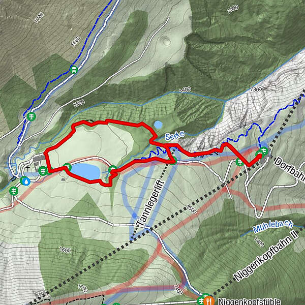
Dorfbahn valley station - ascent with the Dorfbahn - Dorfbahn mountain station - Tannleger - barefoot trail access - Waldteich - Alpwiese Parpfienz - Innere Parfpienzalpe - high moor - reservoir pond - barefoot trail access - Dorfbahn mountain station
- Highest point
- 1,521 m
- Endpoint
-
Dorfbahn mountain station, Brand
- Height profile
-

- Equipment
-
Strong footwear, warm clothing, rain and sun protection and hiking poles are recommended. Cell phone for emergencies.
- Safety instructions
- Directions
-
www.maps.google.at
- Public transportation
- Parking
-
Car park at the Dorfbahn valley station in Brand
- Author
-
The tour Barefoot Trail | Brand is used by outdooractive.com provided.


General info
-
Heidiland
2201
-
Brandnertal
1568
-
Brand
431