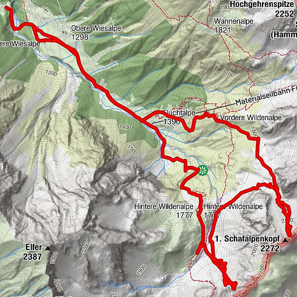
Kemptner Kopf und Schafalpenkopf

Logo Kemptner Kopf und Schafalpenkopf
Tour data
12.06km
1,202 - 2,203m
Distance
1,182hm
1,223hm
Ascent
03:24h
 
Duration
Brief description

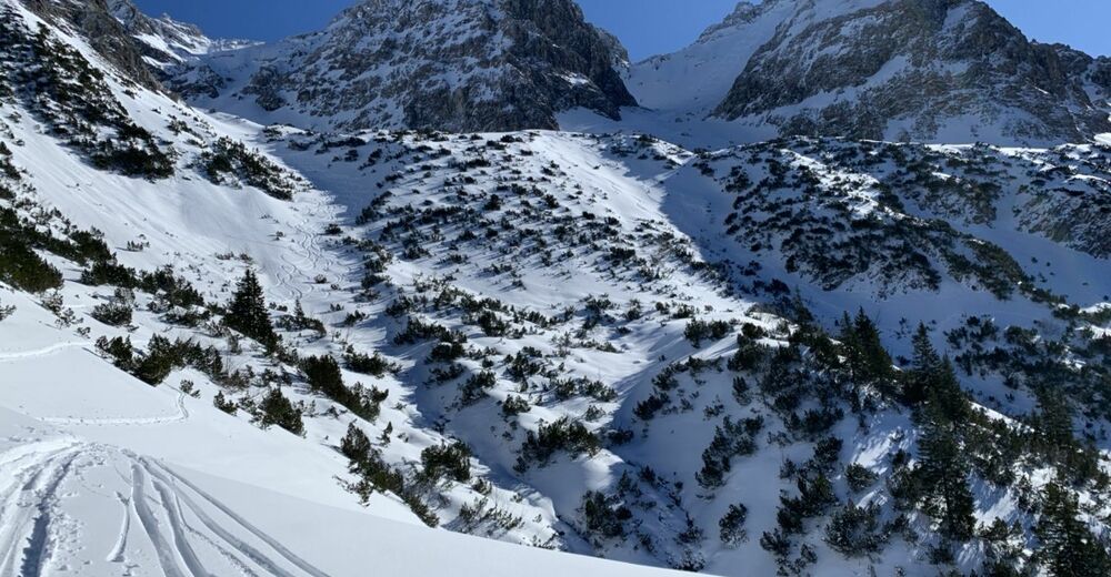
Steile großzügige Hänge, aber ohne Gipfel. Aufstieg entlang des Sommerweges über eine Steilstufe, die sich allerdings wunderbar auflöst.

Difficulty
medium
Rating
Technique
Fitness
Landscape
Experience
Route
Untere Wiesalpe
0.2 km
Wildental
3.2 km
Fluchtalpe
10.1 km

Highest point
2,203 m

1,0
Overall rating

5

0

%

4

0

%

3

0

%

2

0

%

1

100

%

GPS Downloads
  • GPX GPS Exchange Format (XML)
  • KML Google Earth, Google Maps
QR Download Codes for Mobile Phones
Other tours in the regions

Popular tours in the area

Ski tour: To the Hählekopf

medium Ski tour
13.18km | 766hm | 03:15h

Skitour auf den Kleinen Seekopf in den Allgäuer Alpen

medium Ski tour
12.57km | 981hm | 04:15h

Ski tour: From Baad to the Grünhorn

medium Ski tour
9.21km | 886hm | 04:15h

Ski tour: To the Seekopf

medium Ski tour
11.96km | 794hm | 03:15h