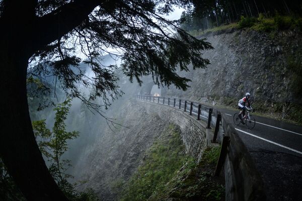
© Au-Schoppernau Tourismus - Monika Albrecht

© Au-Schoppernau Tourismus - Ludwig Berchtold

© Au-Schoppernau Tourismus - Monika Albrecht

- Brief description
-
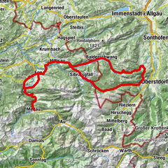
Au - Egg - Hittisau - Balderschwang - Riedbergpass - Fischen i.A. - Sonthofen - Oberjoch - Tannheimertal - Lechtal - Warth - Hochtannbergpass - Schröcken - Au
- Difficulty
-
difficult
- Rating
-
- Route
-
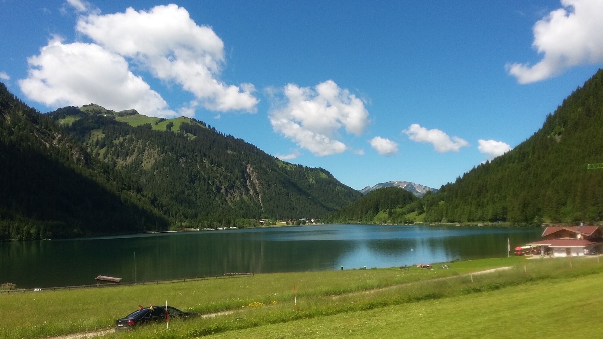
Au (800 m)0.2 kmLisse0.2 kmPfarrkirche St. Leonhard0.3 kmPfarrkirche Schnepfau4.5 kmSchnepfau4.5 kmHirschau6.7 kmKapelle Hl. Martin6.7 kmLourdeskapelle6.7 kmEnge8.0 kmTanna9.3 kmHinterbündt10.2 kmAchsiedlung10.2 kmTempel10.5 kmNaze's Hus10.5 kmMellau10.6 kmMoos10.6 kmPfarrkirche Mellau10.7 kmPlatz10.7 kmRistorante Pizzeria Sandro10.9 kmÜbermellen10.9 kmZimmerau11.3 kmIn der Mellen11.6 kmKlaus12.3 kmReuthe13.7 kmBaien14.9 kmHof15.7 kmZiegler (S-Line Gastronomie)18.8 kmSchwarzenberg (636 m)18.9 kmBersbuch (634 m)19.4 kmGasthof Adler21.2 kmUnterbezegg21.4 kmPizzeria La Montanara22.2 kmAndelsbuch22.5 kmPfarrkirche Andelsbuch22.8 kmWasserfälle Brühlbach23.6 kmWasserfälle Brühlbach23.7 kmEgg25.7 kmGroßdorf27.0 kmGasthaus Falken27.2 kmGasthof Adler27.3 kmLingenau29.3 kmPfarrkirche Johannes der Täufer29.3 kmGasthaus Traube29.4 kmGasthof Adler29.5 kmGasthof Krone32.5 kmPfarrkirche Heilige Drei Könige32.5 kmGasthof Hirschen32.7 kmHittisau32.8 kmKapelle Sippersegg39.5 kmGerisgschwend39.9 kmSchlipfhalden42.3 kmGschwend43.2 kmGschwendlift II43.4 kmBalderschwang44.5 kmMitarbeiterkantine Hubertus44.6 kmWäldle45.5 kmAu46.1 kmSchwabenhof46.7 kmObermaiselstein58.1 kmZum Guten Hirten61.0 kmFischen im Allgäu61.3 kmSt. Verena61.4 kmSankt Johannes Nepomuk62.0 kmAu62.2 kmOberthalhofen62.9 kmSt. Joseph63.5 kmUnterthalhofen63.5 kmSt. Peter und Paul65.0 kmAltstädten65.3 kmSt. Michael68.2 kmSonthofen (741 m)68.3 kmprivate Kapelle68.9 kmGasthof zur Linde69.8 kmKapelle St. Johannes Nepomuk69.8 kmBinswangen69.9 kmTiefenbach71.4 kmReckenberg72.5 kmVorderhindelang73.7 kmBad Hindelang (825 m)75.2 kmPfarrkirche Johannes der Täufer75.5 kmBad Oberdorf76.9 kmKapelle St. Jakob82.1 kmHeilig Geist Kirche82.5 kmOberes Dorf82.5 kmOberjoch82.6 kmKaminstube83.8 kmSteig87.0 kmSchattwald (1,072 m)88.0 kmZöblen (1,087 m)89.2 kmKienzen91.7 kmNeu Kienzen91.8 kmTannheim (1,097 m)92.7 kmGrän (1,138 m)95.8 kmSt. Jakobus96.5 kmHaldensee96.5 kmVia Salina Hotel am See98.2 kmSt. Johannes98.4 kmHaller98.5 kmSchmittekapelle99.3 kmSchmitte99.5 kmNesselwängle (1,136 m)100.6 kmMariahilf Kapelle102.3 kmGasthof Klausenstüberl103.2 kmStegmühlkapelle103.2 kmRauth103.3 kmWeißenbach am Lech (885 m)108.2 kmDorfkirche108.2 kmForchach (910 m)114.2 kmBlockau118.0 kmStanzach (940 m)118.8 kmPfarrkirche Stanzach118.8 kmGasthaus Post118.9 km14-Nothelfer Kapelle122.3 kmElmen (976 m)124.1 kmPfarrkirche St. Martin129.3 kmHäselgehr (1,006 m)129.7 kmGrießau132.5 kmElbigenalp (1,039 m)134.7 kmObergiblen137.3 kmGasthof Post138.3 kmGrüner Baum138.4 kmAntoniuskapelle139.2 kmUnterstockach139.8 kmStockach140.6 kmPfarrkirche Stockach140.6 kmGasthof Alte Schule140.6 kmBildstock Maria la Salette142.2 kmHolzgau (1,114 m)143.8 kmDürnau144.9 kmHotel Styrolerhof145.7 kmFriedhofskapelle147.1 kmSebastian-und-Rochus-Kirche147.1 kmGasthof Schwarzer Adler147.3 kmHotel Post148.4 kmSteeg (1,124 m)148.4 kmStearawirt's Hauserei148.7 kmDickenau148.7 kmSt. Oswald149.6 kmKnopplig149.9 kmSerble150.0 kmWelzau150.3 kmHinterellenbogen151.0 kmPrenten151.5 kmGehren158.7 kmWarth (1,495 m)160.1 kmPfarrkirche St. Sebastian160.3 kmHochkrumbach163.5 kmNesslegg167.6 kmHolzschopf167.6 kmSchröcken (1,269 m)170.1 kmTannberg170.2 kmIn der Hölle170.6 kmIm Heimboden170.6 kmUnterboden171.4 kmLandsteg172.5 kmLandhaus Bad Hopfreben174.6 kmHinter Hopfreben (1,007 m)174.9 kmVorder Hopfreben176.1 kmWirtshaus zum Gämsle179.1 kmHotel Gasthof Adler179.4 kmTresoli179.4 kmSchoppernau (852 m)179.8 kmHotel Restaurant Schiff181.3 kmWieden182.0 kmNeugrund182.5 kmArgenau182.7 kmAu (800 m)183.3 km
- Best season
-
JanFebMarAprMayJunJulAugSepOctNovDec
- Description
-
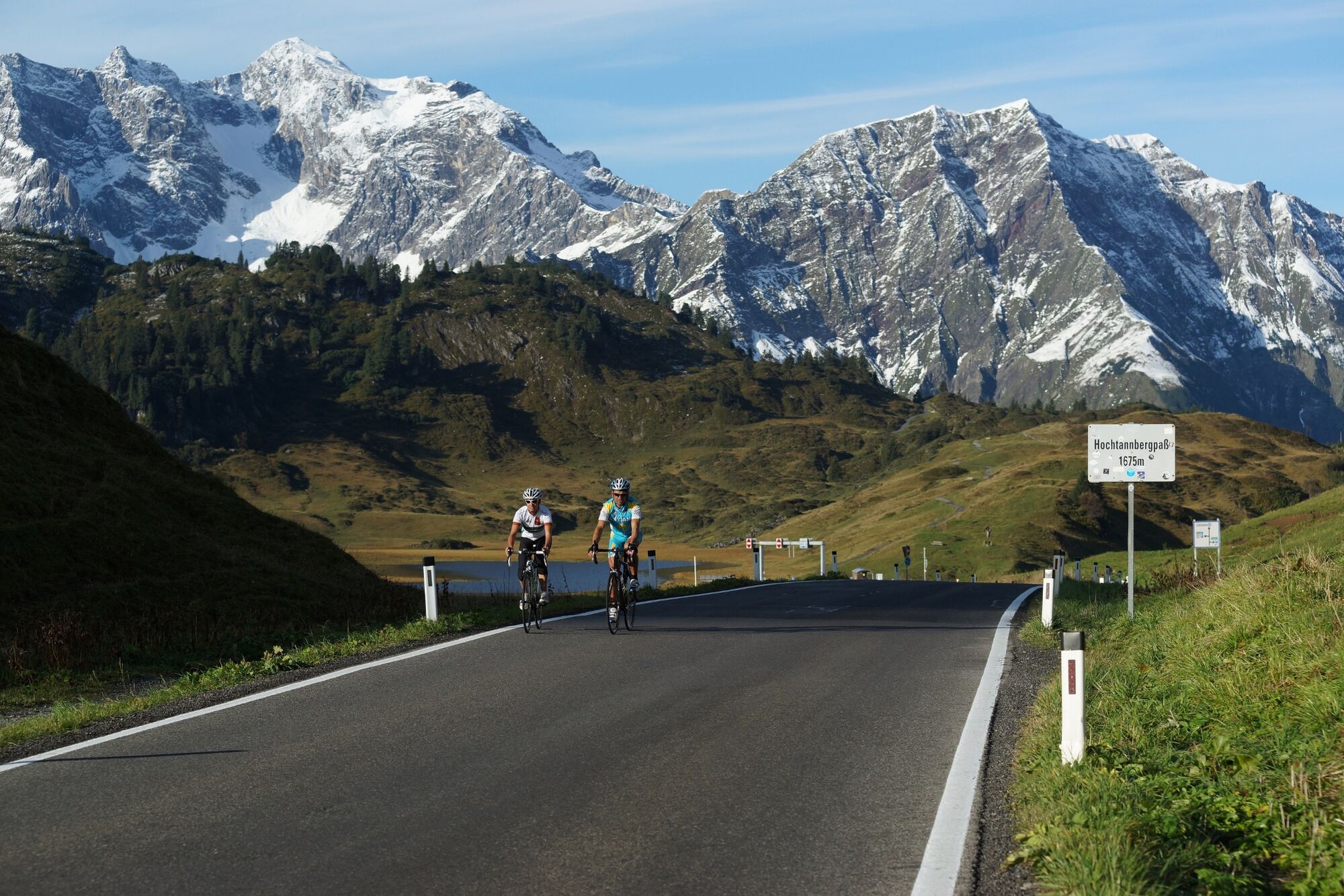
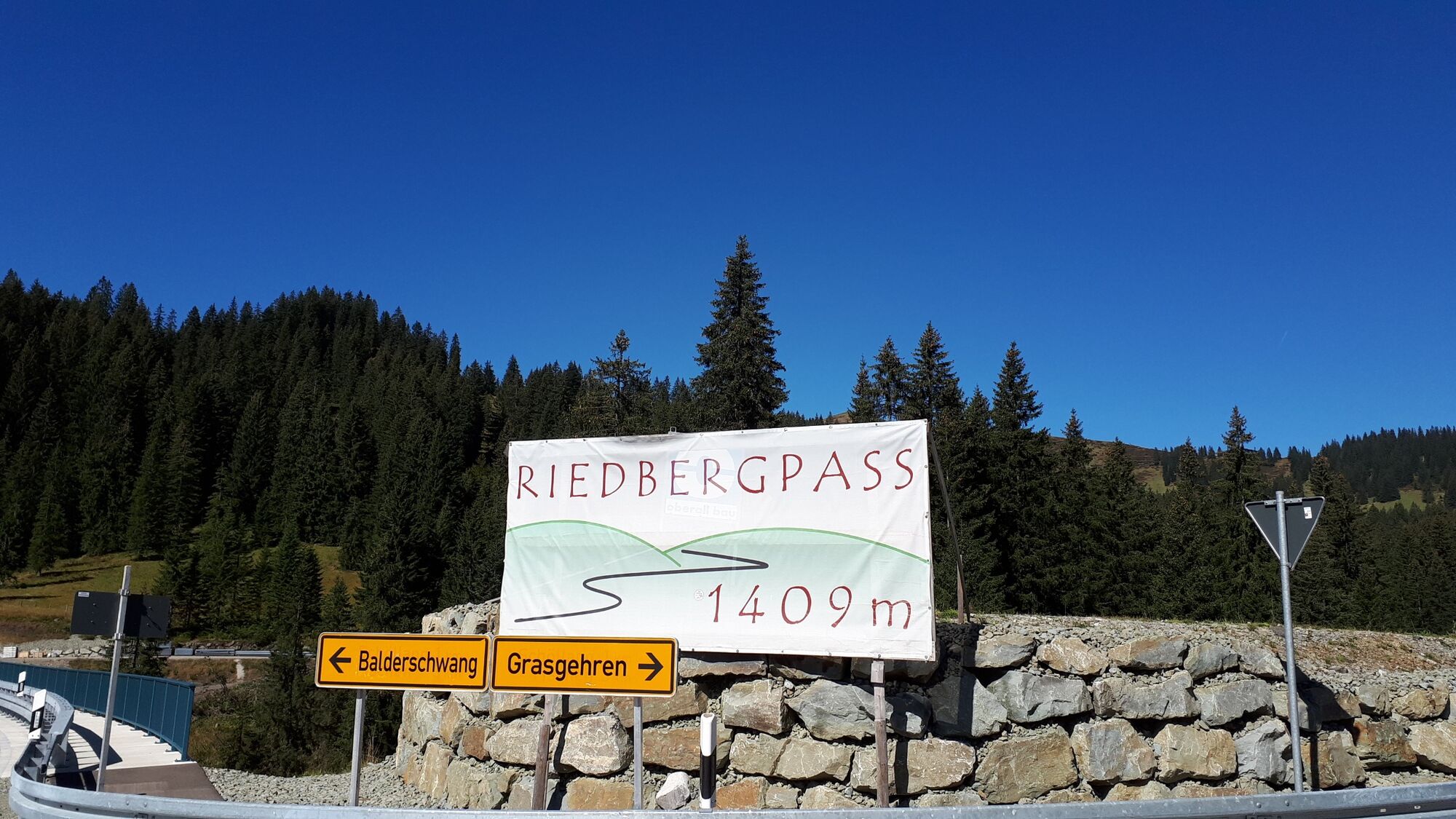
Follow the cycle path as far as Egg. There, turn right to Großdorf and continue as far as Lingenau. At the crossroads, turn right on to the main road to Hittisau/Centre. Pass the church on the L 5 towards Balderschwang and, via the Riedbergpass (1,407 m), Fischen in Allgäu. At the crossroads, go straight ahead and, via the villages Obertalhofen and Untertalhofen, continue to Sonthofen. Leaving Sonthofen, keep right on the cycle path as far as Hindelang. The climb to the Oberjochpass (1,178 m) with a maximum incline of 7% starts in Hindelang. In Oberjoch, turn right at the crossroads towards the Tannheimer Tal. Follow the road through the Tannheimer Tal, past the Haldensee and, via the Gaichtpass, continue to Weißenbach. At the roundabout, turn off to the right into the Lechtal as far as Warth. There, turn right and continue to the highest point of the tour, the Hochtannbergpass, at an altitude of 1,676 metres above sea level. Now comes the fast and technically demanding descent through Schröcken to Au-Schoppernau.
- Highest point
- 1,675 m
- Endpoint
-
Au - Gemeindeamt/Tourismusbüro Au
- Height profile
-

-

-
AuthorThe tour Au-Schoppernau | Tannheimer Tal is used by outdooractive.com provided.
GPS Downloads


Other tours in the regions