Teufelsbach-Wasserfall-Schleife

Logo Teufelsbach-Wasserfall-Schleife
Tour data
4.38km
882 - 967m
Distance
111hm
97hm
Ascent
00:49h
 
Duration
Brief description

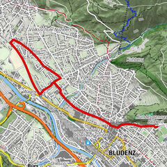
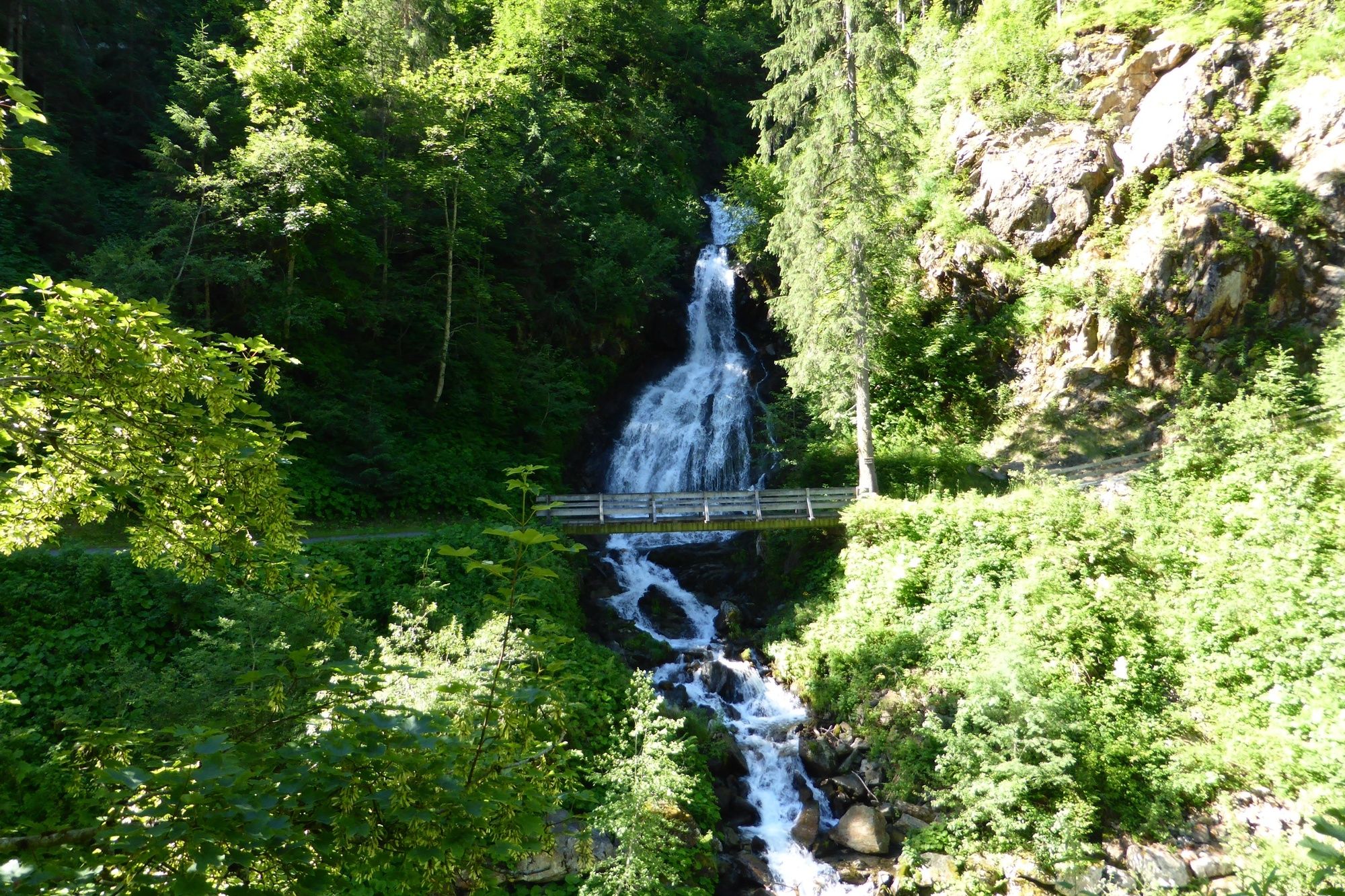
Sportplaz - Burgkopf - Teufelsbach-Wasserfall - Felsa - Wüarri - Sportplatz

Difficulty
easy
Rating
Technique
Fitness
Landscape
Experience
Route
Silbertal
Teufelsbach-Wasserfall
2.2 km
Silbertal
4.2 km

Best season
Jan
Feb
Mar
Apr
May
Jun
Jul
Aug
Sep
Oct
Nov
Dec
Highest point
967 m
Endpoint

Sportplatz Silbertal

Height profile

Author
The tour Teufelsbach-Wasserfall-Schleife is used by outdooractive.com provided.

Overall rating

5

0

%

4

0

%

3

0

%

2

0

%

1

0

%

Error
An error has occurred. Please try again.
Thank you for your review

Rating has been deleted

GPS Downloads
  • GPX GPS Exchange Format (XML)
  • KML Google Earth, Google Maps
QR Download Codes for Mobile Phones
Other tours in the regions

Popular tours in the area

2 Valleys Loop

medium Running
6.84km | 136hm | 01:10h

Nüziders Tour | Bludenz-Nüziders

easy Running
6.24km | 56hm | 01:00h

Weibermahd-Ascent

difficult Running
8.53km | 433hm | 02:00h