
- Brief description
-
Klettersteig gesperrt - WINTERSPERRE!
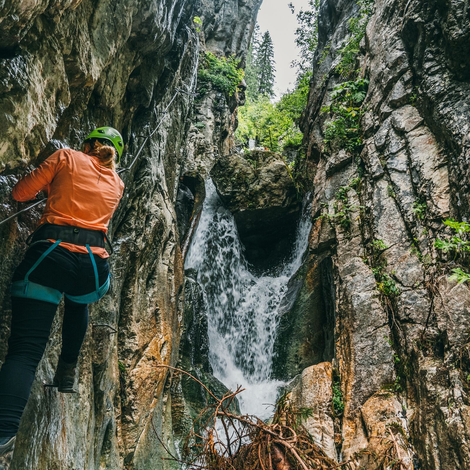
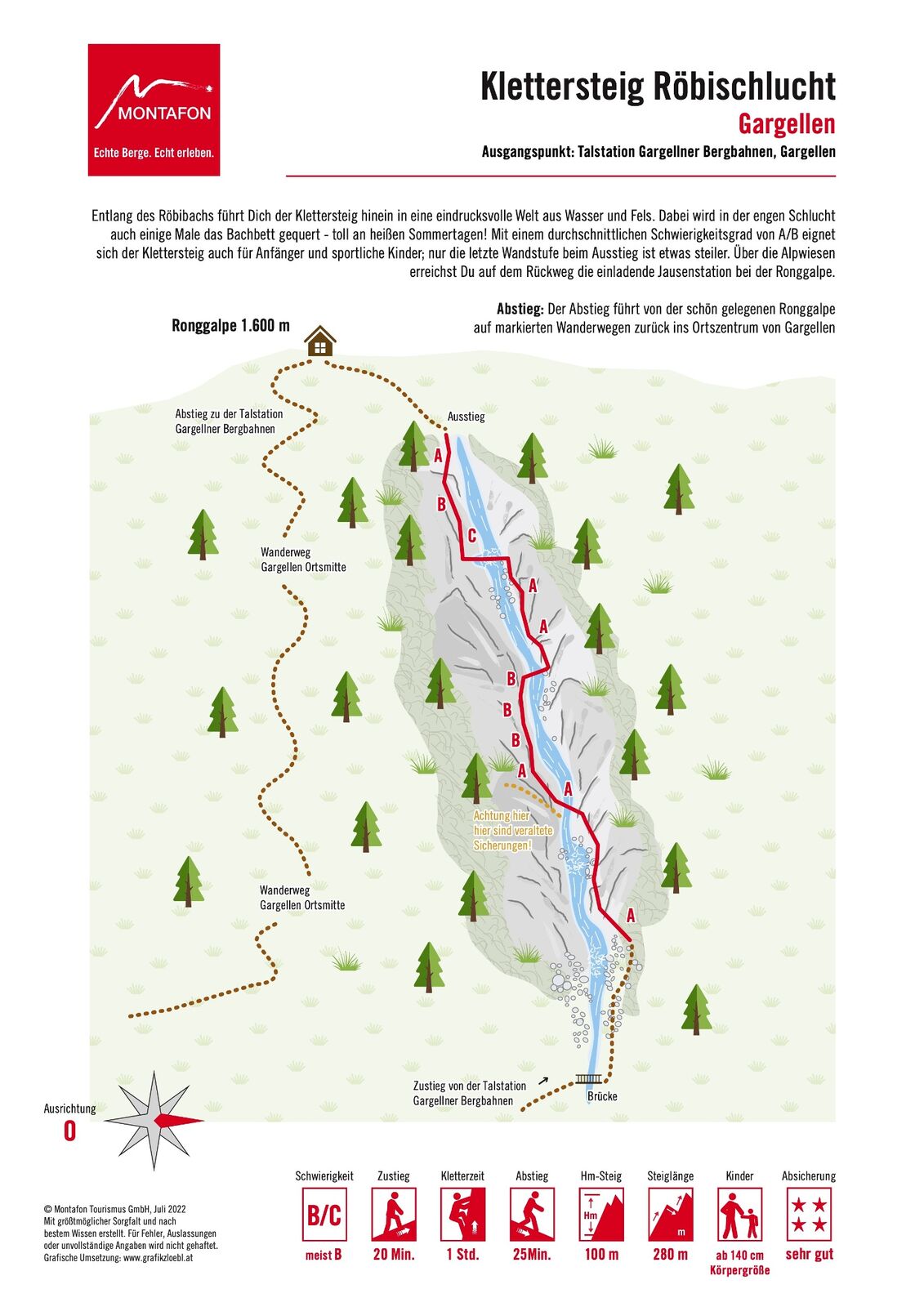
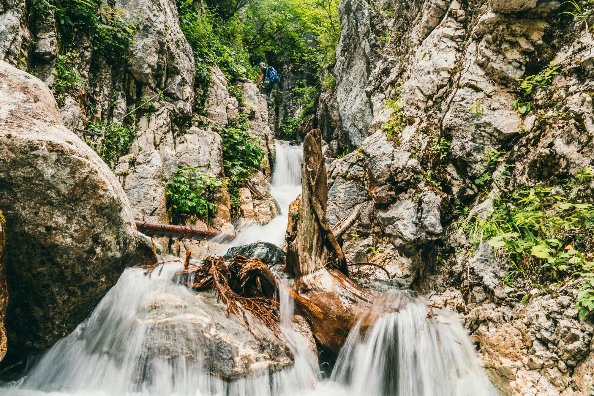
Ein Steig, der sich für Anfänger und Familien gut eignet, da er nicht zu lang und nicht besonders schwierig ist. Der Verlauf direkt durch die Schlucht verspricht an heißen Tagen ein erfrischendes Klettersteigerlebnis.
- Difficulty
-
mediumDifficulty level B/C
- Rating
-
- Starting point
-
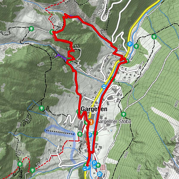
Gargellen
- Route
-
Gargellen0.4 kmGargellner Stoba2.7 kmKuratienkirche Hl. Maria Magdalena2.9 km
- Best season
-
JanFebMarAprMayJunJulAugSepOctNovDec
- Description
-
Difficulty: B, in 1 to 2 areas C
- Directions
-
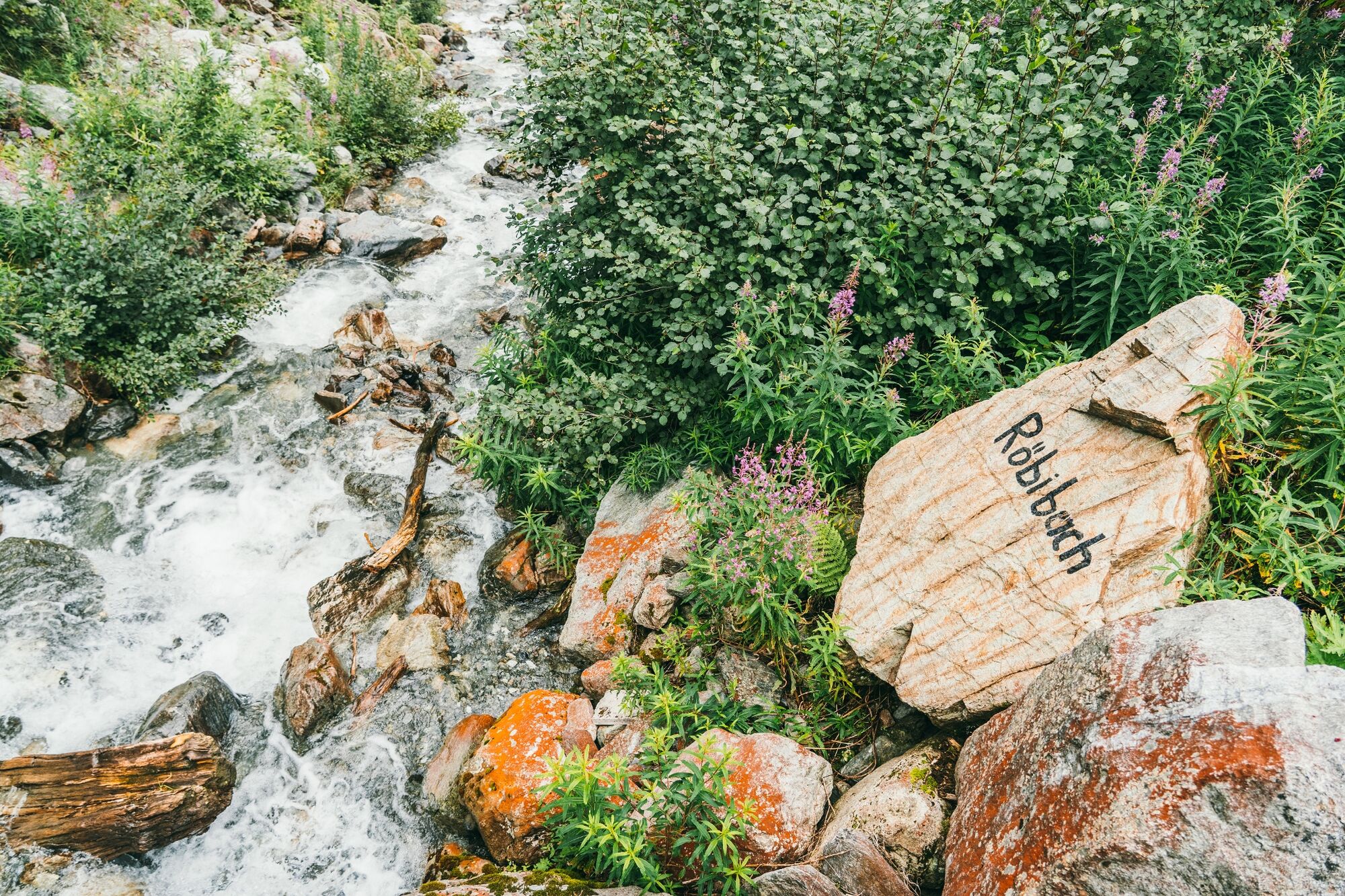
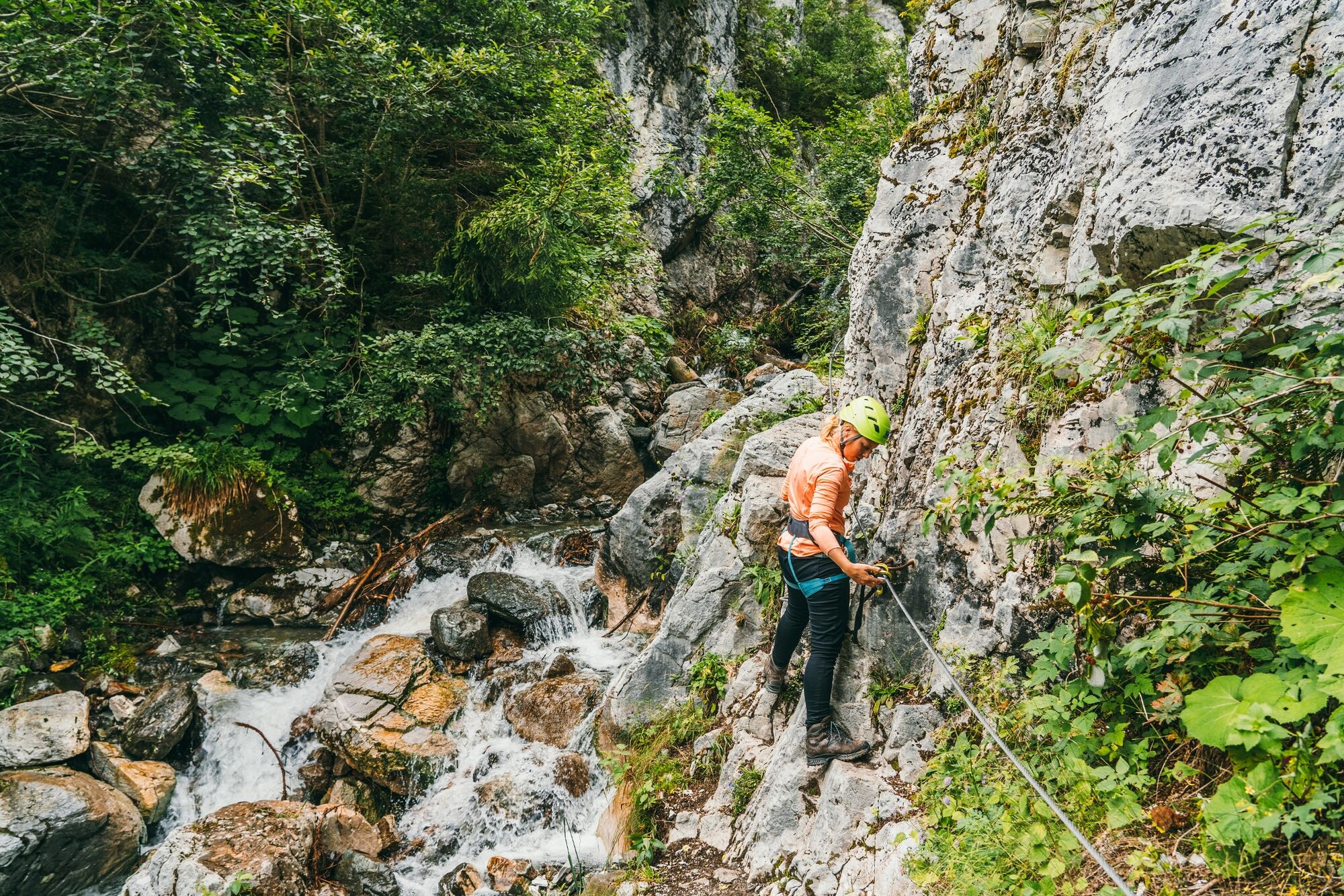
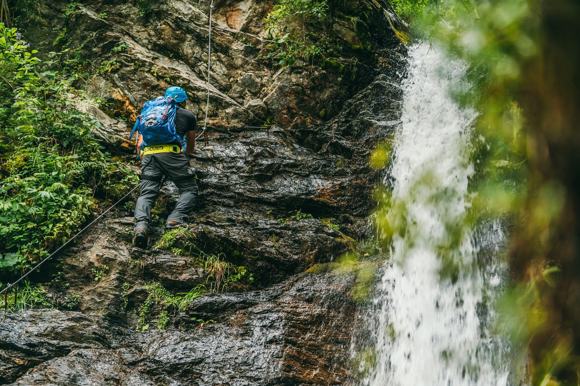
The via ferrata is situated directly along the Röbibach stream and includes a crossing of the streambed. There is a steel cable at the starting point. The via ferrata runs directly through the gorge at a height of about 3 to 4 m above the streambed. Descent: Return along the via ferrata or take the hiking trail back to Gargellen.
- Highest point
- 1,581 m
- Endpoint
-
Gargellen
- Exposition
- Height profile
-

- Equipment
-
Good condition required, surefootedness and no vertigo
Equipment: Helmet, via ferrata set, climbing harness, light mountain shoes - Safety instructions
- Tips
-
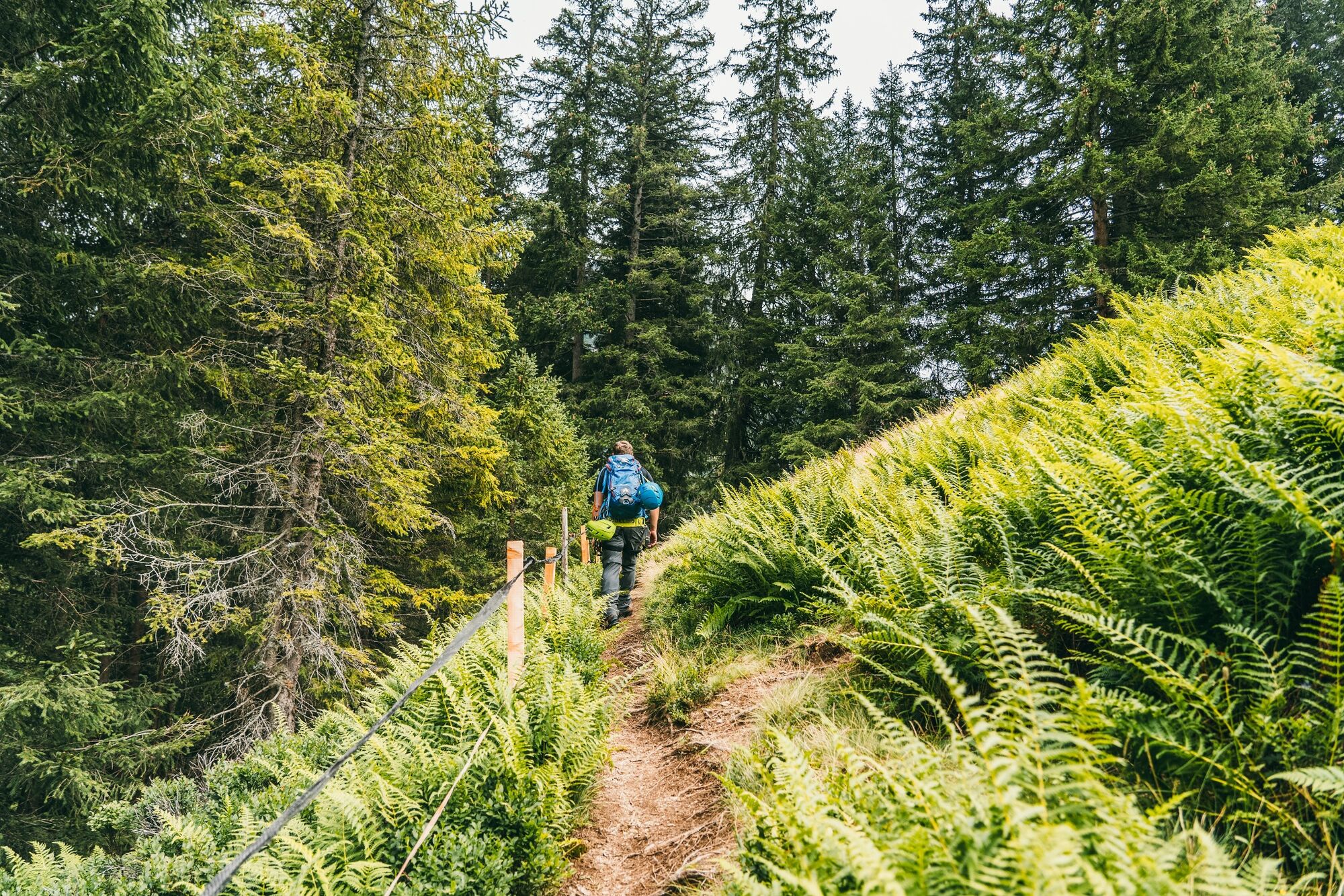
Combination option: On the Gargellner Höhenweg, continue toward Alpe Rongg or Rüti Maisäss
- Directions
-
From the village edge of Gargellen, take the hiking trail toward the Röbi Maisäss; follow the Röbibach stream to the starting point.
-

-
AuthorThe tour via ferrata Röbischlucht is used by outdooractive.com provided.