
- Brief description
-
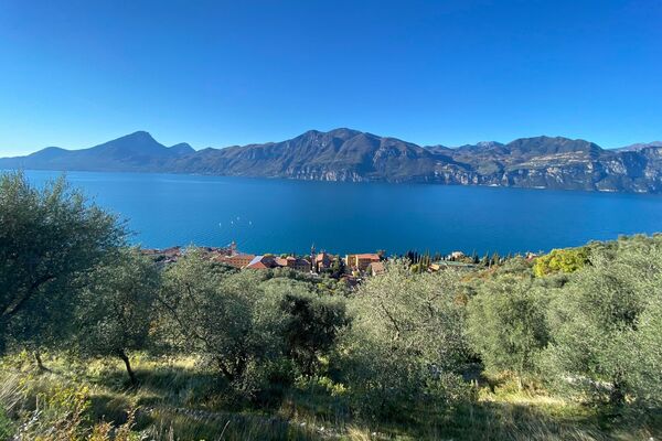
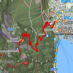
Walking suspended on Lake Garda
- Rating
-
- Starting point
-
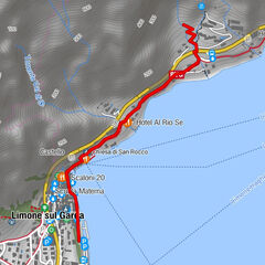
Zocchi-Alti Parking (Bocca di Navene)
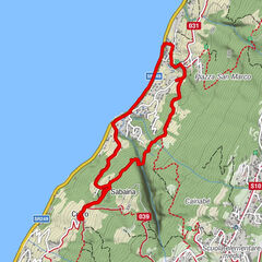
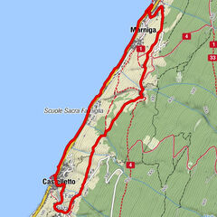
- Route
-
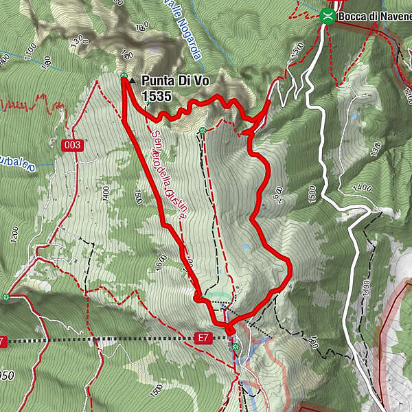
Punta Di Vo (1,535 m)1.3 kmStazione Monte Baldo3.4 km
- Best season
-
JanFebMarAprMayJunJulAugSepOctNovDec
- Description
-
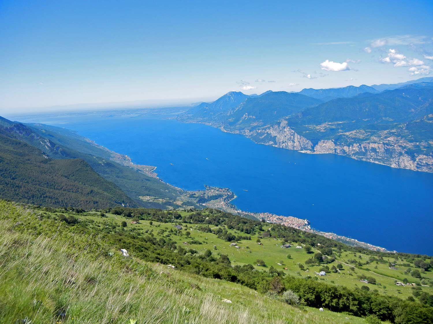
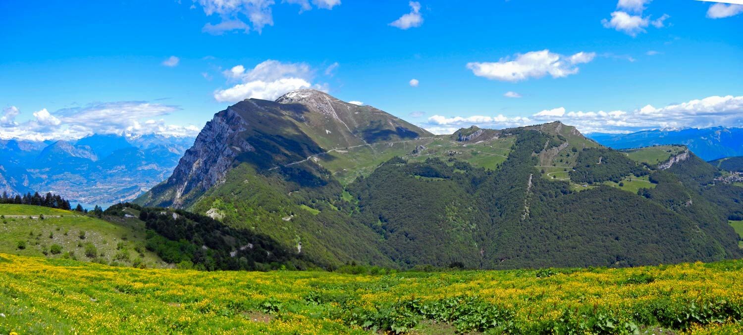
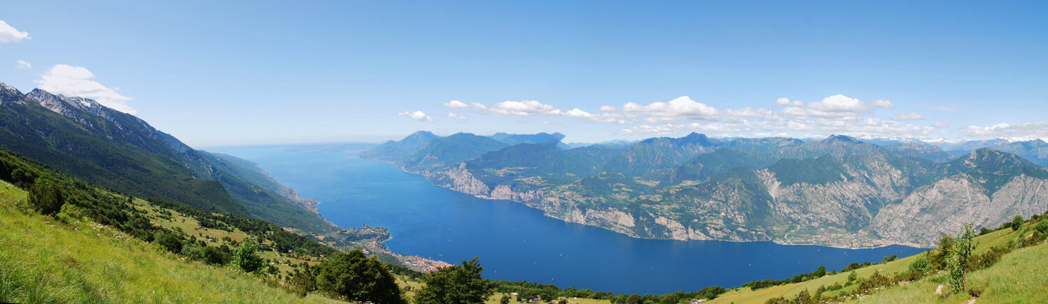
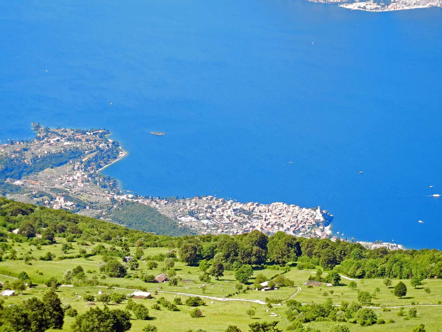
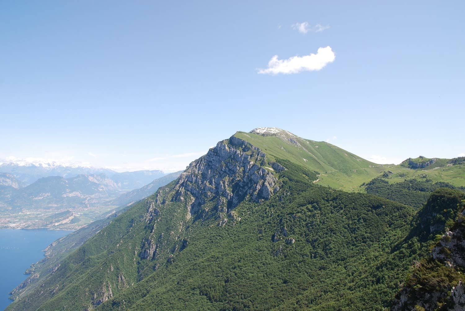
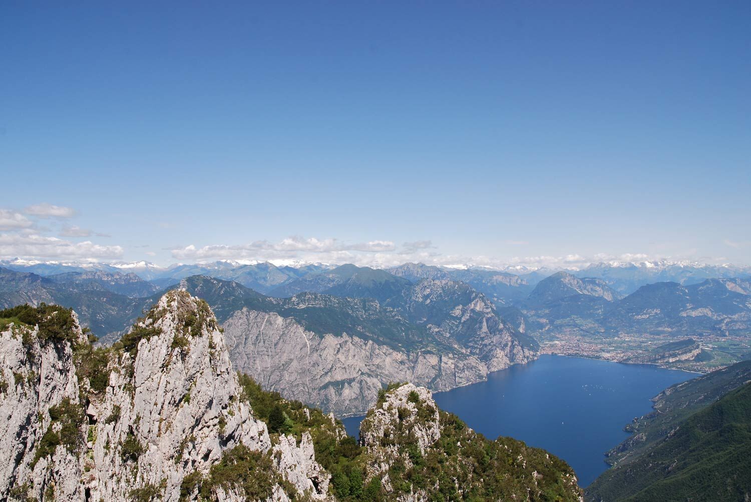
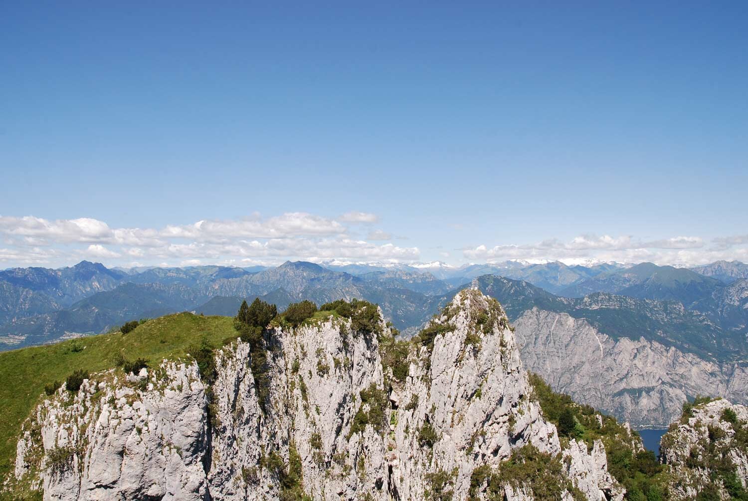
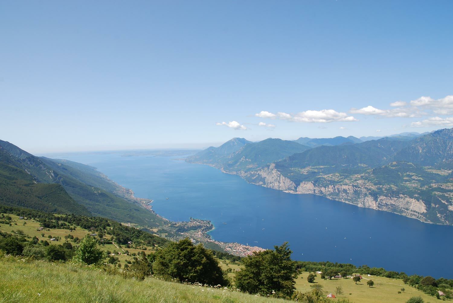
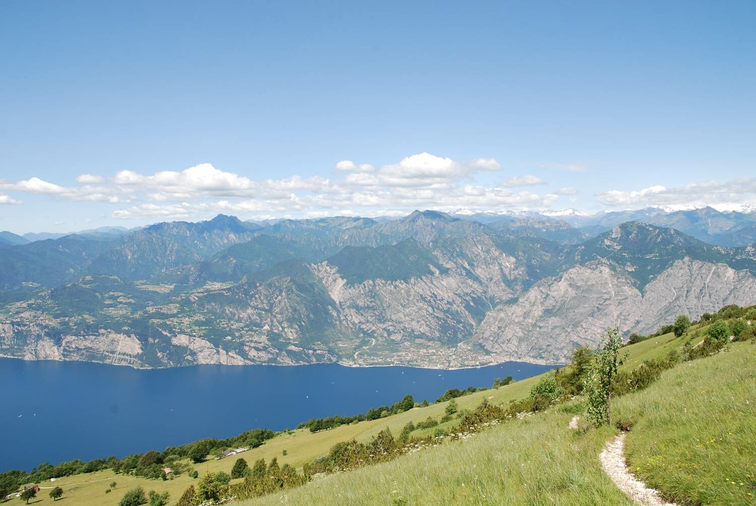
The route goes into the gullies between the rocky peaks that dominate Lake Garda from above. Each curve offers a breathtaking view with glimpses of rare beauty on Lake Garda in the first part, on the entire Benaco then, until you reach the peaks of Malcesine and Monte Grande, arrival of the Malcesine cable car. In the months of June and July, along the way you will encounter enchanting blooms of rhododendron and several species of wild orchids. The recommended return is from the opposite side, overlooking Lake Pra de la Stua nestled among the woods and pastures of the Terre Verdi.
Ring itinerary with small exposed sections, requires a minimum of physical training, not suitable for too small children or for people suffering from vertigo.
- Directions
-
Departure from the Zocchi Alti car park above Bocca di Navene uphill on a dirt road for 150 meters, then take the Ventrar nature trail on the right that descends in the first section into the woods and then continues with a slight up and down until you come out on the facing side towards Lake Garda. From there, continue uphill, cutting the slope diagonally on the path until you reach the arrival of the Malcesine cable car. Possibility to take the summit path and return from the dirt road that descends to the parking lot.
- Highest point
- 1,749 m
- Endpoint
-
Colme di Malcesine
- Height profile
-
 © outdooractive.com
 - Equipment
-
We recommend that you wear appropriate clothing and footwear.
- Safety instructions
-
Please note that the practicability of the itineraries in a mountain environment is strictly linked to the contingent conditions and is therefore influenced by natural phenomena, environmental changes and weather conditions. For this reason, the information contained in this page may have changed. Before leaving for a tour, make sure the path you will approach is still accessible by contacting the owner of the mountain hut, the alpine guides or the visitor centres of the nature parks, the info offices of the local tourist board.
- Tips
-
Panoramic tour with very beautiful blooms in June and July.
- Directions
-
From the Rovereto Sud motorway exit keep in the direction of Mori and then to Altipiano di Brentonico. After Brentonico continue uphill for 12 km taking the road on the right towards S.Valentino - S.Giacomo at the crossroads after the town. After passing the S.Valentino pass, continue on the Graziani road to Bocca di Navene, after passing the Navene refuge, after 200 m, take the uphill road on the left at the fork and continue to the parking lot.
- Public transportation
-
There are no regular buses that take you to the Pianetti di San Valentino Village. You can get there by bus to Brentonico. Consult the Trentino Trasporti timetables on the portal.
In summer, a shuttle bus runs 2 days a week from Brentonico to Passo San Valentino. (for info call the Brentonico Tourist Office on tel. 0464 395149.
- Parking
-
Parking of the Zocchi Alti above Bocca di Navene


-

-
AuthorThe tour Ventrar path is used by outdooractive.com provided.


General info
-
Verona
278
-
Garda Trentino
666
-
Malcesine
214