
- Brief description
-
Two mountain ranges, two regions, two parks: different environments for structure and nature, both World Heritage Sites, united by the continuous line of the Alta Via n. 2
- Difficulty
-
difficult
- Rating
-
- Starting point
-
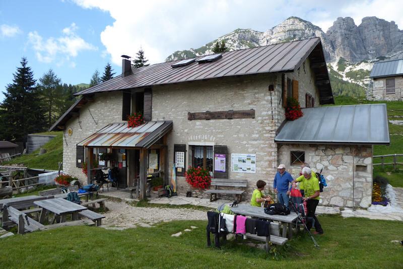
Rifugio Boz
- Route
-
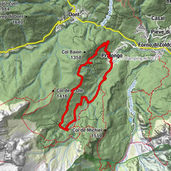
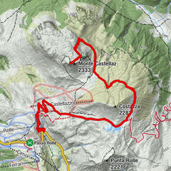
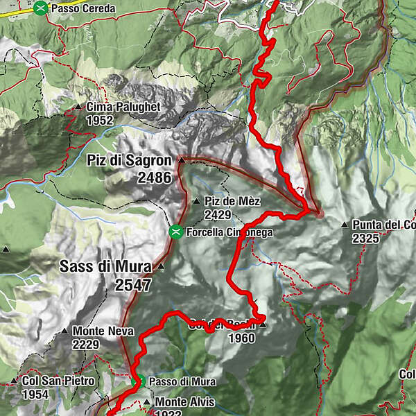
Col dei Bechi (1,960 m)3.4 kmBivacco Walter Bodo5.2 kmSagron (1,061 m)10.2 km
- Best season
-
JanFebMarAprMayJunJulAugSepOctNovDec
- Description
-
Alta Via n. 2 connects the Dolomiti Bellunesi National Park and the Paneveggio Pale di San Martino Natural Park, places where biodiversity manifests in all its beauty. The great richness and rarity of the flora makes the former a botanical jewel, while the latterexalts the geological and forestry beauties.
- Directions
-
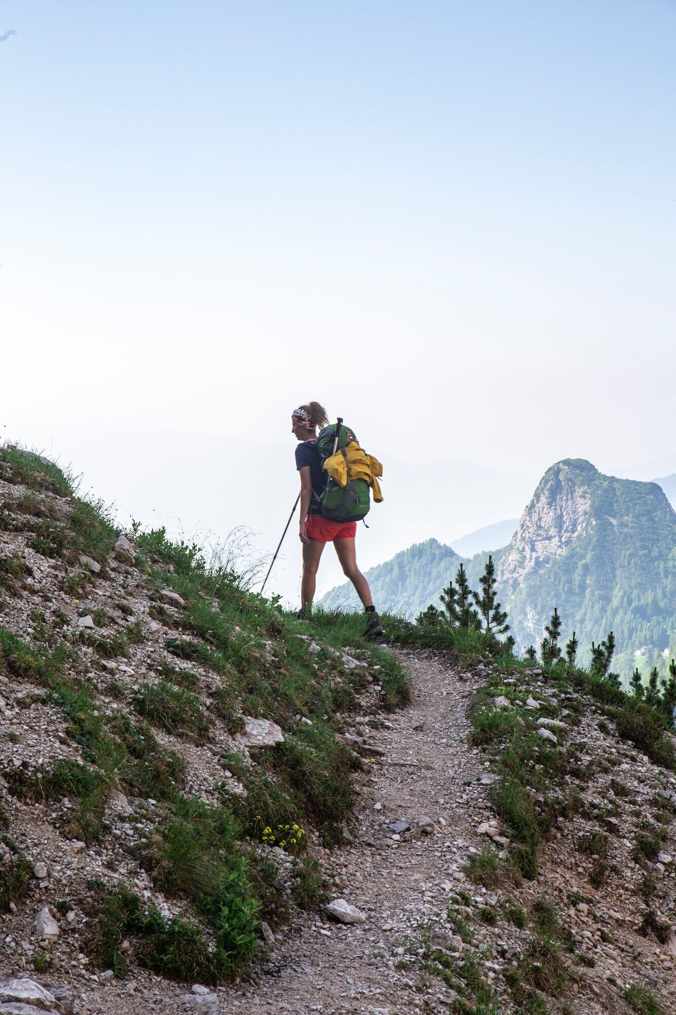
The descent from Passo Finestra to Boz refuge takes place on mostly grassy terrain while the unmistakable profile of the Sass de Mura and the Cimonega Group begins to rise on the horizon.
From the meadows of Boz refuge the path gains altitude again moving toward north-east and reaching Pass de Mura in about 30 minutes; from here, after an initial traverse still on grassy ground, a rocky section begins on the southern slopes of Sass de Mura. This part, known as the Troi dei Caserin, offers some very suggestive glimpses toward Val Canzoi and accompanies you, after a climb on grassy and earthy ground, until Col dei Bechi (1960 m), where a majestic view opens over the basins of Cimonega.
Once again on stony ground, the path remains substantially at altitude reaching Col del Mul and then, in a matter of minutes, the bivouacs Feltre and Walter Bodo (1930 m), under the gaze of Sass de Mura, Piz de Mez, Piz de Sagron, and Comedon.
From the meadows of Pian della Regina, one of the most suggestive corners of the entire itinerary, where the bivouacs are located, the path moves eastward and quickly becomes sloped and stony, offering suggestive views over the Cimonega Group. A final traverse then leads you to Passo del Comedon (2067 m), where the view opens on the Pale di San Martino and some of the most famous Dolomite peaks. After Passo del Comedon, you go down path 801 toward Colza to then take path 801B and reach Chalet Giasenei.
To reach Passo Cereda (starting point of 4th stage) from Chalet Giasenei on path 801A that connects to path 801 (1 hour).
Discover here the easy variant or here for the 4th stage - Highest point
- 2,149 m
- Endpoint
-
Chalet Giasenei
- Height profile
-
 © outdooractive.com
 - Equipment
-
Strong and snug Trekking backpack Trekking boots or Trekking shoes, possibly Gore-Tex
Fleece Wind-stopper jacket and light Wind-stopper trousers
T-shirts, underwear and socks
Lightweight long trekking trousers
Heavy fleece jacket or pullover
Sun hat, warm beanie and lightweight termal gloves
Towel, sleeping bag liners
Basic First Aid Kit, blister patches
Water bottle or Thermos
Head lamp and pocketknife
Information material and map
Telescopic trekking poles (optional)
Sunscreen, photocamera
Climbing helmet
Climbing Kit (carabiners, thin ropes, descender)
Harness
Mountaineering gloves - Safety instructions
-
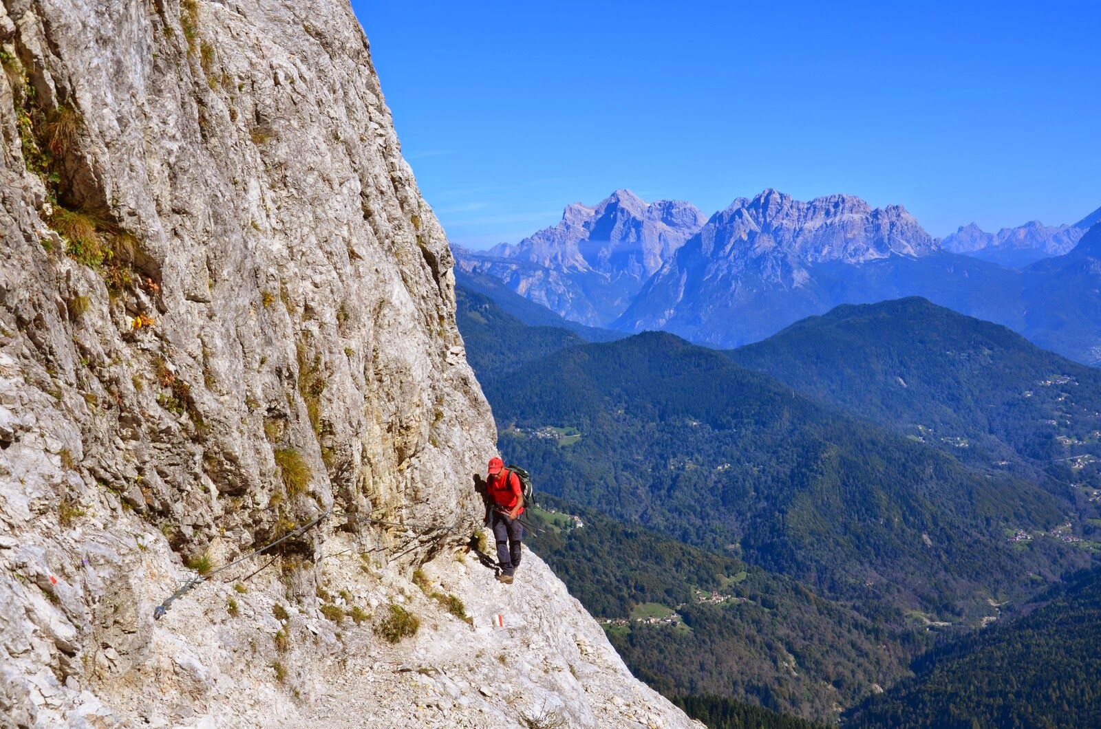
Part of the tour is equipped and classified as EEA (expert hikers with equipment). Therefore it’s important to have the right equipment.
Choose the route according to your experience and your physical preparation: start with short distances first!
The more, the merrier: leaving alone for a hike can be risky, travel with at least one other person, the experience of a Trekking is better when shared with friends and family!
Program your Trekking in advance, check trails and paths on the maps, have a look online to find out more about your itinerary, ask somebody who already walked the same route.
Prepare your backpack: have a look at our check-list to be sure you already packed all the equipment you may need during the Trekking!
Don’t forget to check the weather forecast.
If you really want to try the experience of a Trekking but you don’t feel ready to do it by your own, just ask one of our Alpine Guides!
Try to estimate an average journey-time of every route, considering the physical condition of each member of the group.
Inform the Hut owner or who is waiting for you at home about your time of arrival and the itinerary.
Keep your eyes open: while you’re walking, check the number of each footpath, but don’t forget to enjoy nature and its magic!
A plan B is always a good idea! Organize an alternative route in case of bad weather or unforeseen event: go back if it’s necessary, play it safe!
Please note that the practicability of the itineraries in a mountain environment is strictly linked to the contingent conditions and is therefore influenced by natural phenomena, environmental changes and weather conditions. For this reason, the information contained in this page may have changed. Before leaving for a tour, make sure the path you will approach is still accessible by contacting the owner of the mountain hut, the alpine guides or the visitor centres of the nature parks, the info offices of the local tourist board.
- Additional information

-

-
AuthorThe tour Park2Trek Dolomites - 3rd stage is used by outdooractive.com provided.


General info
-
Belluno-Dolomiti
1073
-
Conca Agordina
307
-
Gosaldo
102