- Brief description
-
A route to travel by car, or on foot if you wish, on horseback or by bike, to discover some fascinating historic sites
- Difficulty
-
easy
- Rating
-
- Starting point
-
Sant'Ambrogio
- Route
-
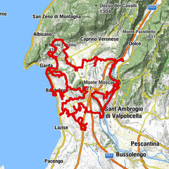
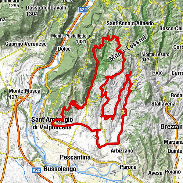
Sant'Ambrogio di Valpolicella0.1 kmChiesa Parrocchiale di Sant'Ambrogio di Valpolicella0.4 kmAl Borgo dell' Arusnate3.4 kmPieve di San Giorgio di Valpolicella3.5 kmSan Giorgio di Valpolicella (376 m)3.6 kmOsteria n°110.6 kmChiesa Parrocchiale di Fumane11.4 kmFumane (198 m)11.4 kmManune17.9 kmTrattoria Du Scalini21.9 kmMolina21.9 kmValcesara23.2 kmCasalin (754 m)26.5 kmSpiazzo26.9 kmCerna (750 m)28.6 kmOrbie29.7 kmS. Cristina30.8 kmAgriturismo El Bocolar31.2 kmlocalità Fava31.3 kmNoroni31.5 kmLa Pontarola33.6 kmLa locanda di nonna Ida33.7 kmCarazzole34.2 kmTerminei34.2 kmAl Sole34.8 kmAntica Osteria della Valpolicella34.9 kmSan Rocco34.9 kmSantuario di Santa Maria di Valverde35.8 kmPezza (467 m)36.3 kmCrocetta (410 m)37.3 kmAi Torcoli37.4 kmMarano di Valpolicella38.3 kmCanzago (313 m)38.8 kmPrognol39.7 kmRavazzol40.3 kmValgatara (176 m)42.2 kmVilla42.9 kmNegrar di Valpolicella45.0 kmTrattoria dalla Bice48.4 kmTrattoria Caprini48.6 kmTorbe (433 m)48.7 kmRistorante Casale Spighetta48.8 kmpizzeria la Fenice51.0 kmPertegà51.4 kmPrun (523 m)51.9 kmMonspigolo52.9 kmVilla58.0 kmVigolo58.1 kmNegrar di Valpolicella59.5 kmSan Vito61.1 kmRistorante Pizzeria Al ritrovo61.2 kmOsteria del bugiardo62.1 kmSanta Maria62.2 kmPizzeria la Nespola62.9 kmPedemonte63.5 kmCengia (113 m)64.6 kmCastelrotto (112 m)65.9 kmSan Floriano68.4 kmSan Pietro in Cariano (151 m)70.2 kmBure (150 m)71.3 kmSant'Ambrogio di Valpolicella74.2 km
- Best season
-
JanFebMarAprMayJunJulAugSepOctNovDec
- Description
-
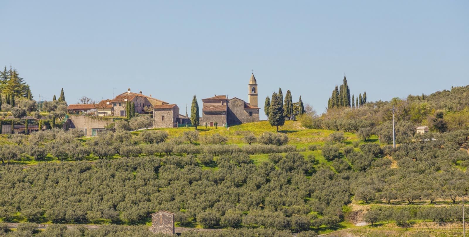
The "Valley of several cellars", being a strict interpretation of the name Valpolicella, extends from the Lessini Mountains up to Soave, and its calcareous soil is perfect for making exceptional quality red Valpolicella wines. The real landmark of the Valpolicella Wine Road are the five centres of the classic DOC area, but there are numerous diversions through medieval hamlets, to see villas and vineyards that spread from the plain to the terraced hills. Sant'Ambrogio di Valpolicella has some of the most successful vineyards in the area, and in the hillside hamlet of Garganego you will find Villa Sarego-Alighieri, a lovely complex of buildings from different periods, which still belongs today to the heirs of the great poet. San Pietro in Cariano is a very ancient town, which flourished under the Scaligeri dynasty. There are numerous noble residences there, including Villa Santa Sofia which was designed by Andrea Palladio but unfortunately never finished. There are also some lovely homes dotted among the vines of the small town of Fumane. The fascinating stone village of Molina and the nearby Waterfall Park are well worth visiting, some of the loveliest sites in the Valpolicella area. There is some lovely renaissance architecture in Marano di Valpolicella and Negrar, a large municipal area between the hills and mountains which includes several villages in the Negrar Valley.
- Highest point
- 766 m
- Endpoint
-
Negrar
- Height profile
-
 © outdooractive.com
 - Tips
-
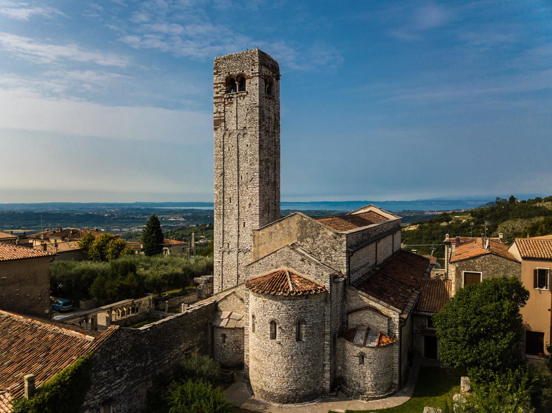
The Pieve di San Floriano is certainly worth a visit, as it is considered to be the most significant testimony of the Roman period in Valpolicella. Adjacent to the parish church with its beautiful façade in tufa with regular segments, a mighty square-shaped bell tower with a composite structure stands out on the north side: the lower part is in stone, while the upper one is built in alternating layers of tufa and brick that give it a polychrome colouring.
- Additional information

- Author
-
The tour Valpolicella Wine Road is used by outdooractive.com provided.


General info
-
Verona
273
-
Gardasee / Venetien
305