


- Brief description
-
The cycle-pedestrian tourist itinerary On the Trails of the Ezzelini along Muson and Lastego is divided into two branches and reaches a total length of 40 km.
- Difficulty
-
easy
- Rating
-
- Starting point
-
Resana
- Route
-
Castelfranco Veneto4.8 kmChiesa di San Sebastiano6.9 kmVillarazzo6.9 kmCastello di Godego8.6 kmPoggiana12.7 kmOasi ai Due Torrenti12.9 kmLoria14.2 kmSpineda di Riese Pio X17.3 kmCase della Rosina17.8 kmAl Maglio18.4 kmLauro19.0 kmCase Berton19.1 kmAl Scarsocio19.4 kmPont de Fero21.8 kmCarpenedo23.0 kmZamperoni23.8 kmPonte di Pagnano24.1 kmPagnano24.2 kmPizzeria Ristorante24.2 kmCase dei Rigo - Giannotti25.0 kmFonte Alto26.5 kmContrada dei Schit26.8 kmFarra27.5 kmPiovega27.5 kmCapitello Madonna delle Grazie28.5 kmBrunelli di sopra28.5 kmAi Bernardi28.6 kmPaderno del Grappa29.2 kmPedecol29.8 kmCapitello Sant'Antonio30.0 kmQuattro Strade30.7 kmFietta31.3 kmChiesa Parrocchiale della Santissima Trinità di Fietta31.3 kmSant'Andrea33.2 kmTaverna Al Gallo33.3 kmRistorante San Liberale34.8 kmValle San Liberale34.8 km
- Best season
-
JanFebMarAprMayJunJulAugSepOctNovDec
- Description
-
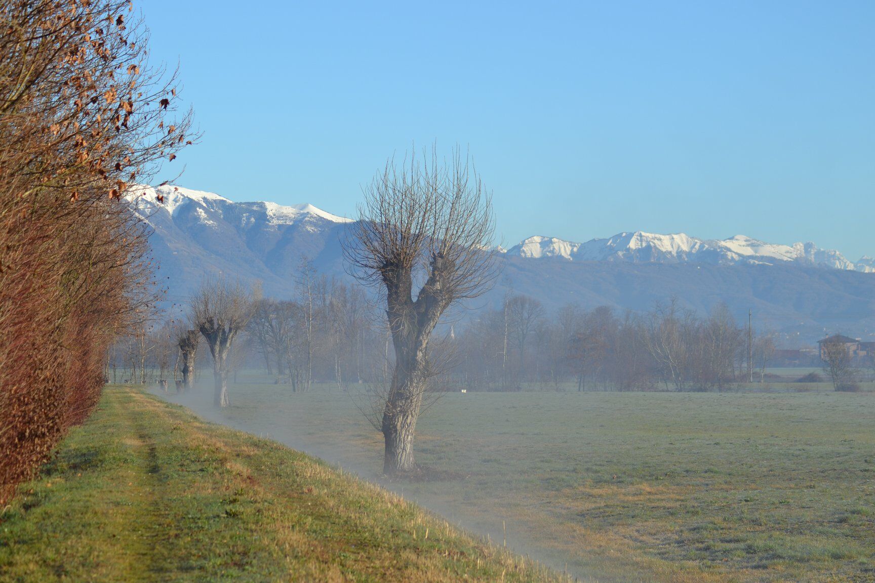
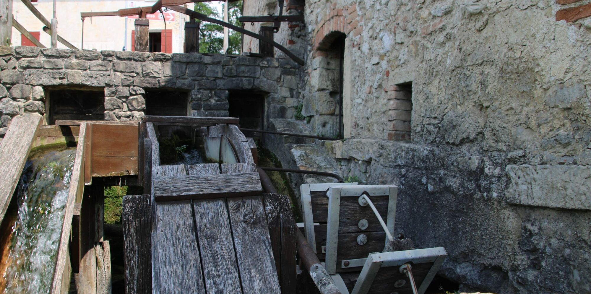
The itinerary can be walked or cycled. The first 19,100 km long stretch, from south to north, mainly follows the stream Muson dei Sassi, in some sections also the Musonello, in the Municipalities of Resana, Castelfranco Veneto, Castello di Godego, Loria, Riese Pio X, Fonte and Asolo, where the ancient Maglio is located, in the locality Pagnano d'Asolo. The second 20,250 km long branch branches off from the first at the Scremin bridge near the Asolo furnace along the SS248, laps the Eastern area of the centre of Onè di Fonte, crosses Fonte Alto, then follows the course of the Lastego stream in the valley of the mills until reaching the vegetation garden of Astego in the Municipality of Pieve del Grappa.
The tourist project On the Trails of the Ezzelini aims at enhancing the environmental aspects along Astego, Muson dei Sassi and Musonello, which are streams flowing down from the Asolano area to Castelfranco Veneto and continue, crossing the Tergola, towards Resana, Camposampiero and Padua; as well as at visiting towns rich in history, art and religious references.
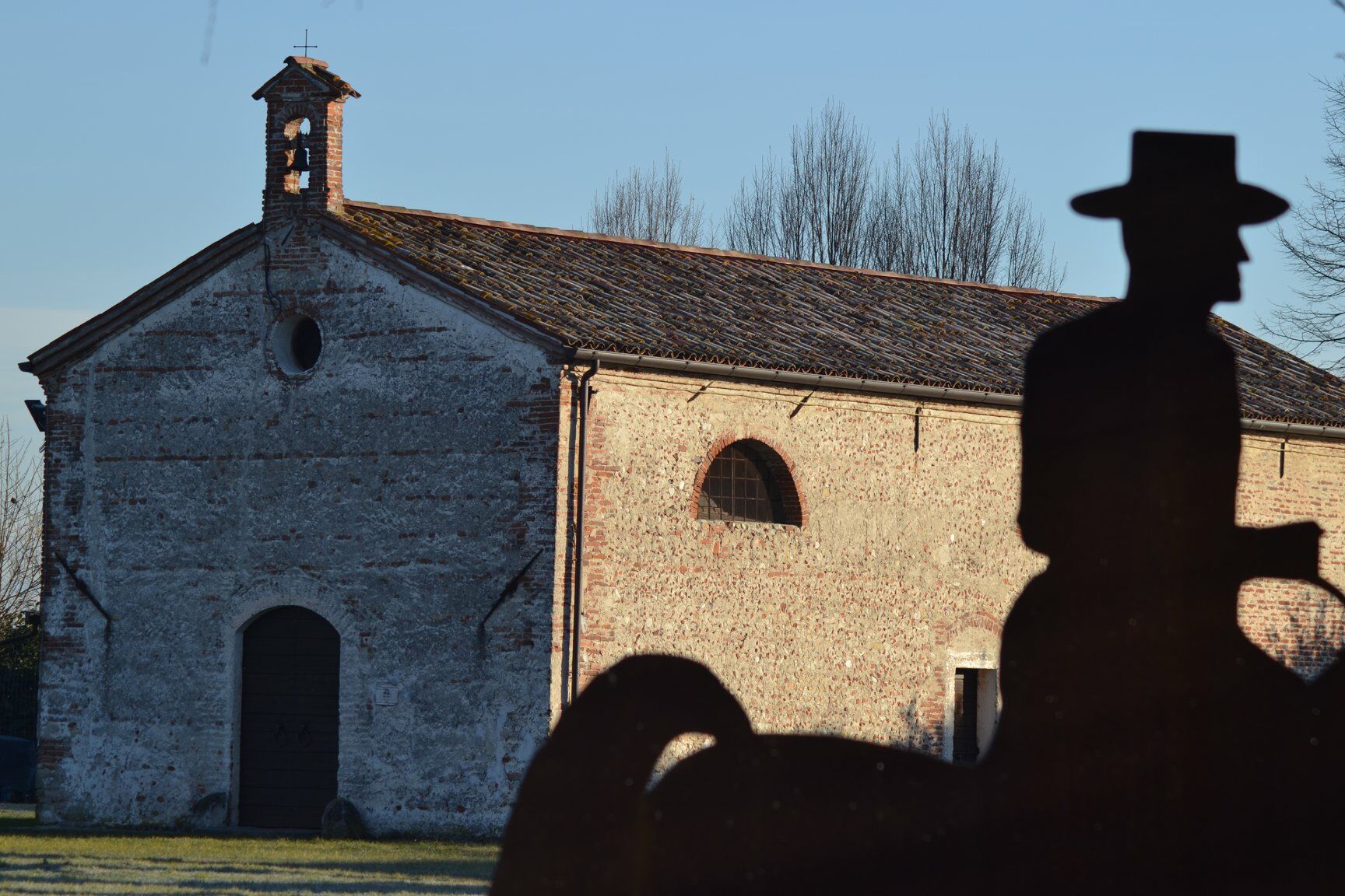
The cycle route north of Castelfranco Veneto has Castello di Godego as reference, in particular the park of the splendid oratory of San Pietro. The trail takes its name from the medieval family of the Ezzelini, who settled in Godego among various diatribes with their cousins Camposampiero, and then settled permanently in San Zenone with an operational centre in Bassano del Grappa, without forgetting the domains gravitating to the Castle of Onara, which motivated the construction of strongholds such as Castelfranco Veneto by the inhabitants of Treviso and of the Citadel by the Padovans.
- Highest point
- 593 m
- Endpoint
-
Pieve del Grappa
- Height profile
-
 © outdooractive.com
 - Tips
-
Significant is the painting of rings, one for each Municipality, that intersect the Trails of the Ezzelini in and out as indicated in the new tourist map downloadable on www.suisentieridegliezzelini.it.
- Additional information


- Author
-
The tour On the Trails of the Ezzelini: Along Muson and Lastego is used by outdooractive.com provided.


General info
-
Treviso
118
-
Monte Grappa
164
-
Asolo
35