
- Brief description
-
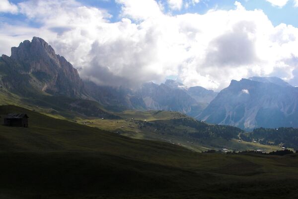
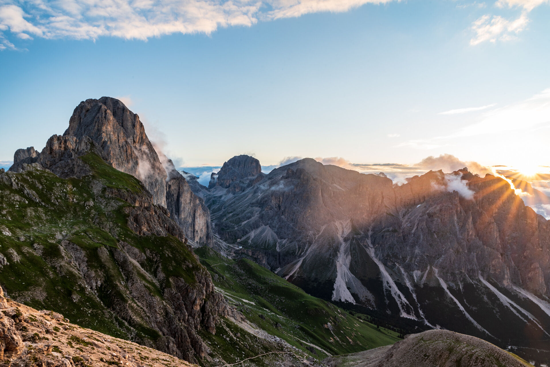
Autumn version of the Dolomiti Trek King, sleeping in a mountain hut and walking for 3 days through landscapes and forests glowing in golden hues. The first stage will take you from Ciampedie to the Antermoia Refuge, with an ascent to the Vaiolet Towers.
- Difficulty
-
difficult
- Rating
-
- Starting point
-
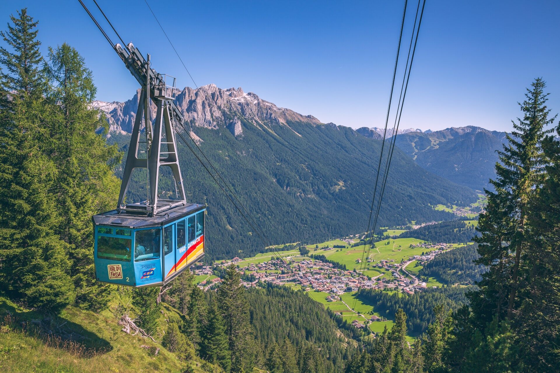
Vigo di Fassa
- Route
-
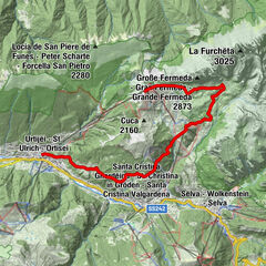
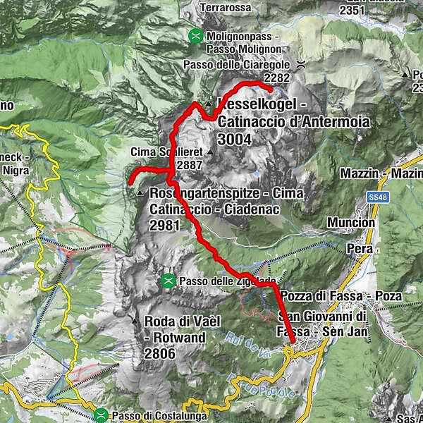
Vigo di FassaRistorante Bellavista0.0 kmVigo0.0 kmCatinaccio1.5 kmBaita La Zondra1.6 kmRifugio Ciampedie (1,998 m)1.6 kmRif. Baita Checco (1,988 m)1.6 kmRifugio Negritella (1,986 m)1.8 kmEx Rifugio Catinaccio4.3 kmBaita Enrosadira4.5 kmRifugio Gardeccia4.6 kmRifugio Stella Alpina4.6 kmPreuß-Hütte6.5 kmVajolethütte6.5 kmGartlhütte (2,621 m)7.6 kmPasso Santner8.2 kmSantnerpasshütte8.2 kmGrasleitenpasshütte11.7 kmRifugio Antermoia14.7 km
- Best season
-
JanFebMarAprMayJunJulAugSepOctNovDec
- Description
-
From Vigo take the cable car up to Ciampedie. From here on path no. 540 you will get to the basin of Gardeccia. Continue on path no. 546 until you find the Vaiolet and Preuss refuges.
Optional: from here, the Re Alberto I Refuge can be reached in about an hour along path no. 542. Adding further 20 minutes from Re Alberto I Refuge, you can reach Passo Santner Refuge.
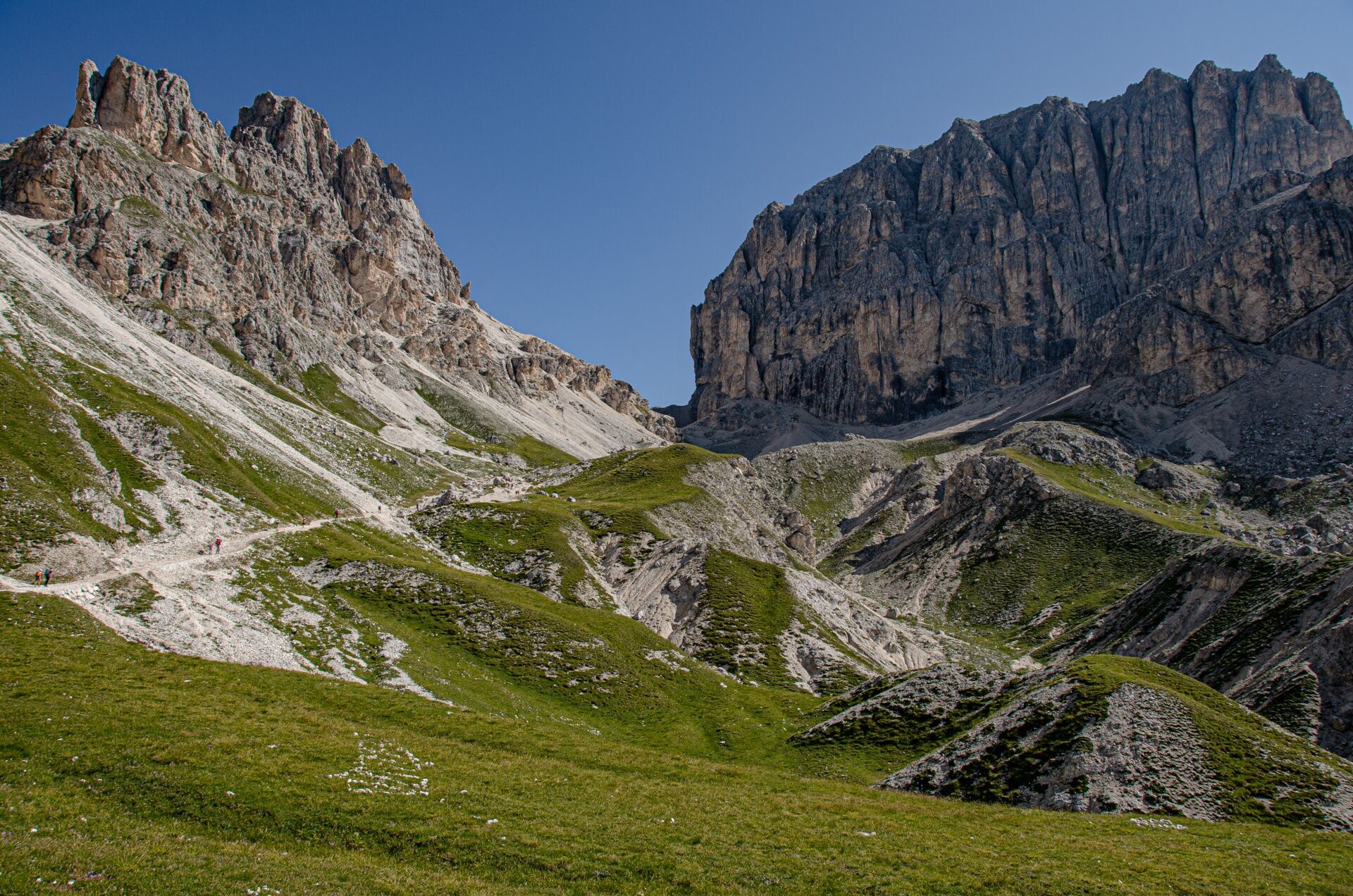
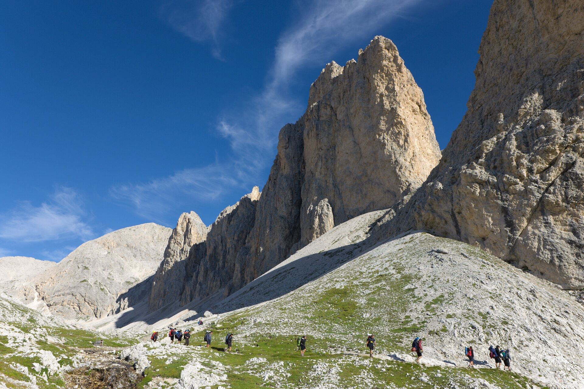
The itinerary continues north along path no. 584 which first shows the Vaiolet Valley and then ends up in a steep stretch which takes to the Passo Principe Refuge. As you walk, the Catinaccio d’Antermoia mountain becomes increasingly imposing. From the Principe Pass and refuge go up on path no. 584 until the Antermoia Pass to then flank the western slope of the Catinaccio d’Antermoia. Shortly, you will reach the Antermoia Refuge, where the overnight is planned.
Total time with detour to the Passo Santner Refuge 6 hours (4 hours without variant).
- Directions
-
From Vigo di Fassa take the cable car up to Ciampedie, which offers a magnificent view of the entire Vaiolet Valley and the Fassa Dolomites. From here on path no. 540 you will get to the basin of Gardeccia.
From the Antermoia Pass, flank the western slope of the Catinaccio d’Antermoia. Shortly, you will reach the Antermoia Refuge, where the overnight is planned.
- Highest point
- 2,762 m
- Endpoint
-
Antermoia Refuge
- Height profile
-
 © outdooractive.com
 - Equipment
-
Wear adequate clothing, footwear and equipment suitable for the length and grade of difficulty of trail to be taken. Always try to be self-sufficient and carry with you the necessary to face possible emergency situations and a first aid kit.
- Safety instructions
-
1. Plan your excursion according to your skills and the weather.
2. Walk slowly, enjoy the landscape and the silence.
3. Inform somebody about your itinerary, return time and possible changes.
4. Rely on professionals (Alpine and local guides).
5. Help those in need. Call 112 only in case of real necessity.
6. Make sure you have suitable clothes and equipment + some water and snacks.
7. Respect the environment around you and its inhabitants. Bring back your rubbish.
8. Follow the marked trails avoiding those in the bike park.
9. To protect the wonders of nature, leave everything in its place.
10. Bring your pet along, but keep it on a leash.
- Tips
-
Organised 3-day high altitude trekking, from refuge to refuge, to discover the most beautiful peaks of the Fassa Dolomites on foot.
Number of mountain lifts to take: 1 (cable car Vigo-Ciampedie).
The tour counts 3 stages on well-indicated CAI-SAT paths. From any point, it is possible to descend to the valley and, thanks to the shuttle service, the mountain lifts or the public means, easily get back to the departure.
- Additional information
-
The 3-night holiday package includes: 3 free and independent trekking tours of medium difficulty 1 night in a Dolomiti Walking Hotel (first and last night), in a double room, with half board 2 overnight stays in a refuge, in a multiple room, with half board 1 cotton sleeping bag for overnight stays in the refuge map of Val di Fassa trails
Tourist Board Val di Fassa
Strèda Roma, 36
38032 Canazei (TN)
Phone +39 0462 609500
info@fassa.com
www.fassa.com
- Directions
-
Main access points to the valley coming from the A22, Modena-Brenner motorway
- exit Ora/Egna, S.S. 48 delle Dolomiti - Passo San Lugano - Val di Fiemme - Val di Fassa (distance km 45). From the Moena bypass (artisan area) towards Canazei
- Bolzano Nord exit, S.S. 241 Grande Strada delle Dolomiti - Passo Carezza - Vigo di Fassa (distance km 40). From Vigo northwards towards Canazei, southwards towards Soraga di Fassa and Moena
Other accesses to the Val di Fassa
- from the A27 (Venice) motorway, exit Belluno/Ponte nelle Alpi, S.S. 203 for Agordo and S.P. 346 Passo San Pellegrino - Moena (Val di Fassa). From the Moena bypass towards Canazei
- from the A27 (Venice) motorway, exit Belluno/Ponte nelle Alpi, S.S. 203 for Agordo/Alleghe/Rocca Pietore. S.P. 641 Passo Fedaia - Canazei
- coming from Arabba, S.S. 48 Passo Pordoi - Canazei
- from Val Gardena, S.S. 242 Passo Sella - Canazei
- Public transportation
-
Public transport lines Trentino Trasporti - Val di Fassa:
- line no. 101 Canazei - Cavalese - Trento
- line no. 104 Cavalese - Ora - Trento
- line no. 123 Moena - San Pellegrino Pass - Falcade
Public transport lines SAD - Val di Fassa:
- line no. 180 Vigo di Fassa - Carezza Pass - Bolzano
- Parking
-
Parking spaces in the vicinity of the cable car departure station or near the sports field.


- Author
-
The tour Stage 1 Dolomiti Trek King autum - Catinaccio is used by outdooractive.com provided.