
- Brief description
-
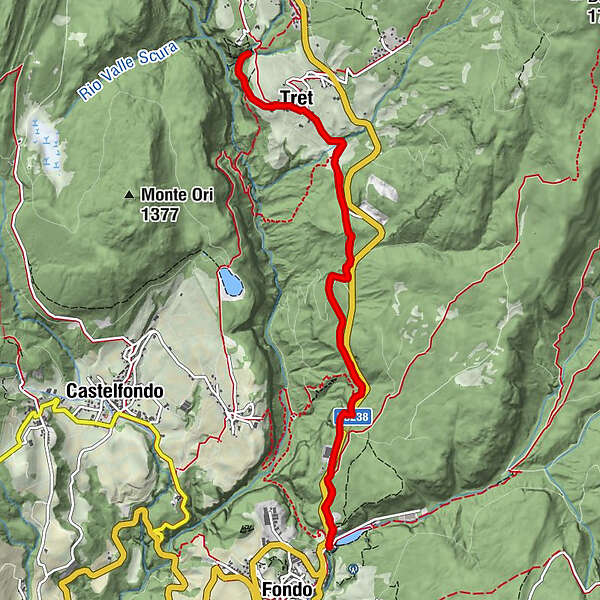
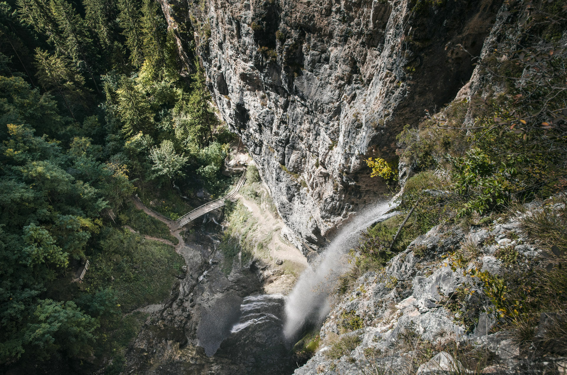
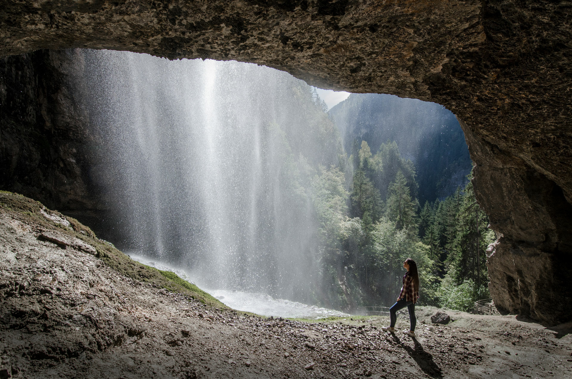
A pleasant walk, passing through the woods, with spectacular views of the valley canyon and of the Tret waterfall.
- Difficulty
-
medium
- Rating
-
- Starting point
-
Fondo
- Route
-
Hotel Lago SmeraldoTret4.8 kmAurora4.8 kmCascata di Tret5.7 kmCascata Lago Smeraldo11.4 kmHotel Lago Smeraldo11.4 km
- Best season
-
JanFebMarAprMayJunJulAugSepOctNovDec
- Description
-
The canyons are an outstanding feature of Val di Non. This walk enables you to view one of the widest of the valley’s canyons, that of "del Mondino", and to go as far as a postion where you can admire the spendid sight of the Tret waterfall.
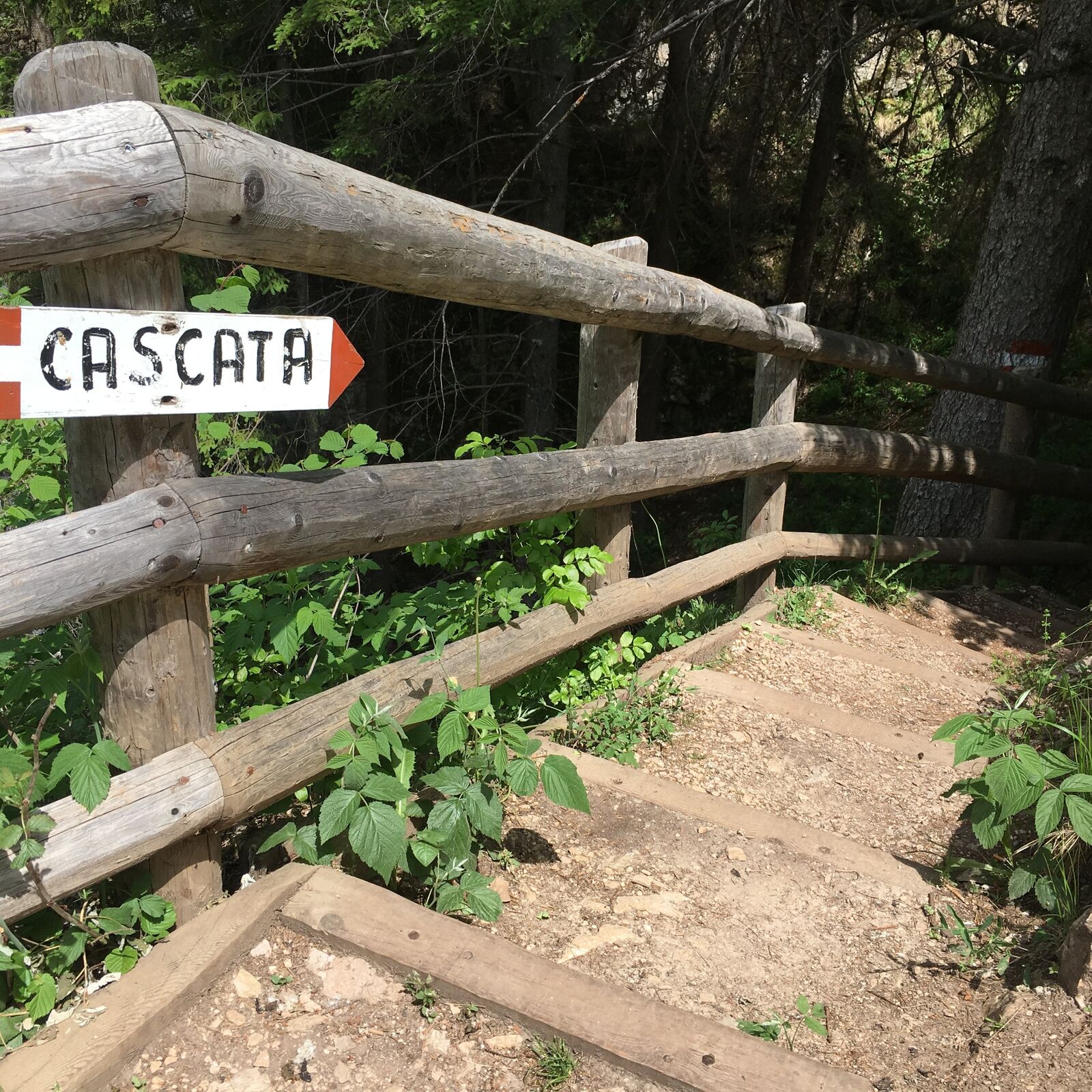
- Directions
-
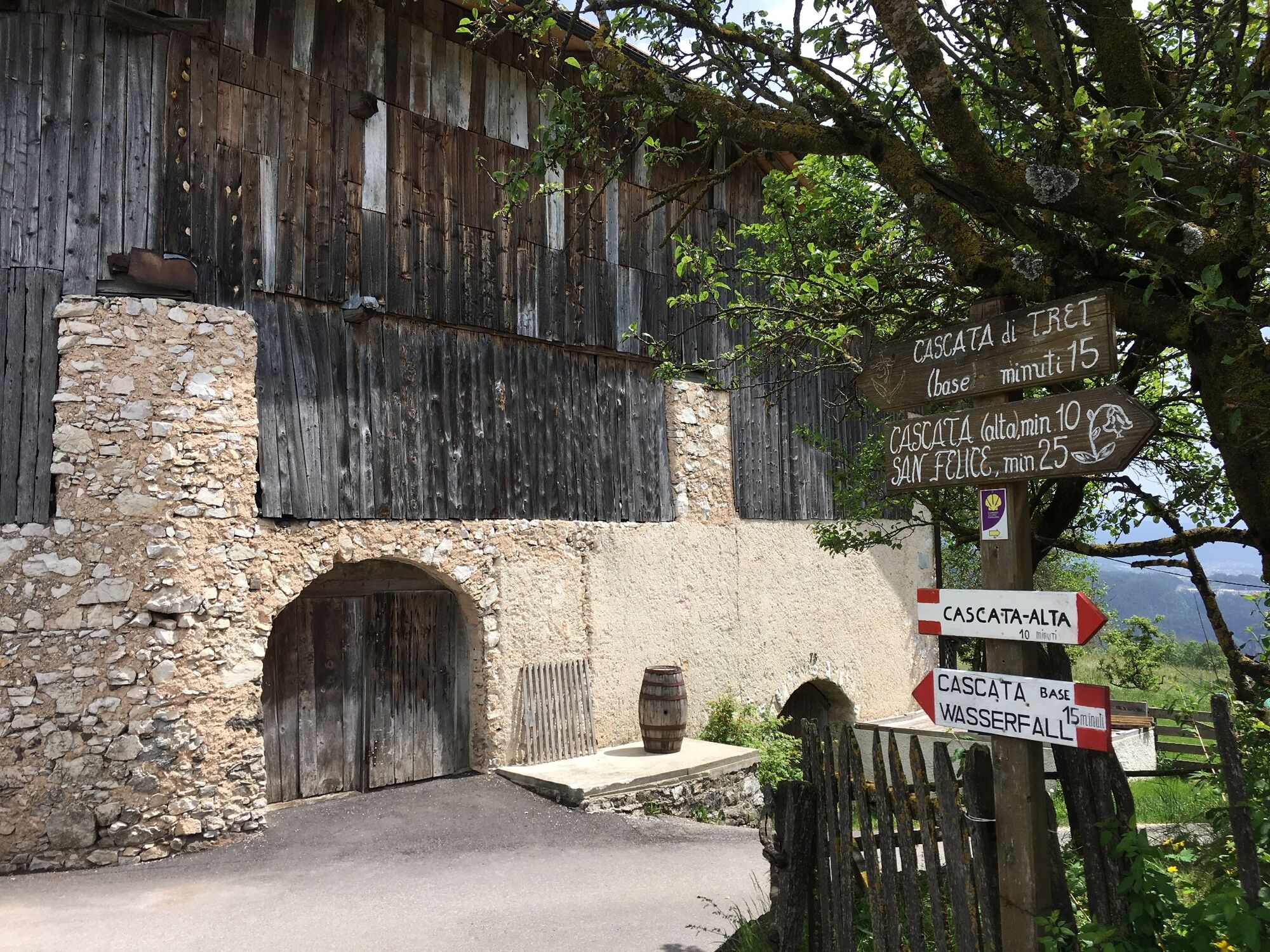
From Fondo you go by car along the 238 main road in the direction of Passo Palade. After about a kilometre you will see on the left a large carpentery and the access to the small road, it signposted with a yellow shell symbol, indicating the route of the Jacopeo d’ Anaunia walk. Right here begins the old road that connected Fondo to the nearby district of Tret.
You can park in the area on the right, and then carefully crossing the road you take the path which takes you to the carpentry. The first stretch is asphalted but after you pass the bar barrier it becomes a dirt track. Follow the way and you enter a wood which is not too dense and has many viewpoints on the canyon and the houses of Dovena on the opposite side of the canyon.
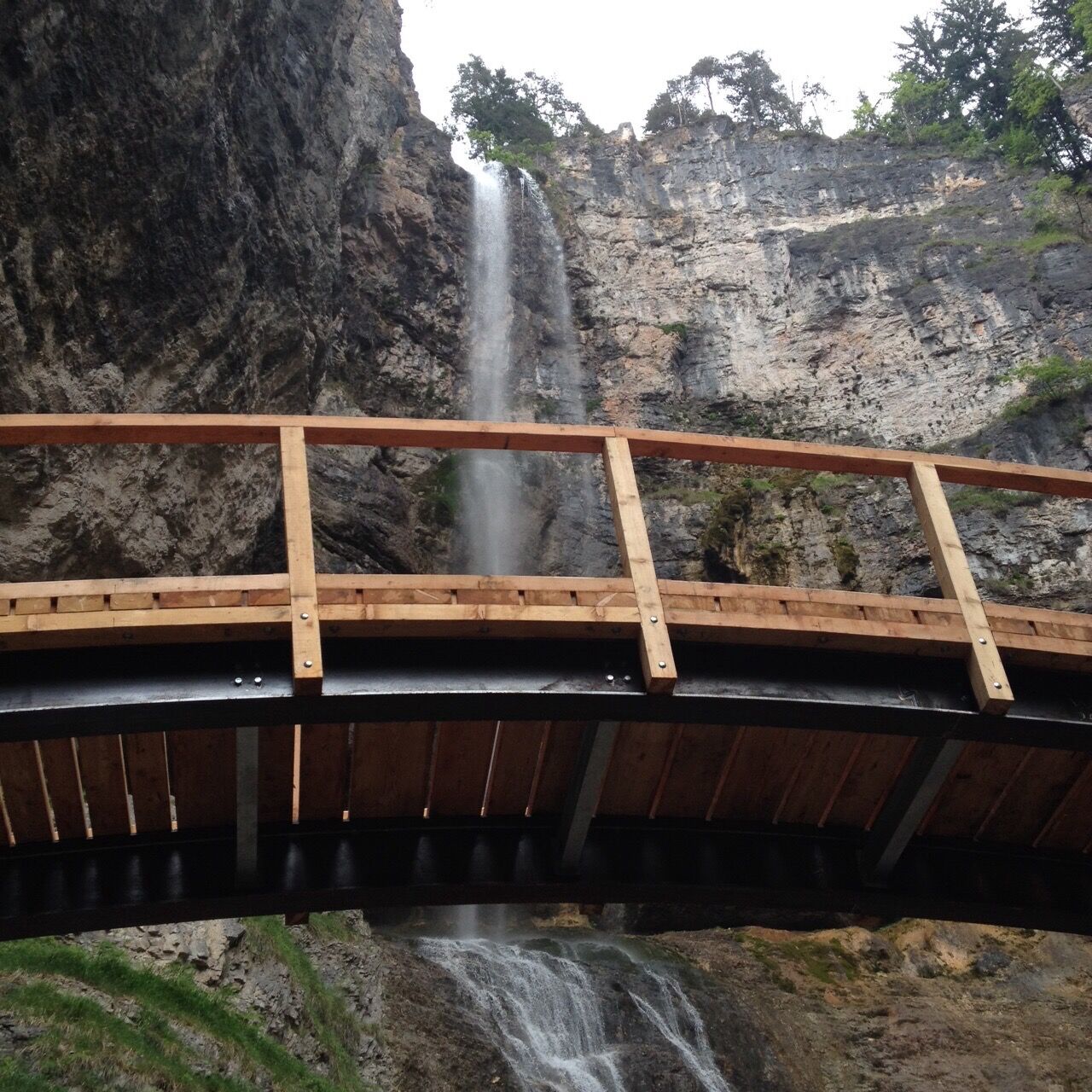
Go straight on and always keep an eye out for the ummistakable yellow shell sign of the Cammino Jacopeo walk and you will reach the asphalted road which wil take you on to Tret and Hotel Aurora. Once you pass the hotel you will come to a choice of direction point. Here, keep to the right and following the way you will come to a panoramic viewpoint above the Tret waterfall. The road then goes on as far as the German speaking villages of San Felice and Senale.
If you take the track to the left you will go down quite quickly to the base of the waterfall and from where you will have a better view of the waterfall itself and of the lake which has formed below it.
The way back is along the same route as the approach, or alternatively and from the foot of the waterall you can go up the steps which bring you to the panoramic point above the waterfall, and then turn right and go to the district of Tret itself.
- Highest point
- 1,160 m
- Endpoint
-
Fondo
- Height profile
-
 © outdooractive.com
 - Safety instructions
-
Please note that the practicability of the itineraries in a mountain environment is strictly linked to the contingent conditions and is therefore influenced by natural phenomena, environmental changes and weather conditions. For this reason, the information contained in this page may have changed. Before leaving for a tour, make sure the path you will approach is still accessible by contacting the owner of the mountain hut, the alpine guides or the visitor centres of the nature parks, the info offices of the local tourist board.

- Author
-
The tour From Fondo to the Tret waterfall is used by outdooractive.com provided.


General info
-
Bozen und Umgebung - Südtirols Süden
1948
-
Nonstal
647
-
Malosco
158