Sentiero delle Aquile e Sentiero Botanico (Eagles trail and botanic path)


- Brief description
-
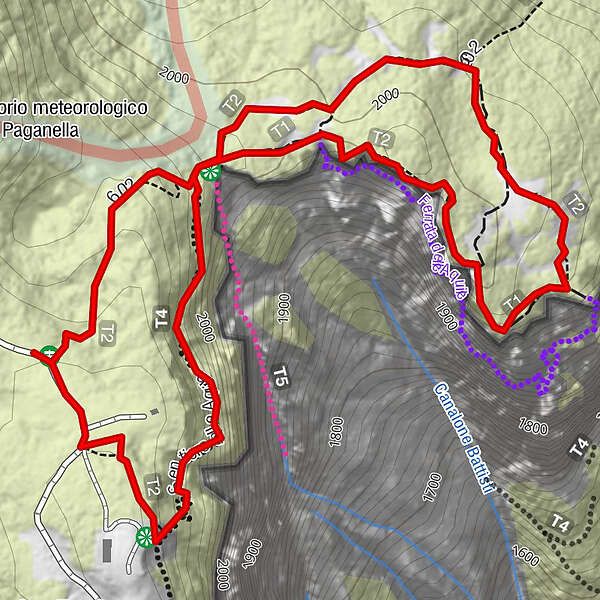
New panoramic walk on Paganella top.
- Difficulty
-
difficult
- Rating
-
- Starting point
-
Cima Paganella
- Route
-
La Roda (2,080 m)0.3 km
- Best season
-
JanFebMarAprMayJunJulAugSepOctNovDec
- Description
-
New panoramic round walk on Paganella top, looking for breathtaking landscapes and discovering the Alpflora.
.
- Directions
-
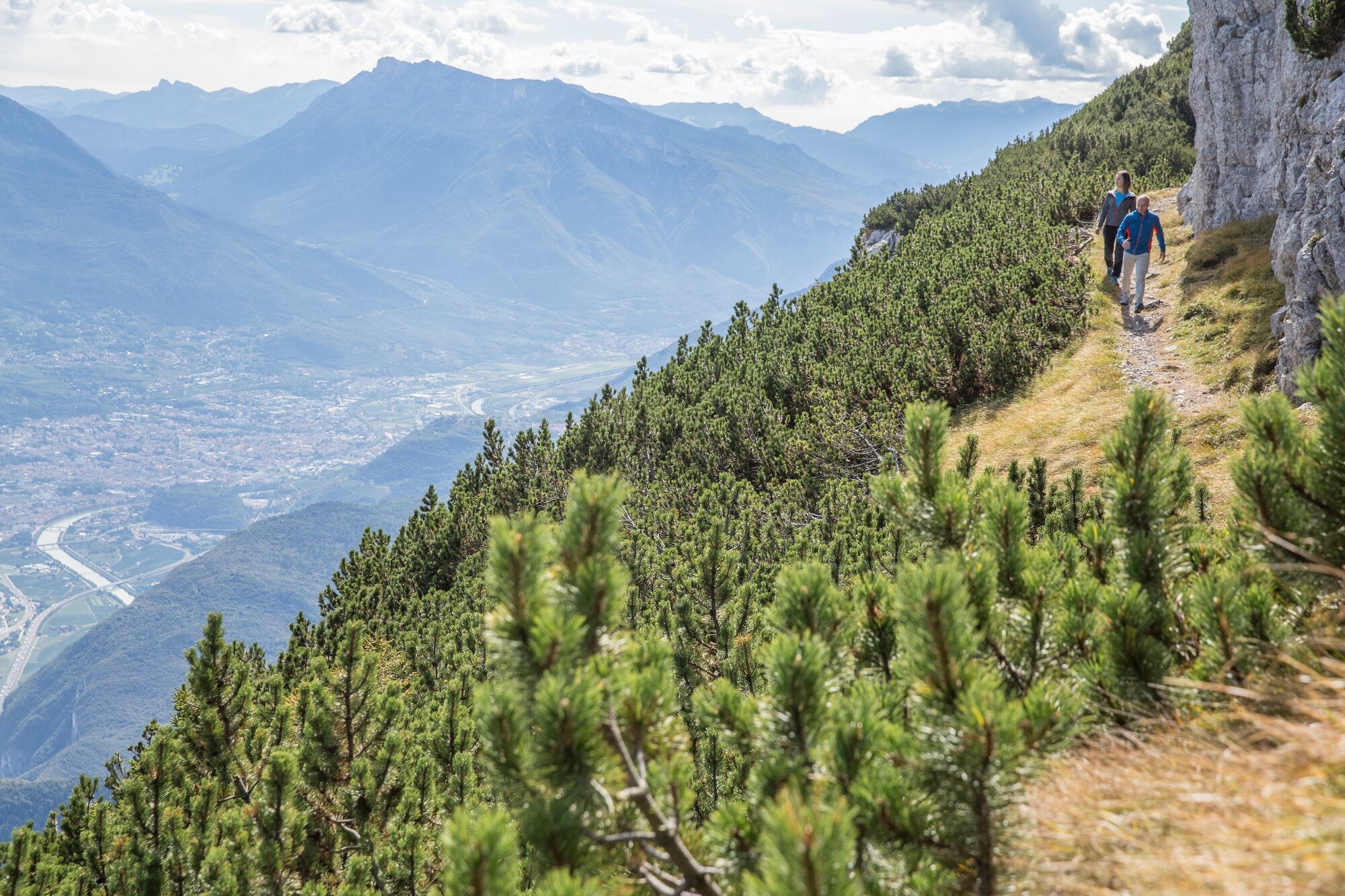
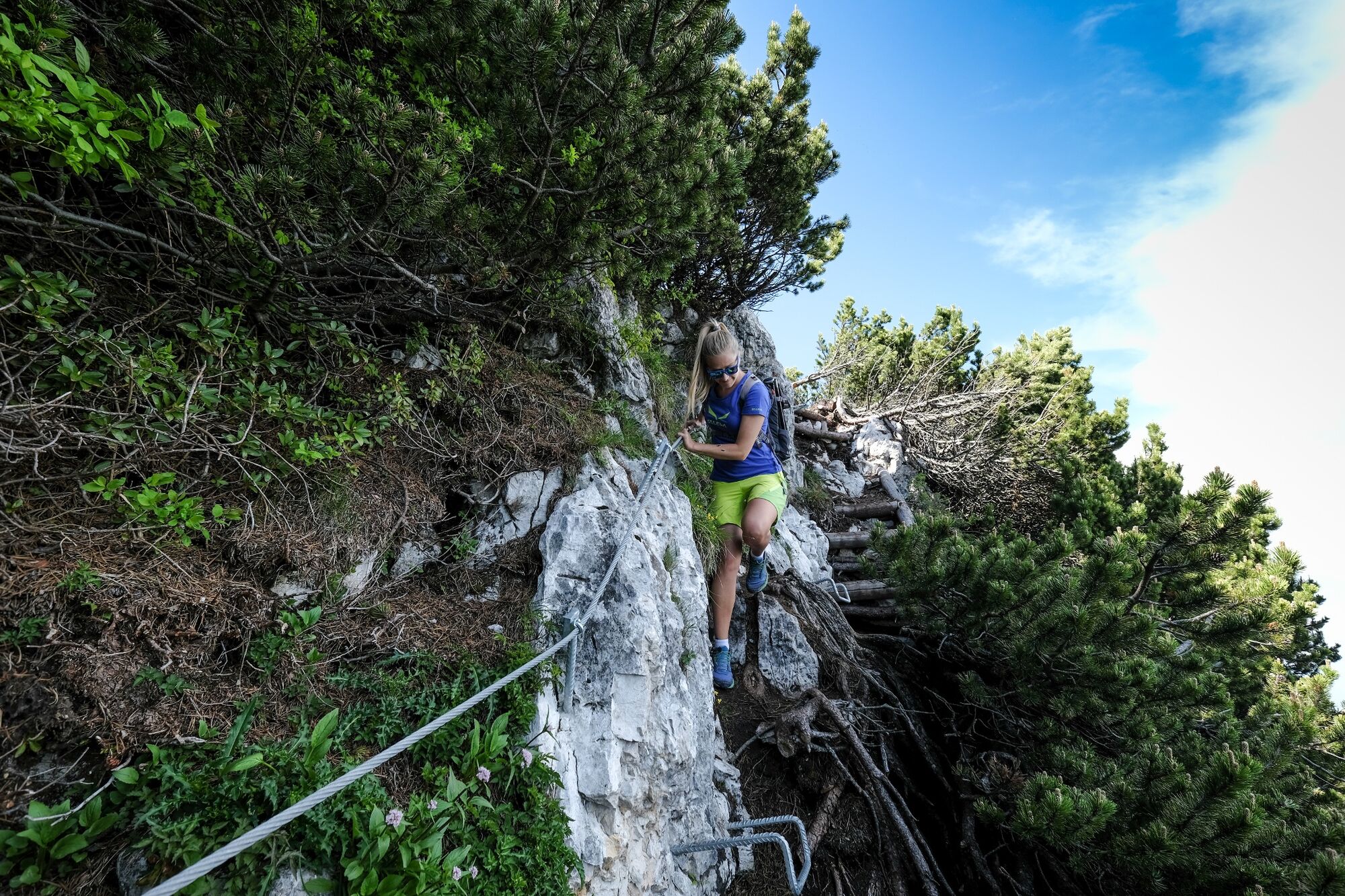
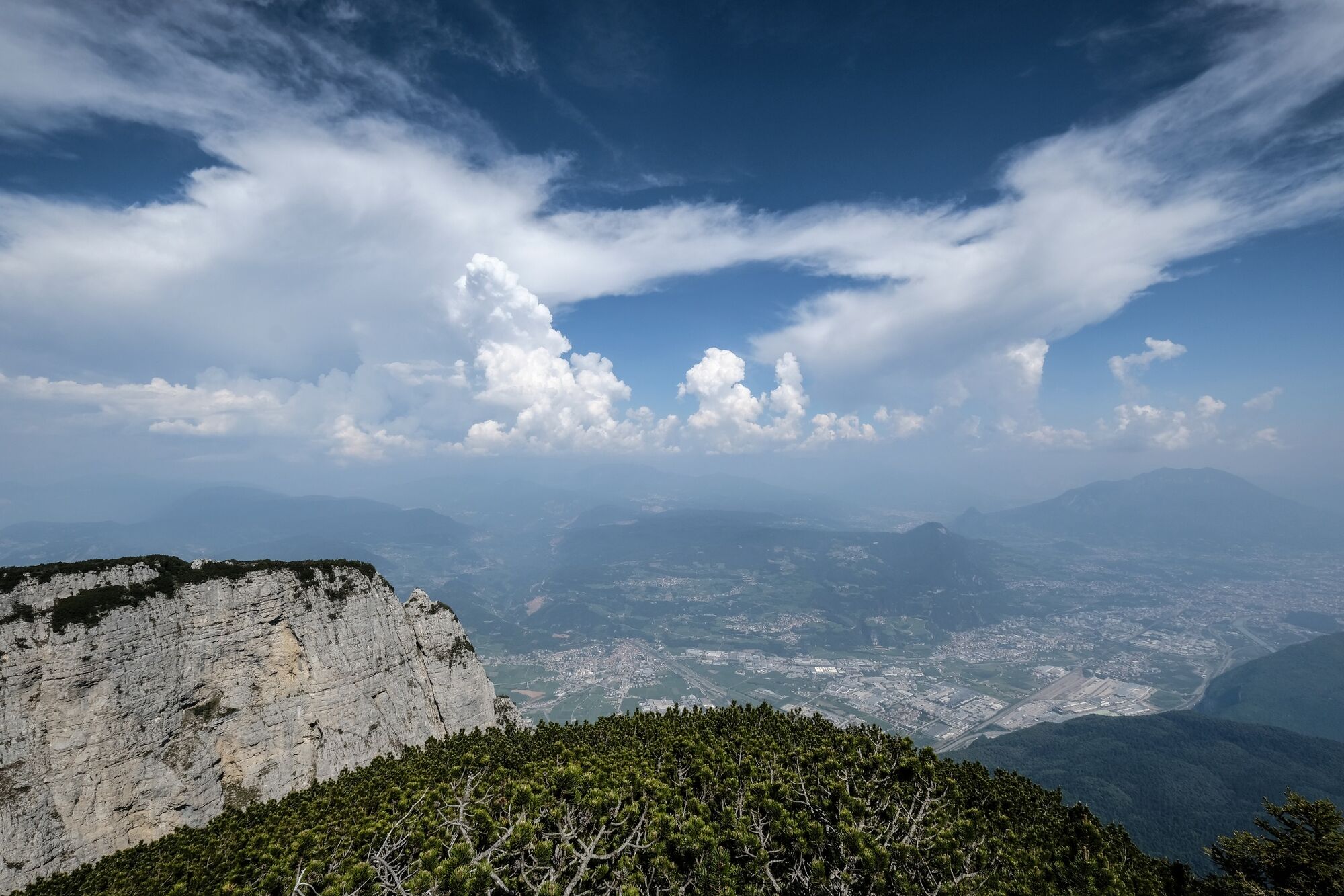
The "eagles trail" starts from the arrival of the chairlift on Cima Paganella; be careful during the first stretch of the path. After passing a great natural cave you will find the Canalone Battisti; then, after 30 minutes walking, you will reach the "trono dell'aquila", from where you will enjoy a beautiful view over the mountains. From here you can walk on the botanic path, a pleasant walk through the enchanting local flora of Paganella, one of the richest in Trentino.
- Highest point
- 2,089 m
- Endpoint
-
Cima Paganella
- Height profile
-
 © outdooractive.com
 - Equipment
-
Trekkingshoes, rain-jacket, water.
- Safety instructions
-
1) Prepare your itinerary
2) Choose an excursion appropiate for your real ability and training level
3) Choose the fitting equimpent
4) Check the weather forecast
5) Hiking alone is risky
6) Give details about your itinerary and about the approximate hour of your return
7) Do not hesitate to entrust you to an expert
8) Pay attention to the indication and signals you will find along your journey
9) Do not hesitate to retrace your steps
10) Ask for help and call the number 112
Please note that the practicability of the itineraries in a mountain environment is strictly linked to the contingent conditions and is therefore influenced by natural phenomena, environmental changes and weather conditions. For this reason, the information contained in this page may have changed. Before leaving for a tour, make sure the path you will approach is still accessible by contacting the owner of the mountain hut, the alpine guides or the visitor centres of the nature parks, the info offices of the local tourist board.
- Tips
-
Avoid the queue: purchase online your ticket and go directly to turnstile. Choose the stage and pay with your credit card. You will receive by email your ticket (you can print the ticket or save it in your smartphone), scan it on the orange scanner on the turnstile located at the gates of the lift.
- Additional information
- Directions
-
From the motorway exit Trento nord we drive direction val di Non and Altopiano della Paganella; just afer the long tunnel by Mezzolombardo, we turn right (SP 64), to Fai della Paganella and Andalo.
- Public transportation
-
Trentino Trasporti - line 611
- Parking
-
Andalo town centre and at the departure of the cable way to mount Paganella.


-

-
AuthorThe tour Sentiero delle Aquile e Sentiero Botanico (Eagles trail and botanic path) is used by outdooractive.com provided.