- Brief description
-
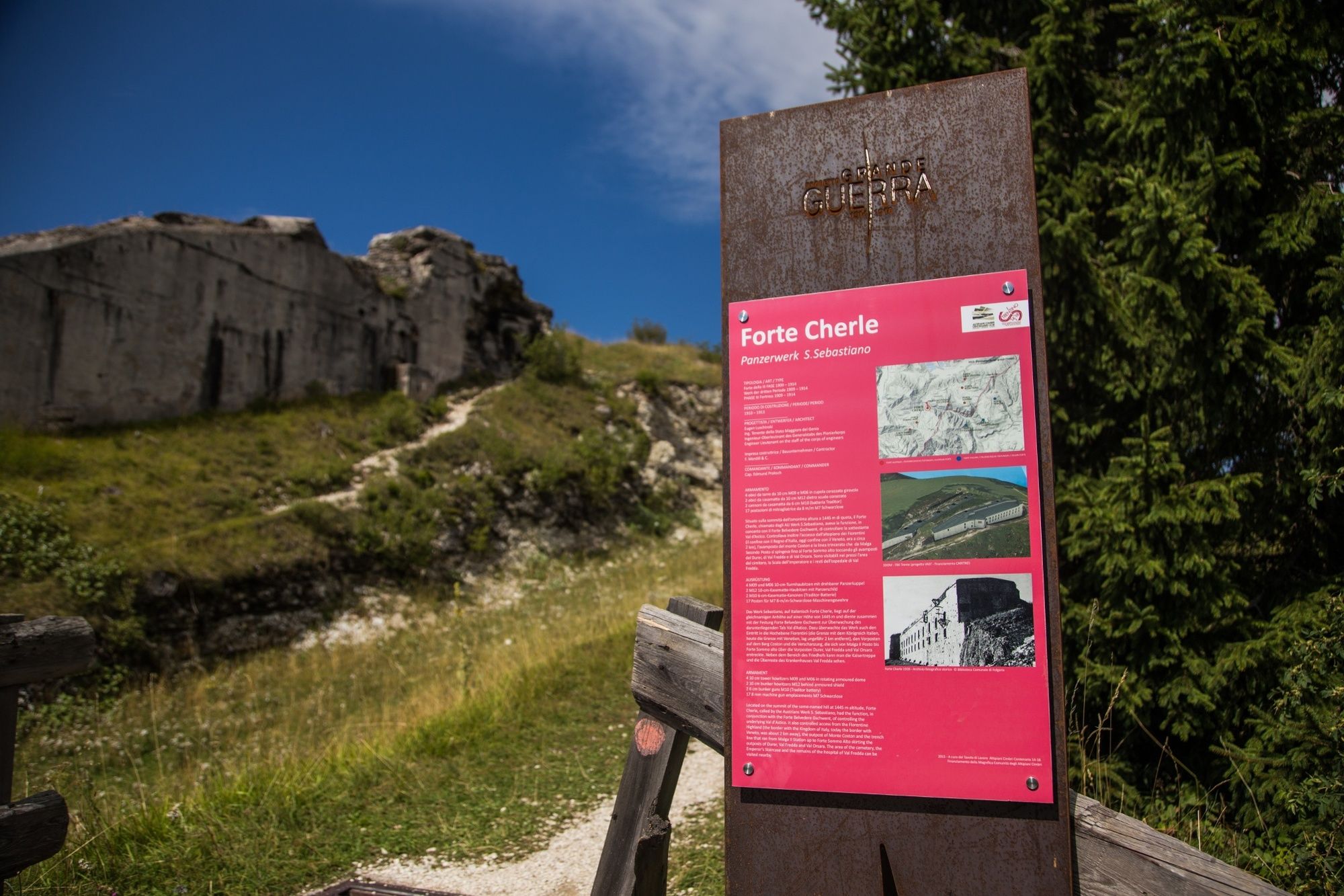
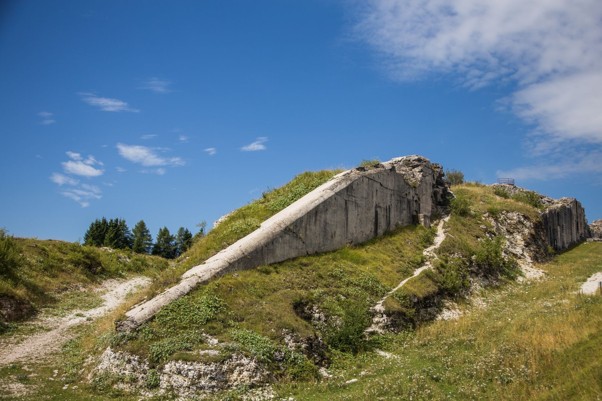
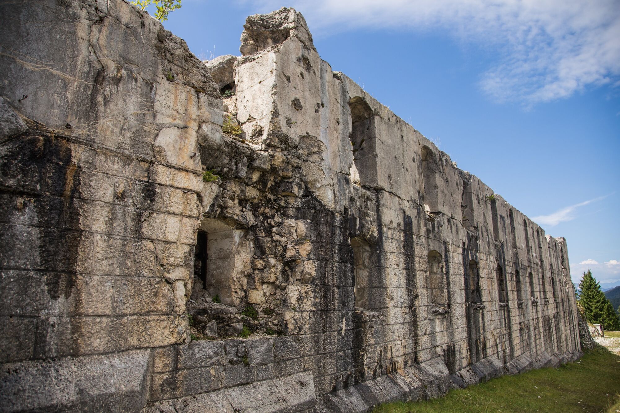
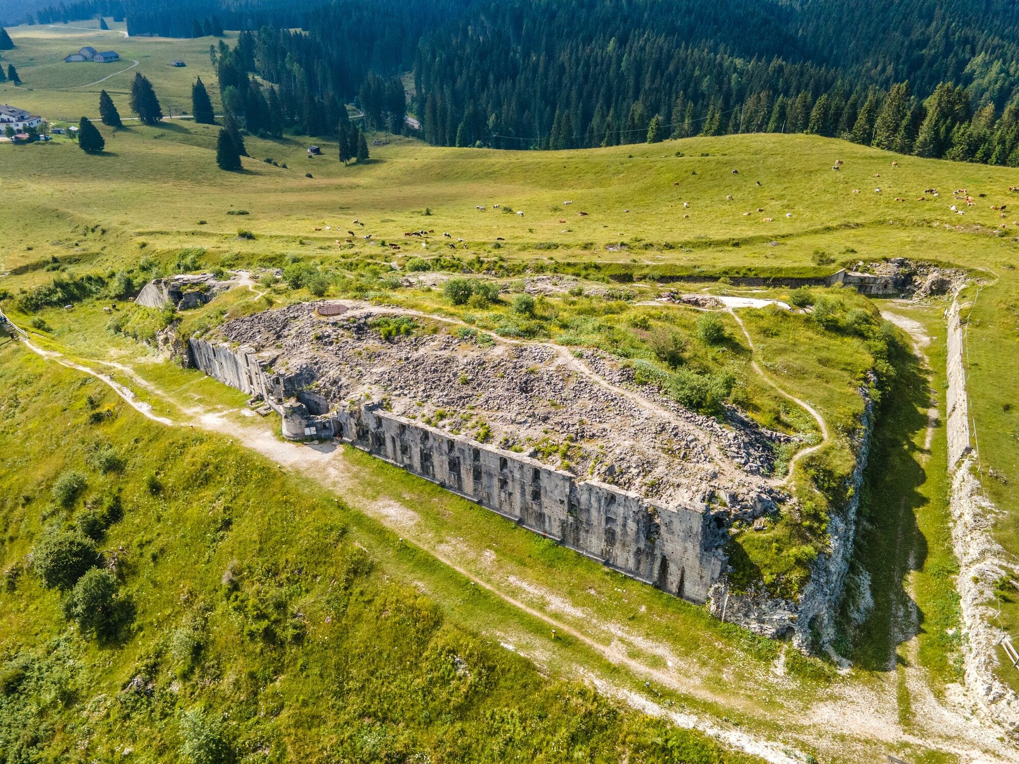
The Cherle ridge, between the upper Val d'Astico and the Fiorentini plateau, is known for the Austro-Hungarian fortress that occupies its summit and of which the ruins remain today. Although damaged by the work of salvage workers and the removal of metal by means of mines in 1936, the fort - which the Austro-Hungarians called Werk Sebastiano - still stands today in all its extension and grandeur. All around it are extensive pastures and a lush spruce forest.
- Difficulty
-
medium
- Rating
-
- Route
-
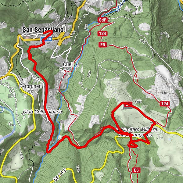
San Sebastiano (1,279 m)Tezzeli (1,245 m)1.7 kmHotel Forte Cherle5.2 kmTezzeli (1,245 m)8.5 kmSan Sebastiano (1,279 m)10.3 km
- Best season
-
JanFebMarAprMayJunJulAugSepOctNovDec
- Description
-
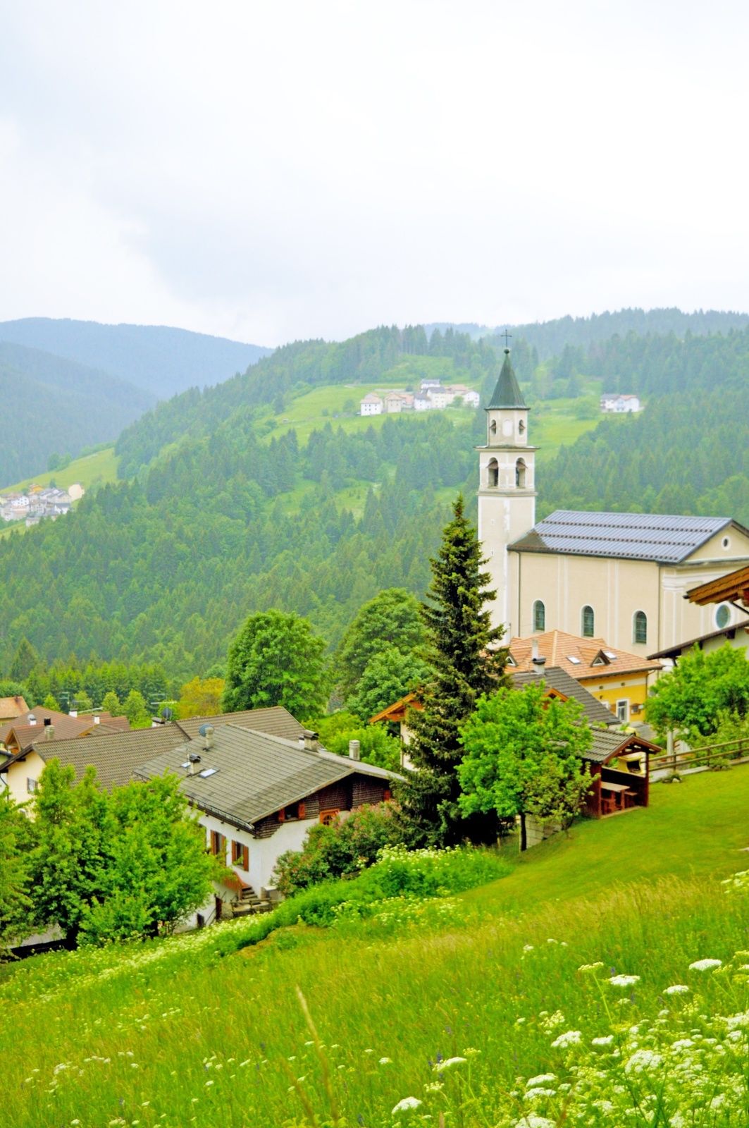
The beauty of this route lies in its destination, in Forte Cherle, from the roof of which there is a wide panorama of the eastern part of the Alpe Cimbra, Mount Cornetto and Bècco di Filadonna. It also lies in the characteristic village of Tézzeli, in the hydraulic sawmill of Mein, in the area of San Fermo (the vanished village) and in the remains of the Great War (1914-1918) that can be visited in the vicinity of the Fort: the well-known Scala dell'Imperatore (Emperor's Stairs), the former military cemetery and the remains of the military hospital of Val Fredda.
- Directions
-
From the centre of San Sebastiano (just downstream from the church) we descend to the SS350 road. With due care, we cross it and take the easy path that cuts through the meadows (Bisen) below the village, which enters the beautiful Télder forest and, passing several small valleys, leads us to the Cimbrian village of Tézzeli. Turning left we cross the village (signposts) and at the end of it we descend the wide dirt track that leads to the Astico torrent, which passes the hydraulic sawmill of Mein, the San Fermo area and continues in a meadow and forest environment (beautiful panoramic views of San Sebastiano) along a long dirt track that after a long stretch on a false level gradually ascends the high ground until we reach the grazing plateau of Cherle. We pass by the Cherle hotel, reach the nearby fortress (panoramic viewpoint) on grassy ground, after which we continue down the north-western slope of the high ground and along a well-descended path we reach the dirt road we took on the outward journey near the locality of San Fermo. We turn left and enter the dirt track that, having passed the Mein sawmill, takes us back to Tézzeli and finally to San Sebastiano.
- Highest point
- 1,429 m
- Endpoint
-
San Sebastiano
- Height profile
-
 © outdooractive.com
 - Safety instructions
-
Please note that the practicability of the itineraries in a mountain environment is strictly linked to the contingent conditions and is therefore influenced by natural phenomena, environmental changes and weather conditions. For this reason, the information contained in this page may have changed. Before leaving for a tour, make sure the path you will approach is still accessible by contacting the owner of the mountain hut, the alpine guides or the visitor centres of the nature parks, the info offices of the local tourist board.
- Directions
-
From the Folgaria East roundabout, continue in the direction of Lavarone, pass the village of Costa, and continue until you reach the Sommo Pass. San Sebastiano is just a little further on.


- Author
-
The tour Cherle Tour is used by outdooractive.com provided.