- Brief description
-
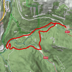
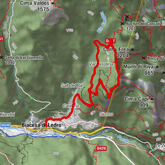
Breve passeggiata, senza particolari difficoltà, che da Vason porta alla piana delle Viote. Il rientro è possibile con mezzi pubblici.
- Difficulty
-
easy
- Rating
-
- Route
-
Vason (1,654 m)Bond One0.1 kmRocce Rosse1.2 kmCapanna Viote3.2 km
- Best season
-
JanFebMarAprMayJunJulAugSepOctNovDec
- Highest point
- 1,654 m
- Endpoint
-
Vason
- Height profile
-
 © outdooractive.com
 - Safety instructions
-
Please note that the practicability of the itineraries in a mountain environment is strictly linked to the contingent conditions and is therefore influenced by natural phenomena, environmental changes and weather conditions. For this reason, the information contained in this page may have changed. Before leaving for a tour, make sure the path you will approach is still accessible by contacting the owner of the mountain hut, the alpine guides or the visitor centres of the nature parks, the info offices of the local tourist board.
- Additional information
-
Trento Tourist Office - Tel. +39 0461 216000 - info@trento.info - www.trento.info


- Author
-
The tour Vason - Viote is used by outdooractive.com provided.