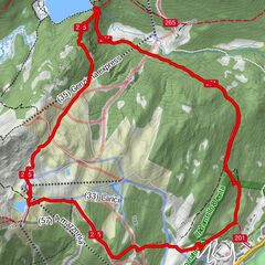

- Route
-
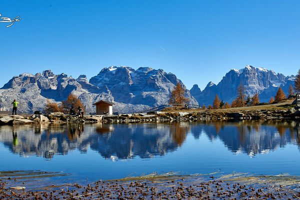
Malga Scale4.2 kmMalga Mondifrà9.6 kmMalga Vaglianella11.0 kmMalga Vagliana12.0 km
- Highest point
- 2,383 m
- Height profile
-
 © outdooractive.com
 - Safety instructions
-
1) Prepare your itinerary
2) Choose a route that is suitable for your skill level
3) Choose suitable equipment and gear
4) Consult the snow/weather bulletins
5) Heading out on your own is more risky
6) Leave information on your itinerary and on the approximate time you expect to return
7) Do not hesitate to seek the support of a professional
8) Pay attention to the information and signs that you find along the trail
9) Do not hesitate to follow your steps backwards
10) In case of an accident, sound the alarm by calling the emergency number 112.
Please note that the practicability of the itineraries in a mountain environment is strictly linked to the contingent conditions and is therefore influenced by natural phenomena, environmental changes and weather conditions. For this reason, the information contained in this page may have changed. Before leaving for a tour, make sure the path you will approach is still accessible by contacting the owner of the mountain hut, the alpine guides or the visitor centres of the nature parks, the info offices of the local tourist board.
- Author
-
The tour Brenta Trek - Etappe 8 - Costanzi-Albasini – Rif. Stoppani is used by outdooractive.com provided.


-
Bozen und Umgebung - Südtirols Süden
1936
-
Val di Sole
579
-
Folgarida
157