
- Brief description
-
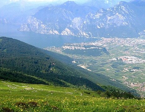
Monte Stivo dominates Garda Trentino, and from its summit you have one of the most spectacular views over Lake Garda and the surrounding valleys.
- Difficulty
-
medium
- Rating
-
- Starting point
-
Sant'Antonio
- Route
-
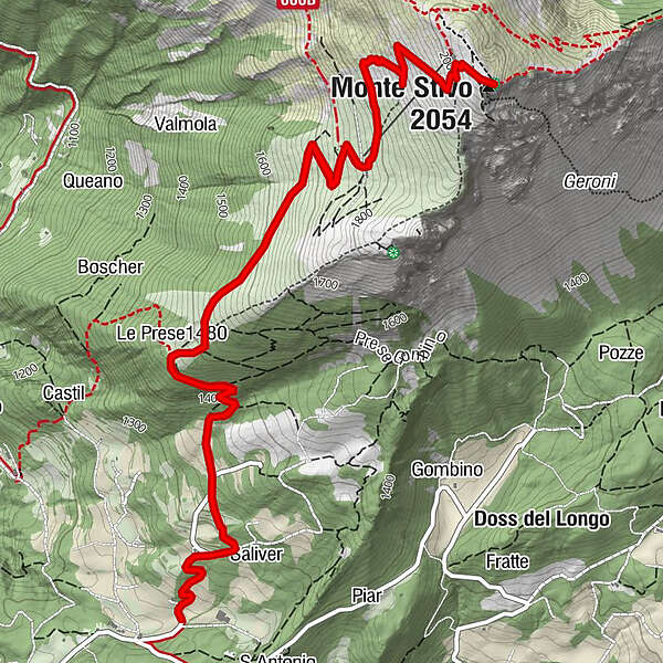
Le Prese (1,480 m)1.7 kmMonte Stivo (2,054 m)4.8 kmLe Prese (1,480 m)7.9 km
- Best season
-
JanFebMarAprMayJunJulAugSepOctNovDec
- Description
-
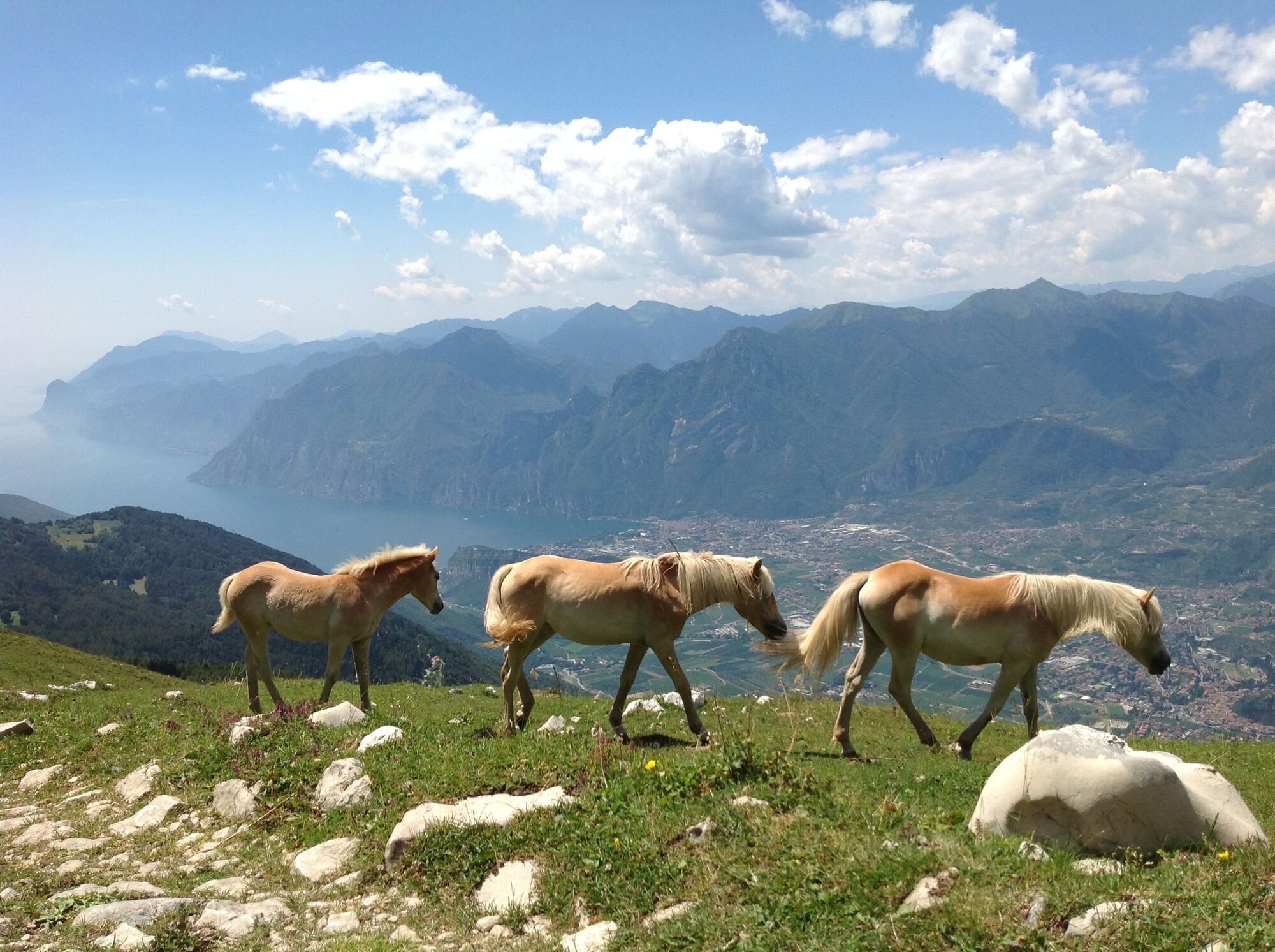
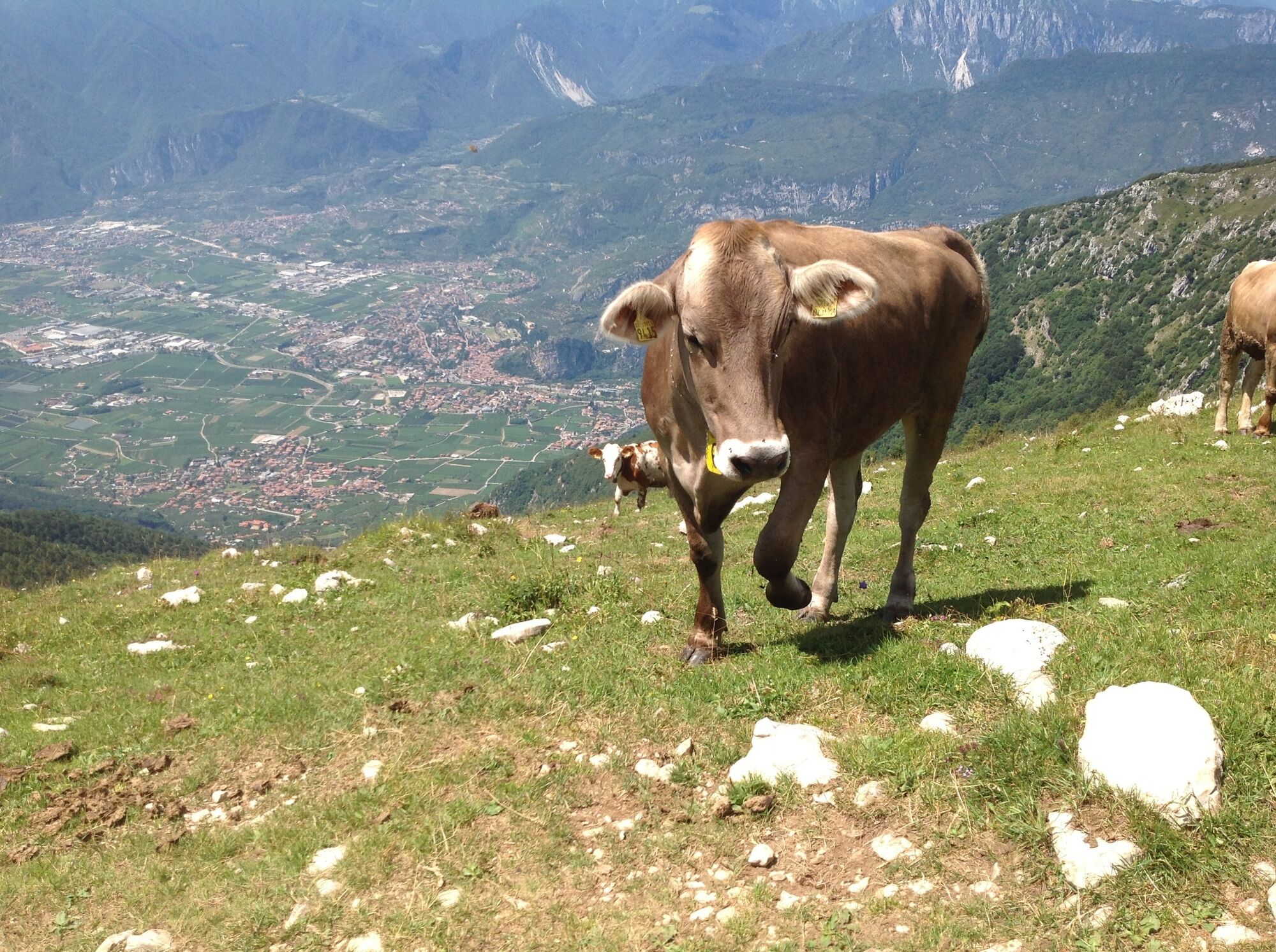
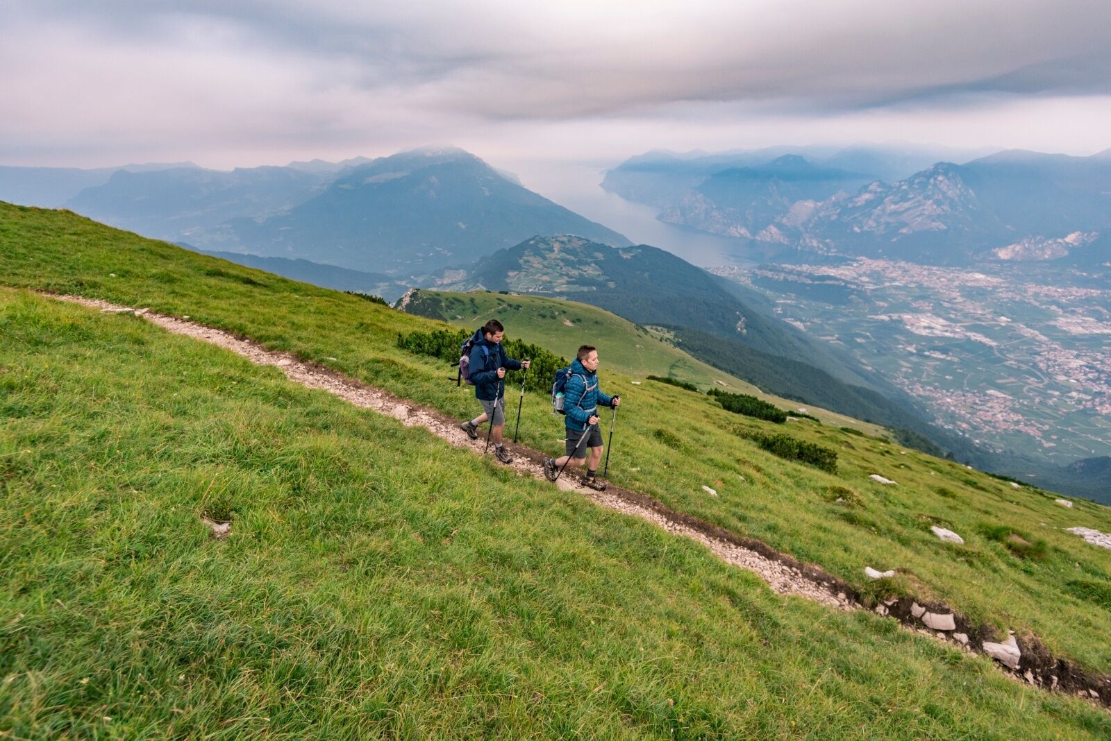
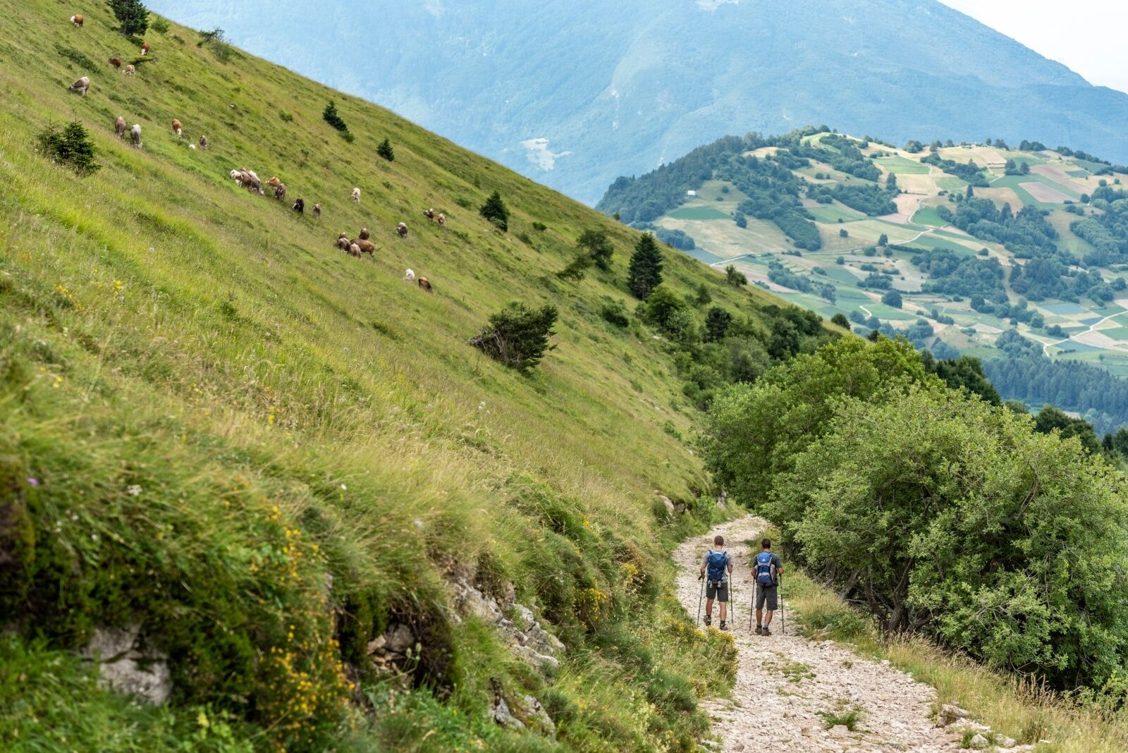
The trail soon takes you above the woods and onto the wide open pastures which cover the summit of Monte Stivo and are clearly visible from the Basso Sarca. You are likely to come across cows and horses grazing on the pastures. Monte Stivo is an imposing presence in Basso Sarca, its bulk towering above the "Busa" (the flat lands between Riva del Garda, Arco and Torbole).
Proverbs in local dialect bear witness to the importance of this mountain in the life of the community, with expressions like "When Stivo has its hat on, either it's going to rain or the sun's coming out soon” (Quando el Stif el g'ha el capel o che'l piove o che'l fa bel".) The “hat” is the crown of cloud which covers the peak of the mountain and is a sign of variable weather.
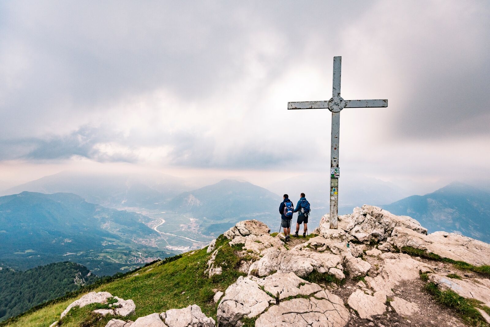
There is an observation/viewing point near the mountain hut which identifies all the surrounding peaks from Monte Baldo to the south, the Ledro Alps to the southwest, the Adamello glaciers, Carè Alto and Presanella to the northwest, the Brenta Dolomites to the north, the lesser Dolomites, Lagorai and Pasubio chain to the east.
- Directions
-
From Arco head for the village of Bolognano and up the Monte Velo road as far as Santa Barbara. Here turn left onto the tarmac road for Sant’Antonio and continue until you come to the car park where you can leave your car. Take the tarmac road (marked SAT 608B). After a few hundred metres you start to climb towards Prese, where the slopes of Monte Stivo open out before you. A dirt track SAT 608 leads to Malga Stivo pasture and from there a steep trail takes you to the mountain hut Rifugio Marchetti. From there it is only 10 minutes to the summit of Monte Stivo. Go back the way you came.
- Highest point
- 2,047 m
- Endpoint
-
Monte Stivo
- Height profile
-
 © outdooractive.com
 - Equipment
-
You need to wear the right clothing and take the proper gear when you go hiking in the mountains. Even on relatively short easy outings make sure to take all you need so you don't run into trouble if things take an unexpected turn, for example a storm blows up or you have a sudden drop in energy levels.
What should you take when you go on a hike?
Your rucksack (for a day trip a 25/30L capacity should do) should contain:
water canteen (1L) snacks (e.g. mixed dried fruit or chocolate) First aid kit windproof jacket fleece change of t-shirt and socks (in a plastic bag) make sure to wear or at least bring a pair of long trousers hat sun screen sunglasses gloves whistle to attract attention in an emergencyMake sure you're wearing the right footwear for the trail and season. The going can get rough and rocky underfoot and a pair of hiking boots will protect you from sprains. When wet, a grassy slope, rocky slab or steep trail can be dangerous unless you are wearing the proper footwear.
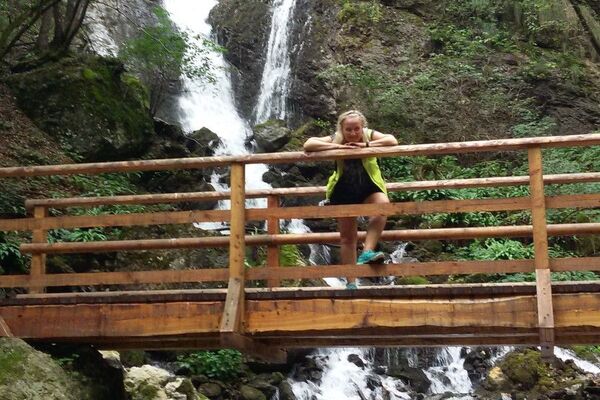
And finally... don't forget to bring your camera! You'll need it to capture the stunning views you come across all over Garda Trentino. And if you like, you can share your memories with us at #GardaTrentino.
Emergency telephone number 112.
- Safety instructions
-
Safety Tips
Choose itineraries that suit your physical and technical abilities. Collect information about the area you are visiting and the trail’s conditions and get a detailed trekking map. Wear clothes and take equipment that suit the difficulty and length of your tour. Keep emergency gear in your rucksack, including first aid supplies. Do not go walking alone in the mountains. In any case, tell someone where you are going and report back on returning. Look at the weather forecast before setting off and always keep an eye on the weather. In case of doubt, go back. It is better to give up than risk bad weather or face difficulties beyond your strength, ability and equipment. Do not leave marked paths and do not take shortcuts. All described walks are in a natural environment and therefore their use is at your own risk.This information is subject to inevitable variations, so none of these indications are absolute. It is not entirely possible to avoid giving inexact or imprecise information, given how quickly environmental and weather conditions can change. For this reason, we decline any responsibility for changes which the user may encounter. In any case, it is advisable to check environment and weather conditions before setting out.
- Tips
-
On clear days, in the space of just 70 km, you can see an incredible difference in elevation which ranges across all the landscapes of Trentino: from the 64 metres above sea level at Lake Garda to the summit of Ortles at 3905 metres!
- Additional information
- Directions
-
From Bolognano, a district of Arco, take the road for Monte Velo and the Santa Barbara pass. Alternatively, you can reach the pass by taking the road which goes from Loppio to Val di Gresta. Once you get to the fountain in Santa Barbara, turn left and follow directions for Sant'Antonio.
Find out how to reach Garda Trentino.
- Public transportation
- Parking
-
Free parking in Sant'Antonio (near the information panels at the mountain hut). Alternatively free parking in Santa Barbara before the fountain.
-
-
AuthorThe tour Monte Stivo is used by outdooractive.com provided.