
- Brief description
-
A hike along the Austro-Hungarian line of defence, the imposing fortifications built at the turn of the Twentieth century to defend the southern border
- Difficulty
-
medium
- Rating
-
- Starting point
-
Loc. S. Giuseppe - Nago
- Route
-
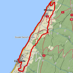
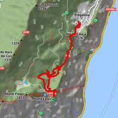
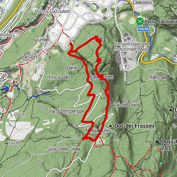
Segron0.7 kmGrotta Bianca Bini1.2 kmCrepa alle Daine1.4 kmPaternoster1.7 kmVersante Garda - Gresta2.0 kmDos de la Cronèla (706 m)2.6 kmMalga Zures2.6 km
- Best season
-
JanFebMarAprMayJunJulAugSepOctNovDec
- Description
-
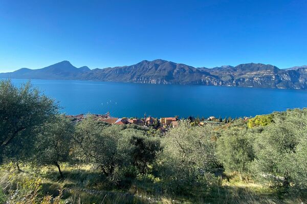
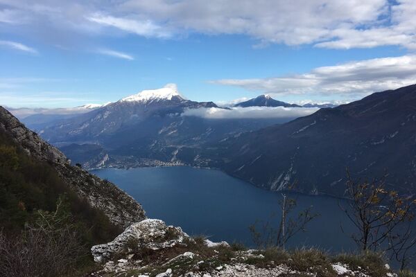
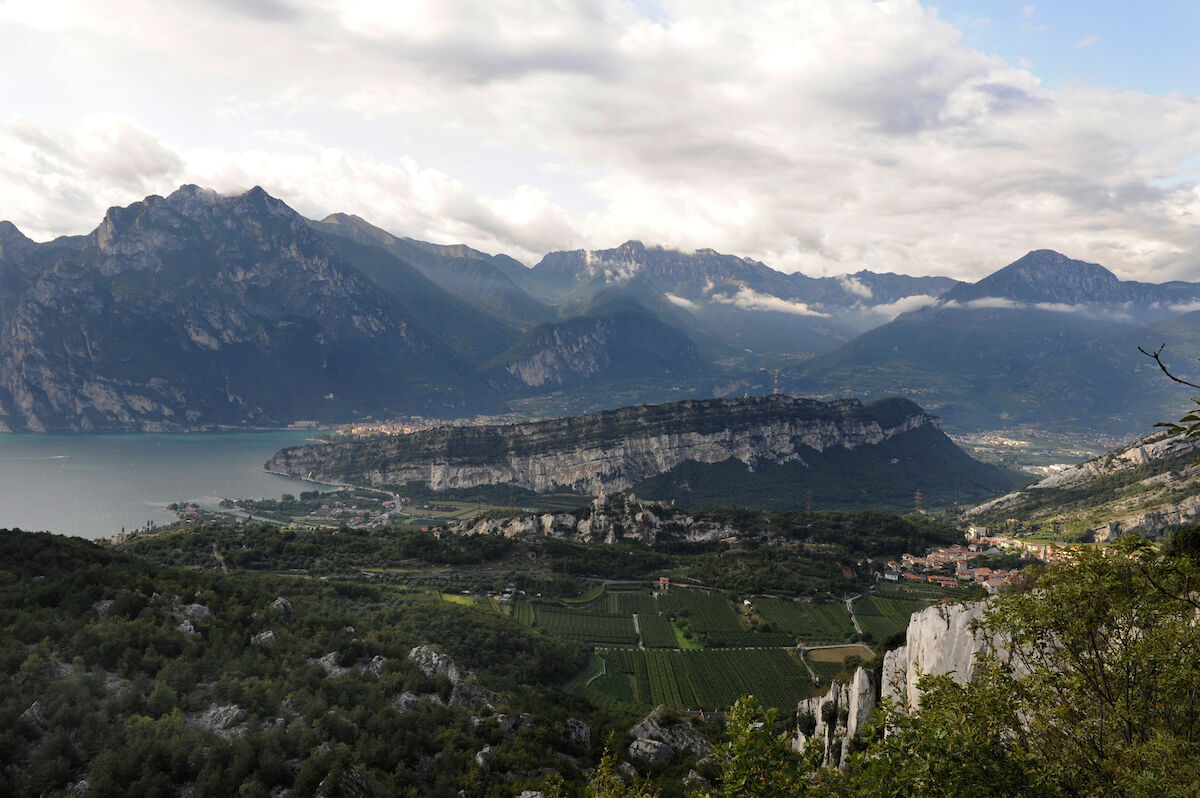
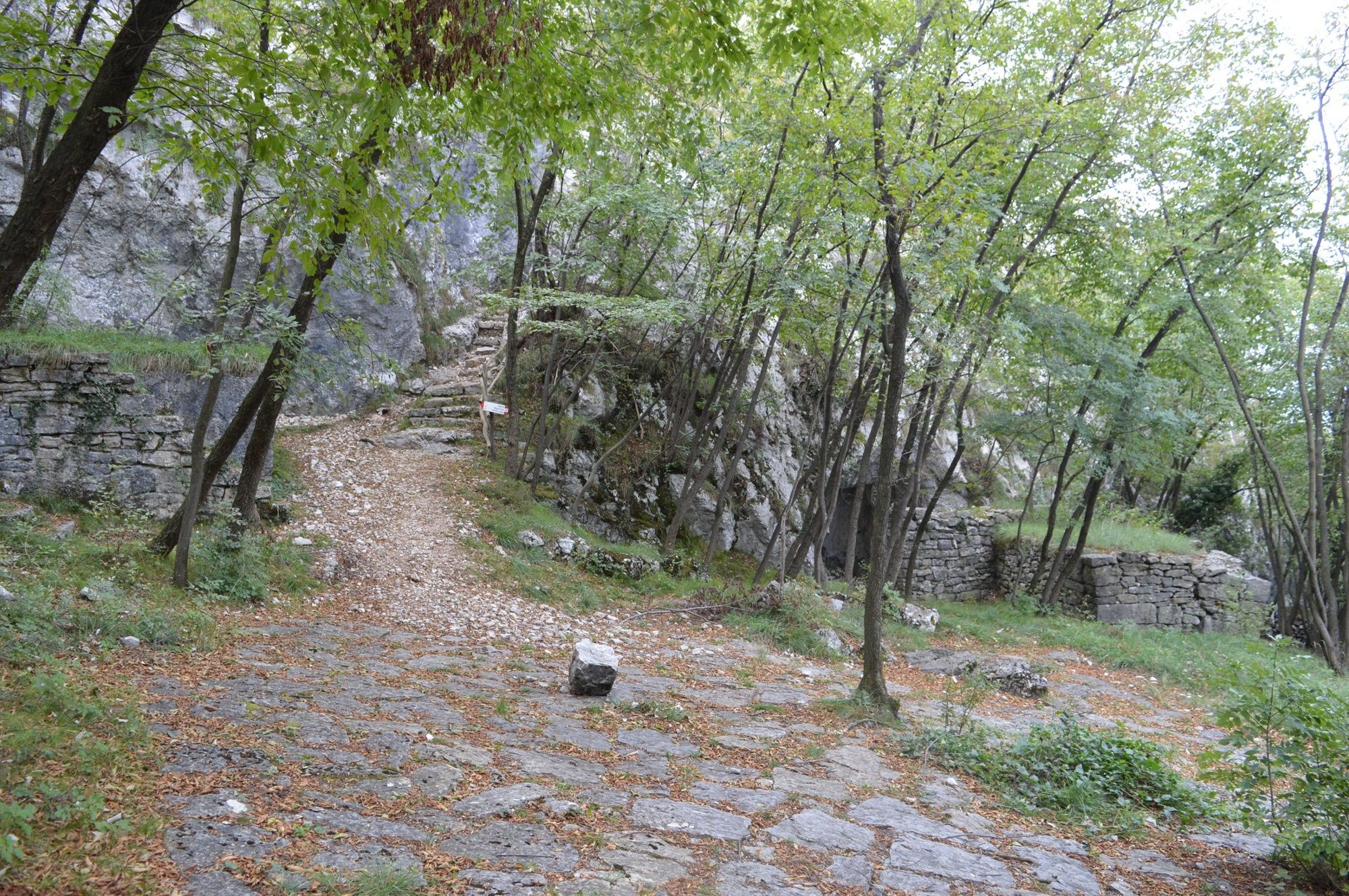
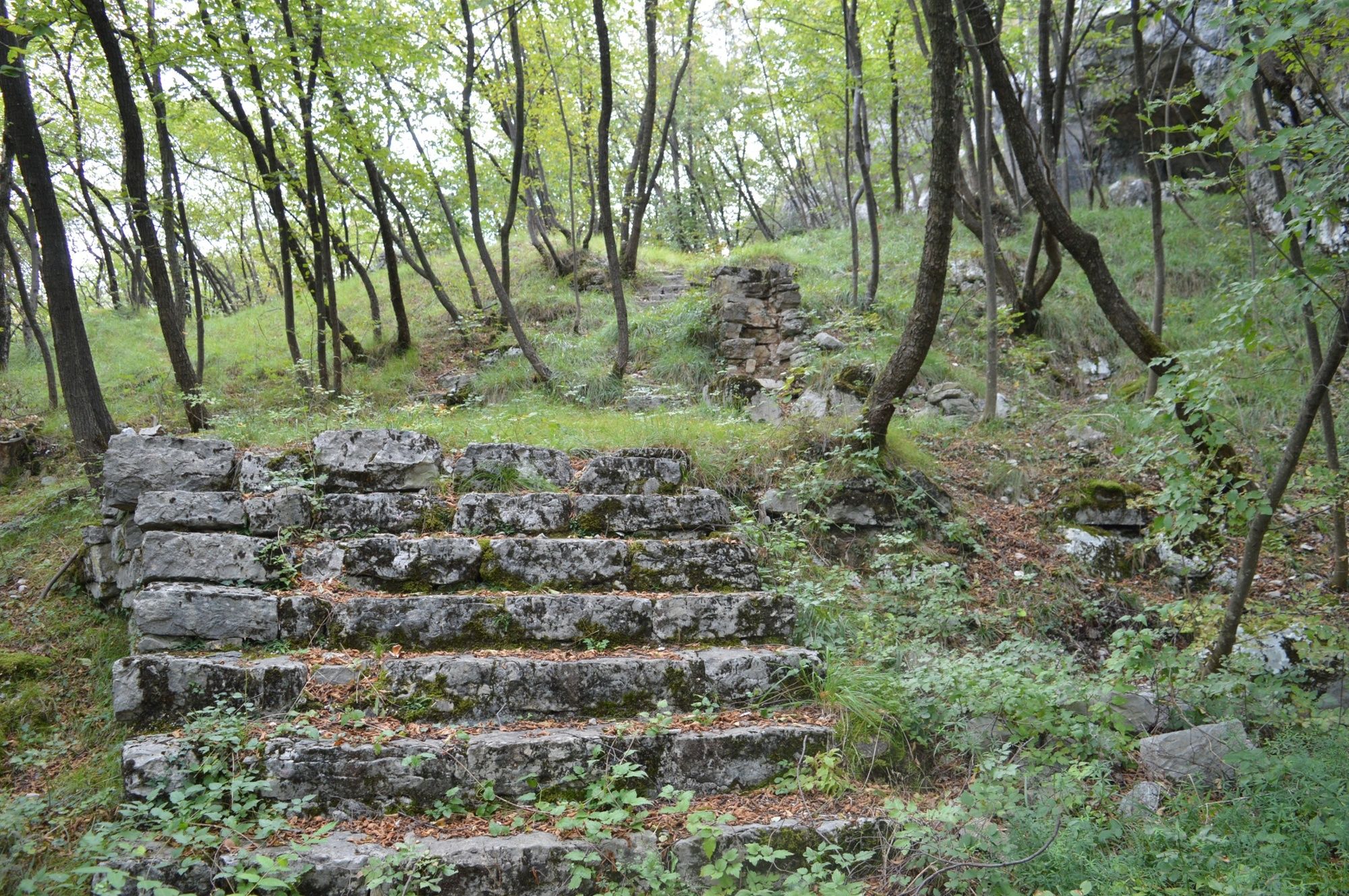
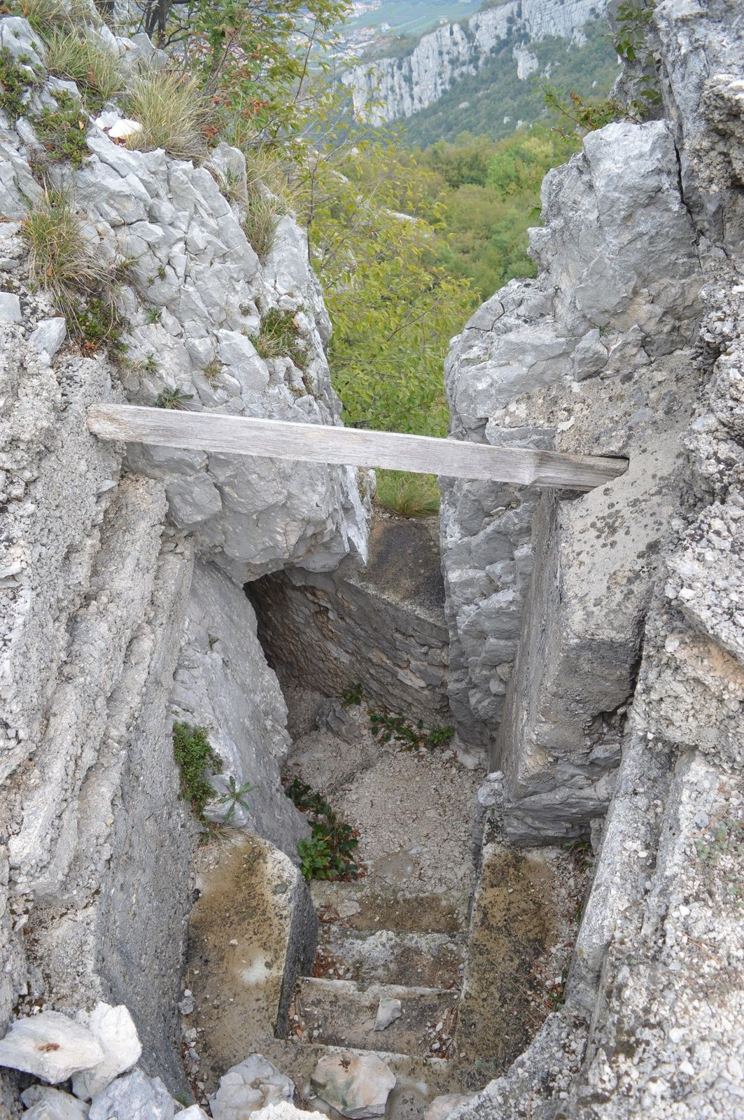
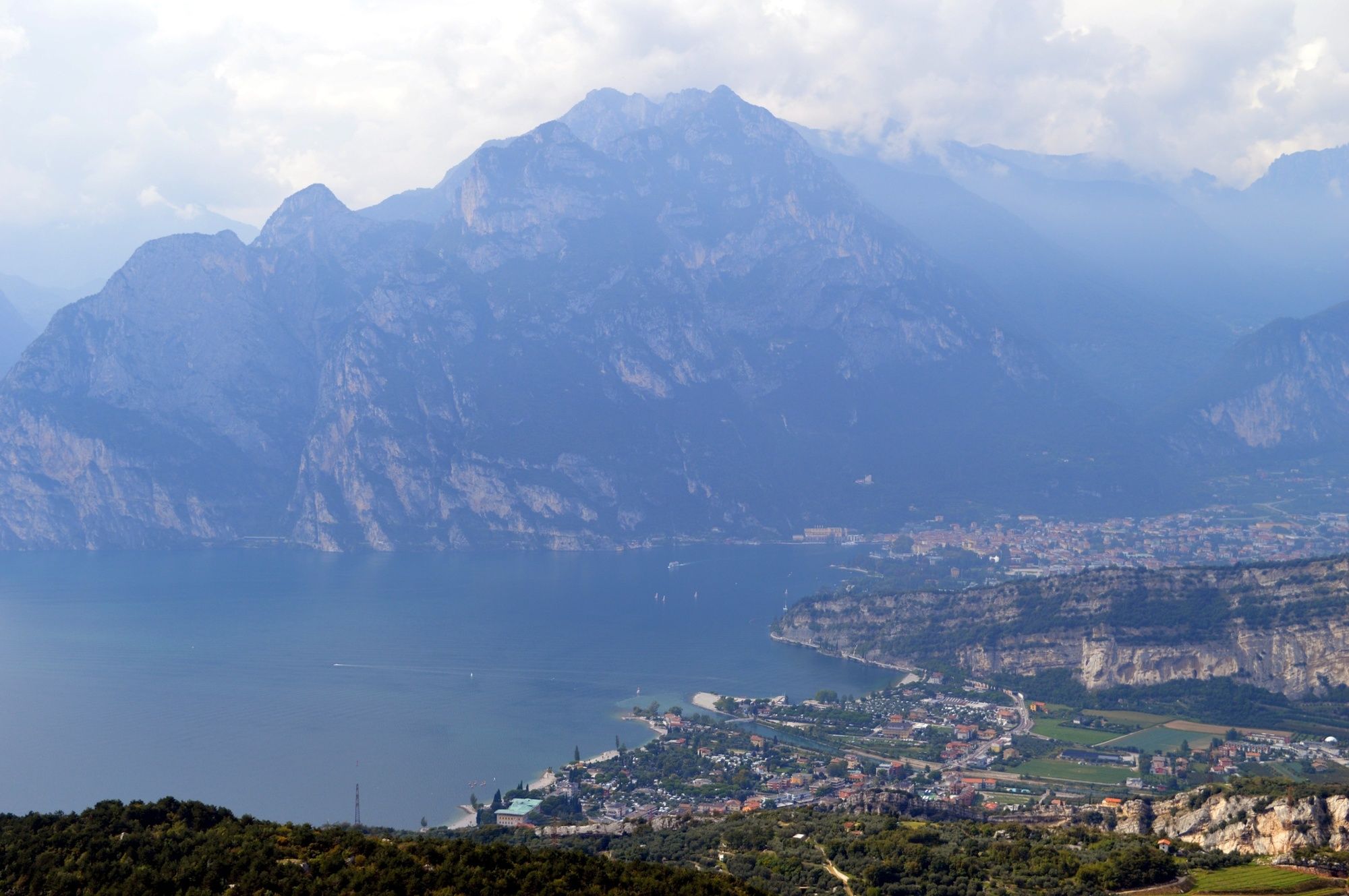
There can be no doubt about the strategic importance of Garda Trentino for the Austro-Hungarian Empire given the number and scale of the fortifications above the shores of Lake Garda and the Segrom is a part of these. Barracks, trenches, tunnels and artillery positions bear witness to the complexity of this system and form a unique historic backdrop for a trek.
Here the trail largely overlaps with a military road built by the Austro-Hungarian army from 1880 onwards when work started to reinforce defences along the Italian border. The fortifications along the Segrom ridge date back to the same period and these are linked by trenches with the stronghold of Malga Zures, a considerable line of resistance in case of loss of the advanced position.
- Directions
-
From San Giuseppe in Nago follow the Sentiero della Pace (SAT 601) as far as Malga Zures, heading up the Segrom ridge. All along the trail there are defence positions built by the Austro-Hungarian army to protect the southern border. The artillery positions have stupendous views over the entire upper lake. On the way down again follow the mule track which runs beneath Parete del Segrom (see hiking map no. 23), one of the most famous sports climbing walls in the world.
- Highest point
- 694 m
- Endpoint
-
Loc. S. Giuseppe - Nago
- Height profile
-
 © outdooractive.com
 - Equipment
-
You need to wear the right clothing and take the proper gear when you go hiking in the mountains. Even on relatively short easy outings make sure to take all you need so you don't run into trouble if things take an unexpected turn, for example a storm blows up or you have a sudden drop in energy levels.
What should you take when you go on a hike?
Your rucksack (for a day trip a 25/30L capacity should do) should contain:
water canteen (1L) snacks (e.g. mixed dried fruit or chocolate) First aid kit windproof jacket fleece change of t-shirt and socks (in a plastic bag) make sure to wear or at least bring a pair of long trousers hat sun screen sunglasses gloves whistle to attract attention in an emergencyMake sure you're wearing the right footwear for the trail and season. The going can get rough and rocky underfoot and a pair of hiking boots will protect you from sprains. When wet, a grassy slope, rocky slab or steep trail can be dangerous unless you are wearing the proper footwear.
And finally... don't forget to bring your camera! You'll need it to capture the stunning views you come across all over Garda Trentino. And if you like, you can share your memories with us at #GardaTrentino.
Emergency telephone number 112.
- Safety instructions
-
Safety Tips
Choose itineraries that suit your physical and technical abilities. Collect information about the area you are visiting and the trail’s conditions and get a detailed trekking map. Wear clothes and take equipment that suit the difficulty and length of your tour. Keep emergency gear in your rucksack, including first aid supplies. Do not go walking alone in the mountains. In any case, tell someone where you are going and report back on returning. Look at the weather forecast before setting off and always keep an eye on the weather. In case of doubt, go back. It is better to give up than risk bad weather or face difficulties beyond your strength, ability and equipment. Do not leave marked paths and do not take shortcuts. All described walks are in a natural environment and therefore their use is at your own risk.This information is subject to inevitable variations, so none of these indications are absolute. It is not entirely possible to avoid giving inexact or imprecise information, given how quickly environmental and weather conditions can change. For this reason, we decline any responsibility for changes which the user may encounter. In any case, it is advisable to check environment and weather conditions before setting out.
- Tips
-
The first part follows the Sentiero della Pace, a long-distance trail which links up the most important places on the front lines during the Great War in Trentino.
- Additional information
- Directions
- Public transportation
-
The main towns in Garda Trentino - Riva del Garda, Arco, Torbole sul Garda, Nago – are connected by several urban and intercity bus lines which will take you to the starting point of tours or in the immediate surroundings.
You can also get to Riva del Garda and Torbole sul Garda by the public ferry service.
- Parking
-
Free parking in Traole in Nago.
-

-
AuthorThe tour 23. The Great War: along the Segrom ridge to Malga Zures is used by outdooractive.com provided.