
- Brief description
-
Nice trek for fit families with children used to walk for quite a long time
- Difficulty
-
medium
- Rating
-
- Starting point
-
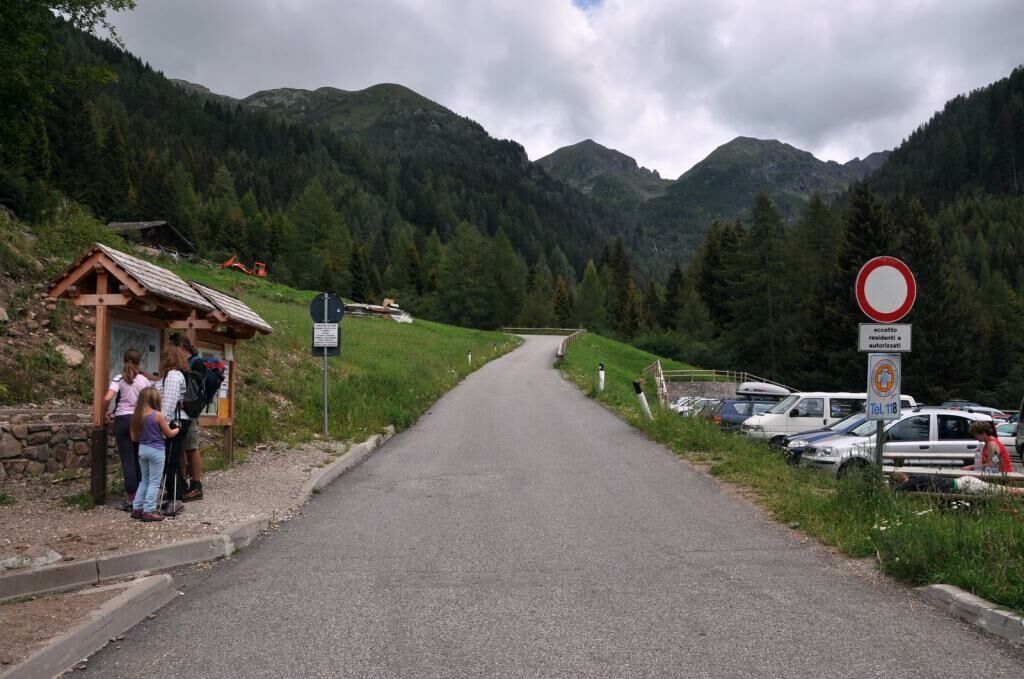
Frotten, car park near the section closed to traffic (1500 m)
- Route
-
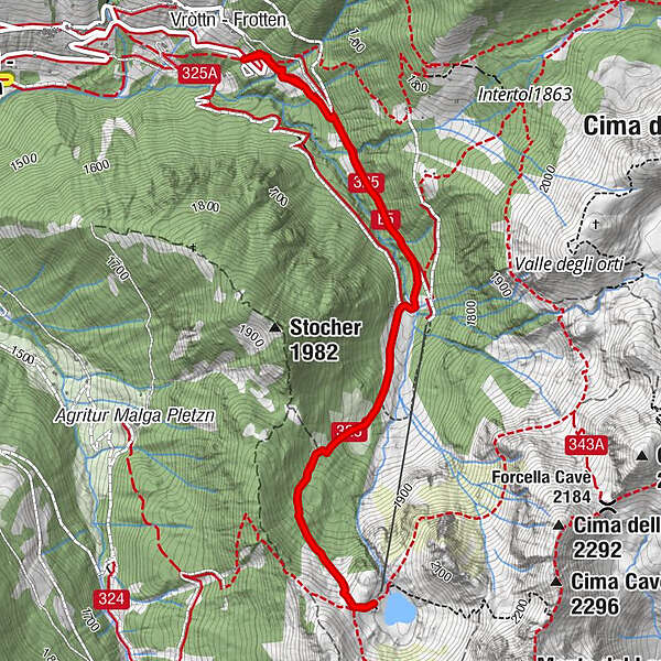
FrottenFrotten6.0 km
- Best season
-
JanFebMarAprMayJunJulAugSepOctNovDec
- Description
-
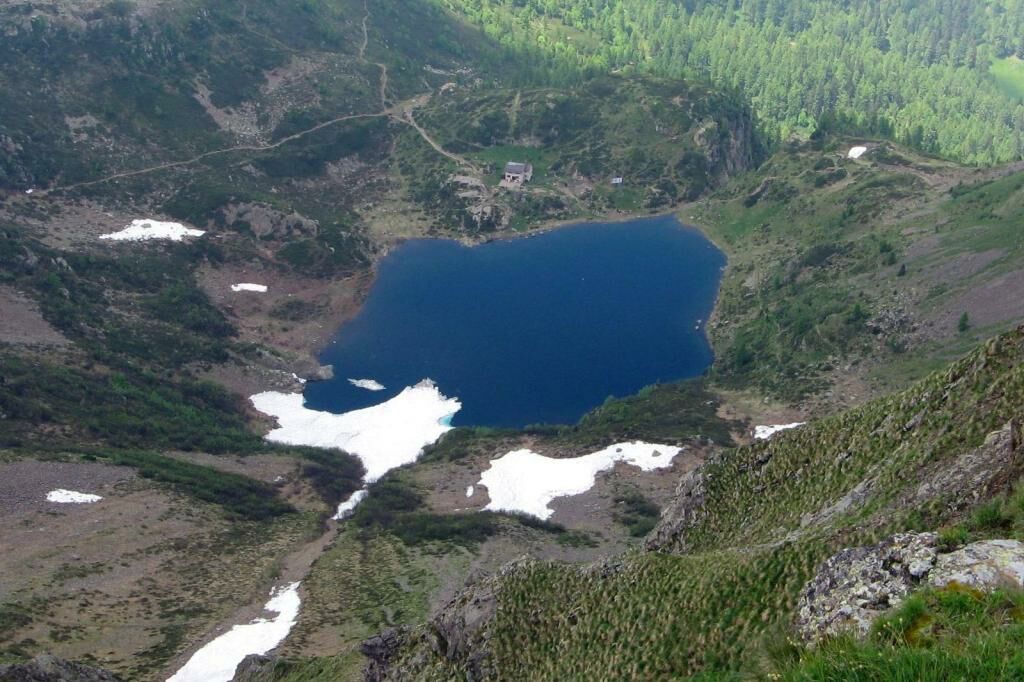
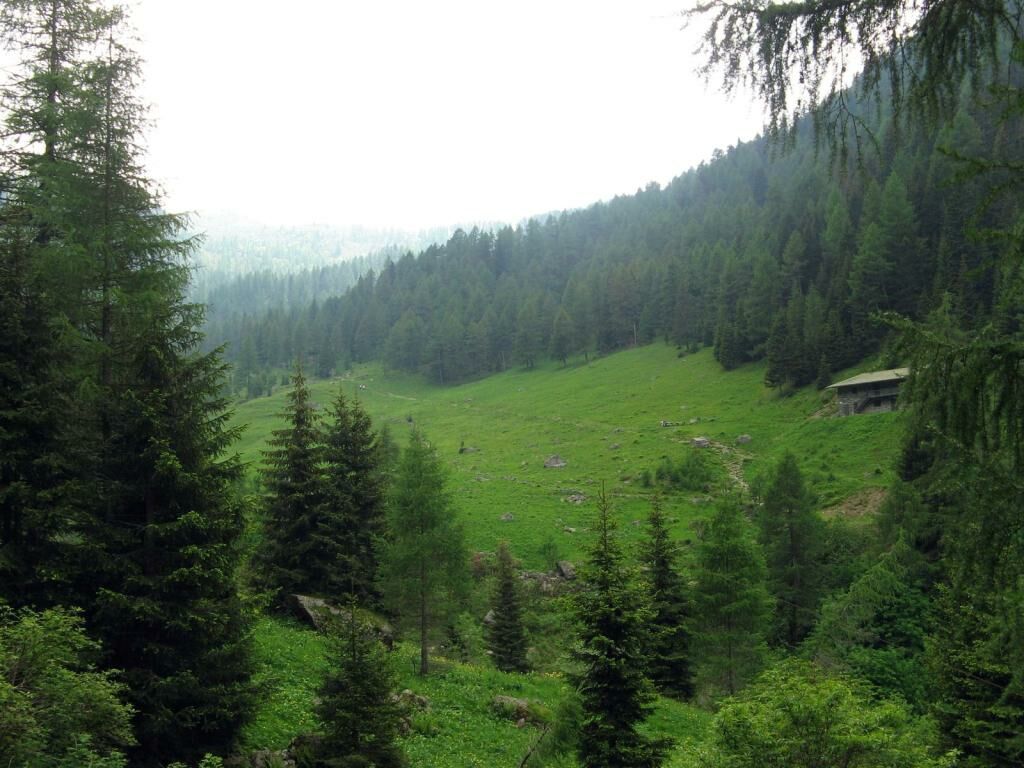
The destination of this trek is the little Alpine lake of Erdemolo. The first half of the itinerary, on a tarmac road through a wood, is not very attractive, but the second half is much more interesting, as soon as you leave the road for a trail and the views start opening up.
The hollow in which the small lake is situated is very picturesque, at the foot of the Pizzo Alto and Monte del Lago. Very suggestive, and emblematic of Lake Erdemolo, is the small snowfield, which remains throughout summer, unless the season is very hot, and practically “leaps” into the lake.
- Directions
-
Follow the tarmac road with prohibition, SAT marked No. 325 and/or E5. At the first crossroads, after the left-hand bend, turn right (signposted).
The tarmac road continues uphill through the wood, in a south-east direction, up to another car park at the base of a change of incline of the road, where it becomes dirt.
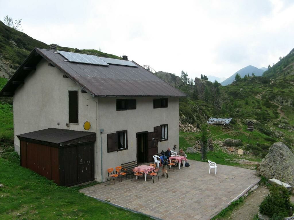
The road becomes steeper and climbs up to the crossroads to the Maso Erdemolo mountain farmhouse (signposted, 1662 m). Leave the main road and continue on flat ground, then gently downhill to the Fersina stream.
Cross the stream and leave this dirt lane, climbing uphill on the left across the field (house on the right – Maso Erdemolo).
Cross the entire field, in a south, south-west, direction and re-enter the wood on the opposite side to the entrance to the field.
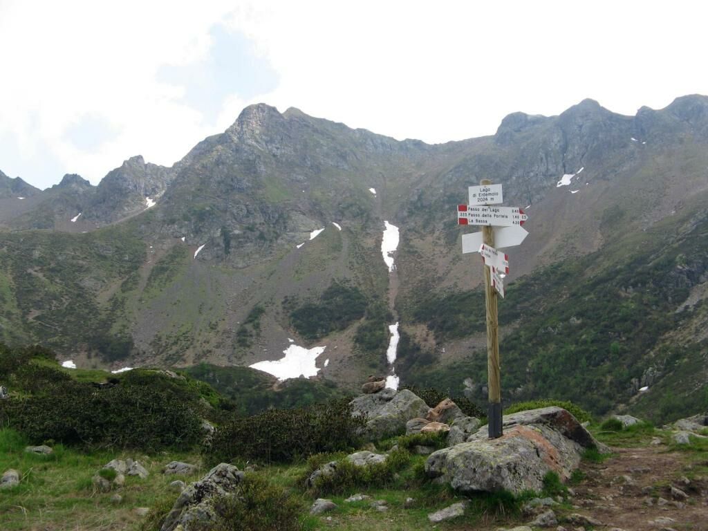
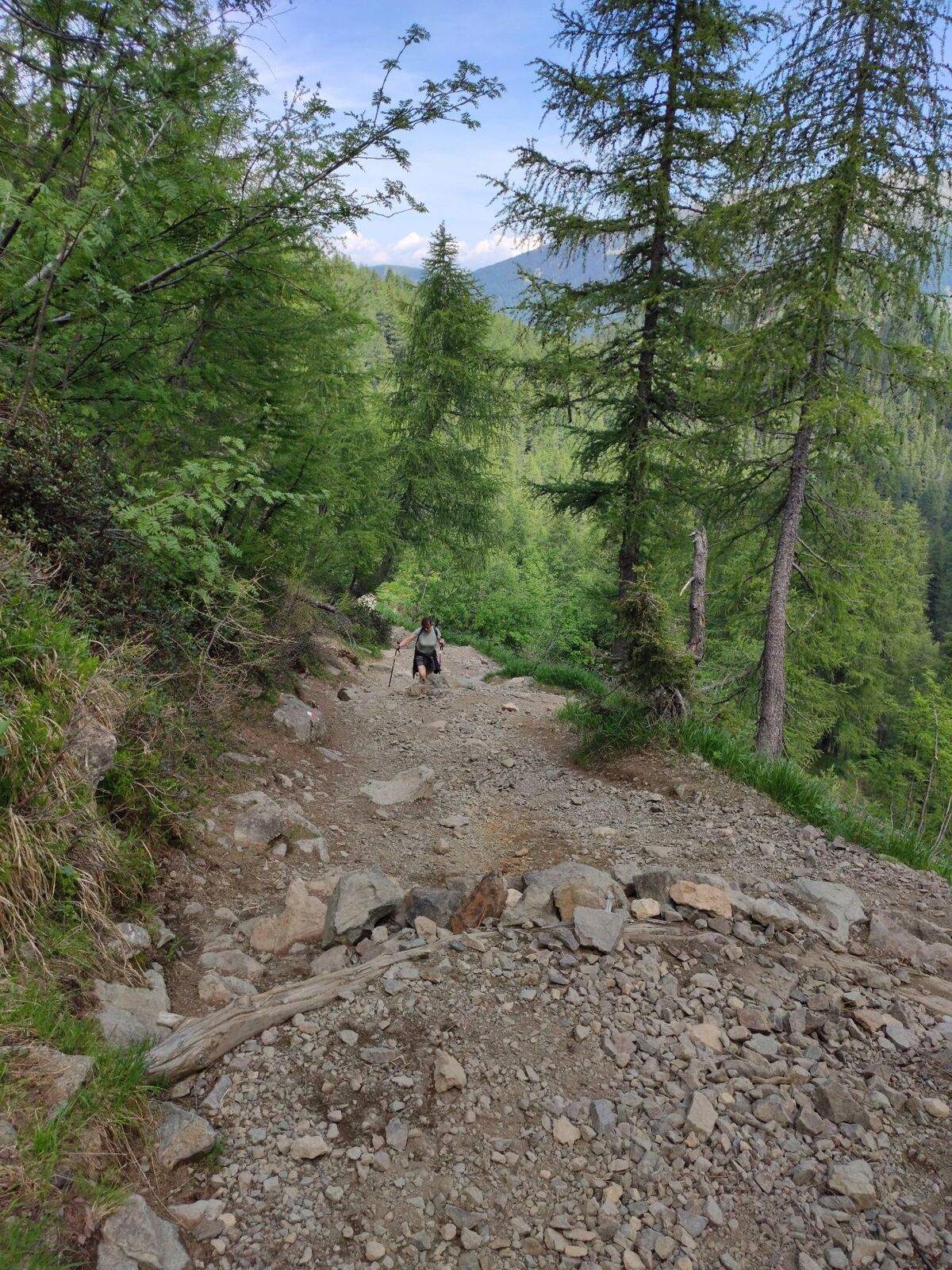
The trail features some rather steep inclines and draws a broad curve to the left, in a south-east direction, up to a sort of saddle between the North ridge, which descends from Pizzo Alto, and a ledge that forms a natural barrage allowing the lake to form.
At the saddle (sign) descend on the left to the small Rifugio Lago Erdemolo at 2024 m .
From here trace your steps back to the departure point.
- Highest point
- 2,012 m
- Endpoint
-
Lake Erdemolo
- Height profile
-
 © outdooractive.com
 - Safety instructions
-
This itinerary is suitable for families with children who are used to walking. On the way back you can take a 5-10 minute detour to pass by the Mining Museum, not far from Maso Erdemolo, where, for a fee, you can go on a guided tour into the heart of the mountain, along the tunnels excavated by the miners in the olden days.
Please note that the practicability of the itineraries in a mountain environment is strictly linked to the contingent conditions and is therefore influenced by natural phenomena, environmental changes and weather conditions. For this reason, the information contained in this page may have changed. Before leaving for a tour, make sure the path you will approach is still accessible by contacting the owner of the mountain hut, the alpine guides or the visitor centres of the nature parks, the info offices of the local tourist board.
- Directions
-
Leave the Valsugana highway at the exit for Pergine and then follow the directions to the centre of the town. Continue to Val dei Mocheni, along the entire valley in the direction of Sant’Orsola and then Palù del Fersina.
At Palù del Fersina continue straight ahead to I Battisti, a small hamlet just to the north of the main village, where, at the crossroads for the hamlet, continue straight on until you reach the end of the road, where there is a large car park and a no access sign.


-
-
AuthorThe tour Lake Erdemolo is used by outdooractive.com provided.