
- Brief description
-
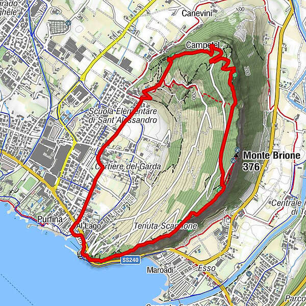
An easy trek to explore the Austro-Hungarian border defences along the Sentiero della Pace or Peace Trail
- Difficulty
-
easy
- Rating
-
- Starting point
-
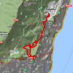
Porto San Nicolò - Riva del Garda
- Route
-
Campetel3.6 kmLa Grotta3.8 kmSant'Alessandro4.5 kmParco giochi Sant'Alessandro4.7 kmColombera4.9 kmSanti Pietro e Paolo5.1 kmRiva del Garda6.0 km
- Best season
-
JanFebMarAprMayJunJulAugSepOctNovDec
- Description
-
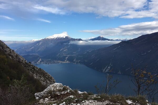
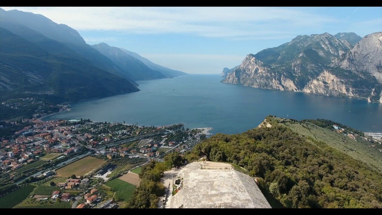
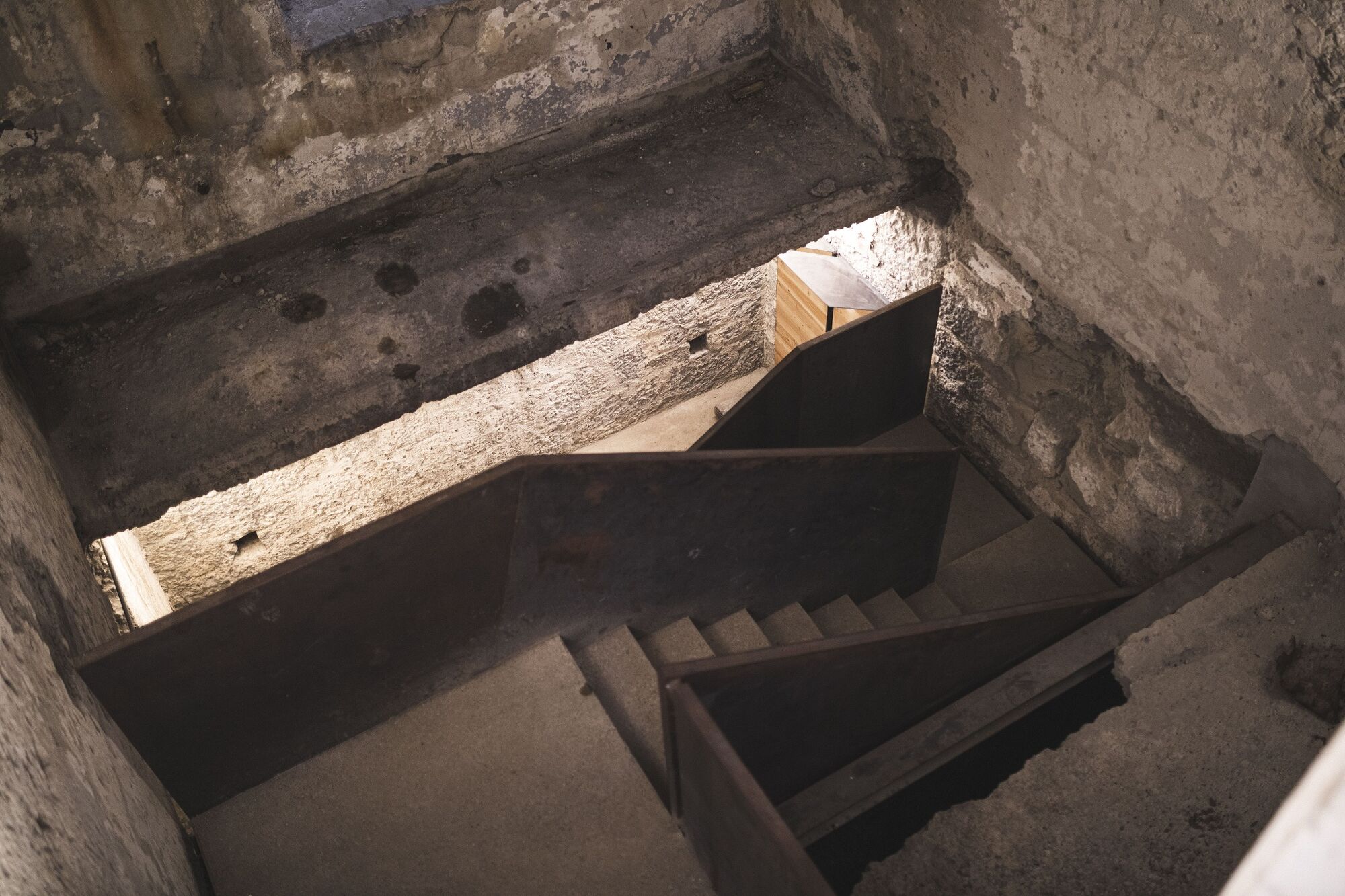
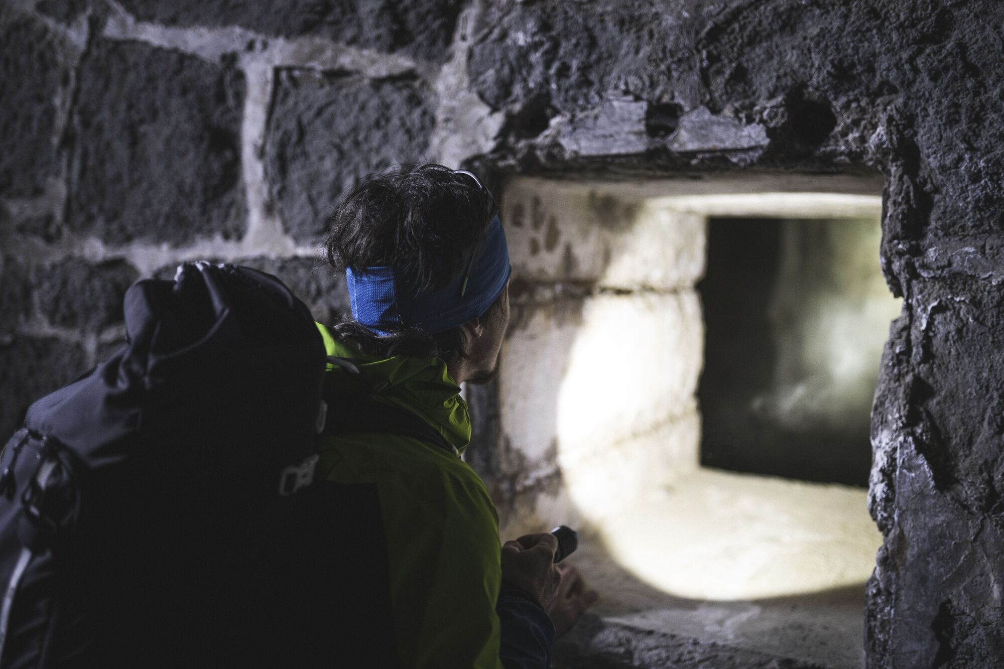
Up until 1918 Garda Trentino belonged to the Austro-Hungarian Empire which, well aware of the strategic position of the area, went about constructing a serious system of defences which centred on Monte Brione. Apart from bearing visible traces of that period, Monte Brione is also a protected area because of the high level of biodiversity of its typical Mediterranean vegetation.
Brione is home to 817 species of plant, 35% of the entire flora of Trentino! Many of these are rare or endangered species and some grow here alone, on the shores of Lake Garda. In particular, there is an extraordinary variety of orchids with 26 known species. This is the reason why the top of Monte Brione is recognised as protected area.
- Directions
-
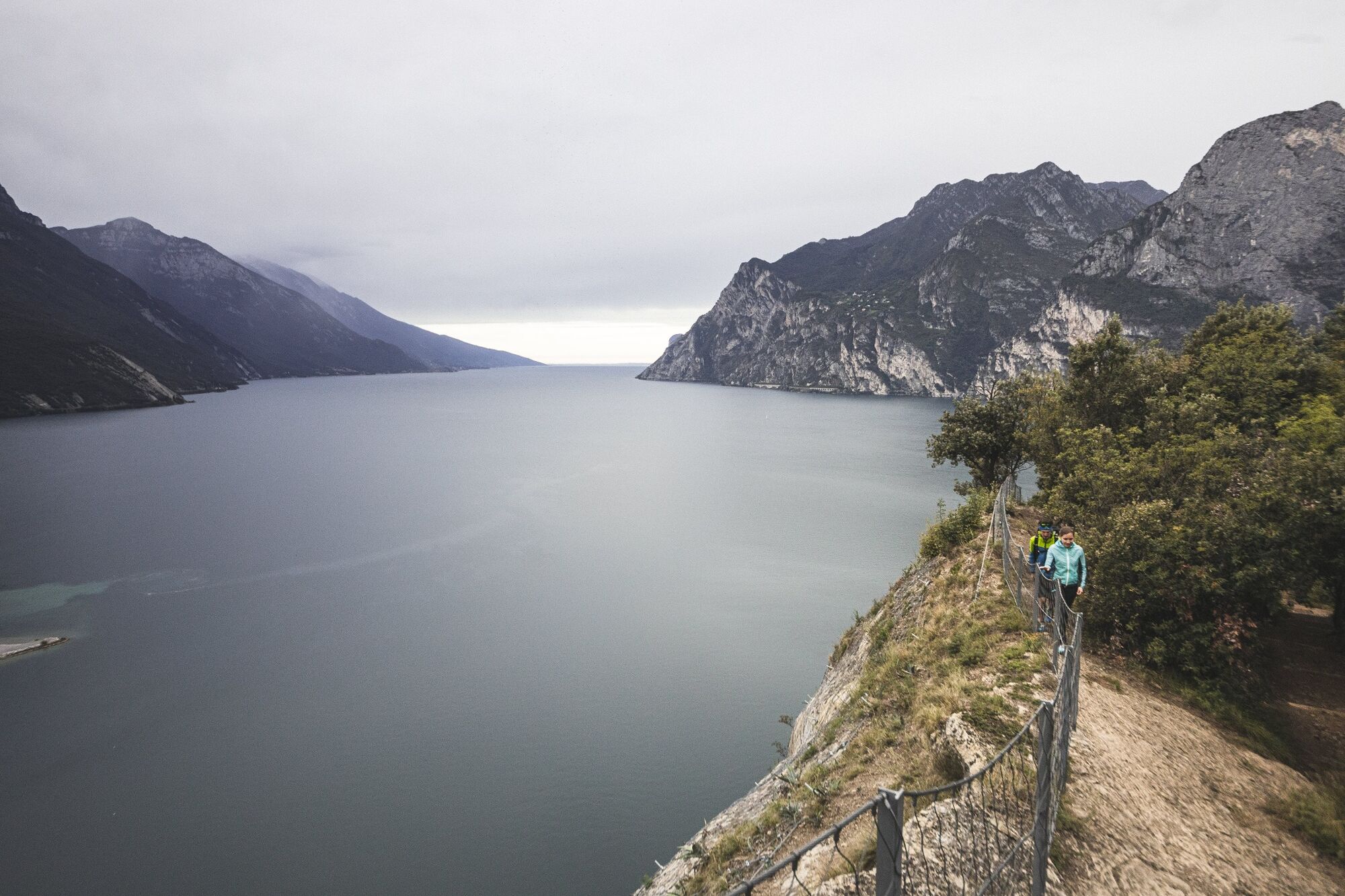
The trail starts from the harbour of San Nicolò in Riva del Garda and continues along the Peace Trail or Sentiero della Pace up the ridge of Monte Brione. The Peace Trail is marked in red and white and identified with a green icon with a white dove.
- Highest point
- 353 m
- Endpoint
-
Porto San Nicolò - Riva del Garda
- Height profile
-
 © outdooractive.com
 - Equipment
-
You need to wear the right clothing and take the proper gear when you go hiking in the mountains. Even on relatively short easy outings make sure to take all you need so you don't run into trouble if things take an unexpected turn, for example a storm blows up or you have a sudden drop in energy levels.
What should you take when you go on a hike?
Your rucksack (for a day trip a 25/30L capacity should do) should contain:
water canteen (1L) snacks (e.g. mixed dried fruit or chocolate) First aid kit windproof jacket fleece change of t-shirt and socks (in a plastic bag) make sure to wear or at least bring a pair of long trousers hat sun screen sunglasses gloves whistle to attract attention in an emergencyMake sure you're wearing the right footwear for the trail and season. The going can get rough and rocky underfoot and a pair of hiking boots will protect you from sprains. When wet, a grassy slope, rocky slab or steep trail can be dangerous unless you are wearing the proper footwear.
And finally... don't forget to bring your camera! You'll need it to capture the stunning views you come across all over Garda Trentino. And if you like, you can share your memories with us at #GardaTrentino.
Emergency telephone number 112.
- Safety instructions
-
Safety Tips
Choose itineraries that suit your physical and technical abilities. Collect information about the area you are visiting and the trail’s conditions and get a detailed trekking map. Wear clothes and take equipment that suit the difficulty and length of your tour. Keep emergency gear in your rucksack, including first aid supplies. Do not go walking alone in the mountains. In any case, tell someone where you are going and report back on returning. Look at the weather forecast before setting off and always keep an eye on the weather. In case of doubt, go back. It is better to give up than risk bad weather or face difficulties beyond your strength, ability and equipment. Do not leave marked paths and do not take shortcuts. All described walks are in a natural environment and therefore their use is at your own risk.This information is subject to inevitable variations, so none of these indications are absolute. It is not entirely possible to avoid giving inexact or imprecise information, given how quickly environmental and weather conditions can change. For this reason, we decline any responsibility for changes which the user may encounter. In any case, it is advisable to check environment and weather conditions before setting out.
- Tips
-
The Austro-Hungarian Empire built a series of forts to protect the northern shore of Lake Garda: the “Festung Abschnitt”. In the middle of the system was Monte Brione with its Forte San Nicolò (1860-62) close to the lake, Forte S. Alessandro (1881) on the top, and in the middle Forte Batteria di Mezzo (1900) and Forte Garda (1907).
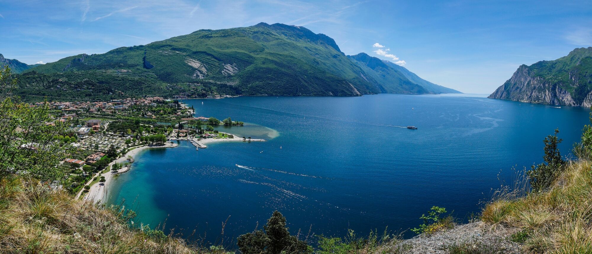
Discover the impressive views over Lake Garda.
- Additional information
- Directions
- Public transportation
-
The main towns in Garda Trentino - Riva del Garda, Arco, Torbole sul Garda, Nago – are connected by several urban and intercity bus lines which will take you to the starting point of tours or in the immediate surroundings.
You can also get to Riva del Garda and Torbole sul Garda by the public ferry service.
- Parking
-
Parking near the former hospital (Via Rosmini) or the former cemetery (Viale Damiano Chiesa).
Paid parking: Terme Romane (Viale Roma), Vecchia stazione (Largo Medaglie d’Oro), Ex-agraria (Via Lutti), Area ex-Cattoi (Viale Rovereto).


-

-
AuthorThe tour The forts of Monte Brione is used by outdooractive.com provided.
Stück zu Fuß von Hotel Reviera zum Hfen Limone und mit dem Boot nach Riva. Hoch auf den Berg Monte Brione , ein Rundeeg und zurück.