- Brief description
-
Reach the Sengio Alto Dolomites whith lots of World War 1 ruins along the way
- Difficulty
-
medium
- Rating
-
- Starting point
-
Passo Pian delle Fugazze (1163 m/3,816 ft.)
- Route
-
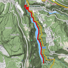
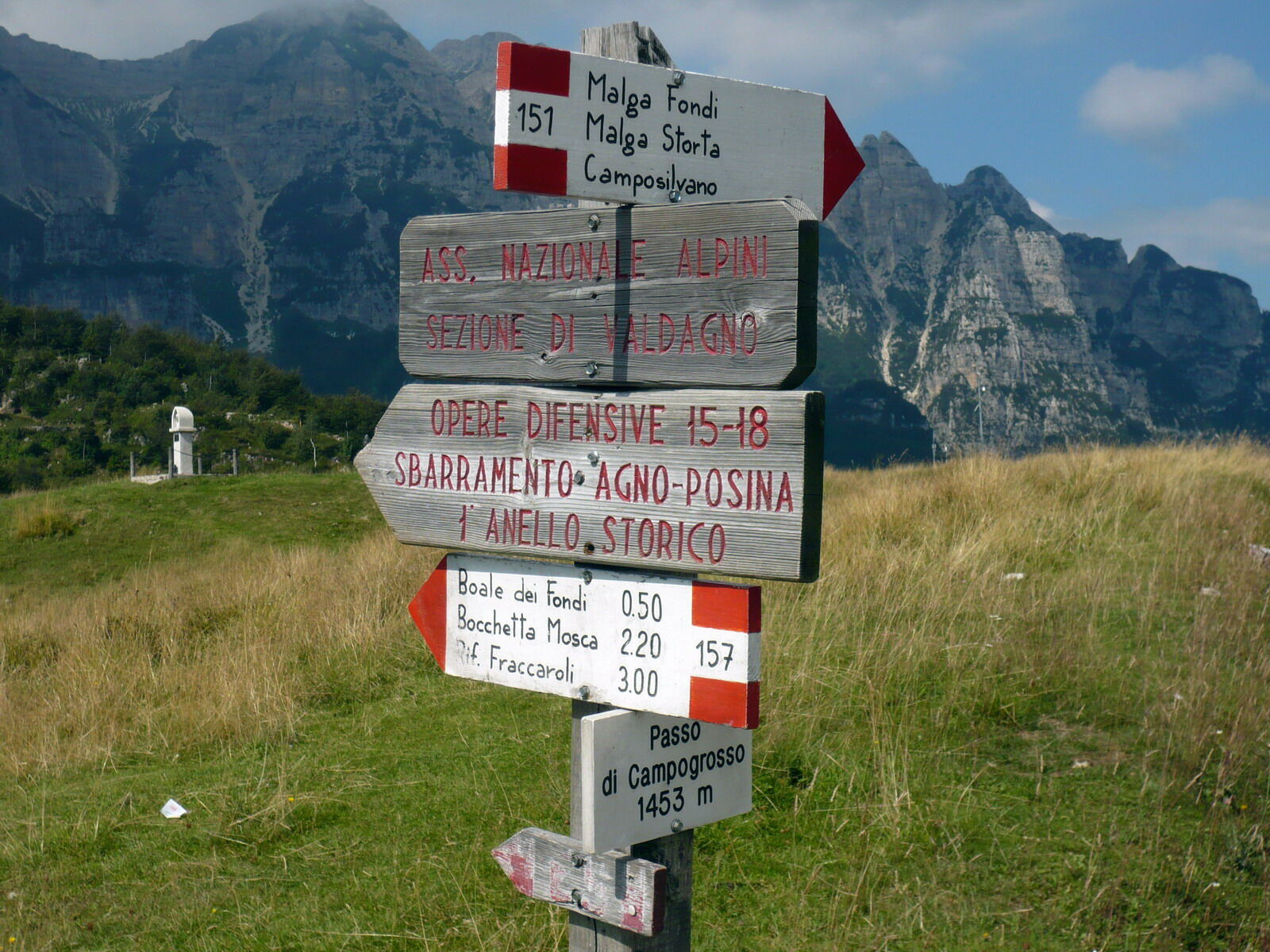
Sette Fontane3.0 kmRifugio Campogrosso5.6 kmSelletta Nordovest (1,611 m)8.5 km
- Best season
-
JanFebMarAprMayJunJulAugSepOctNovDec
- Description
-
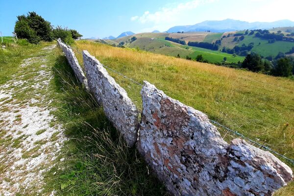
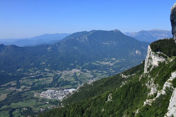
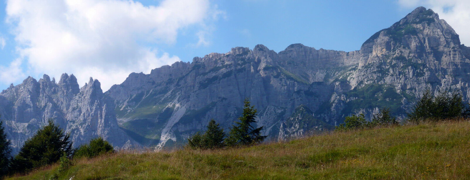
The area of Sengio Alto, at the south-eastern tip of the province of Trento, was the theatre of important battles and massive movements of troops throughout World War I (which lasted from 1915 to 1918 in Italy). The sector extending from Pasubio to Piccole Dolomiti is therefore characterized by the presence of massive military fortifications. This trek ring takes place at the foot of two mountains (Baffelan and Cornetto) connected by a ridge dotted with observatories, trenches, and fortifications. The presence of such World War I remnants adds another dimension to the hike. During the walk, you can however also enjoy a vast panorama, especially views of the Piccole Dolomiti and Pasubio.
The first part of the hike (from the start to Passo Campogrosso) follows an old mule path which has been paved and is closed to motor vehicles. It is therefore quite possible to push a pushchair all the way up to Rifugio Campogrosso, but one should bear in mind the distance separating it from Passo Pian delle Fugazze (about 6 km: one and a half hour’s walk) .
- Directions
-
From the car park situated slightly to the right of Passo Pian delle Fugazze (1163 m), take the road marked SP219 (Provincial Road) to Camposilvano and follow it for a very short stretch. Turn left at the first crossroads and follow the signs for ‘Campogrosso’.
The fact that this paved road is closed to motor vehicles makes it very popular with cyclists and hikers .
The surface of the road may be dull, but the surrounding landscape, with the slender peaks of the Piccole Dolomiti to the south, makes it worthwhile.
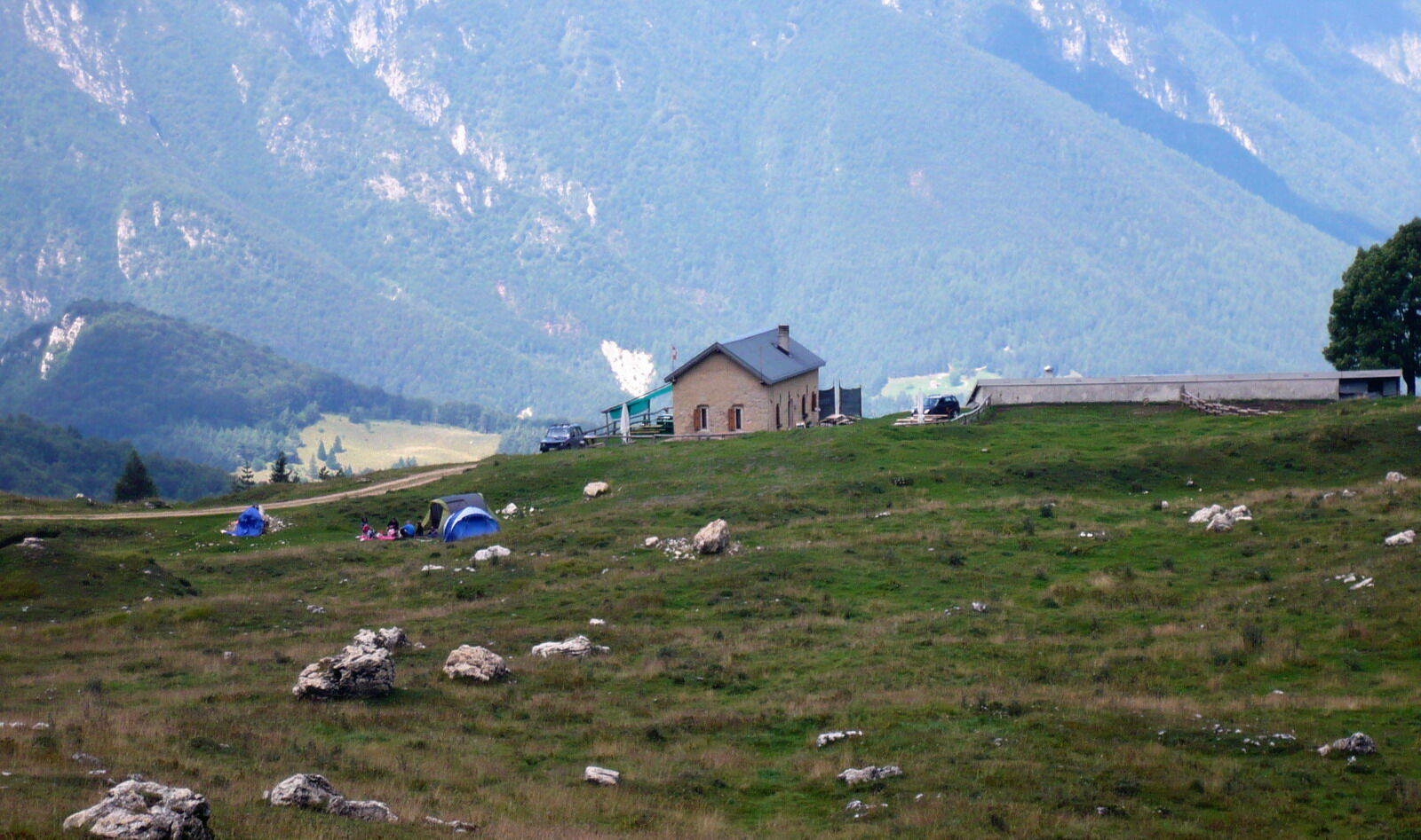
The road climbs a constant incline. This makes Passo Campogrosso (1450 m) relatively easy to reach. Once at the pass, it’s time for a rest at Rifugio Campogrosso.
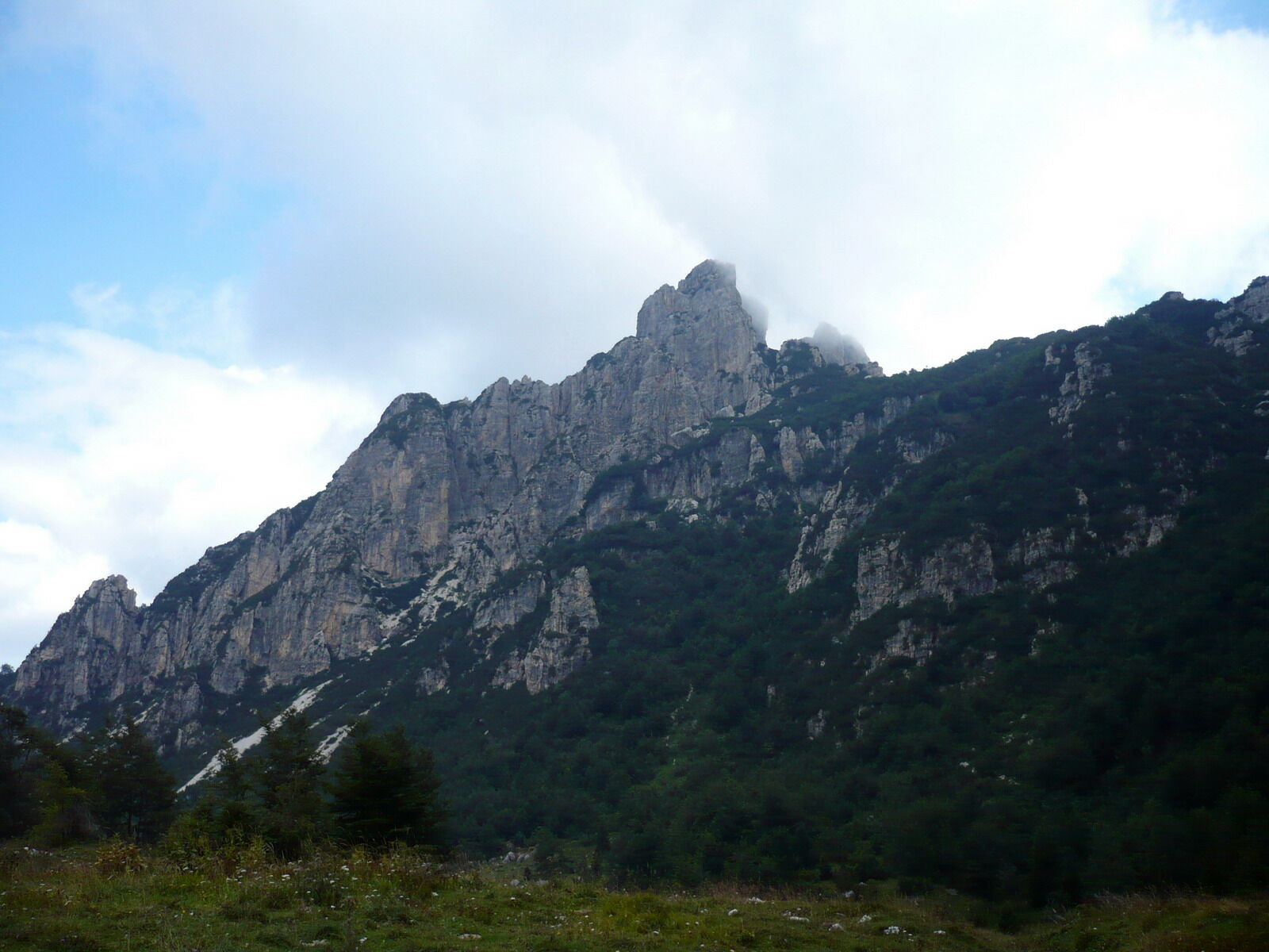
After leaving the hut, branch off from the road onto a mule path/foot path on the left marked 170–E5. It proceeds in a northerly direction and runs along the foot of the south face of Sisilla - Monte Baffelan.
Head north on trail 170-E5 and slightly uphill across a few meadows. The mule path/foot path, although still obvious, slowly becomes narrower and narrower. Ignore a branch to Passo di Baffelan, thus staying on trail 170-E5 and proceeding towards Selletta Nord-Ovest. The nice needles above are those of Monte Cornetto.
Ignore the next fork to Malga Boffetal (visible in the middle of lush meadows down below) and proceed on trail 170-E5 towards Selletta Nord-Ovest.
The trail becomes steeper, but also quite picturesque and finally reaches Selletta Nord-Ovest at an altitude of 1587 m.
From there, it’s all downhill along trail 170-E5 which crosses a wood before reaching the starting point at the car park.
- Highest point
- 1,566 m
- Endpoint
-
Passo Pian delle Fugazze (1163 m/3,816 ft.)
- Height profile
-
 © outdooractive.com
 - Safety instructions
-
1) Prepare your itinerary
2) Choose a route that is suitable for your skill level
3) Choose suitable equipment and gear
4) Consult the snow/weather bulletins
5) Heading out on your own is more risky
6) Leave information on your itinerary and on the approximate time you expect to return
7) Do not hesitate to seek the support of a professional
8) Pay attention to the information and signs that you find along the trail
9) Do not hesitate to follow your steps backwards
10) In case of an accident, sound the alarm by calling the emergency number 112.
Please note that the practicability of the itineraries in a mountain environment is strictly linked to the contingent conditions and is therefore influenced by natural phenomena, environmental changes and weather conditions. For this reason, the information contained in this page may have changed. Before leaving for a tour, make sure the path you will approach is still accessible by contacting the owner of the mountain hut, the alpine guides or the visitor centres of the nature parks, the info offices of the local tourist board.
- Directions
-
From Rovereto, follow the SS46 (Vallarsa national road) in the direction of Schio - Vicenza up to Passo Pian delle Fugazze (1163 m). There’s a car park on the right side of the road (when driving in the direction of Camposilvano).


- Author
-
The tour Trek to Sengio Alto is used by outdooractive.com provided.


General info
-
Verona
278
-
Lessinia
284
-
Valli del Leno
120