
- Brief description
-
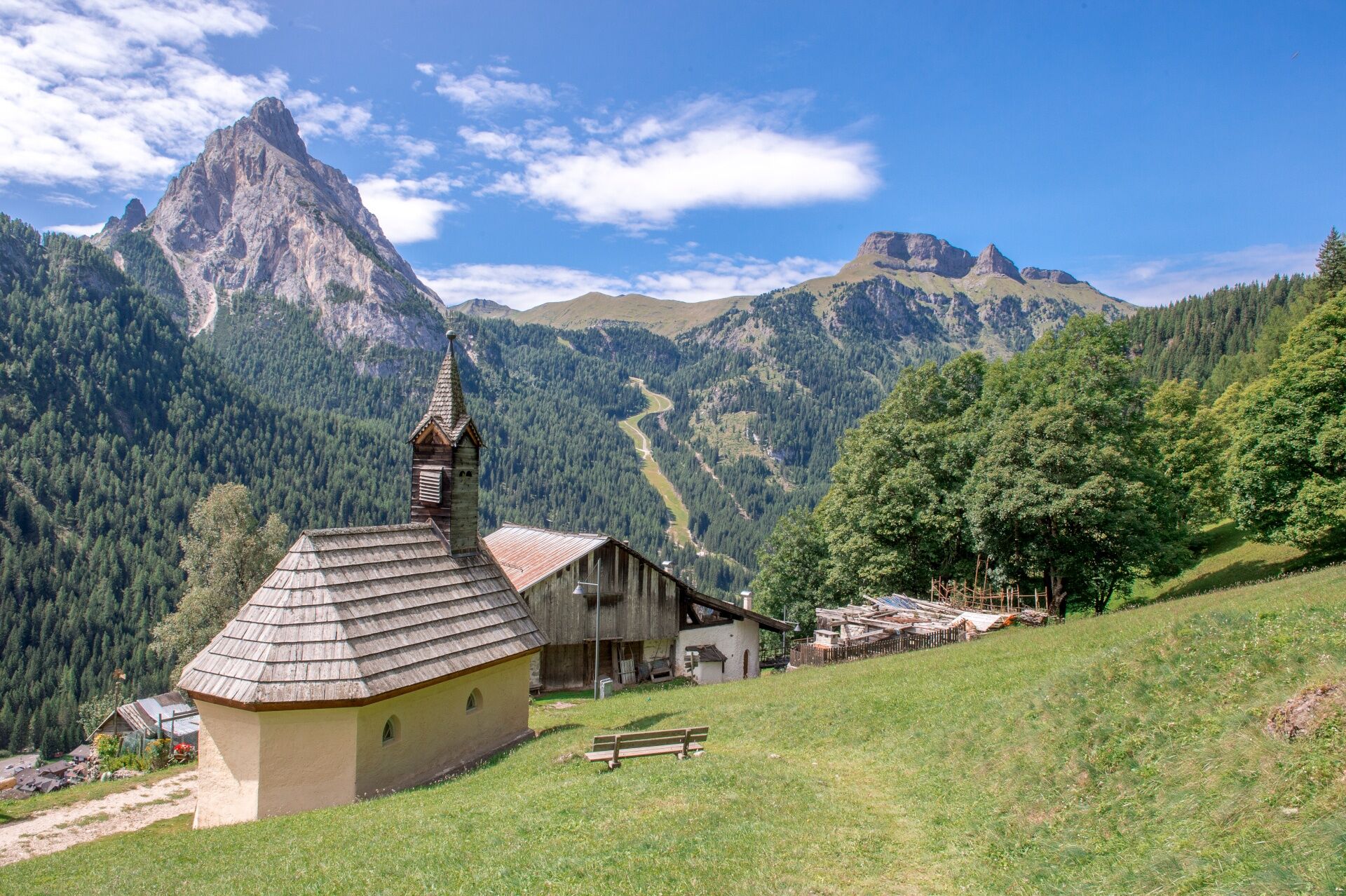
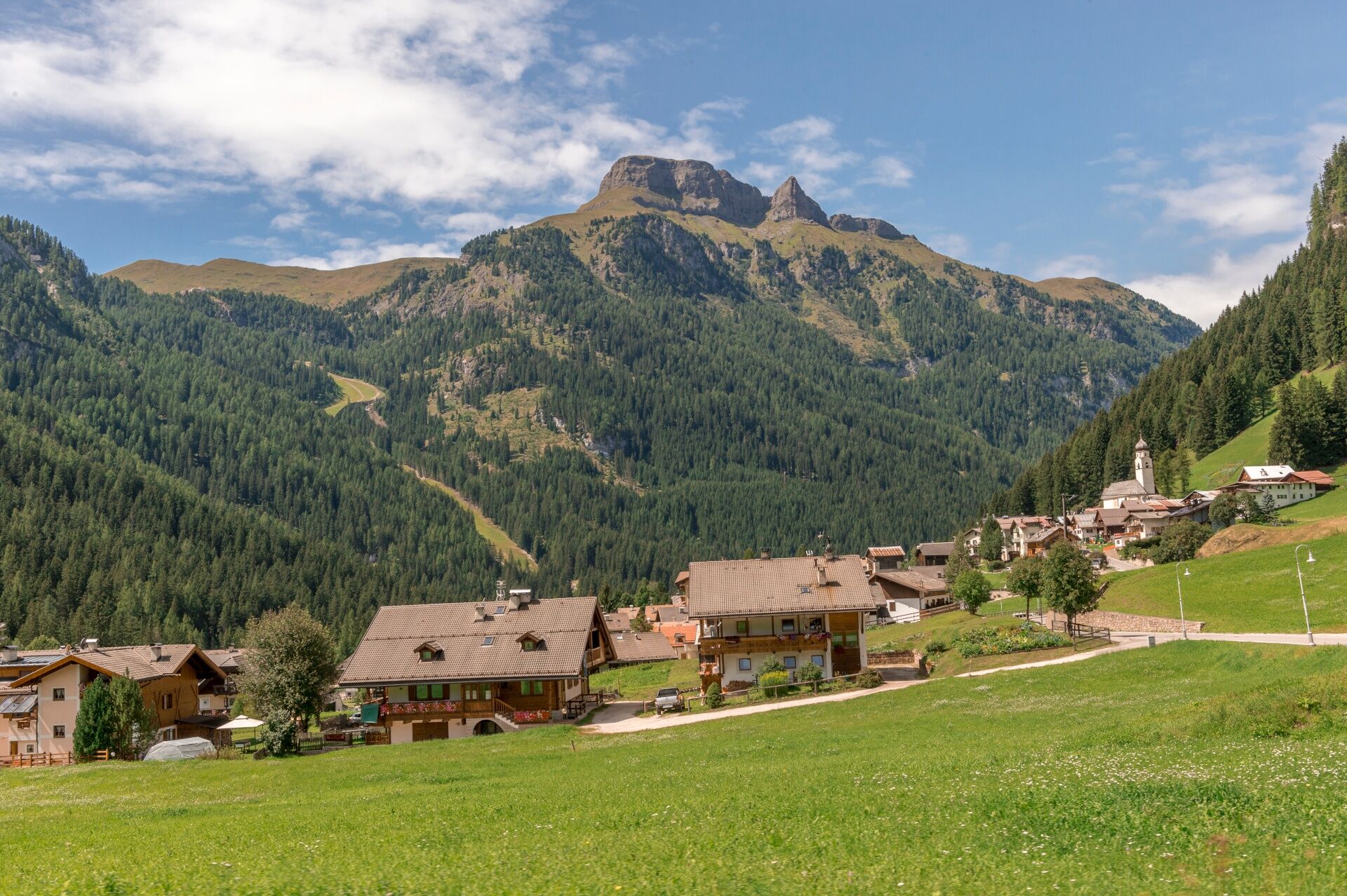
At the foot of "Dolèda" hill, where witches are said to have gathered, lies Penìa. The last village of Val di Fassa, almost perched on the slopes of Marmolada, is rich in history and ancient traditions that are worth discovering. On the way back, follow the educational trail called "L'ega te cuna - l’acqua bambina", about the origins of water.
- Difficulty
-
medium
- Rating
-
- Starting point
-
Alba di Canazei (Strèda de Costa)
- Route
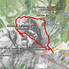
-
Pizzeria Edy0.2 kmInsom4.2 kmVerra4.5 kmLorenz4.7 kmPenia5.3 kmLe Marmotte5.5 kmPizzeria Edy6.4 km
- Best season
-
JanFebMarAprMayJunJulAugSepOctNovDec
- Description
-
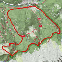
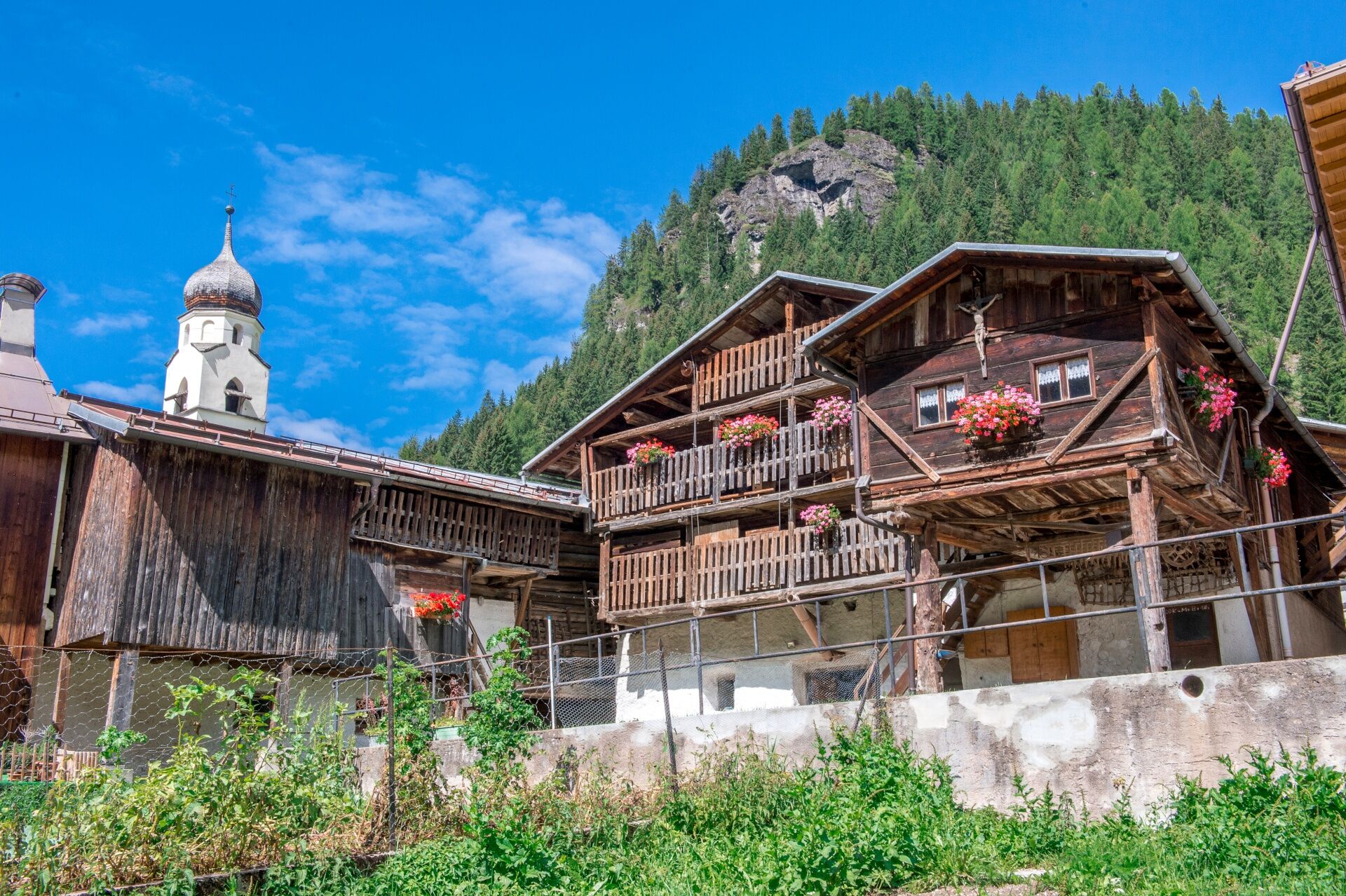
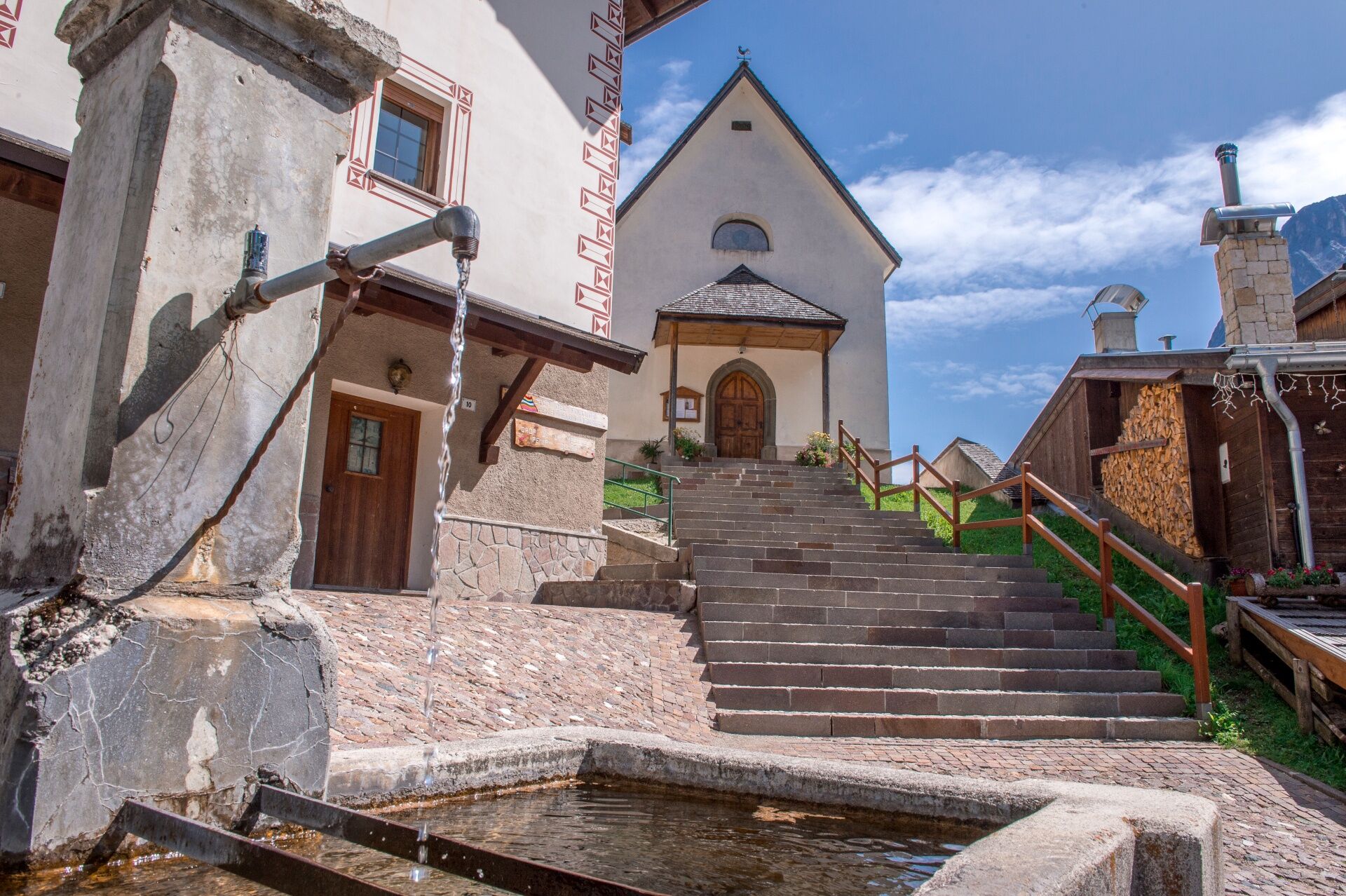
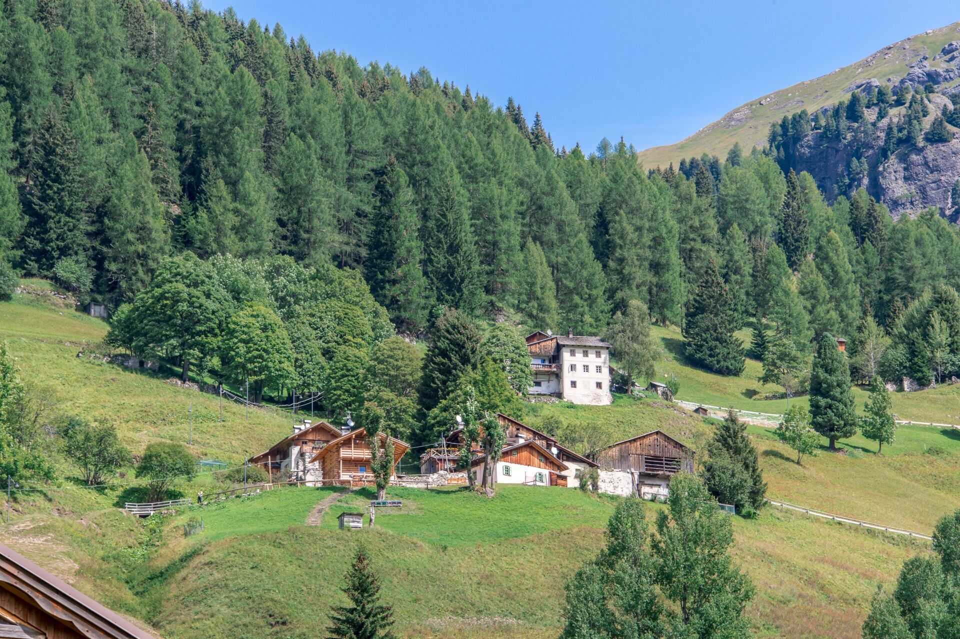
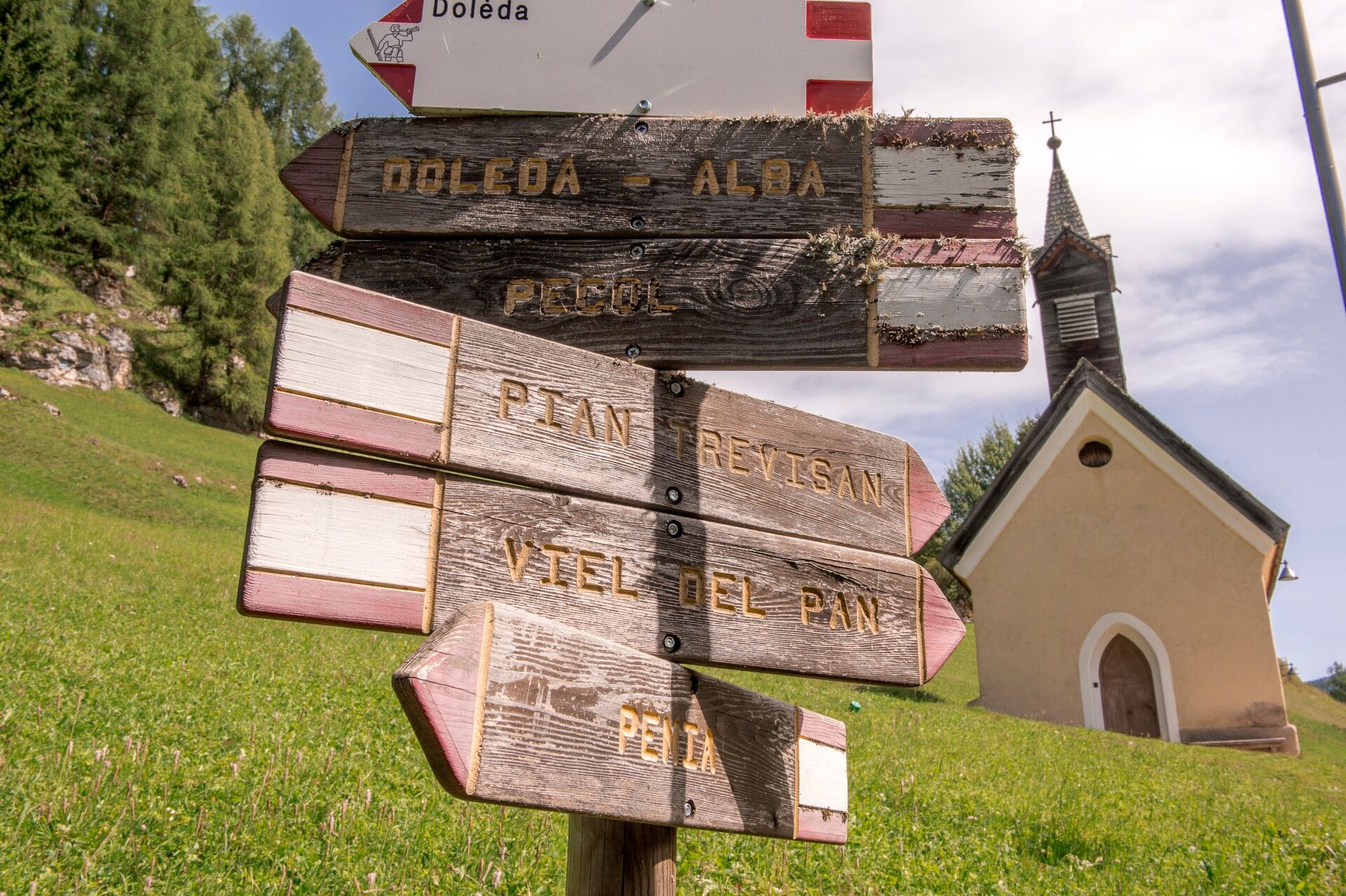
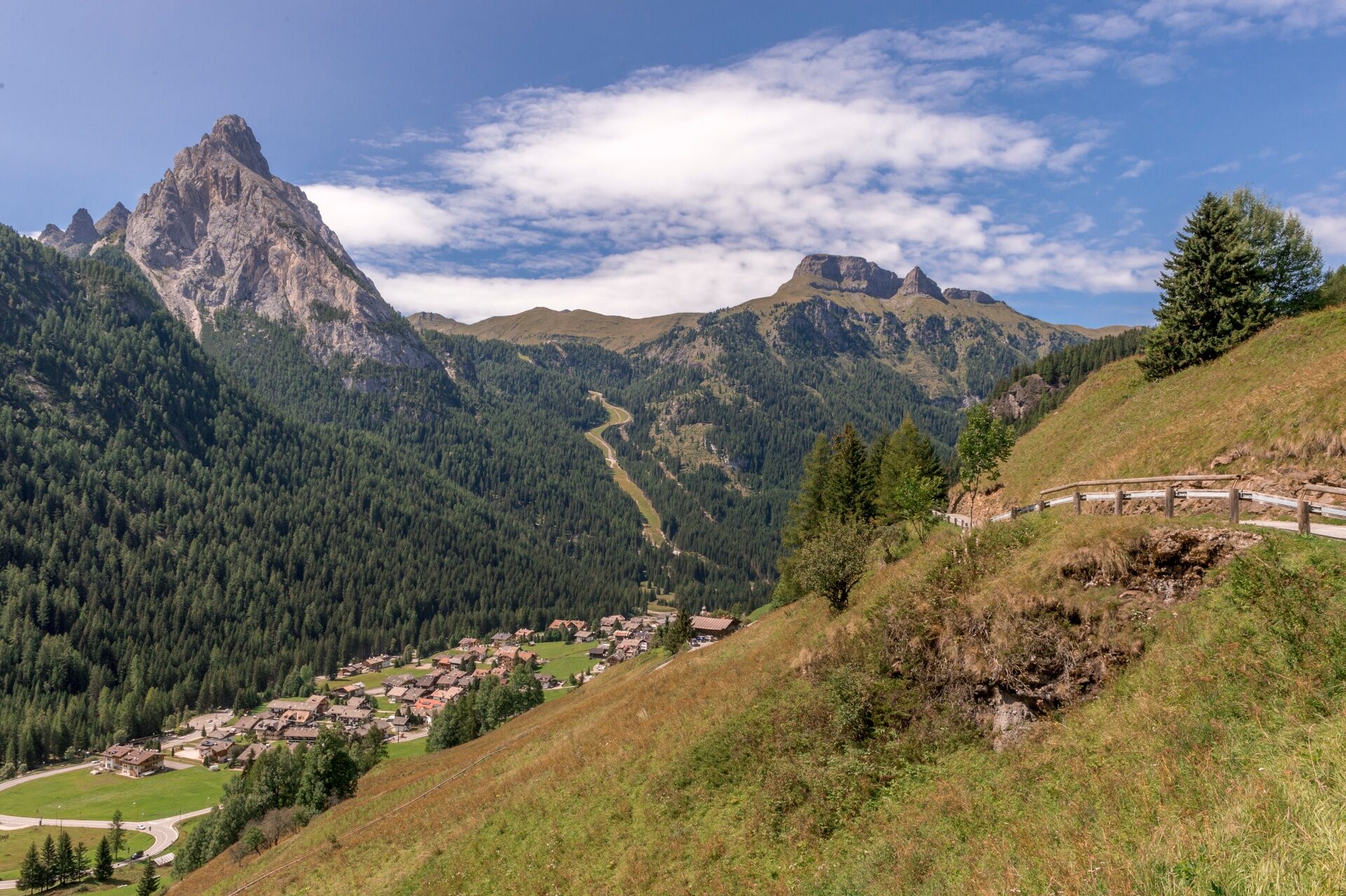
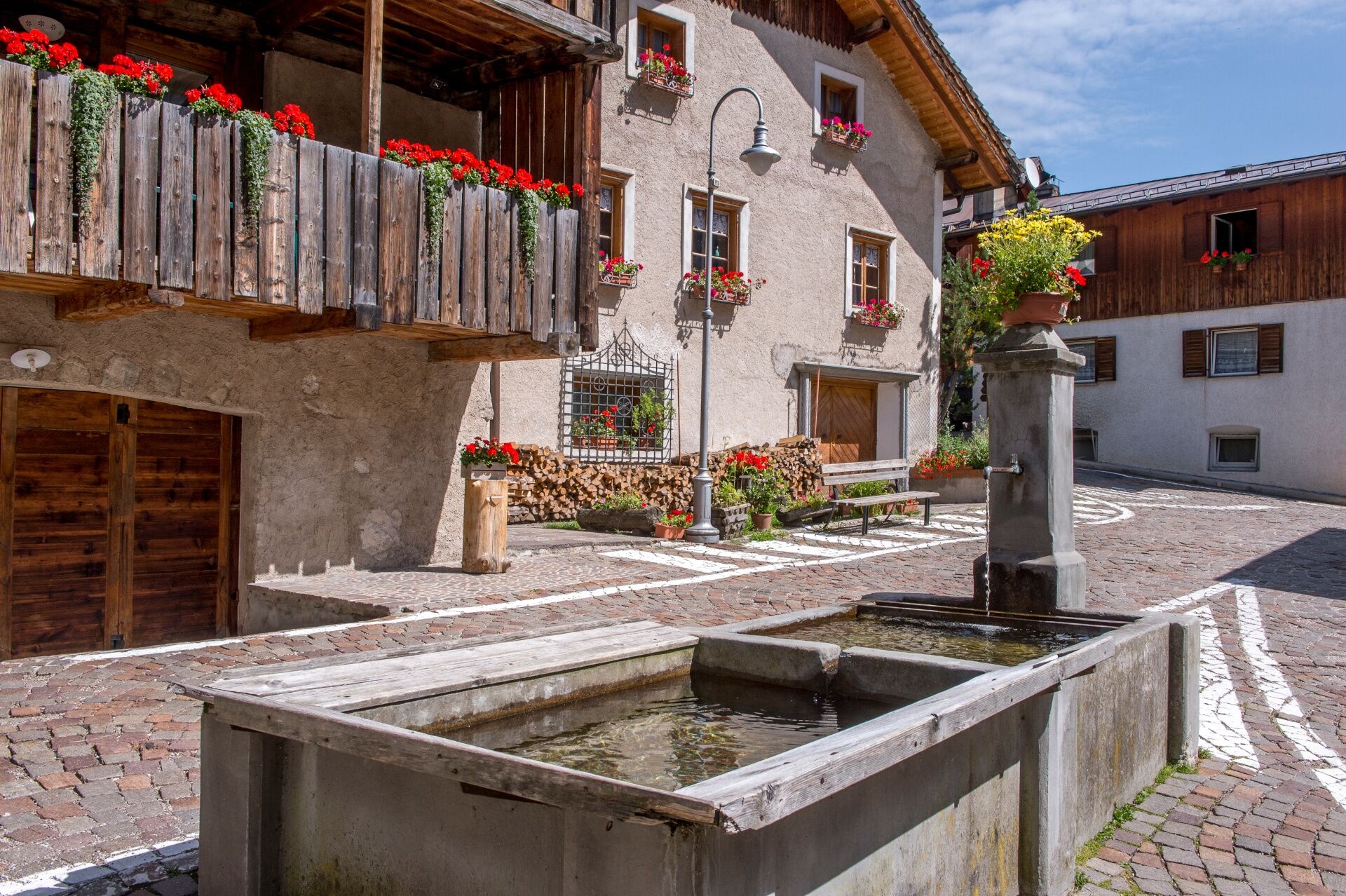
Start from the central square in Penìa and pass to the right of the fountain on "Troi de Lorenz", until you come out of the village and reach the meadows behind it. Continue along the road, which cuts the steep slope and arrives first at the village of Lorenz and then, a bit further above, at the village of Vera. Pass the little church dedicated to "Madonna de l'Aiut" to the right, and continue along the flat paved road, with a magnificent view on the imposing northern wall of Gran Vernel. A few metres above the little road, on the left, the ruins of Insom witness that a third settlement stood there. The road evens up and goes towards "Ruf de Penìa" stream: cross it and turn right onto the easy white gravel road, which runs slightly downhill into the wood. Cross the grassy clearing of "Udàer" and descend towards the main road below. Follow it to the right for approximately 150 metres, up to the guard-rail of the bridge over Avisio river. Walk along the outer side of the guard-rail on the well-visible path covered with fine white gravel. Once inside the wood, go through it along a winding path, flat at first and then slightly downhill. As the descent gets steeper, remain on the main track, and reach the paved road. Go up and over the bridge, then follow the main road for another 30 metres. Enter the woods on the right on the well-visible path, unfolding downhill at the foot of the imposing northern wall of Gran Vernel, following Avisio river. Slightly beyond, you’ll find a boardwalk leading to the ancient Venetian sawmill (one of the local branches of the Ladin Museum). This path is also part of the educational trail called "L'ega te cuna", about the origins of water. Go over the bridge on your right and reach the lower section of Penìa. Pass between Hotel Sonia on the right and a beautiful farmhouse with a barn on the left and reach the main road. Alternatively, don’t cross the bridge but proceed on the path and join the route Canazei - Pènt de la Roa - Molin - Penìa - Canazei.
- Directions
-
Start from the central square in "Penìa" and go up on the right of the fountain until you come out of the village and reach the meadows behind it.
Alternative: returning to the starting point, follow the main road until Hotel Agomer. On the right hand side take "Strèda dò Veisc" and descend to the village of Canazei. Fountains available along the route.
- Highest point
- 1,685 m
- Endpoint
-
Alba di Canazei (Strèda de Costa)
- Height profile
-
 © outdooractive.com
 - Equipment
-
Carry in your backpack the necessary to face possible emergency situations, and a first aid kit.
- Safety instructions
-
1. Plan your walk according to your skills and the weather.
2.Walk slowly, enjoy the landscape and the silence.
3. Inform somebody about your itinerary, return time and possible changes.
4. Rely on professionals (mountain and hiking guides).
5. Help those in need. Call 112 only in case of real necessity.
6. Make sure you have suitable clothes and equipment + some water and snacks.
7. Respect the environment around you and its inhabitants. Bring back your rubbish.
8. Follow the marked trails avoiding those in the bikepark.
9. To protect the wonders of nature, leave everything in its place.
10. Bring your pet along, but keep it on a leash.
- Tips
-
We recommend the use of walking poles.
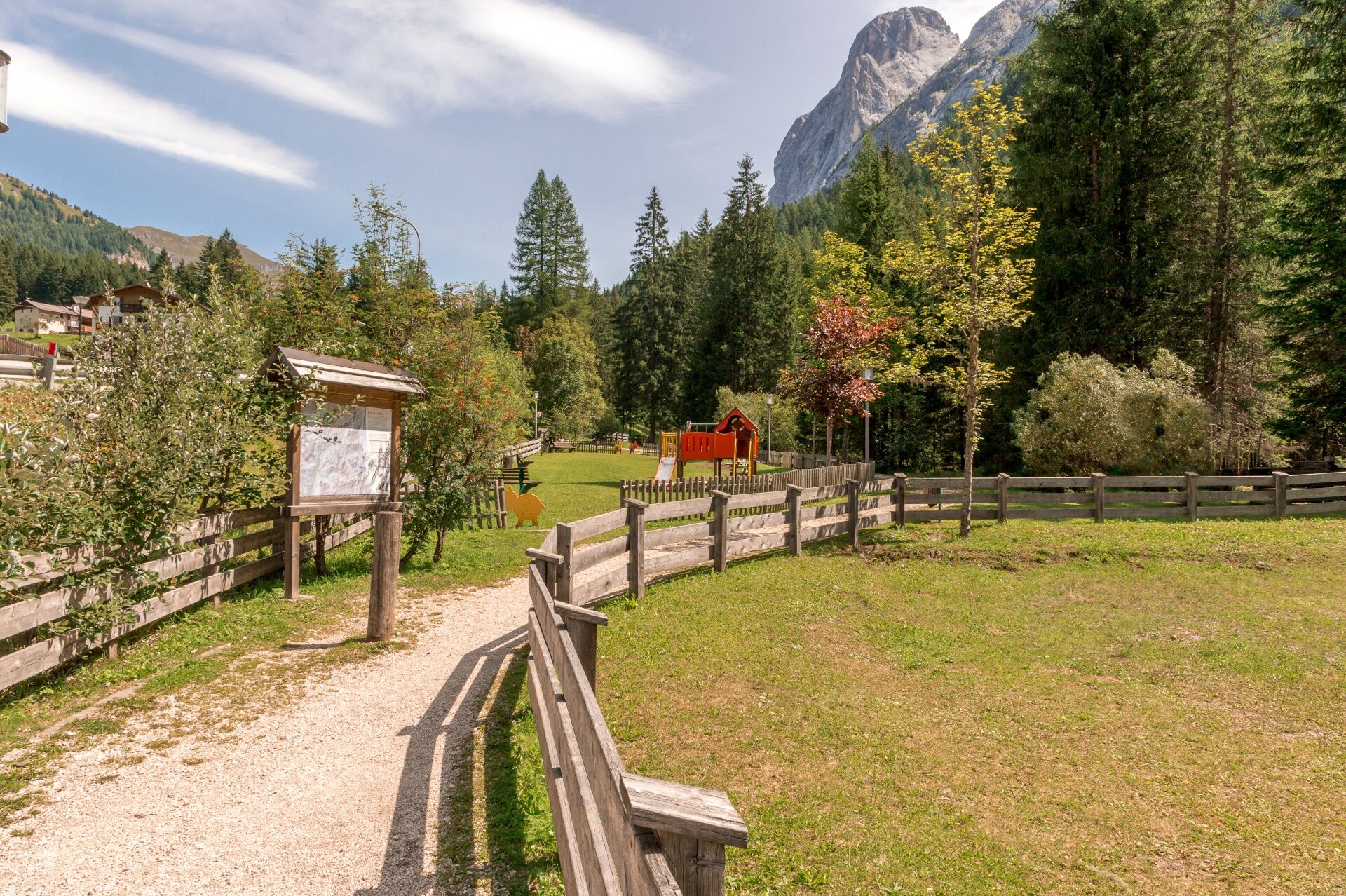
This path is suitable for families with children and is accessible with a baby carrier.
Must-see: Cèsa Dovolavilla, a typical ladin "majon" equipped with a bread oven; the Church of St Rocco and St Sebastiano in the square with the fountain; historic buildings with wooden balconies and galleries.
Possible transport by road train from Canazei to Penìa (for a fee, service only in summer).
Refreshment points only in Alba di Canazei.
- Additional information
-
Tourist Board Val di Fassa
Strèda Roma, 36
38032 Canazei (TN)
Phone +39 0462 609500
info@fassa.com
www.fassa.com
- Directions
-
Main access points to the valley coming from A22 Modena-Brennero motorway:
- exit Ora/Egna, S.S. 48 delle Dolomiti - San Lugano Pass - Val di Fiemme - Val di Fassa (distance 45 km). At the roundabout in Moena (industrial area), proceed towards Canazei
- exit Bolzano Nord, S.S. 241 Grande Strada delle Dolomiti - Carezza Pass - Vigo di Fassa (distance 40 km). From Vigo, head north for Canazei, head south for Soraga di Fassa and Moena
Other access points to Val di Fassa:
- from A27 motorway (Venezia), exit Belluno/Ponte nelle Alpi, S.S. 203 to Agordo and S.P. 346 to San Pellegrino Pass - Moena (Val di Fassa). At the roundabout in Moena, proceed towards Canazei
- from A27 motorway (Venezia), exit Belluno/Ponte nelle Alpi, S.S. 203 to Agordo/Alleghe/Rocca Pietore. S.P. 641 to Fedaia Pass - Canazei
- coming from Arabba, S.S. 48 to Pordoi Pass - Canazei
- from Val Gardena, S.S. 242 to Sella Pass - Canazei
- Public transportation
-
Public transport lines Trentino Trasporti - Val di Fassa:
- line no. 101 Canazei - Cavalese - Trento
- line no. 104 Cavalese - Ora - Trento
- line no. 123 Moena - San Pellegrino Pass - Falcade
Public transport lines SAD - Val di Fassa:
- line no. 180 Vigo di Fassa - Carezza Pass - Bolzano
- Nearest bus stop (Trentino Trasporti/SAD): Alba di Canazei (Strèda de Costa)
- Parking
-
Park at the entrance to the village or at the Ice Stadium in Alba di Canazei.


- Author
-
The tour Penìa - Lorenz - Vera - Penìa is used by outdooractive.com provided.


General info
-
Dolomiten
1826
-
Sellaronda
1116
-
Ciampac
336