
- Brief description
-
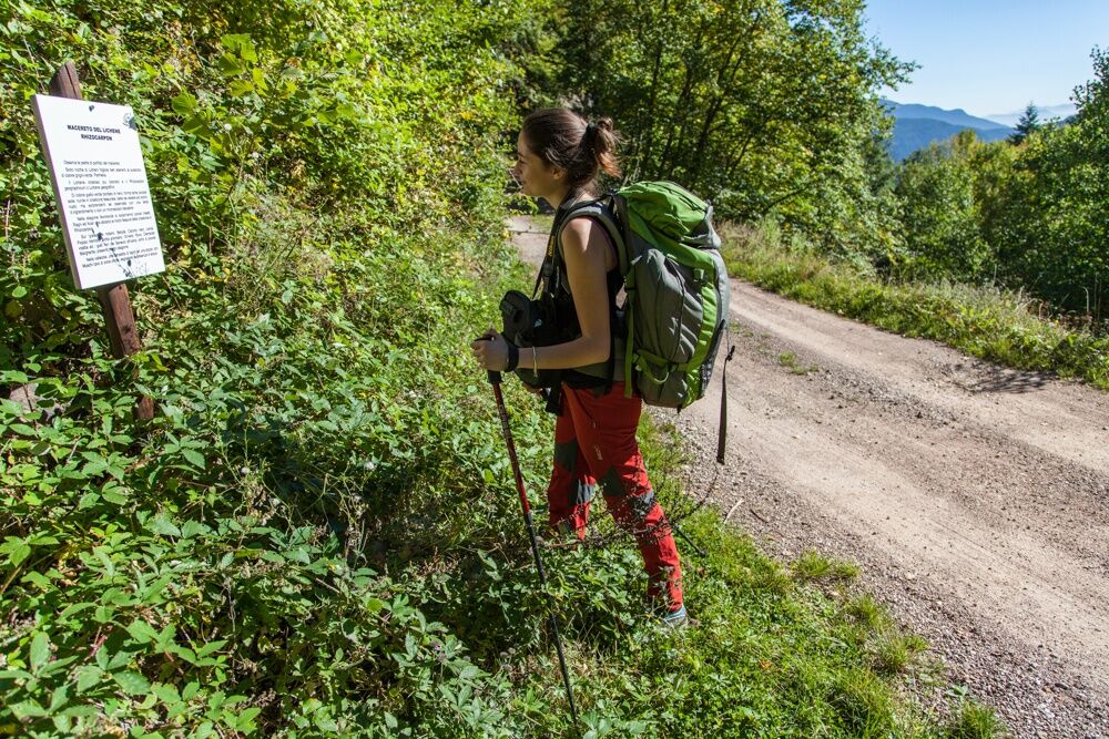
A trip into the forest on the Sentiero botanico naturalistico from Grauno to Capriana with info panels on the environment around you
- Difficulty
-
easy
- Rating
-
- Starting point
-
Grauno
- Route
-
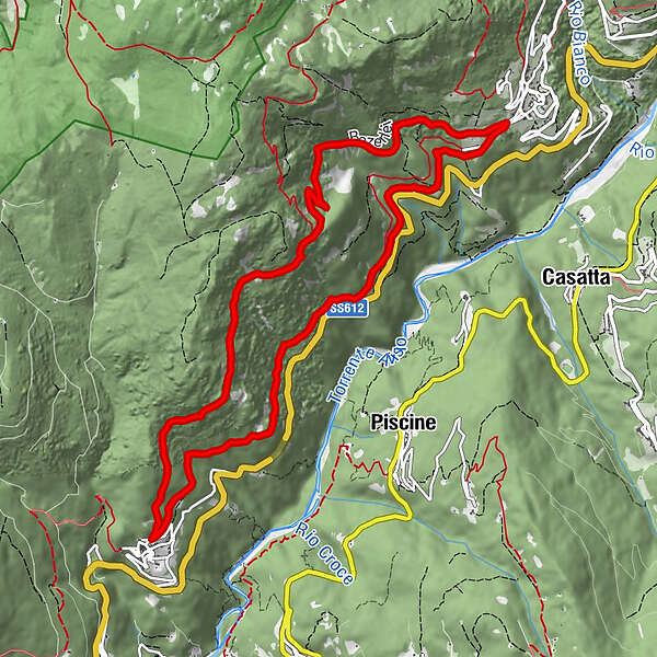
GraunoChiesa di San MartinoCapriana5.5 kmGrauno11.8 km
- Best season
-
JanFebMarAprMayJunJulAugSepOctNovDec
- Description
-
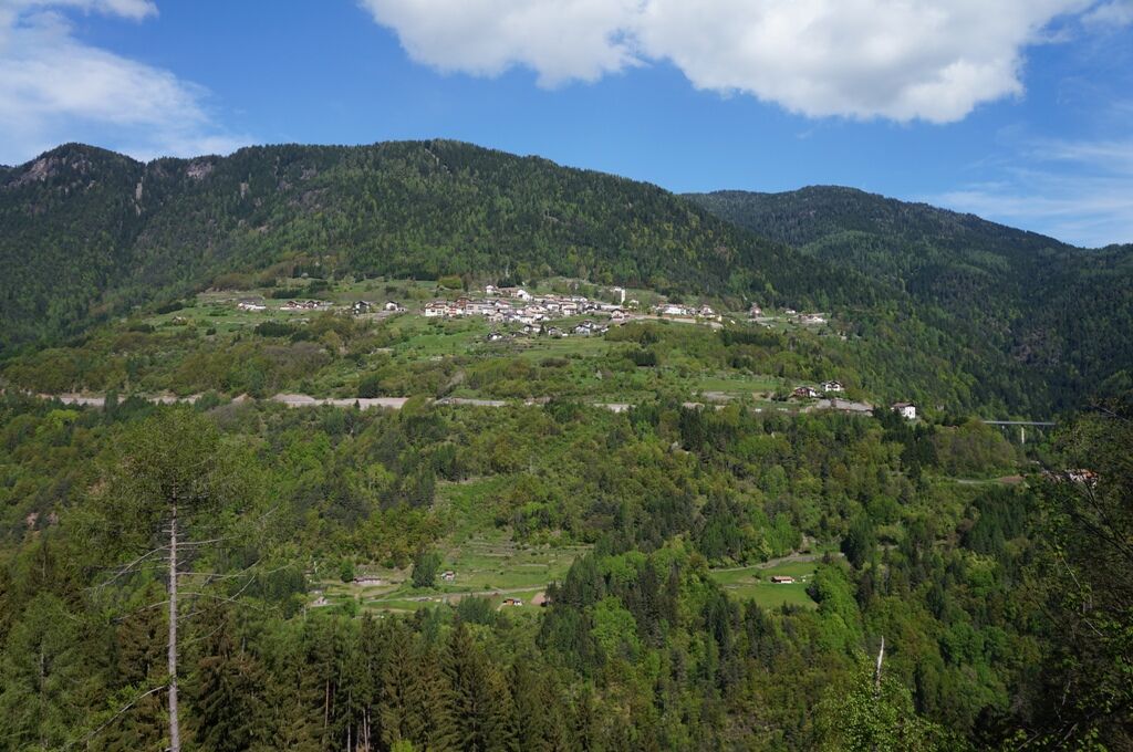
The route begins at the small town of Grauno, known for its historic Carnival rites, and ends at Capriana, in Valle di Fiemme.
Before you make your way into the forest it is worth stopping off to visit the pretty town of Grauno and wander through its maze of steep streets, the ‘frone’, and large historic fountains in the clearings between houses. It was in Grauno that Father Atanasio Cristofori – 1885-1961, friar and expert in herbs as well as author of Piante ed Erbe Medicinali della nostra Regione Tridentina (1931) on the medicinal uses for wild plants – was born. You will come across info panels on him along the route and around the town.
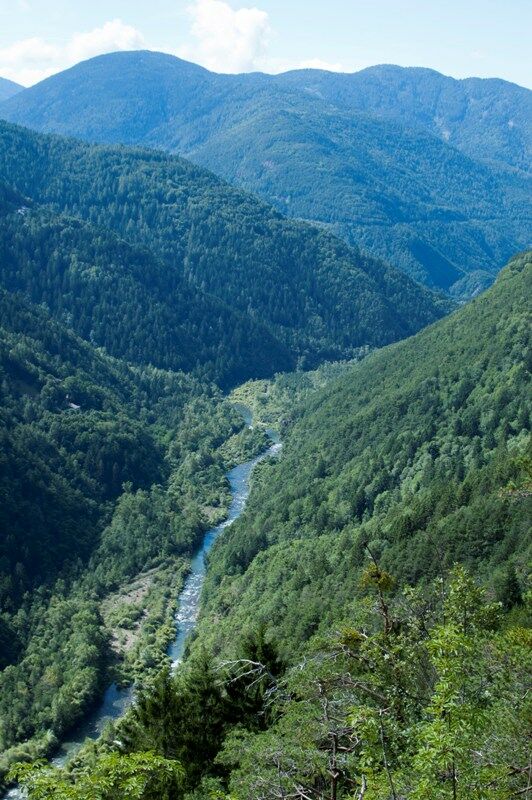
Straightforward and well-signed with waymarking and nature info panels, the itinerary starts near the church dedicated to patron saint Martin. Leaving the church to your right, take a cobbled mule track uphill for around one hundred metres and turn onto an even forest road through mixed pine and chestnut woods with interesting views over the valley.
The route takes you to the town of Capriana surrounded by flower filled meadows. A visit to Capriana is recommended, along an interesting historic route with info panels at significant points of interest featuring attractive period photos and captions packed with insights.
The return journey is on footpath SAT 481 which climbs up to Fontana D’Ao forestry shelter before descending to Grauno once again.
- Directions
-
The trail from Grauno to Capriana ventures into the wood slightly above Grauno church on the top of the town. Leaving the church on the right, after around 100 mt. uphill on a cobbled mule track, take the flat forest road on the right following the road signs to Capriana. This itinerary is quite easy and signaled with directional arrows and as well as with information panels on the nature of the place. After reaching Capriana you can choose either to go back on the same trail or to take path SAT 481, which goes uphill (around 300 mt.) to the mountain hut Fontana D’Ao and then back down back to Grauno.
- Highest point
- 1,294 m
- Endpoint
-
Grauno
- Height profile
-
 © outdooractive.com
 - Equipment
-
Trekking shoes or mountain boots.
Trekking poles. - Safety instructions
-
Even if this trail is not technically difficult and has no dangerous stretches, we always and in any case suggest to follow the general rules on safety for mountain hikes.
Prepare your itinerary Choose an excursion appropriate for your real ability and training level Choose the fitting equipment Check the weather forecast Hiking alone is risky Give details about your itinerary and about the approximate hour of your return Do not hesitate to entrust you to an expert Pay attention to the indication and signals you will find along your journey Do not hesitate to retrace your steps In case of accident: ask for help and call the number 112 - Tips
-
This trail is appropriate not only for a short walk, as it can be combined with some Nordic Walking practice.
- Additional information
- Directions
-
To drive here from Trento, you need to follow the main road S.S. 612 north to the town Grauno, where you can park in the forecourt on the right close to the shed used for the town events on the bottom of the town.
To drive here from the valley Val di Fiemme, you need to follow the main road S.S. 612 south to the town Grauno, where you can park in the forecourt on the right close to the shed used for the town events on the bottom of the town.
- Public transportation
- Parking
-
Car park near the Castelet multipurpose center
-

-
AuthorThe tour Naturalistic botanical footpath is used by outdooractive.com provided.