- Brief description
-
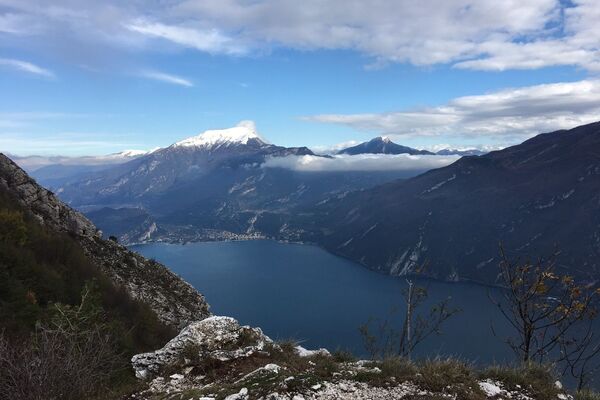
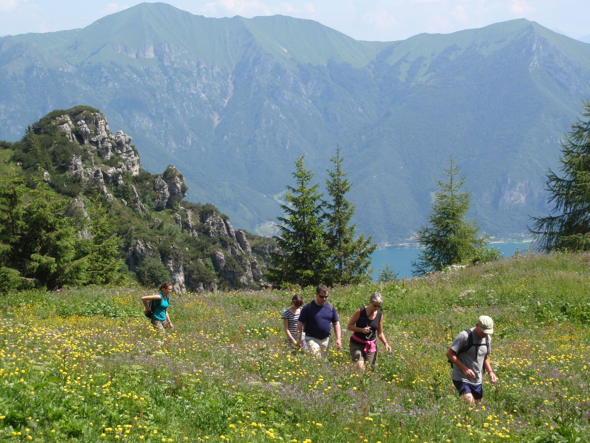
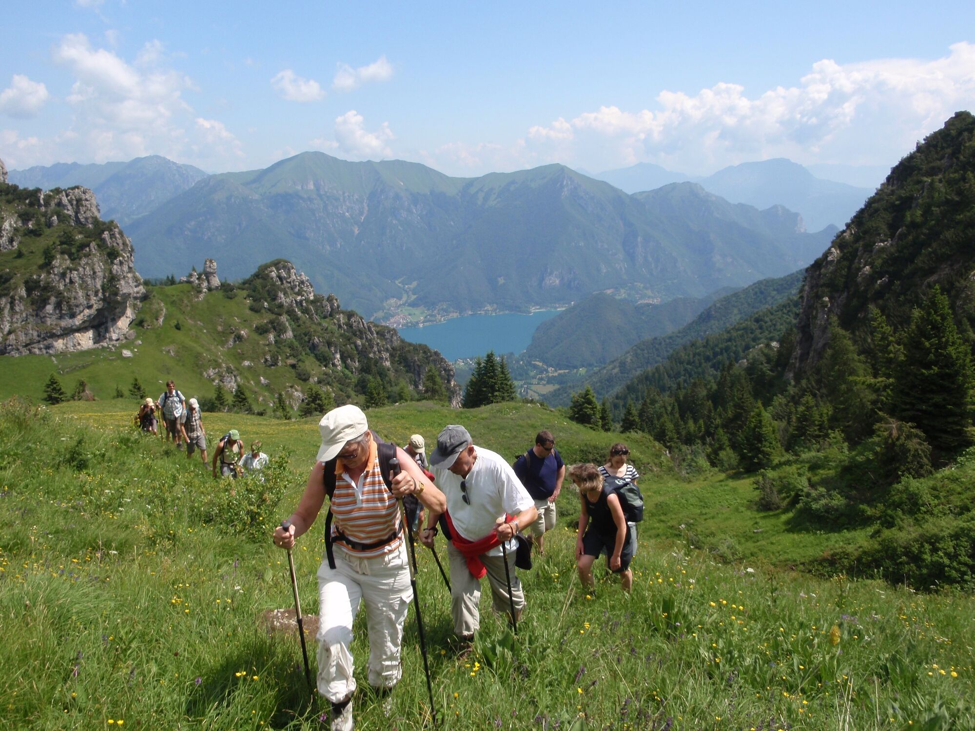
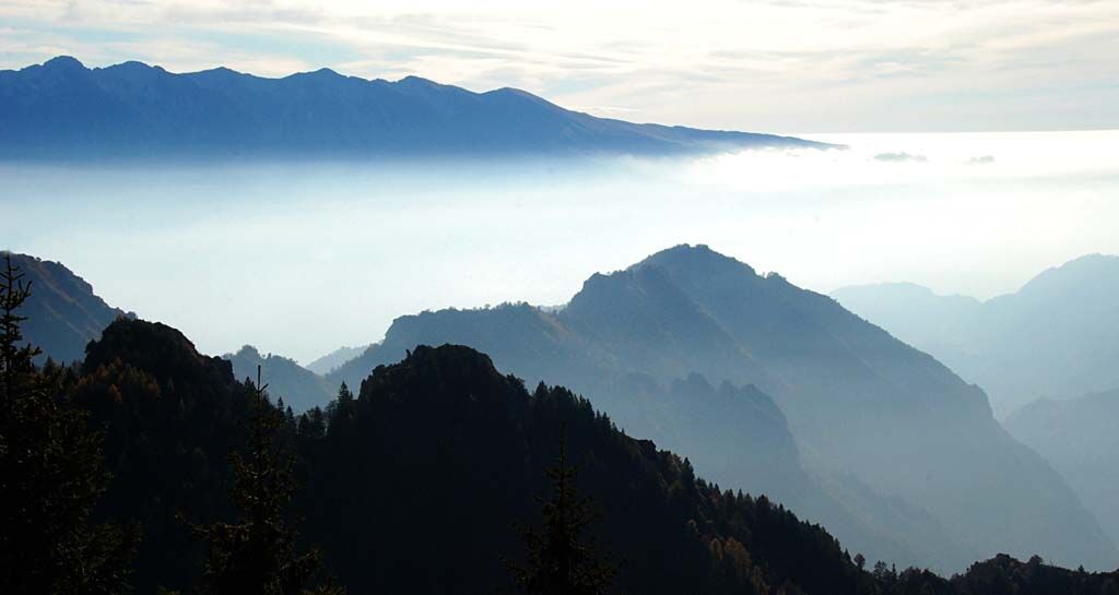
The route alternates the meadows of Tremalzo and Giù to the woods of Caset and the rocks and pines of the Marogna. From the Corno della Marogna the eye can sweep all around. Northwards towards Valle di Ledro, westwards towards the Adamello group, to the east towards Lake Garda and to the south towards the Alpine foothills.
- Difficulty
-
medium
- Rating
-
- Starting point
-
Rifugio Garibaldi
- Route
-
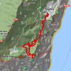
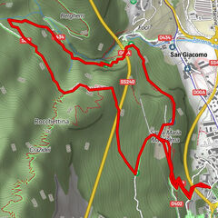
Bivacco malga Pertega5.0 kmMalga Pertega5.0 kmVal Bella5.9 kmAlbergo Ristorante Garda10.6 kmRistorante Da Richetto11.3 kmTremalzo11.4 km
- Best season
-
JanFebMarAprMayJunJulAugSepOctNovDec
- Description
-
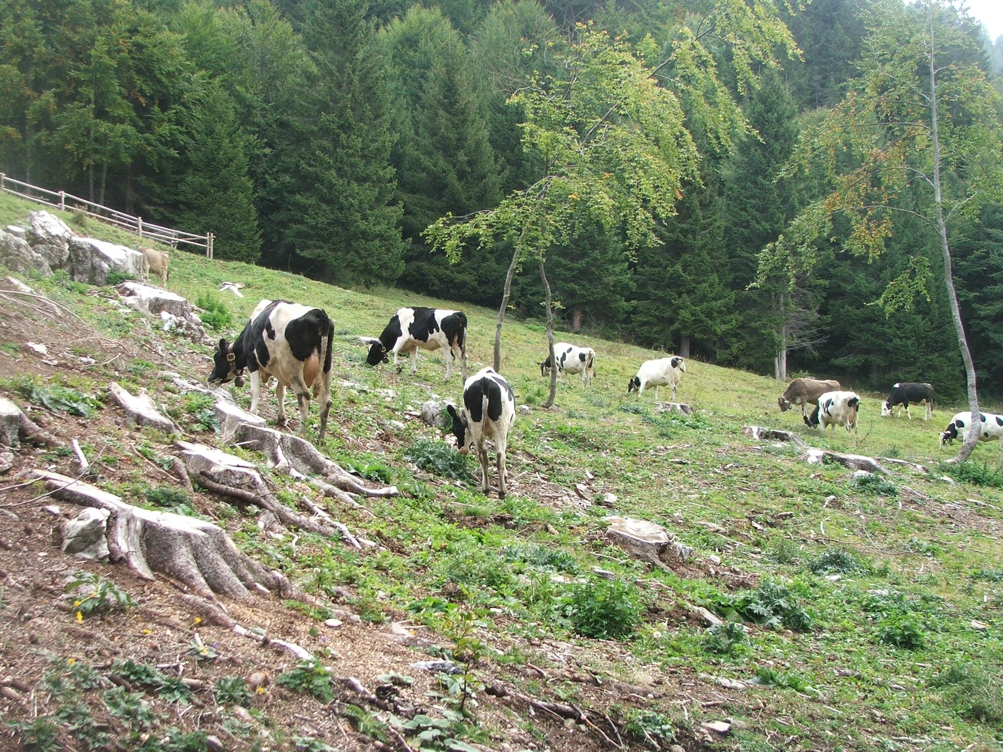
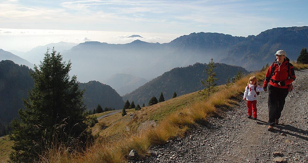
Tremalzo has something to offer every time of the year. Spring is the time of the bloom, Summer that of the alpine grazing. In Autumn migratory birds fly over Bocca Caset. Snowshoeing and Alpine skiing are the Winter activities of Tremalzo.
- Directions
-
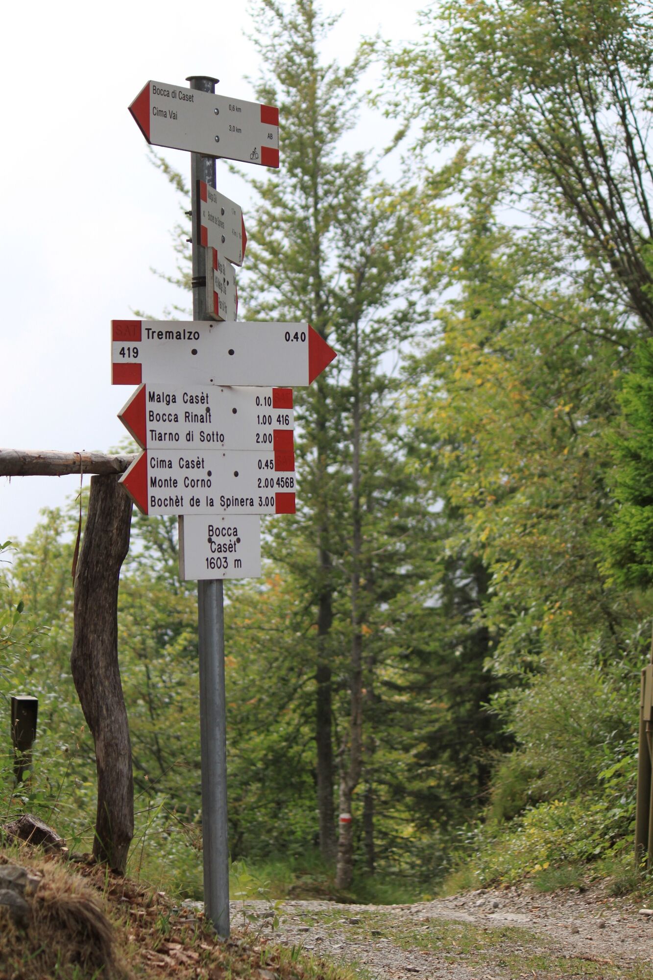
From Rifugio Garibaldi follow the forestry road to Bocca Caset. Take the path to the right towards Malga Giù and turn right onto the SAT 457 path. Shortly before reaching Malga Tremalzo di Molina take the path to the right to Bocca di Val Marza, where the unnumbered path to the Corno della Marogna begins. Return to Bocca di Val Marza along the same path and walk on the old military road to Passo Tremalzo. Return to the car park walking in the meadows.
- Highest point
- 1,903 m
- Endpoint
-
Corno della Marogna
- Height profile
-
 © outdooractive.com
 - Equipment
-
You need to wear the right clothing and take the proper gear when you go hiking in the mountains. Even on relatively short easy outings make sure to take all you need so you don't run into trouble if things take an unexpected turn, for example a storm blows up or you have a sudden drop in energy levels.
What should you take when you go on a hike?
Your rucksack (for a day trip a 25/30L capacity should do) should contain:
water canteen (1L) snacks (e.g. mixed dried fruit or chocolate) First aid kit windproof jacket fleece change of t-shirt and socks (in a plastic bag) make sure to wear or at least bring a pair of long trousers hat sun screen sunglasses gloves whistle to attract attention in an emergencyMake sure you're wearing the right footwear for the trail and season. The going can get rough and rocky underfoot and a pair of hiking boots will protect you from sprains. When wet, a grassy slope, rocky slab or steep trail can be dangerous unless you are wearing the proper footwear.
And finally... don't forget to bring your camera! You'll need it to capture the stunning views you come across all over Garda Trentino. And if you like, you can share your memories with us at #GardaTrentino.
Emergency telephone number 112.
- Safety instructions
-
Safety Tips
Choose itineraries that suit your physical and technical abilities. Collect information about the area you are visiting and the trail’s conditions and get a detailed trekking map. Wear clothes and take equipment that suit the difficulty and length of your tour. Keep emergency gear in your rucksack, including first aid supplies. Do not go walking alone in the mountains. In any case, tell someone where you are going and report back on returning. Look at the weather forecast before setting off and always keep an eye on the weather. In case of doubt, go back. It is better to give up than risk bad weather or face difficulties beyond your strength, ability and equipment. Do not leave marked paths and do not take shortcuts. All described walks are in a natural environment and therefore their use is at your own risk.This information is subject to inevitable variations, so none of these indications are absolute. It is not entirely possible to avoid giving inexact or imprecise information, given how quickly environmental and weather conditions can change. For this reason, we decline any responsibility for changes which the user may encounter. In any case, it is advisable to check environment and weather conditions before setting out.
- Tips
-
Tremalzo has something to offer in every season. Spring is the flowering season, summer the alpine pasture season. In autumn migratory birds fly over Bocca Caset. Snowshoeing and ski touring are winter activities that can be enjoyed in Tremalzo.
- Additional information
- Arrival
- Public transportation
- Parking
-
Car park near Rifugio Garibaldi.


-

-
AuthorThe tour Around Monte Tremalzo is used by outdooractive.com provided.


General info
-
Gardasee / Lombardei
433
-
Valle di Ledro
564
-
Tiarno di Sotto
190