- Brief description
-
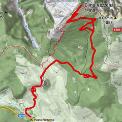
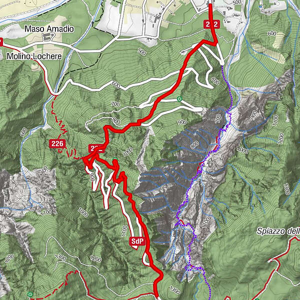
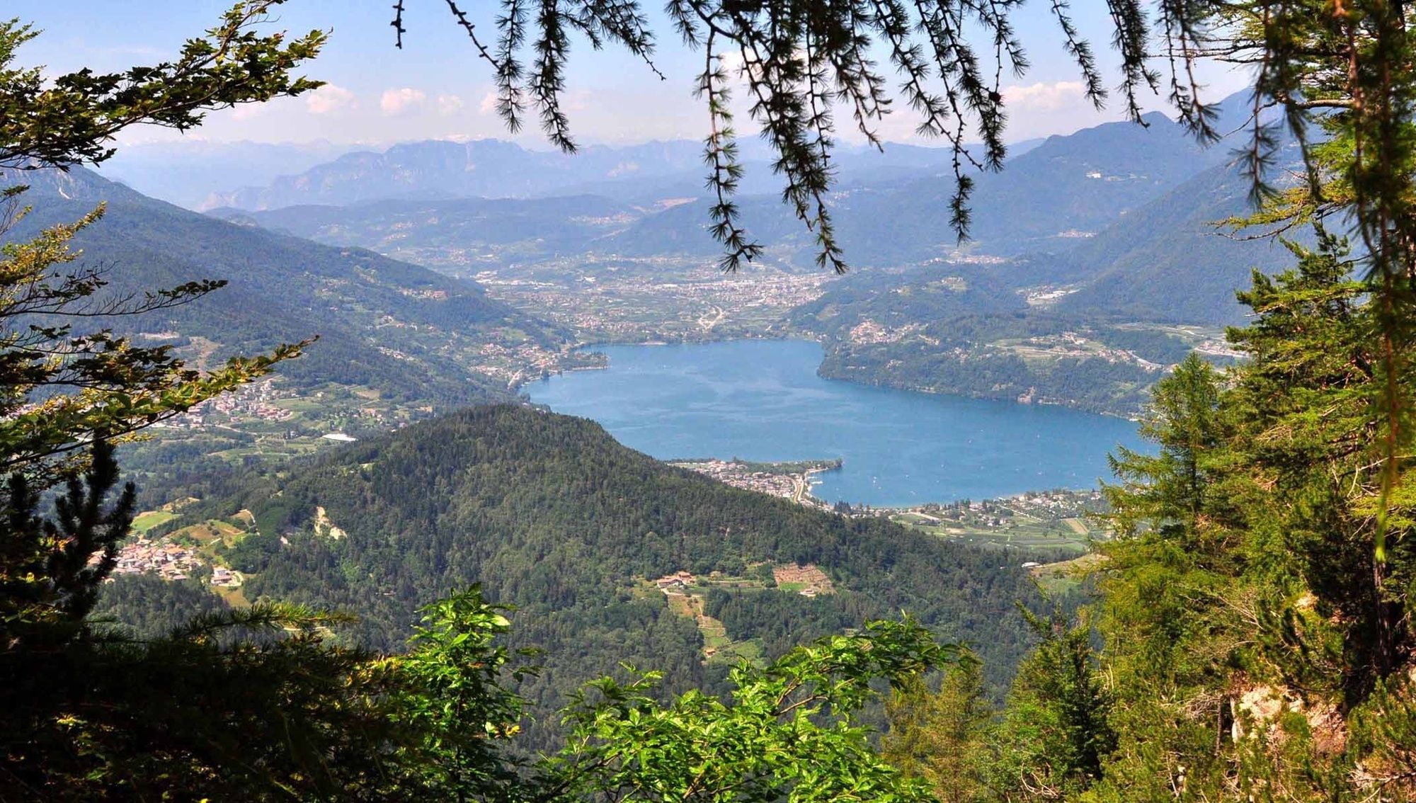
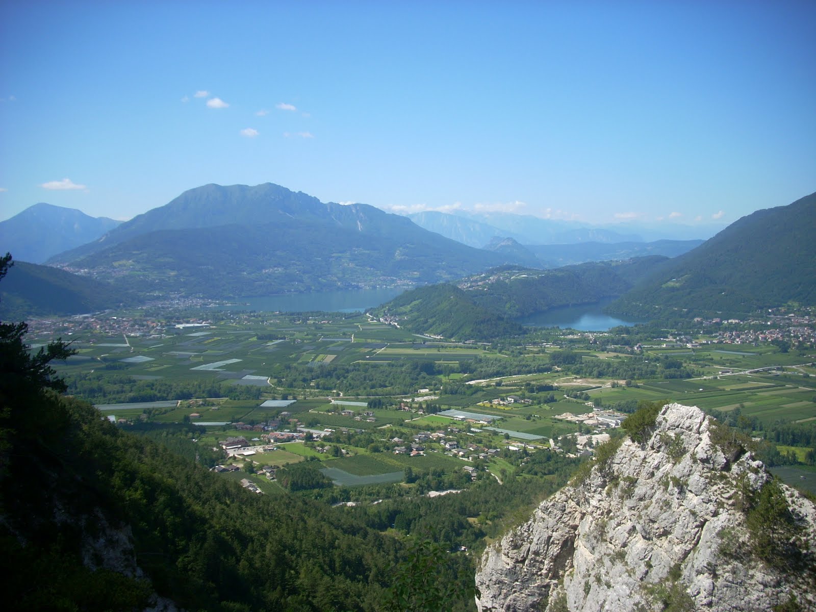
A demanding route that climbs along the rugged western flank of Monte Pegolara, crossing the provincial road of the same name several times. It offers beautiful views of Alta Valsugana and the lakes of Caldonazzo and Levico and connects near Monterovere to the Alpe trail network.
- Difficulty
-
difficult
- Rating
-
- Route
-
Paoli Hotel - Antica Trattoria alla Vedova
- Best season
-
JanFebMarAprMayJunJulAugSepOctNovDec
- Description
-
The start is from the hamlet of Lòchere di Caldonazzo, on the S.P. 133 dir. della Pegolara, near the Albergo alla Vedova. We follow the road to Monterovere for a few minutes and, before reaching the first hairpin bend, we abandon it to take the path to the right, which climbs up through steep mixed woods. The track intersects the hairpin bends of the road and, in some long stretches, we also have to walk along it. Near a tunnel, path no. 226 connects from the right with Caldonazzo for the Bassa Val Cesta: we climb back up the NW ridge of Monte Pegolara until we reach a panoramic, lookout point (1039 m). The path, still fairly easy, but steeper in the second part, joins the road and ends its course at Spiazzo Alto, a few minutes from Monterovere.
- Highest point
- 1,271 m
- Endpoint
-
Spiazzo Alto
- Height profile
-
 © outdooractive.com
 - Safety instructions
-
Please note that the practicability of the itineraries in a mountain environment is strictly linked to the contingent conditions and is therefore influenced by natural phenomena, environmental changes and weather conditions. For this reason, the information contained in this page may have changed. Before leaving for a tour, make sure the path you will approach is still accessible by contacting the owner of the mountain hut, the alpine guides or the visitor centres of the nature parks, the info offices of the local tourist board.
- Author
-
The tour SAT / E202 - Senter dela Pegolara is used by outdooractive.com provided.