
- Brief description
-
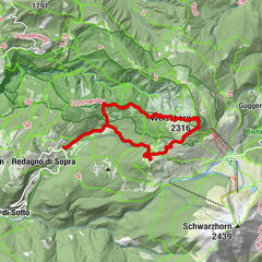
This route, which runs entirely through woods of conifers interspersed by clearings occupied by various mountain huts, is especially interesting from a naturalistic perspective.
- Difficulty
-
easy
- Rating
-
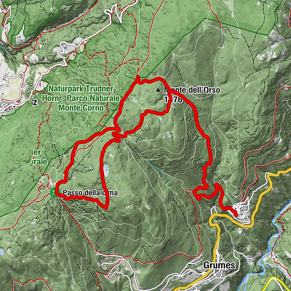
- Starting point
-
Grauno
- Route
-
Grauno0.1 kmValdonega (1,419 m)5.6 kmGrauno16.6 km
- Best season
-
JanFebMarAprMayJunJulAugSepOctNovDec
- Description
-
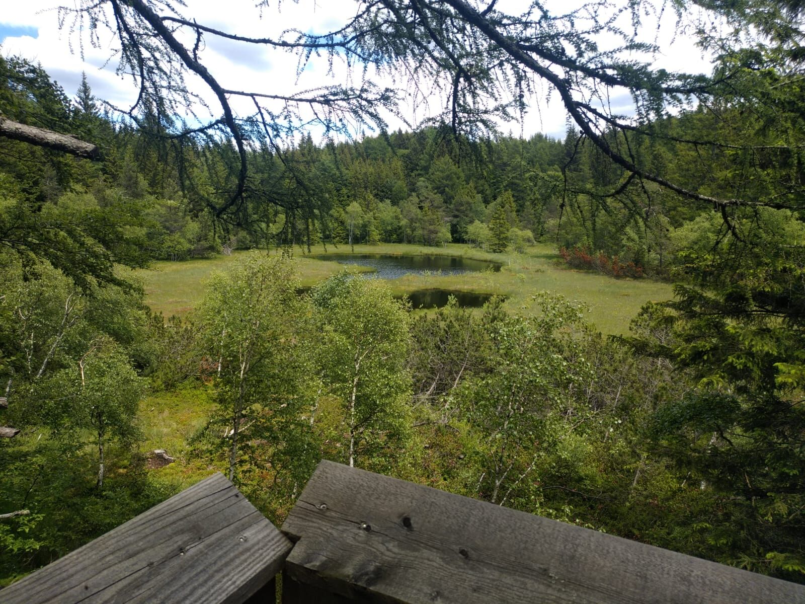
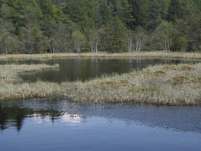
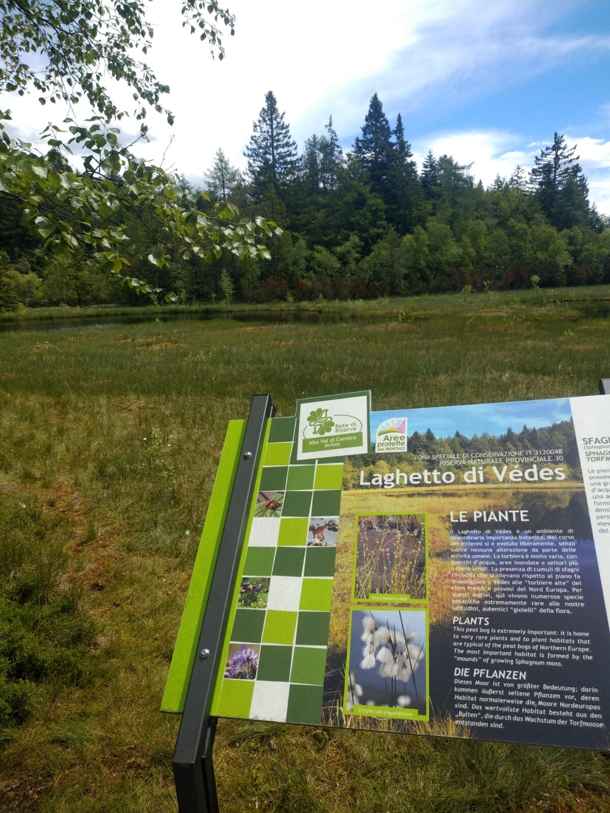
It takes you inside the Monte Corno/Hornspitz nature park (in South Tyrol) and past the peat bog called 'Laghetto del Vedes', an area with its own microclimate and rich biodiversity.
- Directions
-
The starting place is the roundabout at the access to Grauno. Follow Via Siori until you reach a fountain, then bear left up a paved road which runs into a dirt road signposted 'Sentiero dei vecchi mestieri – Mulino Cristofori' (Old Trades Path – Cristofori watermill). Follow it until its end at Mulino Cristofori. There, take the path marked 'Sentiero dei vecchi mestieri' near the stream. Where the path joins the paved road coming from Grumes lower down, head north along the latter towards Monte dell'Orso. This is the most strenuous stretch of the hike: you go constantly uphill on ancient paved roads. Keeping to the left and ignoring several forks in the road, at a hairpin bend, take the bridle path that continues straight northwards. At the first fork in Monte dell'Orso, keep to the right; at the second fork in Monte dell'Orso, turn left until reaching Baita Motta. The road enters the Monte Corno Nature Park, we are in Alto Adige-Südtirol, and we immediately take the E5 path, which proceeds through the forest dotted with mountain huts. At the crossroads in Valdonega (crossroads), we turn right onto the E5 in the direction of the Potzmauer-Possmar Pass (also known as the Passo della Cima), which we reach by following the various branches of the E5 trail. Take the forest road to Lago del Vedes; the road then loses its track until it reaches a dirt track again at the biotope. It is worth spending a few minutes contemplating this vulnerable peat bog, the subject of research and studies for the rarity of its flora, its microclimate and its rich biodiversity. We follow the dirt road downhill to a fork of several roads (capital and pond); here we continue straight ahead on the paved forest road towards the Palude de la Lot biotope. At the fork in the forest road, we keep to the right and after about ten metres we find a larch tree with numerous woodpecker holes on the right, which confirms that we are on the right track. The hollow of the marsh is home to some chalets and lends itself to a rest among the cherry trees and birches. We continue until we reach the outward path, on which we continue downhill to our starting point.
- Highest point
- 1,524 m
- Endpoint
-
Grauno
- Height profile
-
 © outdooractive.com
 - Equipment
-
Hiking shoes, rain-jacket, hiking poles, water, snack and sun cream.
- Safety instructions
-
THE 10 RULES FOR HIKERS
Prepare your itinerary beforehand Choose an itinerary that suits your physical abilities Choose suitable clothes and equipment Check the weather forecast Hiking by yourself is more risky; if this is the case, take a mobile phone with you Leave information about your itinerary and your expected return time If you are not sure about your itinerary, contact an Alpine Guide Pay attention to signposts and directions that you find along your way Do not hesitate in going back if you feel too tired In case of emergency call 112 - Tips
-
Did you know that there are also carnivorous plants at the Vedes lake? Drosera rotundifolia blooms from April to September with small white flowers. It is 10–20 cm tall and feeds on small insects that get trapped in its tentacles.
- Additional information
- Directions
-
By car: From south or north, on the A22 Brennero motorway, leave the motorway at the Trento Nord exit (22.5 km from the toll gate), continue northwards on the Main Brennero Road SS12 until the turn-off for Lavis, then take the Lavis - Castello di Fiemme Main Road SS612 which will take you to the Cembra Valley.
- Parking
-
Parking at the roundabout at the beginning of Grauno
- Author
-
The tour Monte dell'Orso - Vedes Lake is used by outdooractive.com provided.