
- Brief description
-
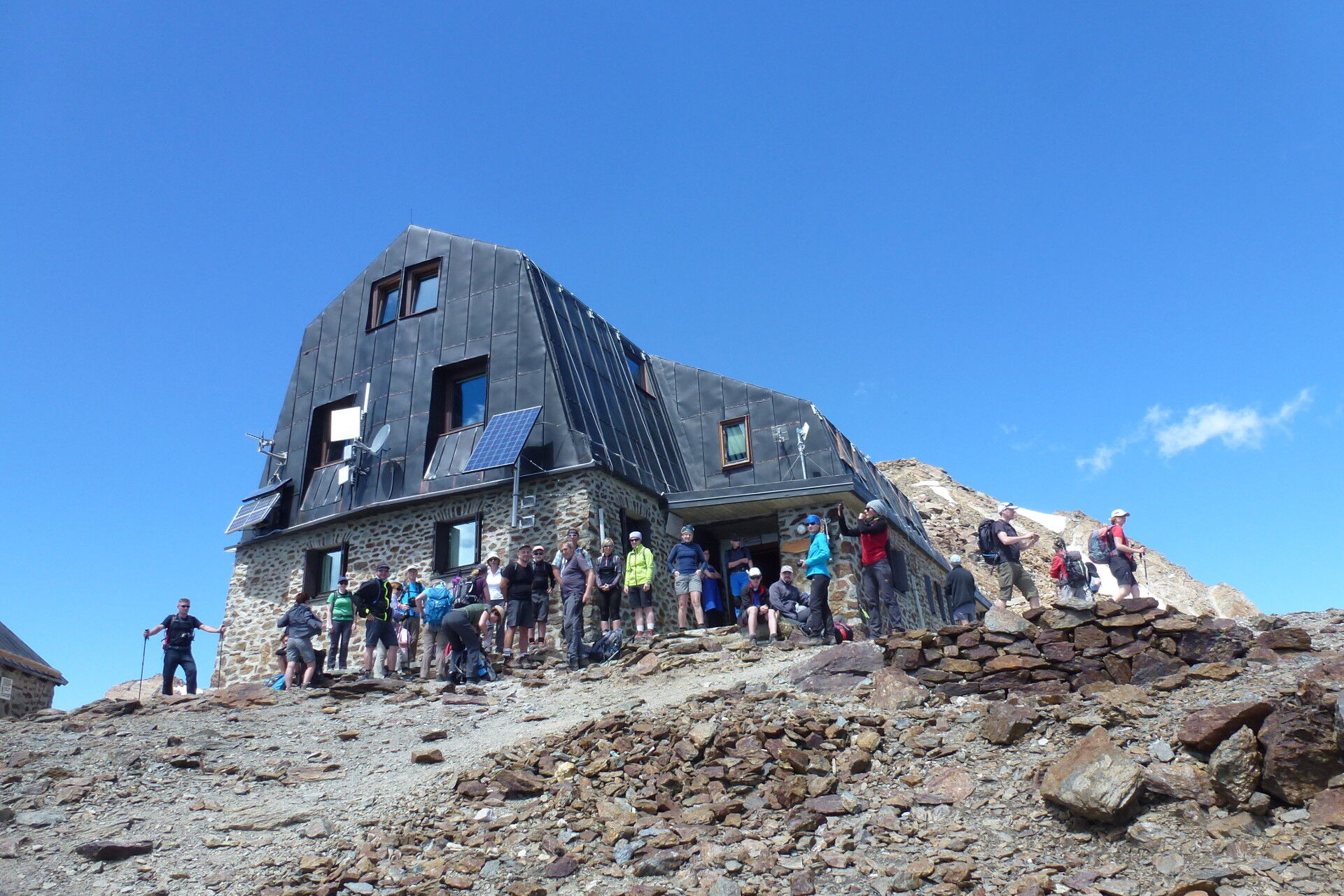
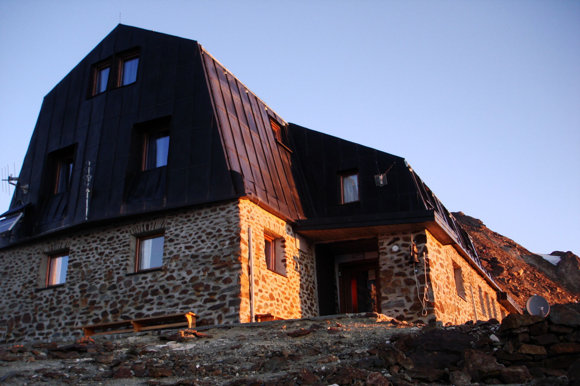
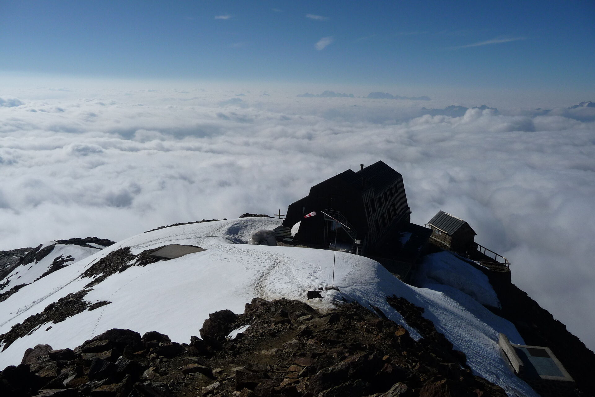
The highest alpine hut in Trentino at the foot of Monte Vioz (3.645m). A demanding and challenging excursion in the Ortles-Cevedale group and the Stelvio National Park.
- Difficulty
-
difficult
- Rating
-
- Starting point
-
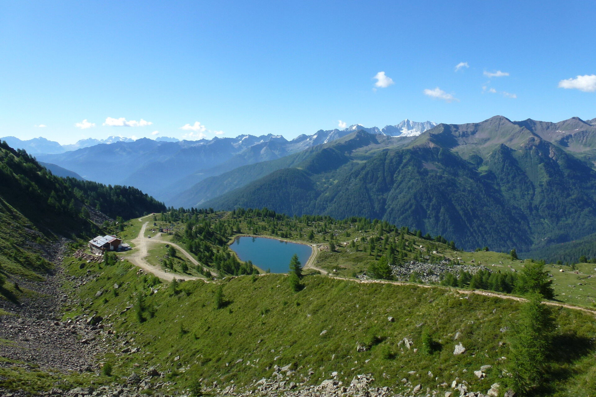
Rifugio Doss dei Gembri alpine hut
- Route
-
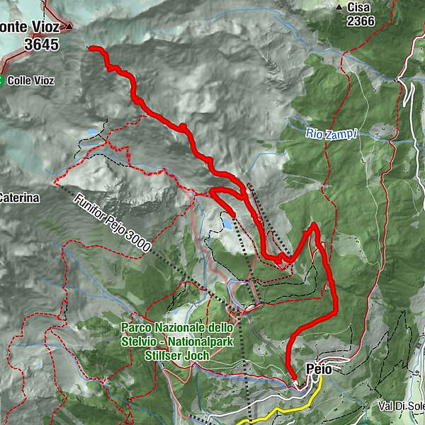
Peio0.0 kmBrik (3,206 m)9.3 kmRifugio Mantova al Vioz10.4 km
- Best season
-
JanFebMarAprMayJunJulAugSepOctNovDec
- Description
-
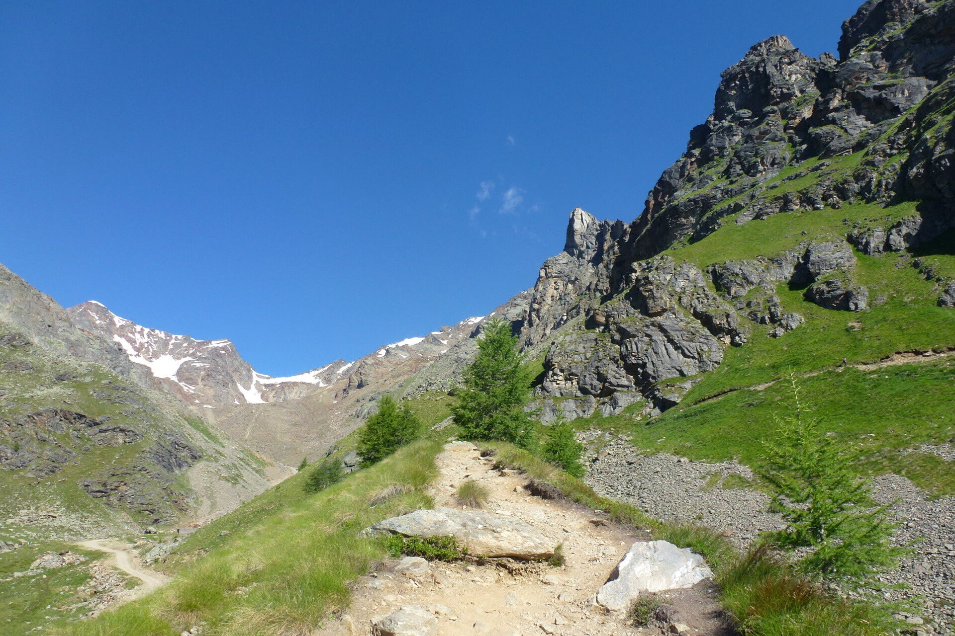
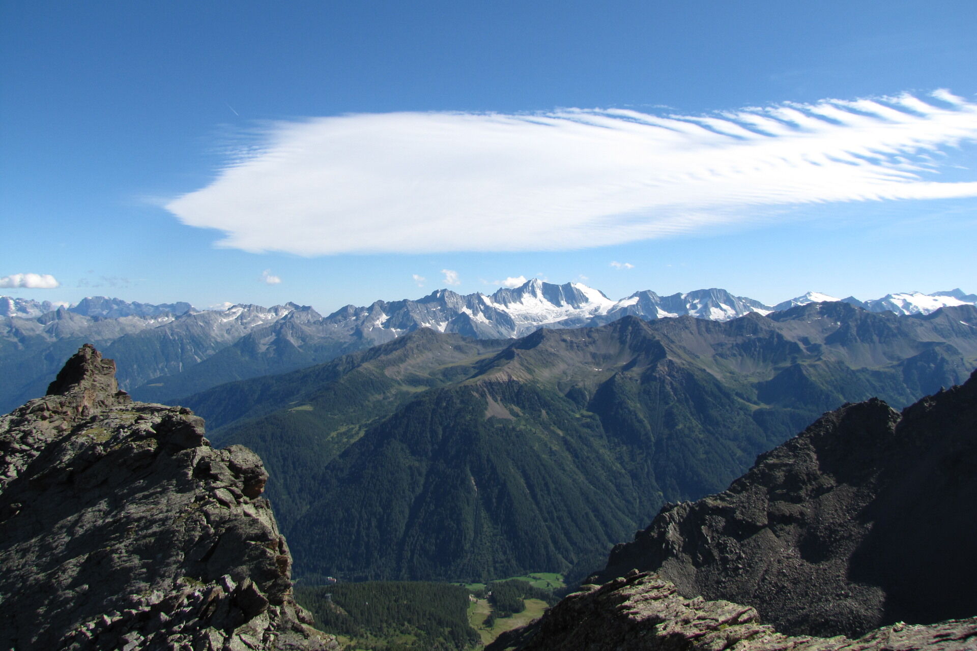
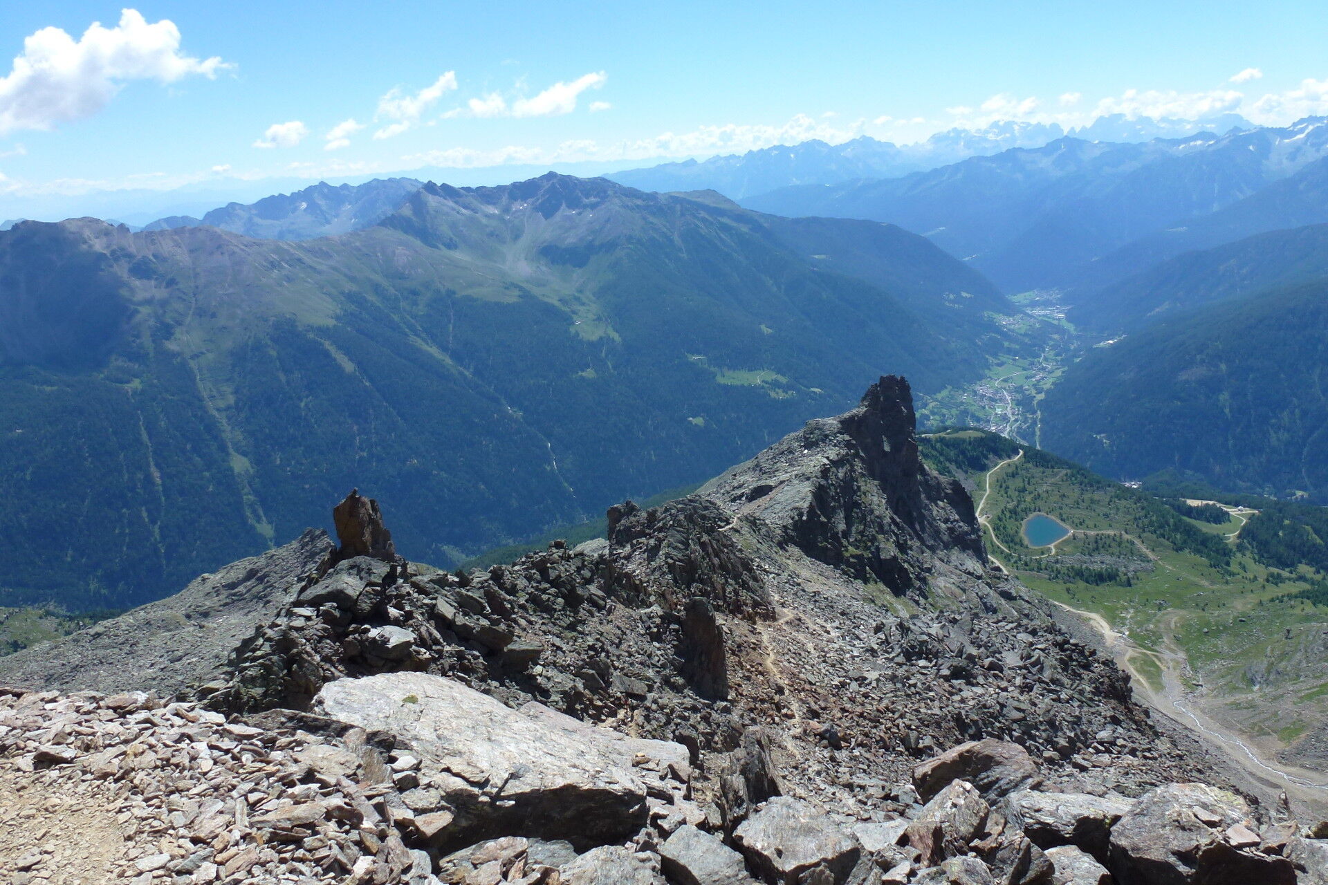
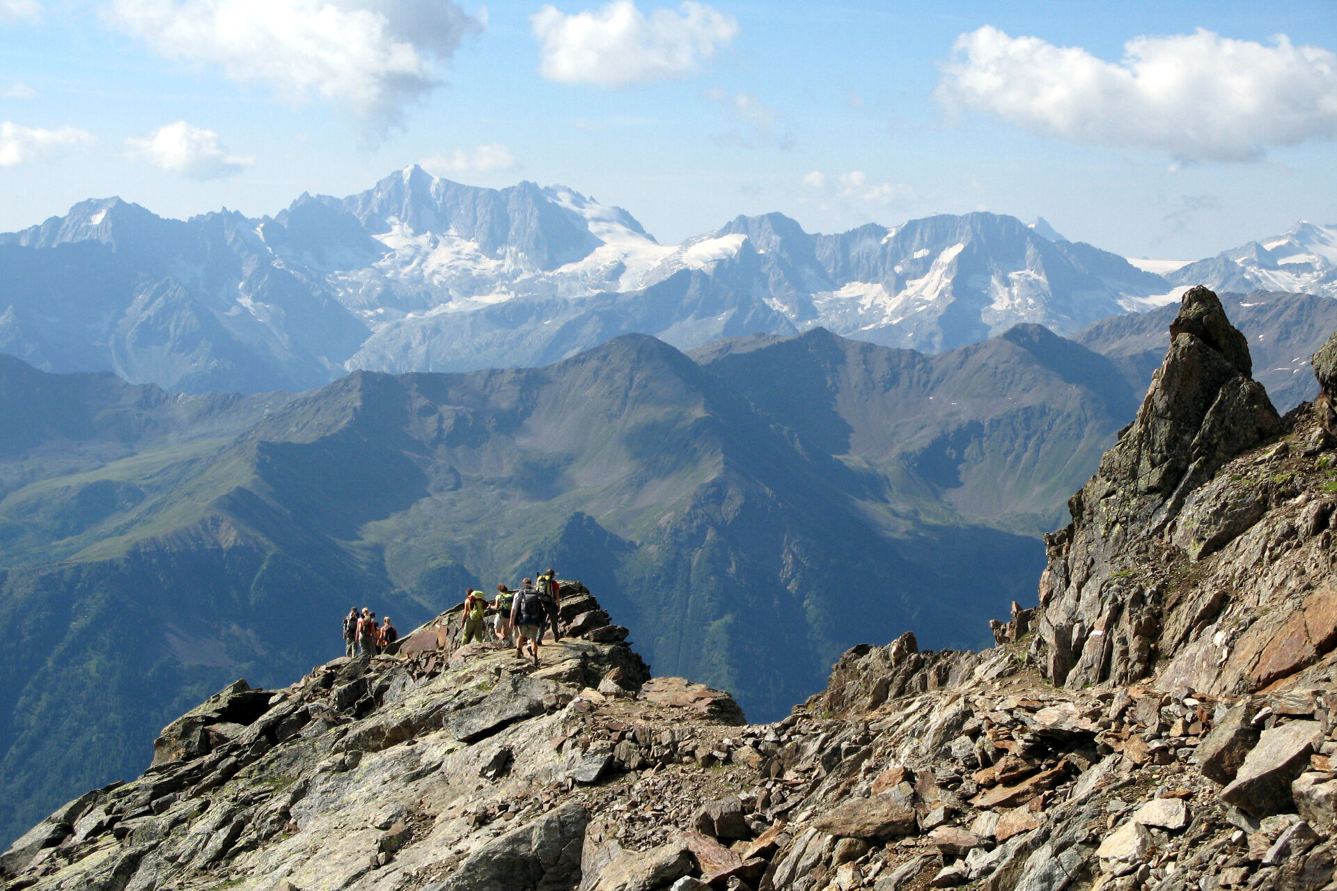
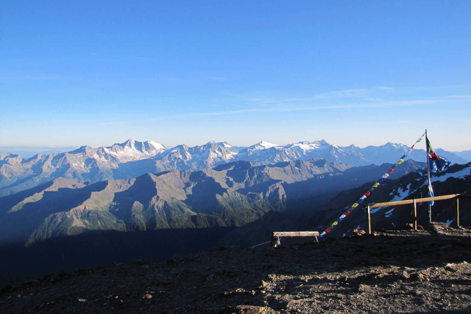
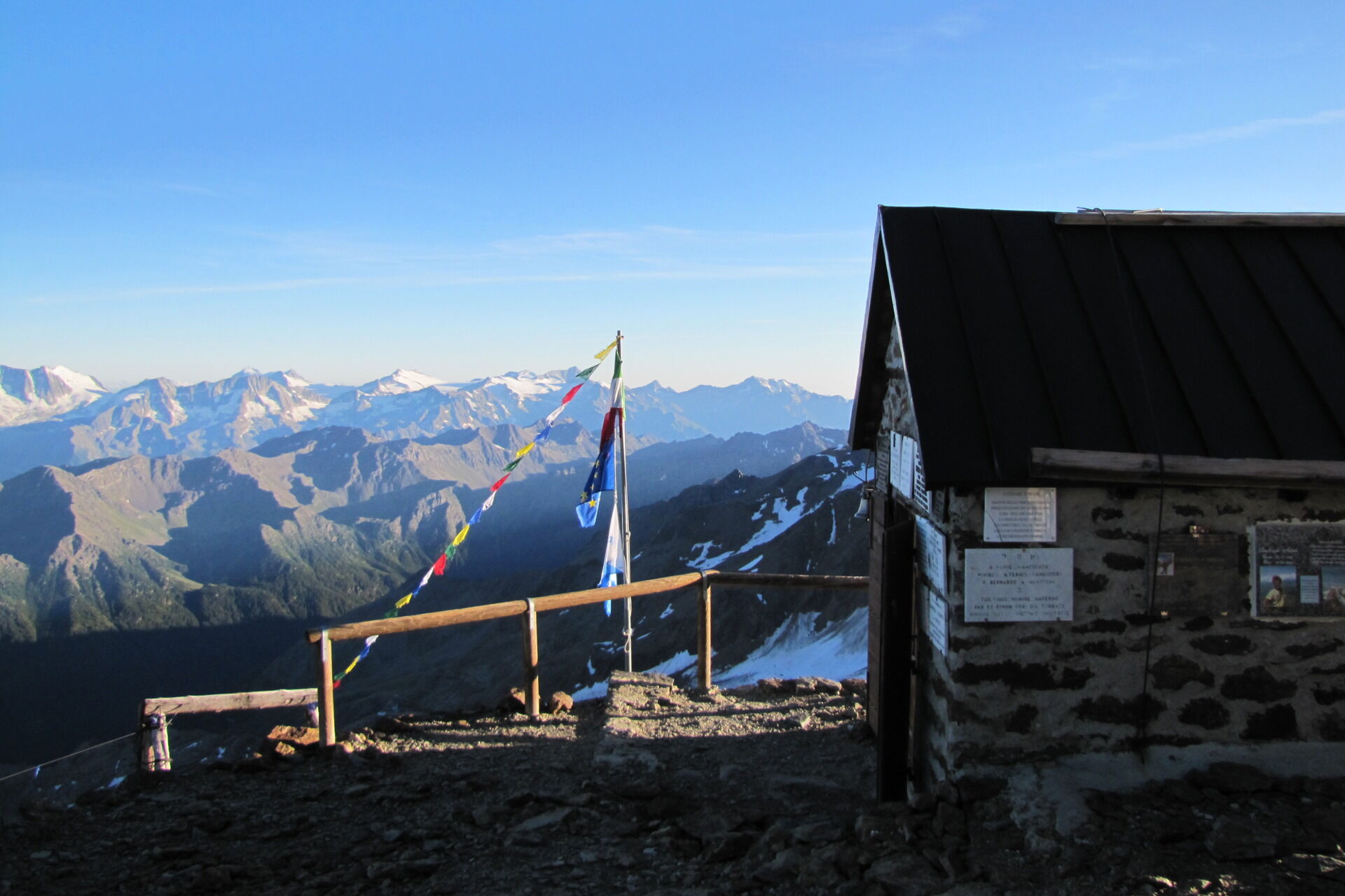
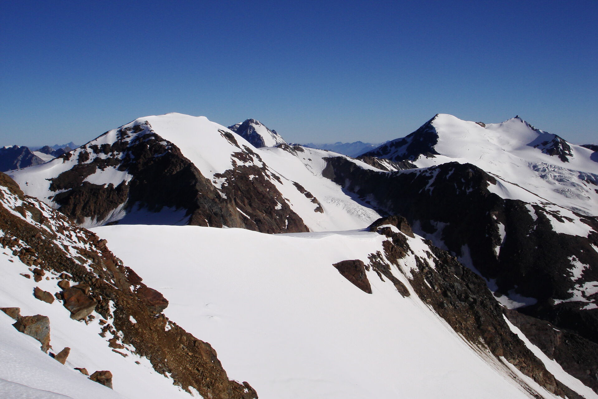
Departure point for the Vioz-Cevedale cross and fundamental for that of the 13 peaks. Unique panorama on the glaciers, the stage of the highest alpine military battles in history. Exceptional view of Val di Peio, the Ortles-Cevedale group and in the distance Adamello-Presanella.
- Directions
-
EE - Escursionisti Esperti (Expert Hiker)
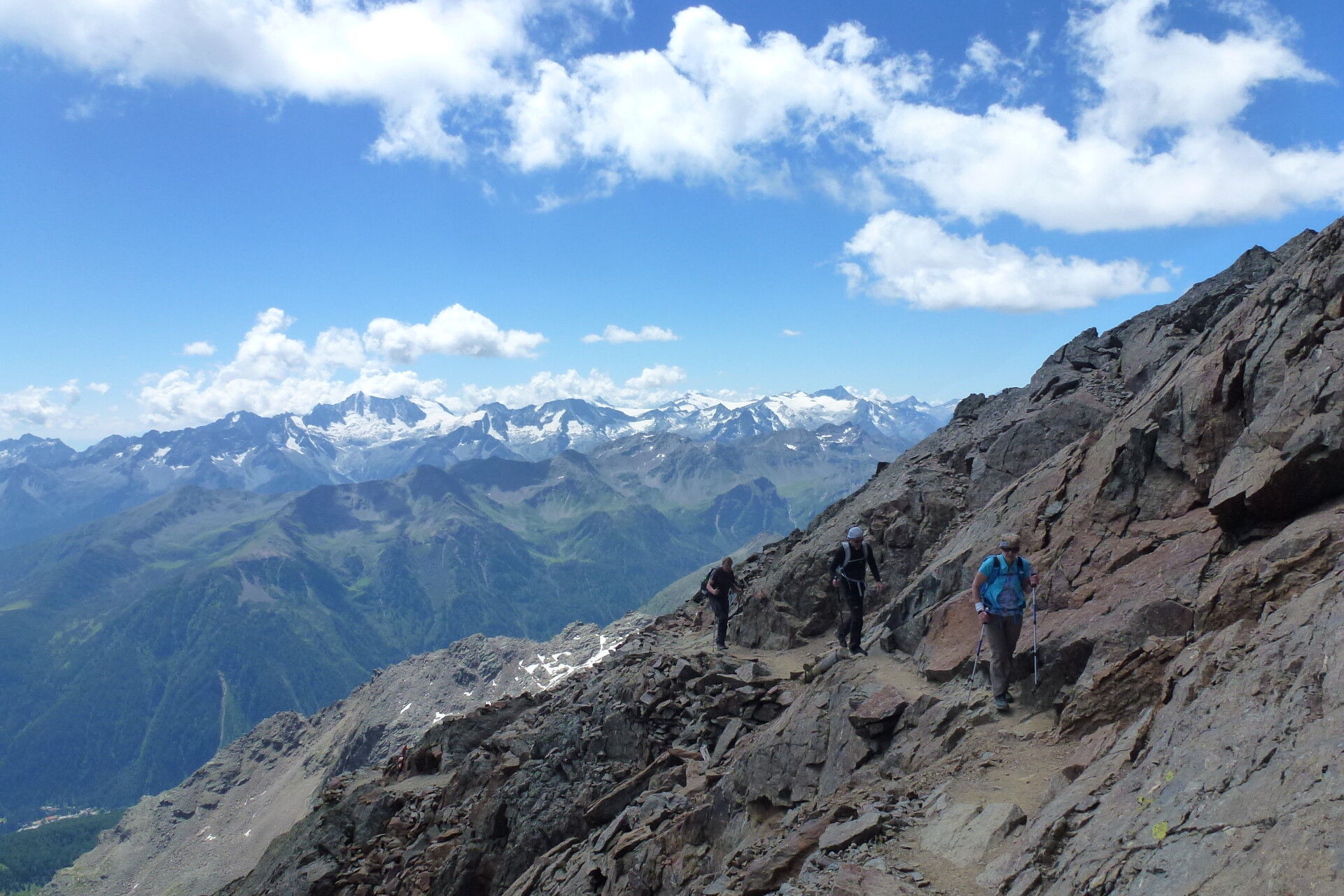
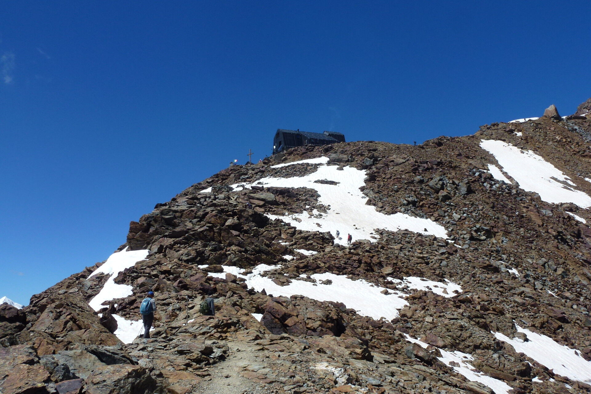
Departure is from Peio Fonti from where you take the Tarlenta gondola to Rifugio Scoiattolo and then the chair lift to Rifugio Doss dei Gembri (2.380m). From here take the SAT 105, an old military road dating back to 1915/18, which after a number of sharp bends will take you to the dorsal of Monte Vioz. Continuing upwards (not too steep) you will pass Dente del Vioz, a characteristic tower shaped like a tooth, after after yet more steep bends at Brick (3.206m) a stretch of road equipped with metal rope (pay attention here). The final stretch of the climb, on some narrow bends, and you will reach Rifugio Vioz Mantova (3.535m). A breathtaking view of the thirteen peaks, of Adamello-Presanella and the Brenta Dolomites, awaits you.
- Highest point
- 3,508 m
- Endpoint
-
Rifugio Vioz «Mantova» alpine hut
- Height profile
-
 © outdooractive.com
 - Equipment
-
Recommended equipment: Waterproof clothes, light but warm (the first layer of clothing in contact with the skin, should be made of polypropylene, a second layer should be of wool or felt (for insulation) and the third layer, waterproof windcheater raincoat in nylon or Gore-Tex and long trousers, heavy walking shoes, (avoid trainers) gloves, hat, a change of clothes, rucksack sun cream and sunglasses.
- Safety instructions
-
The trail is well marked and signposted with the Red and White SAT signs, with the number of the path written in black. Entrust the professionalism of the Val di Sole Alpine Guides for help and advice.
Choose a route which is suitable and in line with your preparation. Leave information of your itinerary and approximate return time. Pay attention to the signs and indications found on the way. Do not hesitate to return if necessary. In case of accident or emergency, call 118.All the information given in this profile is subject to change or alteration and therefore not always absolutely valid. It is not possible to completely avoid inaccuracies due to the very rapid changes in weather or environmental conditions, which can verify themselves without warning. For this reason, we accept No responsibility for eventual changes, which may affect the person involved. We strongly advise that weather and/or environmental conditions be checked before departure.
Please note that the practicability of the itineraries in a mountain environment is strictly linked to the contingent conditions and is therefore influenced by natural phenomena, environmental changes and weather conditions. For this reason, the information contained in this page may have changed. Before leaving for a tour, make sure the path you will approach is still accessible by contacting the owner of the mountain hut, the alpine guides or the visitor centres of the nature parks, the info offices of the local tourist board.
- Tips
-
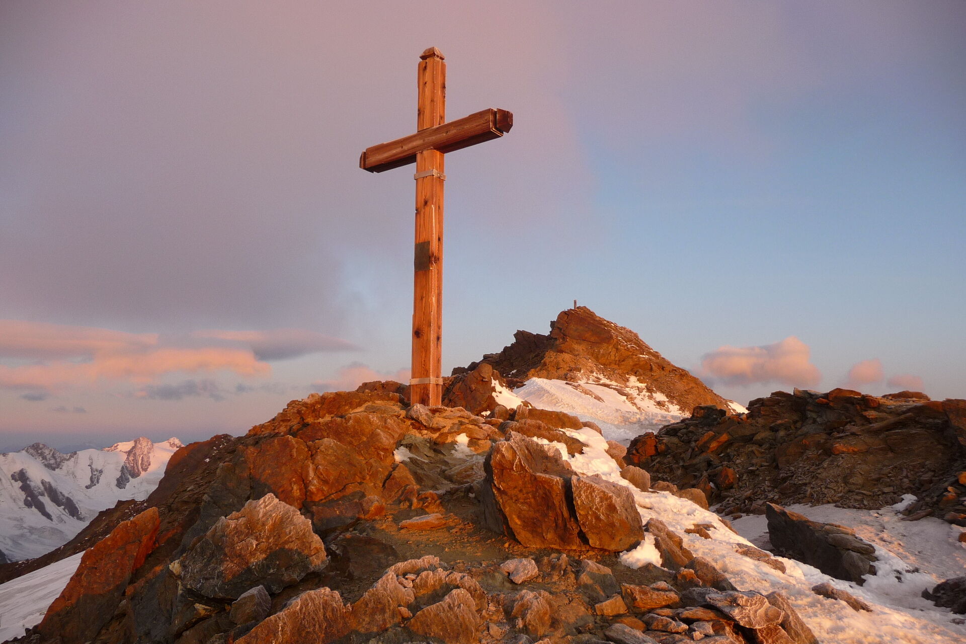
From the rifugio walk the few metres, which separate it from the summit of Monte Vioz (about 15 minutes). From here, it is possible to reach Punta Linke (3.632m) one of the highest and most important nerve-centres on the western front line during the First World War, also known as the White War, for the constant battles on the never-ending snow and ice of the Ortles-Cevedale group. Over the decades then ice and snow have conserved the entire fort in its original state, allowing for an exceptional museum at high altitude.
- Additional information
-
CAI-SAT (Società Alpinisti Tridentini)
Location: Monte Vioz
Municipality: Peio
Beds: 54
Winter camp: 6 places
Facilities: hot water, shower, bath and central heating, bar, restaurant
Summer opening: 22/6 - 21/9
Management: Casanova Mario
Tel.: +39 0463 751386 - +39 339 2798826
E-Mail: info@rifugiovioz.itRifugio Vioz Mantova
SAT Società Alpinisti Tridentini
Val di Sole Mountain Guide
Weather in Trentino
Val di Sole Tourist BoardFor information and times and prices regarding the lifts visit the website Pejo Funivie: www.skipejo.it
- Arrival
-
FROM BOLOGNA-VERONA AND FROM BRENNERO
Take the A22 motorway and exit at Trento Nord (if you are coming from the south) or S. Michele all’Adige (if you coming from the north). Proceed in direction Cles, Val di Non, Val di Sole, to Val di Peio. At Peio Fonti park in front of the Tarlenta gondola and take the lift.FROM BERGAMO-BRESCIA
Proceed along the SS42 (direction Passo Tonale) and follow the signs to Ossana and Val di Peio. At Peio Fonti park in front of the Tarlenta gondola and take the lift. - Public transportation
- Parking
-
Pejo Funivie car park (Peio Fonti)
- Author
-
The tour Rifugio Vioz «Mantova» alpine hut is used by outdooractive.com provided.


General info
-
Vinschgau
1291
-
Val di Sole
579
-
Peio
98