
- Brief description
-
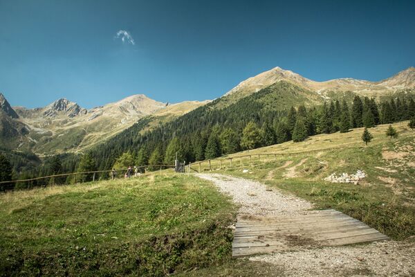
A very pleasant tour in upper Val Saent, one of the most beautiful and uncontaminated in the Stelvio Park and the entire Ortles-Cevedale group.
- Difficulty
-
medium
- Rating
-
- Starting point
-
Coler car park – Malga Stablasolo
- Route
-
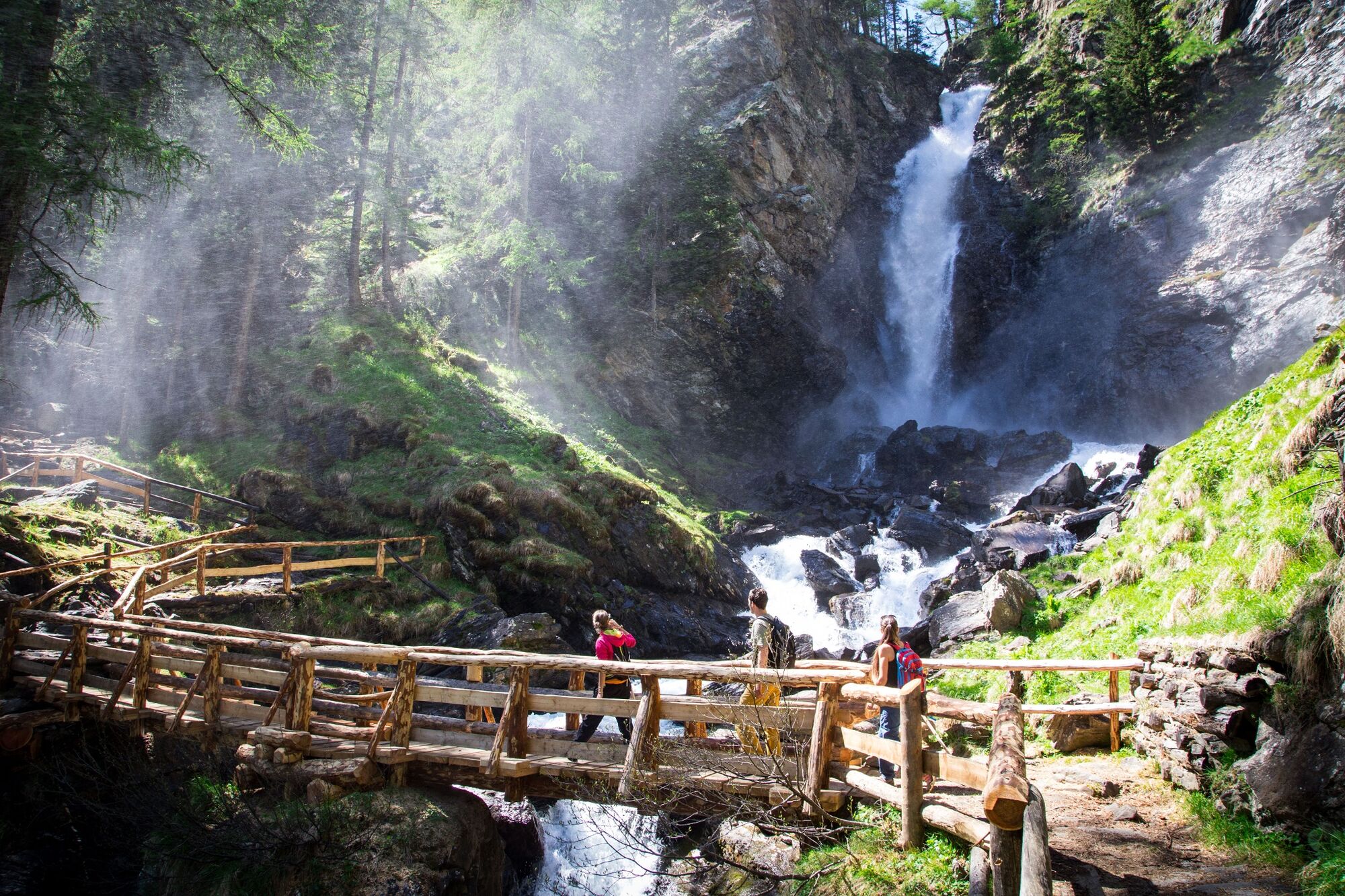
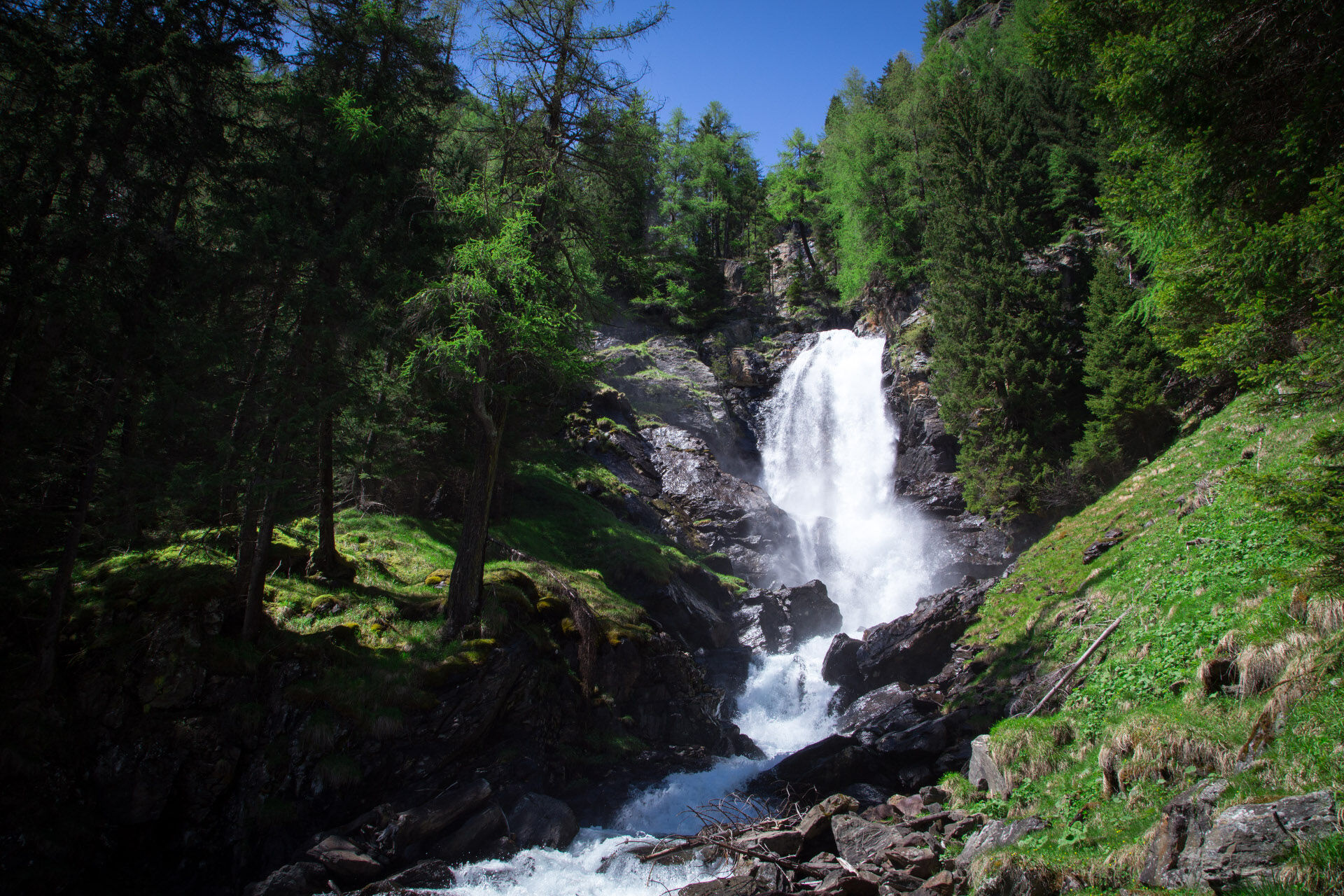
Plan de le Scalace (1,730 m)0.7 kmCascata bassa di Saent0.7 kmCascata alta di Saent0.7 kmMalga Vecia (1,890 m)2.2 kmRifugio Silvio Dorigoni5.1 kmPlan de le Scalace (1,730 m)9.9 kmCascata alta di Saent10.1 kmCascata bassa di Saent10.1 km
- Best season
-
JanFebMarAprMayJunJulAugSepOctNovDec
- Description
-
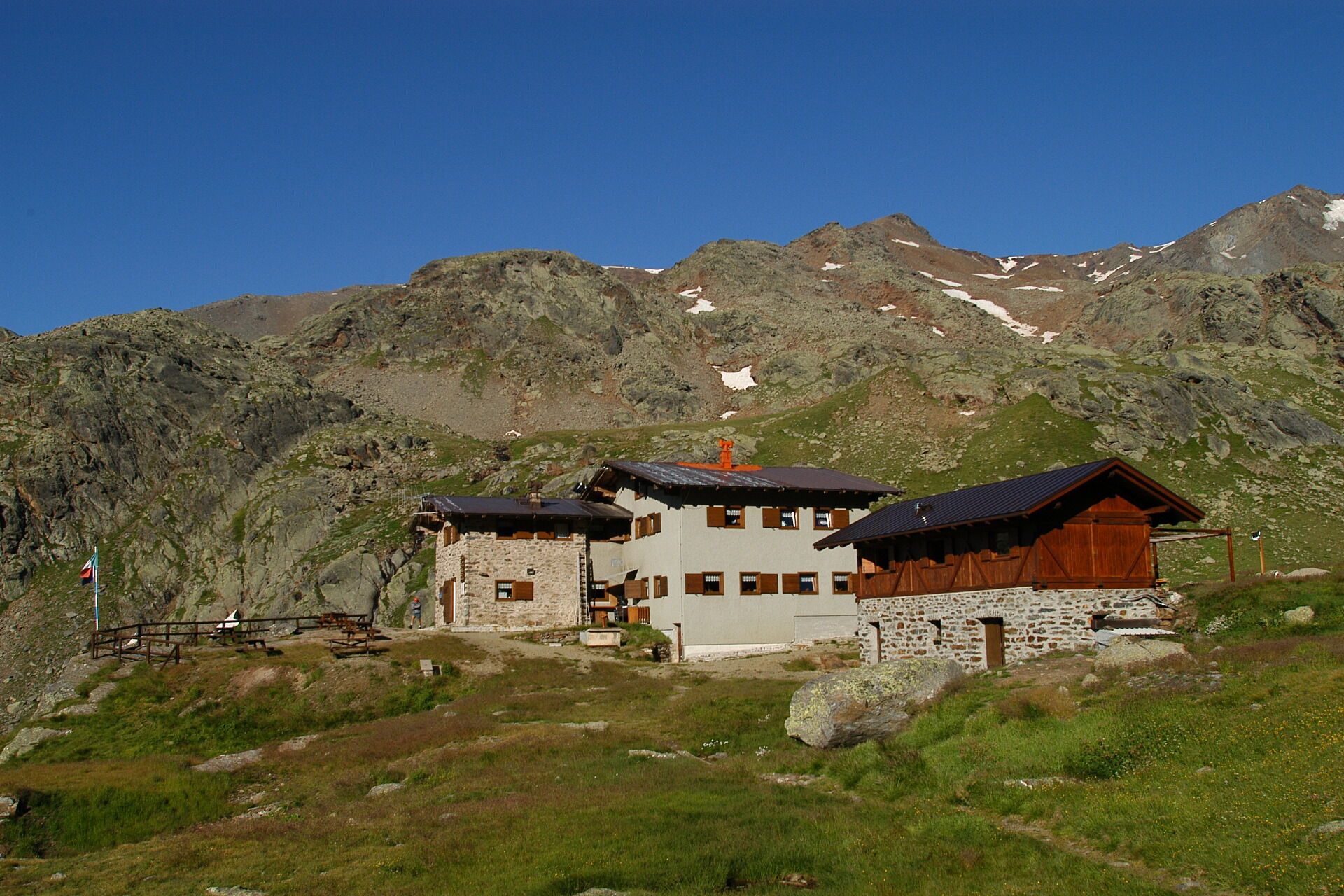
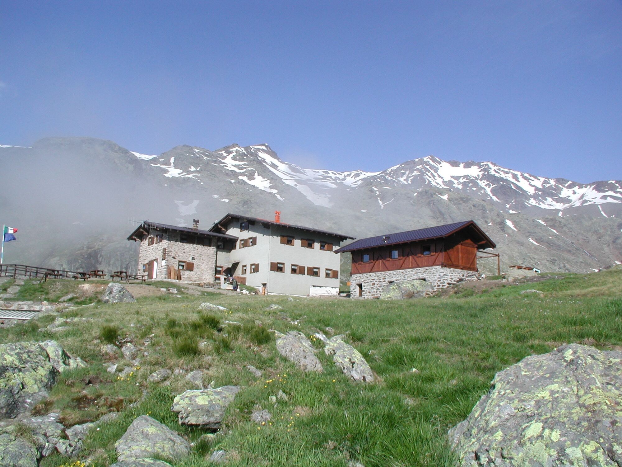
Rifugio Dorigoni can be found in a valley rich in alpine pastureland, larch trees, lakes and waterfalls. It is naturally located between four valleys: Val di Rabbi, Val di Pejo, Val Martello and Val d’Ultimo and serves as a support base, both as a thouroughfare and for the surrounding peaks.
- Directions
-
E - Escursionistico (Hiker)
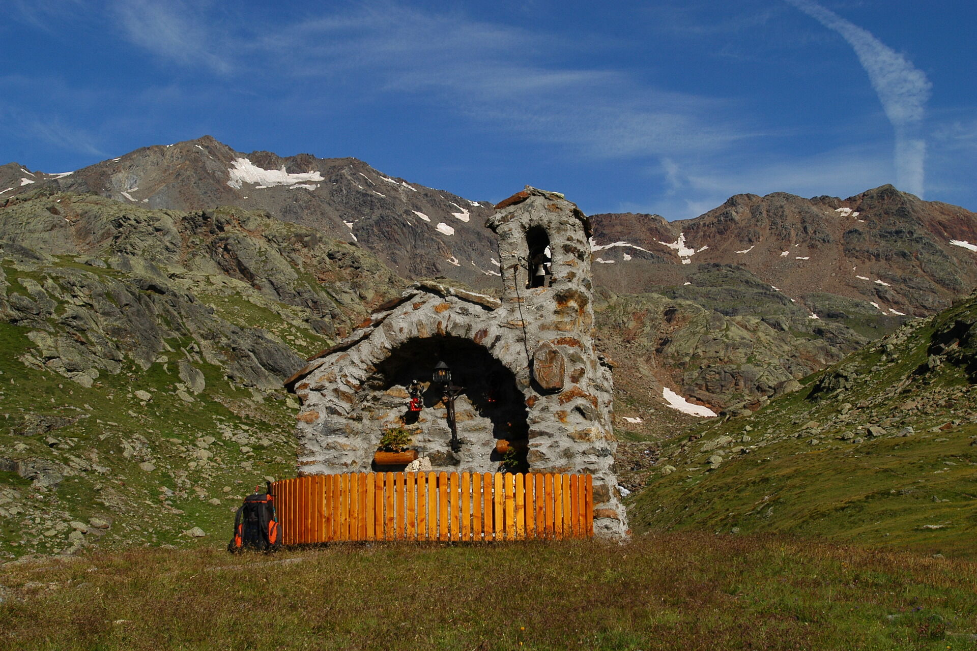
Departure if from the Coler car park (1.386m) reachable by car. In Sommer you cannot acces to the valley by car from 9.45 to 5pm and you can use the shuttle bus service Stelviobus Rabbi to reach the coler park or Malga Stablasolo (1.529m, saves a 30 minute walk). 200m before the Malga, there is a junction to the right from where it is possible to take the path to Cascate di Saent. It is worth the extra 10 minutes, which it takes. By doing this you pass bridges, woodland and stretches of water. Otherwise, continue to follow the road keeping left until reaching Malga Stablet, from where the actual path begins. Along the way, which is very well signposted, an uphill climb for about 5 km on the SAT 106 to Dosso della Croce (1.796m), and the Prà di Saent and its characteristic malga. Carry on to Malga Vecia where the Sentiero degli Alpinisti leads to «Palina» (2.100m). Keeping to the left of the Rabbies torrent cross the countryside, rich in rhododendrums and marmots, and finally to Rifugio Saent S.Dorigoni (2.437m). Drinking water is available from the numerous wooden fountains, which you will find along the way. Note the varying environments on the way and the presence of a number of different animals, such as marmots and eagles. This route is particularly suitable for families or school groups.
It is possible to return by way of the same route or otherwise by doing a ring tour, which brings you, back to Malga Stablasolo. Cross the path beneath Rifugio Dorigoni and at the junctions of 106 and 128 take the SAT 128 in order to reach Baito della Valletta. At this point, keep right and take care to follow the path signed by the stone piles (cairns) which lead to Baito Campisol Alto (2.432m). This path, although not especially difficult, requires good eyesight and attention to the stone piles (ometti). From Baito Campisol Alto descend to Malga Stablasolo (1.529m) where the SAT 106 will take you back to the Coler car park. (1.380m).
- Highest point
- 2,411 m
- Endpoint
-
Rifugio Saènt «S. Dorigoni» alpine hut
- Height profile
-
 © outdooractive.com
 - Equipment
-
When setting out on an excursion in the mountains, it is always a good idea to:
wear hiking boots suitable for loose, uneven or wet terrain, long trousers, a cap and sunglasses;
put a waterproof jacket, fleece sweater, hat and gloves, sun cream and a minimum change of clothing into your backpack;
take a bottle of water and snacks with you for an instant energy boost (dried fruit, energy bars or chocolate);
remember your camera or mobile phone for immortalising the views and favourite sights. If you like, you can then share them on social media at the hashtags #visitvaldisole. - Safety instructions
-
When setting out on an excursion in the mountains, we suggest you: choose a route suitable for your fitness level. When in doubt, contact the Alpine Guides or our Information Offices; get ready for your trip by checking the weather forecast, the route you will follow and the times for the cable cars, ski or chair lifts, if you will be using them. Remember that the feasibility of routes in a mountain environment is closely linked to the contingent conditions and therefore depends on natural phenomena, changes in the environment and the weather conditions. For this reason, make sure you are well informed about the route and conditions before setting out; tell someone about your route and what time you expect to return, and take your mobile phone with you; pay attention to the directions and signs that you find along the way: Stelvio Park signs, red and white SAT signs and red and white painted marks on rocks or trees; raise the alarm by calling 112 in the event of an accident; book the malga or refuge where you intend to stop to eat or sleep in advance; never leave litter in the mountains and, if possible, avoid leaving your rubbish at mountain refuges or malgas that you visit;if you spot wild animals along the way, we invite you to stay on the path, not go too near, not shout and to keep your dog on a lead, to stop it instinctively chasing and scaring the animal.
- Tips
-
From Rifugio Dorigoni it is possible to tour the Laghi Sternai a two-hour walk signposted by stone piles (cairns) and through the intensely coloured glacial lakes from where the Torrente Rabbies begins. We recommend the return journey be done descending the path to Cascate di Saent, one of nature’s marvels. Close to the rifugio there is a magnificent climbing crag and other trails and activities for climbing enthusiasts.
- Additional information
- Directions
-
Take the S.S. 42 state road to the town of Caldes and then the third exit off the roundabout (coming from Trento). Shortly after, take the right-hand fork for Val di Rabbi and continue along Via Nazionale to the roundabout. Here take the second exit onto the S.P. 86 provincial road to Masi Casna, where you turn right for Piazzola. Continue along this road until you come to Coler.
Val di Rabbi is closed to traffic in the summer. Leave the car in the car park at Plaze dei Forni and continue to Coler with the Stelviobus Rabbi shuttle bus.
- Public transportation
- Parking
-
Paid parking in Coler. When the valley is shut to traffic, leave your car in the car park at Plaze dei Forni and continue to Coler with the Stelviobus Rabbi shuttle bus.


- Author
-
The tour Rifugio Saènt «Silvio Dorigoni» alpine hut is used by outdooractive.com provided.

General info
-
Vinschgau
1290
-
Val di Sole
579
-
Rabbi
96