- Brief description
-
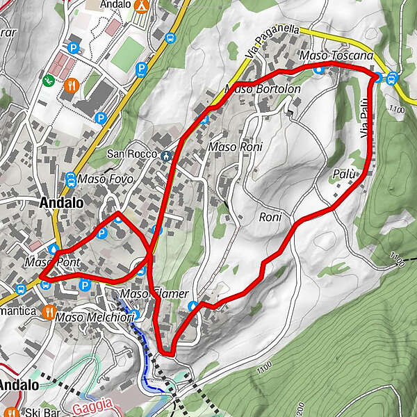
Medium easy circular route accrossing one of the most beautiful places in Andalo.
- Difficulty
-
easy
- Rating
-
- Starting point
-
Andalo - piazza Dolomiti
- Route
-
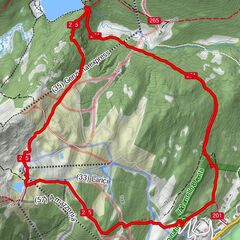
Maso Pont0.0 kmMaso Bortolon1.0 kmMaso Casanova1.1 kmMaso Toscana1.3 kmPalù1.9 kmMaso Monech2.5 kmMaso Clamer2.8 kmChiesa dei Santi Vito, Modesto e Crescenzia3.3 kmAndalo3.4 kmMaso Pont3.5 km
- Best season
-
JanFebMarAprMayJunJulAugSepOctNovDec
- Description
-
A paved route suitable to all type of stroller that will lead you in one of the most important view in Andalo
- Directions
-
Medium easy circular route. Departure from piazza Dolomiti, we go across via Paganella, a paved uphill road. Once we arrived nearly at the top of the village, we take the road on the right that goes up the farm Tuscany and we continue straight until we reach the famous and distinctive Perini’s arch, this is the symbol of one of the oldest farms of Andalo. It’s proceeding a little later that we find the fountain of the farm, where, in ancients time, the inhabitants collected water for home and the women washed clothes. Near the fountain there is the "Capitello dei Pitti". From here, we take the road on the right side which crosses one of the most picturesque places in the village. Here you can enjoy a thrilling view of the Brenta Dolomites, typical houses and large lawns.
The route continues along a dirt road on the right that goes up another picturesque farm: Maso Monego. Once passed the cluster of houses, typically of the original structure of the village, the route descends and it reaches again via Paganella. This time, we cross the road to reach the Church of Andalo wich is charachterized by modern style with its original tent form.
We return to piazza Dolomiti through via Tenagliathat go down to the left after the church square.
- Highest point
- 1,088 m
- Endpoint
-
Andalo - piazza Dolomiti
- Height profile
-
 © outdooractive.com
 - Safety instructions
-
Please note that the practicability of the itineraries in a mountain environment is strictly linked to the contingent conditions and is therefore influenced by natural phenomena, environmental changes and weather conditions. For this reason, the information contained in this page may have changed. Before leaving for a tour, make sure the path you will approach is still accessible by contacting the owner of the mountain hut, the alpine guides or the visitor centres of the nature parks, the info offices of the local tourist board.
- Tips
-
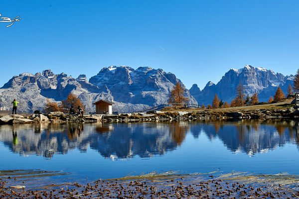
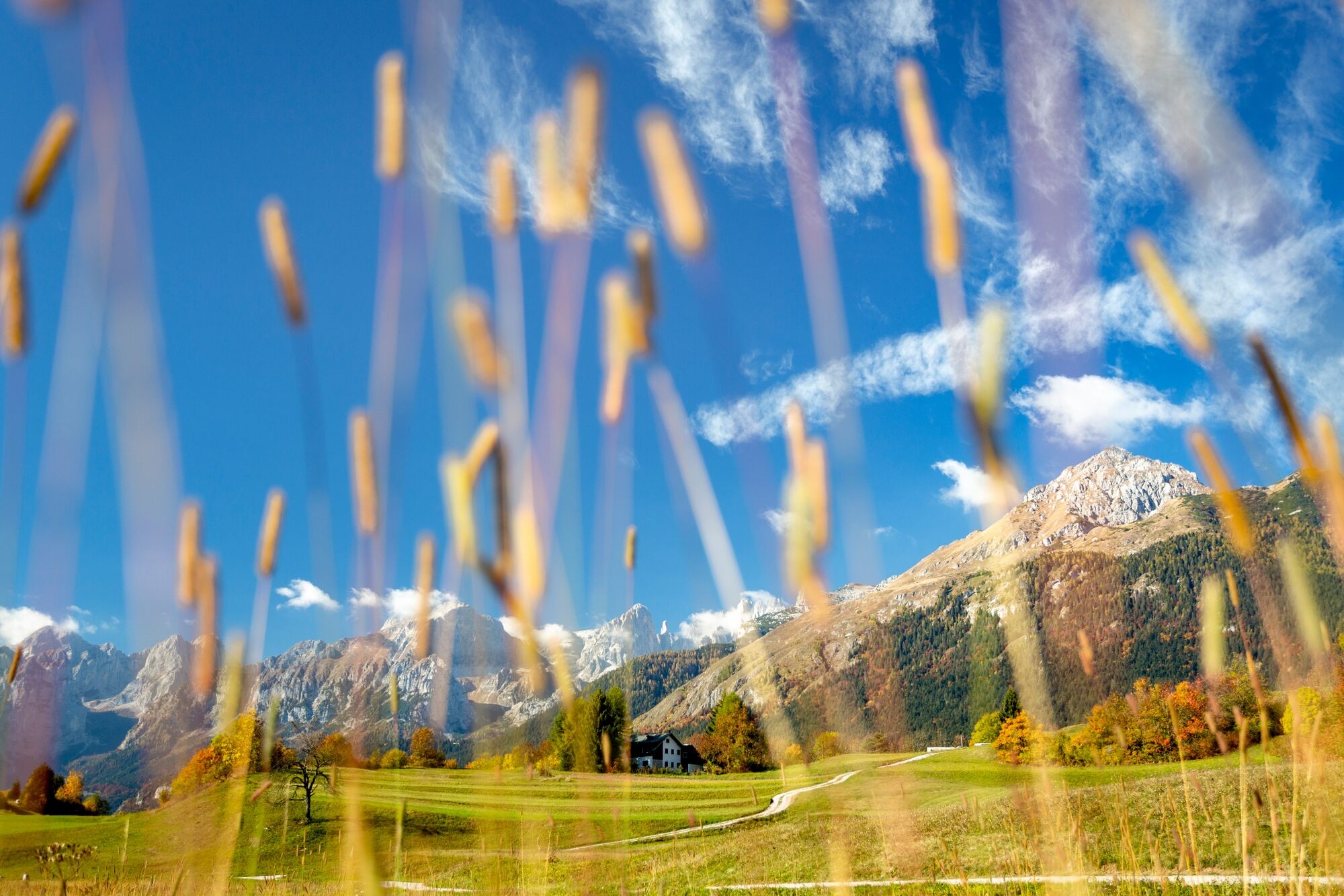
A view on the Brenta dolomites from "via delle villette"
- Additional information
- Directions
-
If you come from the North side: At the roundabout near motorway exit you turn right on Mezzolombardo. After travel across the village, following the driving direction for Fai della Paganella - Andalo - Molveno
If you come from the South side: From the motorway exit of Trento Nord you proceed on Val di Non e Altopiano della Paganella, at the exit of Mezzolombardo tunnel you turn on the right on SP 64. You proceed on Fai della paganella - Andalo direction.
- Public transportation
-
Trentino Trasporti - line 611 - Local train from Trento to Mezzolombardo (line Trento - Malé). From Mezzolombardo to Andalo take the bus.
- Parking
-
In the centre of Andalo or near the swimming pool (payment parking), near the sportscentre (free parking).


-

-
AuthorThe tour Maso Toscana, le Villette, Maso Monego is used by outdooractive.com provided.