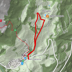

- Brief description
-
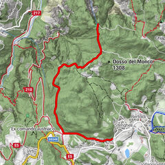
Round trip in the evocative woods of Monte Zugna between the memories of the Great War and the wide views on Vallagarina.
- Difficulty
-
medium
- Rating
-
- Starting point
-
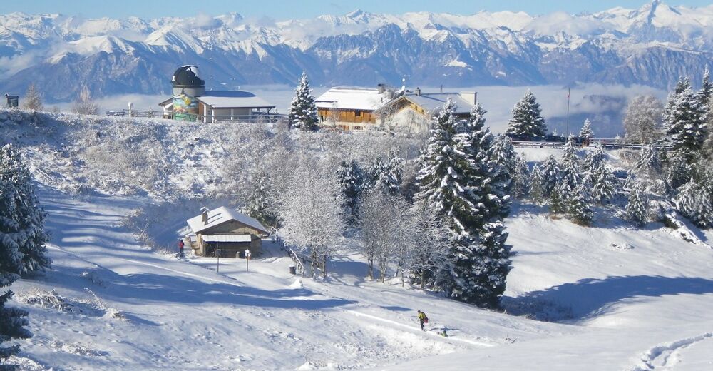
Rifugio Malga Zugna
- Route
-
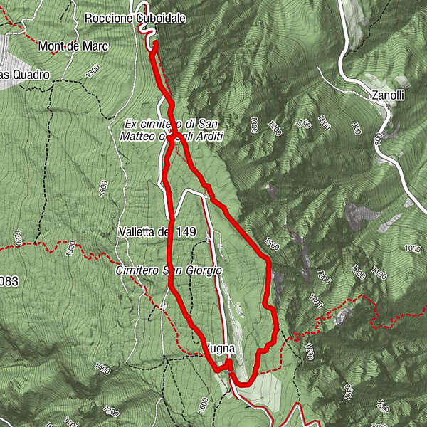
Zugna (1,600 m)Porte dello Zugna3.4 kmValletta S. Lazzaro3.4 kmZugna (1,600 m)5.0 kmRifugio Coni Zugna5.2 km
- Description
-
This walk winds through beech and pine woods, starting from the back of the Italian army placement in the First World War up to the front line near the Austro-Hungarian trenches. The return path winds through the trenches dug by soldiers, passing in front of the cemetery of S. Giorgio and then back up towards Rifugio Zugna.
- Directions
-
The itinerary starts in front of the door of the shelter, taking a downhill road (wooden bar). Up to the Trincerone area, about half way, the track, called "Sentiero del Sinel" is indicated by white square trail markers with blue mark at the center, drawn on the trunks of the trees. From the Trincerone trench, the itinerary goes along the road to the cemetery of S. Lazzaro and then proceeds into the woods alongside the roadway (on the left, going up to the shelter) unraveling inside the remains of a trench. Once you’ve reached the road again, near a hairpin bend, continue on the opposite side along the road that leads to the cemetery of S. Giorgio and from here, following the signs of the Peace Path, along a characteristic mule track up to the mountain refuge.
- Highest point
- 1,625 m
- Endpoint
-
Rifugio Malga Zugna
- Height profile
-
 © outdooractive.com
 - Equipment
-
Take warm clothing with you, it must protect you from the cold but must not be too bulky or heavy. Do not forget to put a spare t-shirt in your backpack as wearing wet or damp clothes can be very annoying pausing with low temperatures.
Remember to take hot drinks with you, they will restore you also with low temperatures.
The use of ski or trekking poles with metal tip is essential. - Safety instructions
-
Pay attention in the case of heavy snowfall which can create dangerous accumulations even in areas considered not subject to the risk of detachment. It is always advisable to consult the avalanche bulletin, possibly integrating it with the request for information to qualified subjects.
With low temperatures pay attention to ice which can be, even with little snow, very dangerous. Avoid the sections entirely covered by ice sheets, especially if sloping and close to exposed stretches. In winter, the opening of shelters and points of support can not be guaranteed. Check availability in advance by contacting the facilities directly.
Please note that the practicability of the itineraries in a mountain environment is strictly linked to the contingent conditions and is therefore influenced by natural phenomena, environmental changes and weather conditions. For this reason, the information contained in this page may have changed. Before leaving for a tour, make sure the path you will approach is still accessible by contacting the owner of the mountain hut, the alpine guides or the visitor centres of the nature parks, the info offices of the local tourist board. - Tips
-
From the Trincerone you can enjoy a wide view of Valle dell'Adige, Pasubio Mountain and the small Dolomites.
- Directions
-
From Rovereto follow the signs to Campana dei Caduti, going up to the hairpin bend above the hamlet Porte di Trambileno. From here continue on the SP89 until the next hamlet, Albaredo. Turn right at the entrance to the village (signs to Rifugio Zugna).
- Parking
-
There are parking lots near the shelter.

-

-
AuthorThe tour Sinel – Trincerone – Peace path is used by outdooractive.com provided.