- Brief description
-
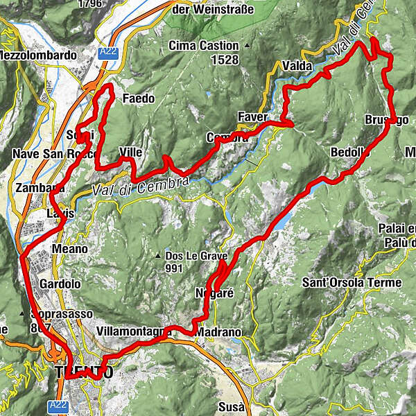
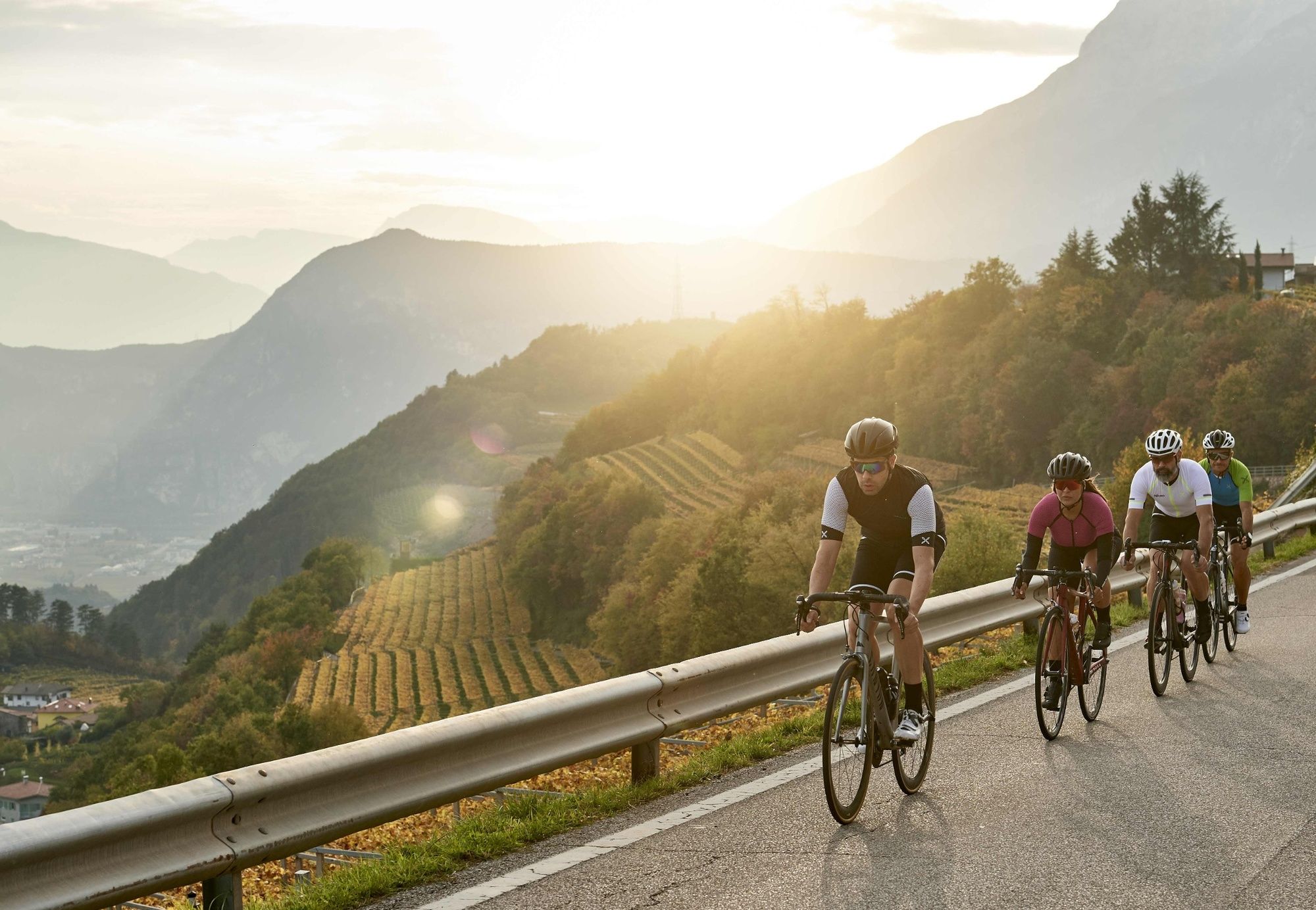
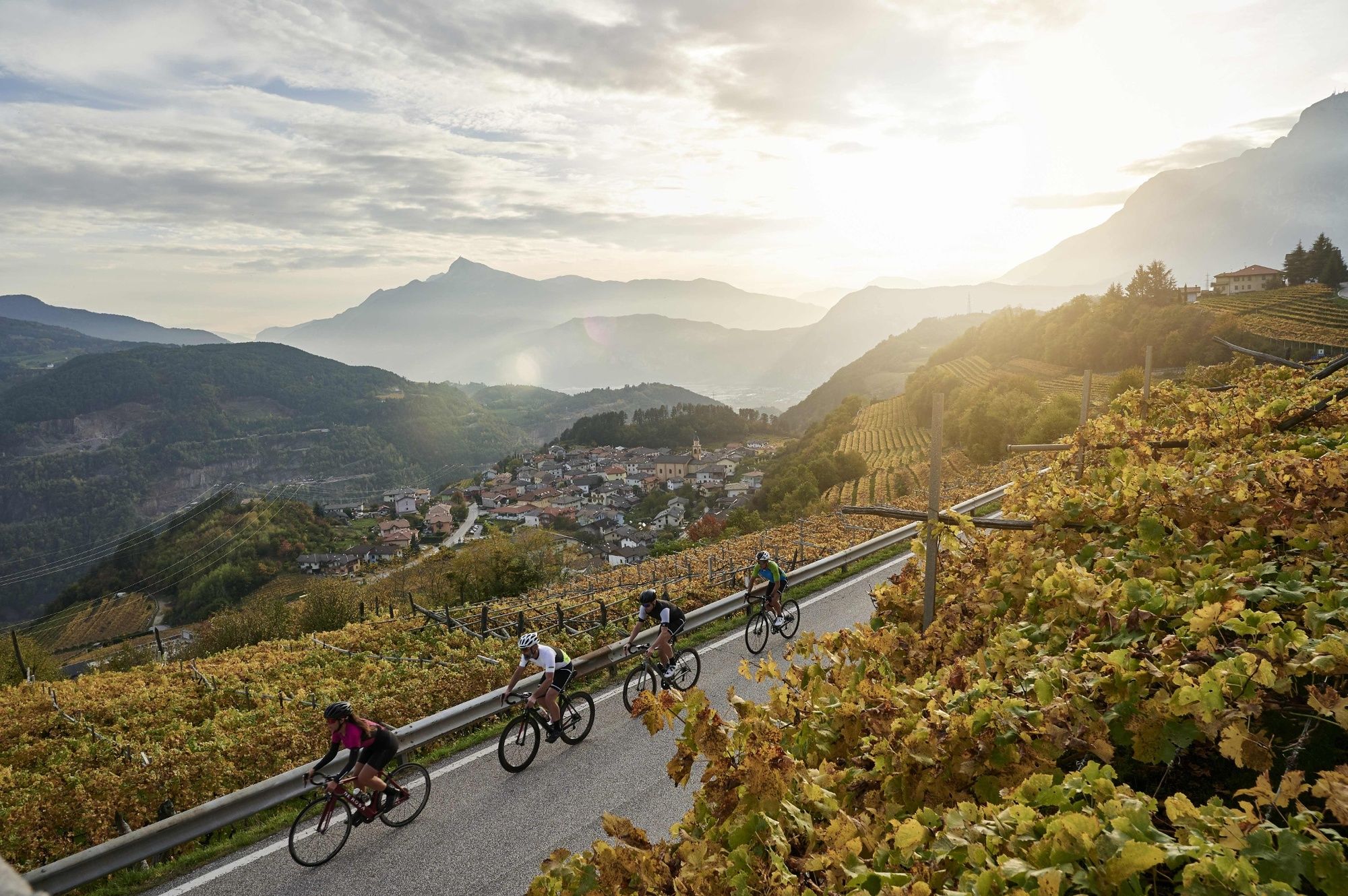
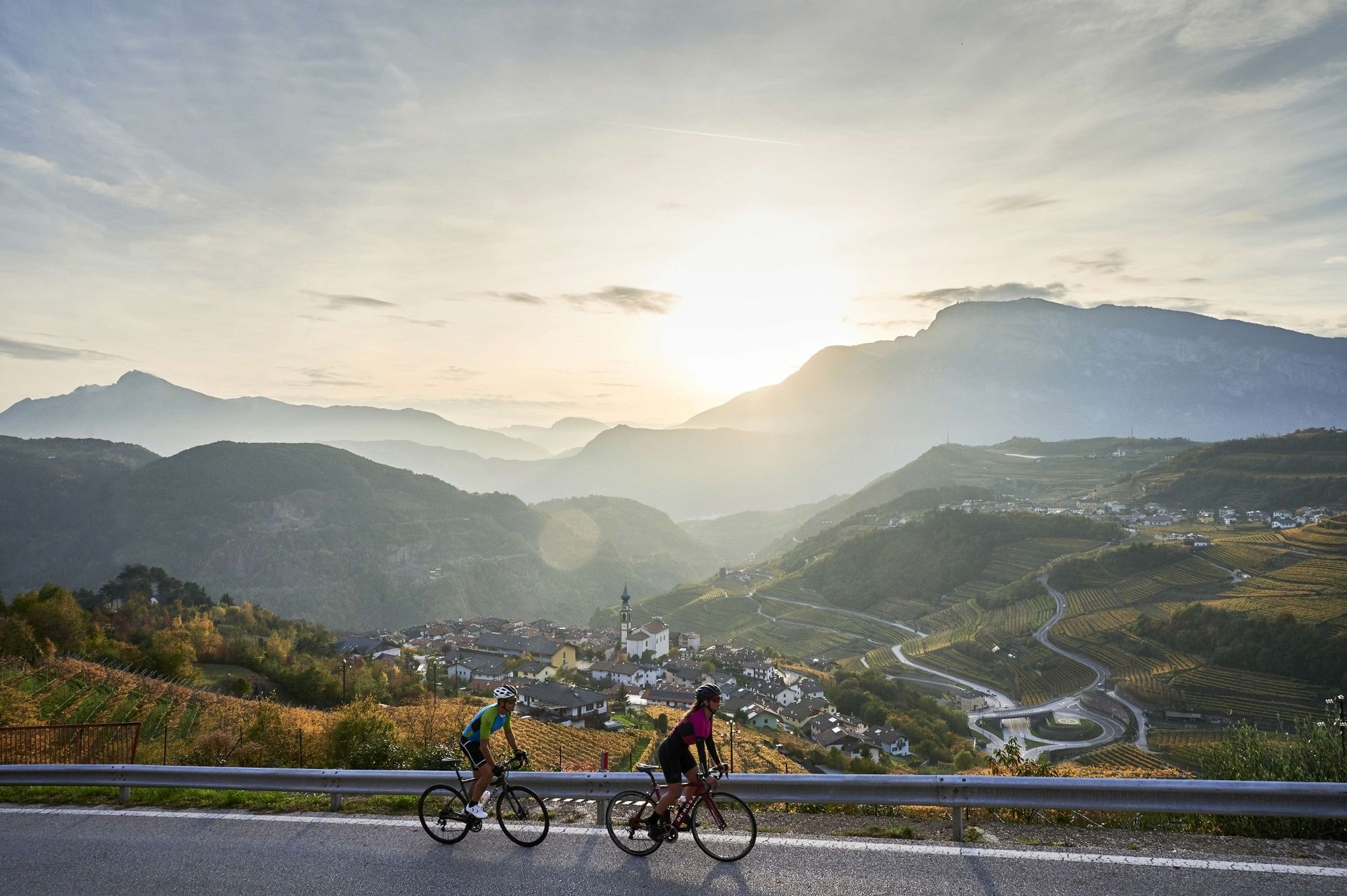
This tour is very popular among cyclists from Trentino who want to admire the spellbinding landscape as they travel through the vineyards of the Val di Cembra while also riding the same roads as greats such as the Moser family and Gilberto Simoni. It starts in Trento and takes in the Piana Rotaliana (a plain), the Altopiano di Pinè (a plateau) and the upper Valsugana, so it is ideal for exploring the central and eastern areas of Trentino.
- Difficulty
-
medium
- Rating
-
- Route
-
Trient (194 m)Centro storicoFunivia Trento Sardagna1.0 kmPiedicastello1.0 kmCristo Re1.7 kmVela3.1 kmLavis10.6 kmPristol10.9 kmPizzeria Dolomiti11.1 kmPressano (285 m)12.8 kmNave San Felice (208 m)14.2 kmMaso Panizza di Sopra15.3 kmSorni18.0 kmSornello18.7 kmSan Michele all'Adige20.6 kmGrumo20.6 kmChiesa di San Michele20.8 kmCoveli21.7 kmMasi Canazzi22.6 kmPalù27.0 kmVille28.7 kmValternigo di Giovo29.4 kmVerla30.0 kmChiesa di San Rocco31.0 kmCeola31.3 kmLisignago33.5 kmChiesa di Santa Maria Assunta37.2 kmCembra37.5 kmFadana38.0 kmFaver39.7 kmPiazzo40.7 kmChiesa dell'Immacolata40.7 kmSaletto42.8 kmStedro42.9 kmSegonzano43.0 kmScancio43.2 kmSabion43.5 kmTeaio43.7 kmCasal43.9 kmGaggio47.1 kmGresta48.0 kmSover52.1 kmFacendi (960 m)53.0 kmPiazzoli (981 m)53.4 kmMontesover53.7 kmSveseri (1,082 m)54.7 kmMaso Sveseri54.8 kmSlosseri (1,121 m)54.9 kmSettefontane (1,112 m)55.7 kmMontepeloso57.3 kmSeghe57.8 kmBrusago58.1 kmVillaggio59.4 kmCentrale61.2 kmRistorante Pizzeria Bar Centrale61.3 kmPistoria61.6 kmCastellani61.7 kmVarda61.9 kmCasei61.9 kmPiazze62.4 kmFabbrica62.6 kmCialini63.1 kmDoss63.7 kmCampolongo64.4 kmAl Sant64.8 kmRizzolaga64.9 kmSternigo al Lago66.0 kmSternigo66.3 kmRicaldo66.7 kmSerraia66.8 kmBaselga di Piné67.3 kmMühlen im Pineid67.7 kmGardizzola67.7 kmVigo68.3 kmTressilla68.4 kmVergole69.8 kmNogaré71.6 kmValle74.6 kmMolino Roccabruna75.0 kmNogaré75.6 kmTorchio77.6 kmCivezzano79.6 kmCappella dell'Addolorata80.2 kmVillamontagna81.7 kmTavernaro81.9 kmCognola83.5 kmSan Donà84.0 kmCorallo84.9 kmChiesa di San Bernardino85.3 kmChiesa dell'Addolorata86.1 kmTrient (194 m)86.3 kmCentro storico86.7 kmÉglise de la Sainte Annonciation86.8 km
- Best season
-
JanFebMarAprMayJunJulAugSepOctNovDec
- Description
-
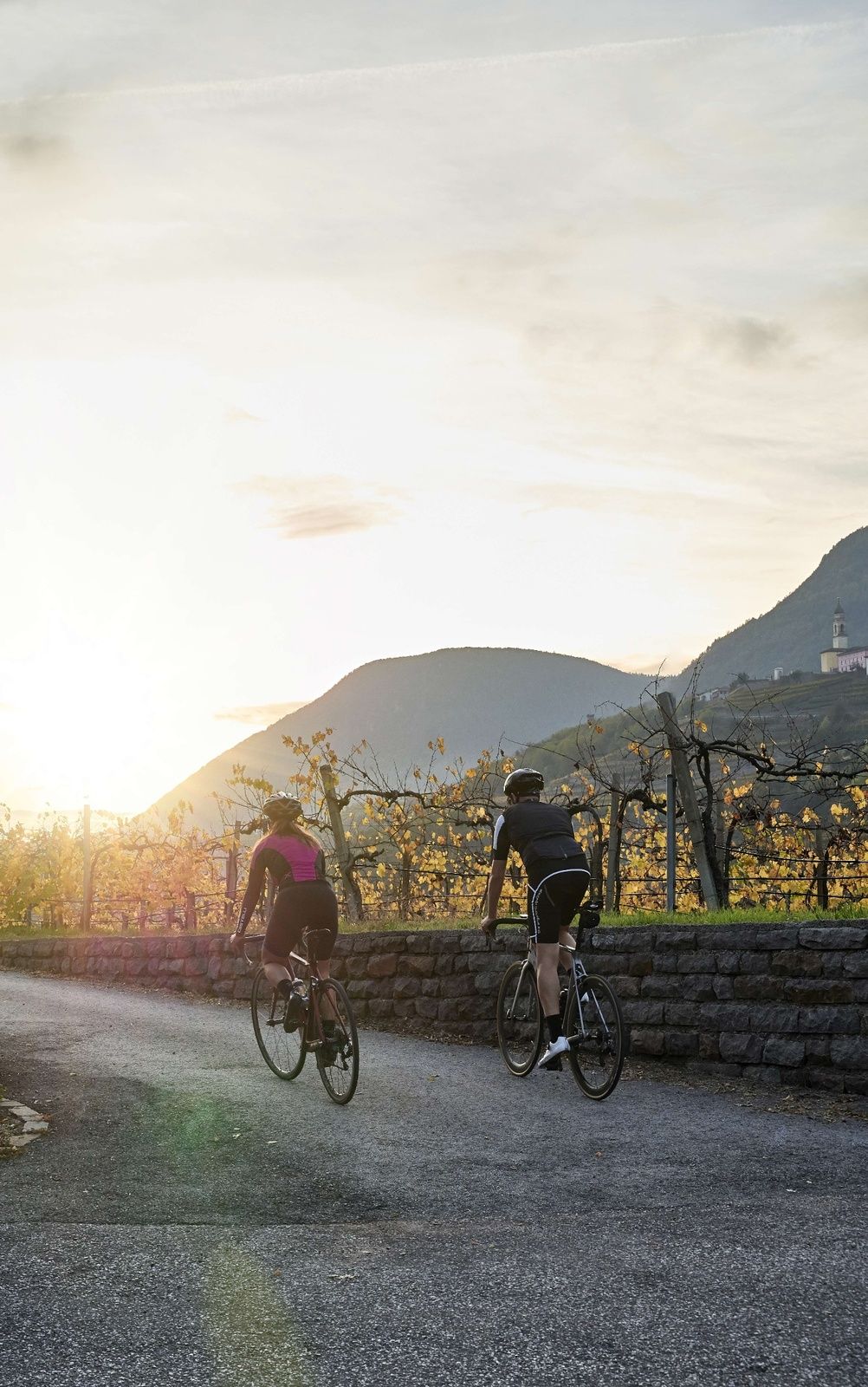
Starting and finishing in Trento, this tour will take you through the hills above the Piana Rotaliana (a plain), the Val di Cembra, the Altopiano di Pinè (a plateau) and the upper Valsugana. The landscape is extremely varied, with big differences between the valleys. There are four climbs in total and they are all manageable for anyone who is in fairly decent shape because they are not very long. In addition, none of them are particularly high (you will never reach 1,200 m above sea level), so you can do the tour from the first warm days in early spring until late autumn. Nonetheless, it is best to train properly by going for some long rides beforehand to get your fitness levels up, because the distance covered is almost 90 km, with 1650 m of elevation gain. The legendary climb on this tour is the “Salita dei Campionissimi”. The name means the “Climb of Great Champions” and it pays tribute to the feats of the Moser family and Gilberto Simoni, who all come from the town of Palù di Giovo at the top of the climb. The Sover climb is also very demanding, with an average gradient of 9%.
- Directions
-
Start in Trento old town centre and ride down to the cycle path that runs alongside the Adige River. Follow it until you reach the mouth of the Avisio River, then head towards Lavis. Go through the town centre towards the hills to the North, where the grapes used in Nosiola and Chardonnay wine are grown. As you pedal past the beautiful Masi (rural homes), you can enjoy breathtaking views of the Piana Rotaliana (a plain). After around 4 km, you’ll come to a junction where you need to follow the sign for Sorni, a hamlet that is located downhill. From there, you will go around a number of hairpin bends on a descent that will take you down to the junction with the SS12 state road. Be careful because it is a busy road, but you only have to travel along it for less than 1 km before you can take the quieter municipal road to San Michele all’Adige town centre, which is the starting point for the first real climb of the day: the “Salita dei Campionissimi”. It is approximately 6.5 km in length and the elevation gain of around 450 m makes it rather challenging. You will come to two junctions on the way and you need to follow the signs for “Cembra” on both occasions. When you get to Ville di Giovo at the top, start the descent towards Verla and continue towards Cembra, then proceed in the direction of Faver. From there, you will descend to the bottom of the Val di Cembra and cross the Ponte dell’Amicizia (a bridge) over the Avisio River (which you will have seen earlier, before you got to Lavis). The road then immediately starts to climb up the other side of the valley and takes you to the Segonzano area, which is famous for the “earth pyramids” shaped by flowing water that has eroded the land in the surrounding mountains. After you have gone past these distinctive geological formations, continue in a north-easterly direction on the road up to Sover. The third of the four climbs starts there and it will take you up to the Altopiano di Pinè (a plateau). The first part of the climb is rather demanding (with an average gradient of 9%), although it is not too long at 3 km. The road then continues on gently sloping land as far as Brusago, which is the first settlement that you will encounter on the Altopiano di Pinè. A long descent starts from there. There is only a slight slope on the first part of the descent, as it goes past Lake Piazze and Lake Serraia to Baselga di Pinè. From there, it gets steeper as you follow the road towards Trento. After the second hairpin bend, turn right onto the SP104 “Quadrate” provincial road and go through Torchio to Civezzano. Continue through Civezzano town centre to the last ascent of the day: the short “Salita dei Forti” (“Fort Climb”), which will take you right through the middle of old fortifications from Austro-Hungarian times just before you reach the top. From there you can race down through Cognola and San Donà, back to where you started in Trento old town centre.
- Highest point
- 1,116 m
- Endpoint
-
Trento
- Height profile
-
 © outdooractive.com
 - Equipment
-
We recommend that you wear a helmet, sunglasses and cycling shorts or tights. You should also take a waterproof jacket (in case it rains), some energy bars and a bottle filled with water or an isotonic drink.
- Author
-
The tour Tour of the Val di Cembra and Pinè is used by outdooractive.com provided.