
- Brief description
-
A long, demanding tour, without a single metre of flat terrain. A continuous series of ups and downs where the climbs are quite tough. Quiet roads and very characteristic landscapes.
- Difficulty
-
difficult
- Rating
-
- Starting point
-
Riva del Garda - Info point
- Route
-
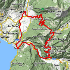
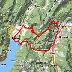
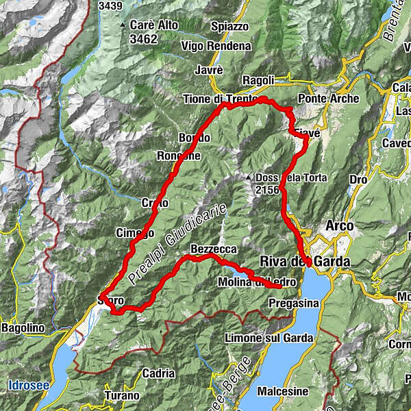
Riva del GardaChiesa dell'Inviolata0.9 kmSan Giacomo1.9 kmDom2.3 kmEden Marone2.6 kmAlbergo Deva4.7 kmDeva4.8 kmTenno6.7 kmPranzo8.2 kmSorgente Seghe12.4 kmChiesa di Santa Lucia14.3 kmCorona Bar Ristorante14.3 kmBallino14.4 kmPizzeria Ristorante da Lucio14.5 kmDos18.5 kmChiesa di San Rocco19.2 kmAl Contrario19.5 kmChiesa dell'Immacolata e dei Santi Fabiano e Sebastiano19.6 kmFiavé19.7 kmAgritur Maso alle Rose22.2 kmCavrasto22.7 kmMarcè23.6 kmMarazzone24.2 kmCavaione24.5 kmPiazzale delle bore25.5 kmLocanda Ridevert33.0 kmGiugià33.1 kmZuclo33.2 kmBolbeno34.2 kmchiesa di San Zeno34.3 kmBasso Arnò35.1 kmTione di Trento35.5 kmChiesa di Santa Maria Assunta e San Giovanni Battista35.5 kmBrevine36.2 kmRistorante Pizzeria Pellegrini36.3 kmPizzeria Pub Fermata 9736.3 kmStele36.5 kmPolin36.9 kmBreguzzo40.1 kmCarlone40.3 kmBondo41.0 kmPradibondo41.7 kmMiravalle42.2 kmRoncone43.7 kmLardaro46.0 kmAgrone47.7 kmFrugone47.8 kmStrada49.2 kmCreto50.0 kmPieve di Santa Giustina50.3 kmBorel50.5 kmCologna51.0 kmLocalità al Ponte - Zona Industriale53.4 kmCimego55.2 kmCondino58.5 kmBersaglio60.0 kmFontana Santa62.1 kmFontana Santa62.3 kmFontana Morta62.5 kmCa' Rossa63.5 kmStoro64.9 kmFiri65.4 kmAmpola waterfall67.6 kmCascata Ampola70.0 kmCostabona74.3 kmTiarno di Sopra77.2 kmAlla Costa (730 m)78.5 kmTiarno di Sotto78.7 kmVia de là79.0 kmChiesa di Santa Lucia80.2 kmPioveri81.3 kmBezzecca (697 m)81.5 kmPieve di Ledro (660 m)83.3 kmMezzolago (665 m)85.2 kmSteak House and Pizza al Sole86.8 kmRistorante Pizzeria Cima d'Oro87.4 kmLe tre oche88.1 kmMolina di Ledro (657 m)88.2 kmBarcesino89.1 kmchiesa di San Giacomo Maggiore90.3 kmPrè di Ledro90.5 kmBiacesa di Ledro91.7 km
- Best season
-
JanFebMarAprMayJunJulAugSepOctNovDec
- Description
-
This itinerary proposes the climb to the Ballino Pass and the Durone Pass, then passing through Tione and the Valle del Chiese, before riding back up towards the Valle di Ledro.
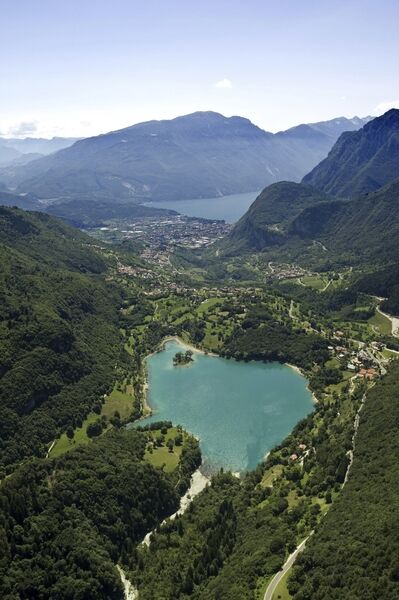
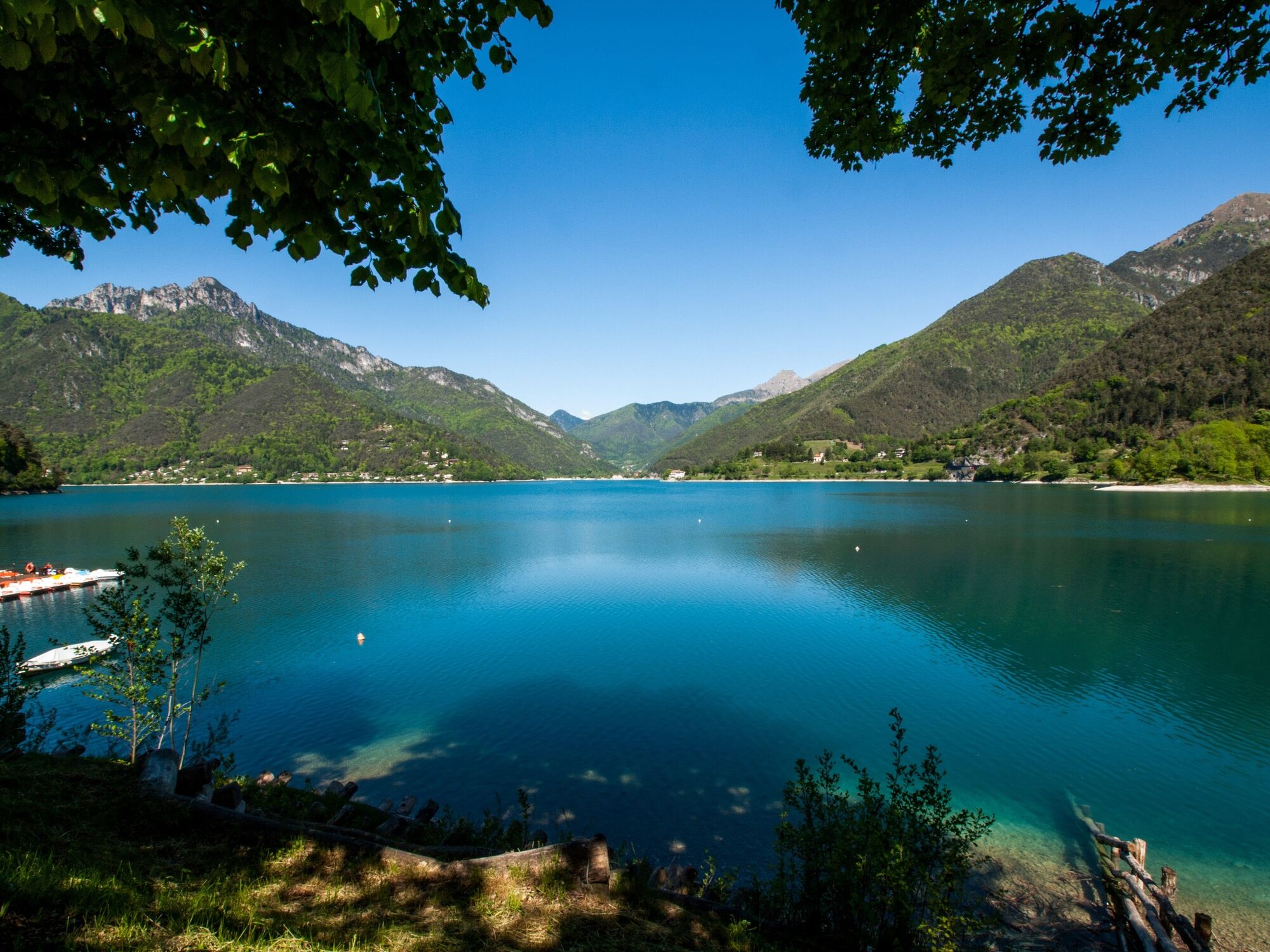
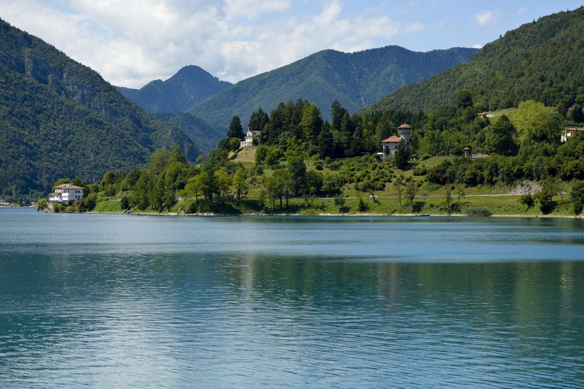
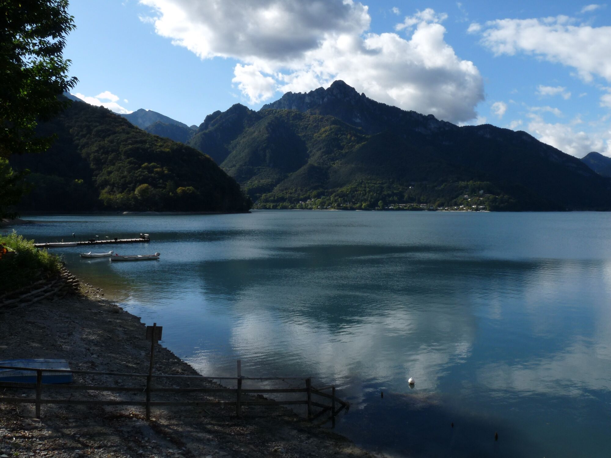
A fantastic tour characterised by roads with little traffic and amazing landscapes. Along the route we encounter no less than five lakes (Garda, Tenno, Roncone, Ampola and Ledro). From a technical viewpoint, this route is quite demanding. In cycling terms, this route could be defined as a “roller coaster”, that is, a continuous series of ups and downs without even a metre of flat land, on an uneven terrain that stretches for over 2000 metres.
Once we reach Biacesa, we can return towards Riva del Garda using public transport, or along the Ponale for those with gravel bikes. Those arriving from the Ledro Valley can reach Riva del Garda in the same way, and begin the tour.
- Directions
-
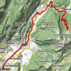
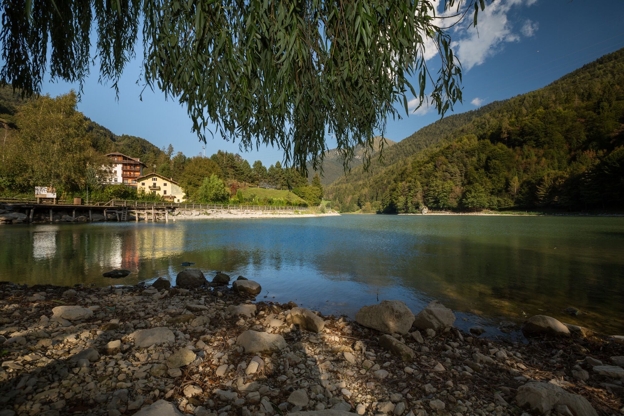
This itinerary starts in Riva del Garda, at the Garda Trentino information office in Largo Medaglie d’Oro. We set off northward bound, following the road signs for the Val di Ledro - Ledro Valley. Having travelled about 3 km, before the gallery that takes us to Ledro, we turn left and begin the gentle climb that leads to Lake Tenno. As we climb, the view of Lake Garda below is wonderful.
We then continue towards the Ballino Pass, leaving behind the clear blue waters of Lake Tenno on our right. Now a downhill section begins, leading us towards the town of Fiavè, famous for its pile-dwellings. Once in the residential area, we turn left, following the signs for the Duron Pass. We pedal up this moderate gradient, which is followed by a long, technical descent.
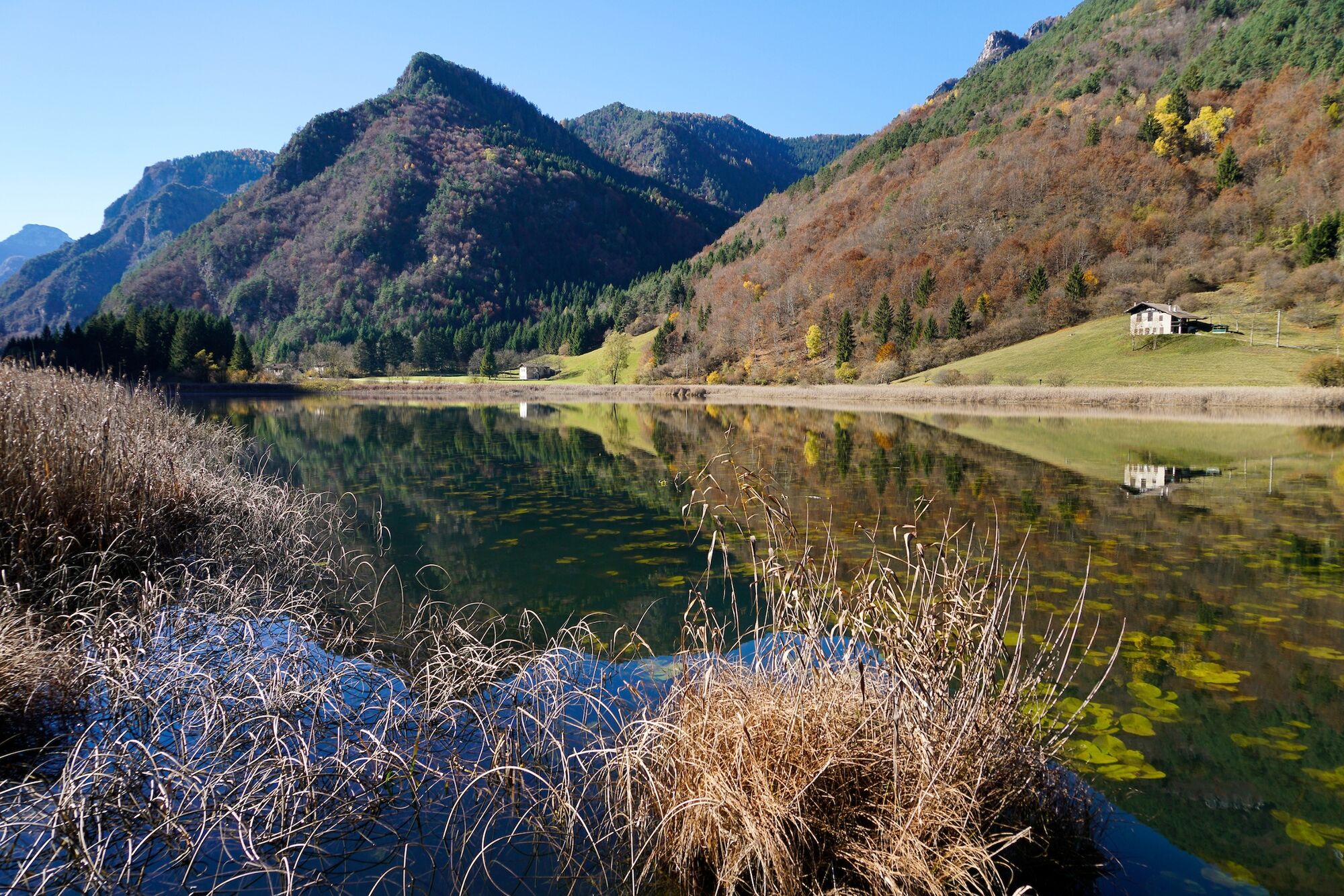
Passing through the towns of Zuclo and Bolbeno, we come to the crossroads with the SS237, at which we take a left turn. At the next roundabout, we take the third exit on the left, towards Brescia. This road climbs first in the direction of Bondo and then descends towards the Valle del Chiese. In the Pradibondo area, a section of cycle path begins, easy to spot because it initially runs parallel to the main road. As we’ll see, this cycle path is interrupted several times, alternating with the main road: we recommend following the signs carefully to ensure you never lose sight of it. In the first part of the descent we encounter the third lake of the day, Lake Roncone: we skirt along its shore on the right hand side. After cycling on the main road for a while, we get back on the cycle path on the left, which we pursue for about 3 kilometres. When we reach the main road again, we turn right and ride 350 metres in the opposite direction to our direction of travel. Now we turn left, and head towards Rio Caino. This small U-turn enables us to take the right road that will lead us back onto the cycle path, which we encounter again after 1.5 kilometres. We pass under the bridge over the main road and turn left. Now we follow the road signs, which lead us to the Bici Grill in Condino, where the cycle path continues on the left. At the crossroads with the main road, the cycle path continues straight on towards Lake Idro. Instead, we turn left and in Storo begin climbing the road towards Val di Ledro.
After about ten kilometres, after Lake Ampola, a sign indicating where the cycle path begins again will be clearly visible. The road begins to descend now, until it reaches Lake Ledro, which we skirt from the left. Our tour ends a little further down, in Biacesa.
Bicycles are not allowed in the tunnel, so to return to Riva del Garda, we can use the BiciBus service (active from 17/06 to 17/09) or the normal scheduled bus service. Alternatively, those with gravel bikes can ride along the Ponale.
- Highest point
- 1,019 m
- Endpoint
-
Riva del Garda - info point
- Height profile
-
 © outdooractive.com
 - Equipment
-
Riding your bike requires specific clothing and equipment, even for relatively short and easy trips. It is always better to be prepared… e.g. for bad weather or a drop your energy levels. The unexpected things also make up a part of the fun!
Do not compare a road bike with a mountain bike. They are very different, especially in technical terms, and facing a hill with a road bike could be much more difficult than facing the same hill with a MTB. Therefore, remember to throughly evaluate the type of route you plan to do and the locations you plan to cross. Do not forget to consider the current season. Has it been raining? Attention: the paint of the crosswalk could be very slick.
What do I need to bring on my bike tour?
Bike helmet Bike gloves Bike glasses Waterproof/Windproof jacket Headlights and rearlights Reflecting suspenders Plenty of snacks (for example, dried fruit or energy bars) Water Bottle Bike repair kit (tire levers, mini bike pump, bike tube)It is always advised to let someone know where you plan to go and how long you expect to be.
Emergency telephone number 112.
- Safety instructions
-
Give your bike a regular checkup, especially if you've had it for years.
Be seen: you must wear a high vis jacket (or sash) in tunnels and on country roads after sunset.
Always wear your helmet.
Make sure your front and rear lights are working.
Put out your arm to give advance warning of your intention to change position and before you do anything, check there are no vehicles coming up behind you.
Don't use headphones or your mobile phone handsfree kit: you need all your concentration on the road!
Obey the road signs: stop at traffic lights and don't ride on the wrong side of the road.
If you are cycling in a group, always go in single file.
You've got a bell: use it to let pedestrians know you're there. Don't ride on footpaths. If you have to then get off and push your bike.
If there are cycle paths use them. It's your safety that's at stake and the rules of the road say you must. - Tips
-
Don’t forget to bring your camera: the five lakes we encounter along this route are well worth capturing on film.
- Additional information
- Directions
- Public transportation
-
The towns in Garda Trentino - Riva del Garda, Torbole sul Garda and Arco – are connected by several urban and intercity bus lines which will take you to the starting point or in the immediate surroundings.
For up-to-the-minute information on timetables and routes
You can also get to Riva del Garda and Torbole sul Garda by the public ferry service.
- Parking
-
Free parking in Riva del Garda at the old hospital (via Rosmini) and the old cemetery (Viale D. Chiesa).
Pay parking at the Public Gardens Porta Orientale, Roman Baths, Viale Lutti (Ex Agraria), Monte Oro, shopping center Blue Garden.
-

-
AuthorThe tour Durone - Valle del Chiese - Valle di Ledro is used by outdooractive.com provided.