
- Brief description
-
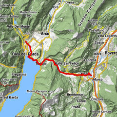
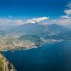
An itinerary suitable for all along the Sarca Valley: follow the river up the valley as far as the Marocche, an impressive post-glacial landslide and protected area.
- Difficulty
-
easy
- Rating
-
- Starting point
-
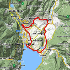
Parking place at the bridge - Arco
- Route
-
MognoArcoChiesa di San GiuseppeChiesa di Sant'Apollinare0.5 kmSan Martino0.7 kmPrabi0.7 kmParco giochi Ristorante California0.9 kmSeesons0.9 kmLa Lanterna2.1 kmCeniga4.0 kmDro5.3 kmLago9.0 kmDro13.8 kmCeniga15.4 kmMoletta17.9 kmPrabi18.3 kmSan Martino18.5 kmChiesa di San Giuseppe19.2 kmArco19.2 kmMogno19.2 km
- Best season
-
JanFebMarAprMayJunJulAugSepOctNovDec
- Description
-
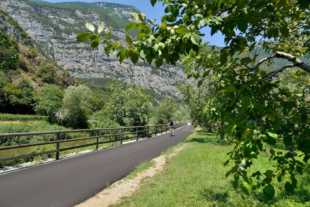
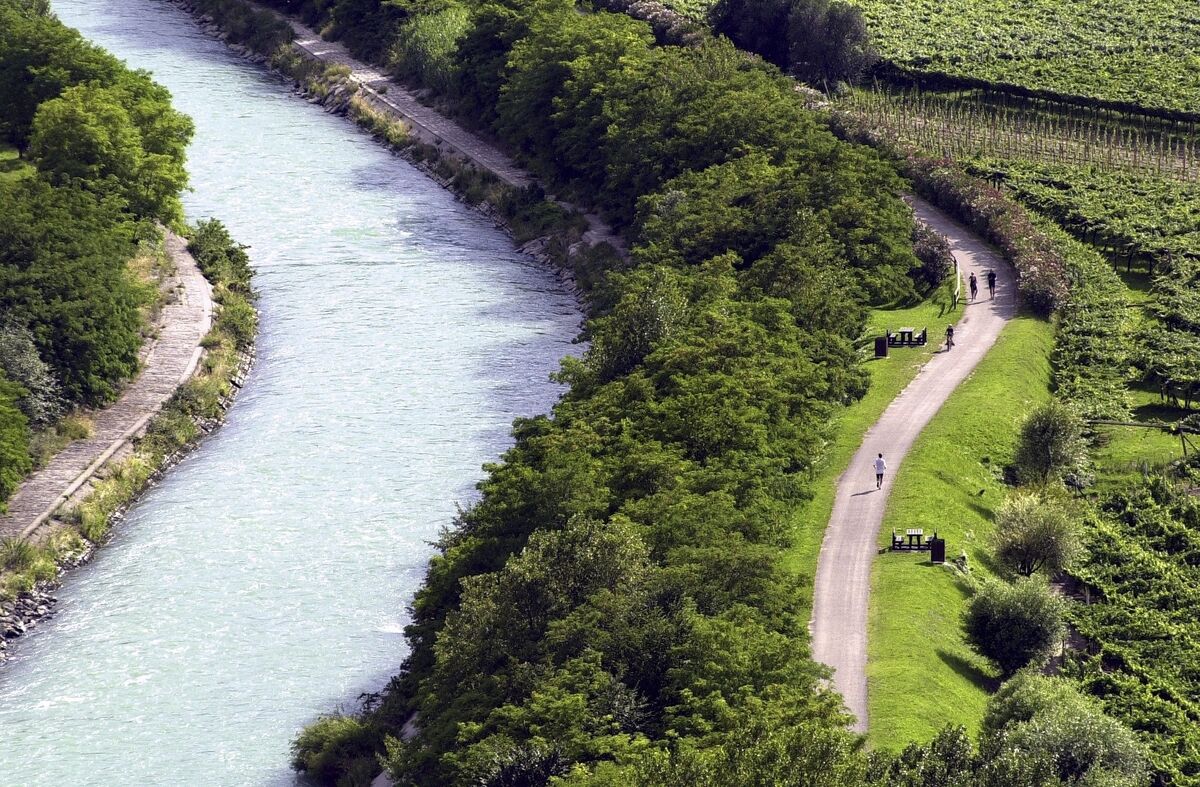
An easy route without much elevation gain which follows the course of the River Sarca northward. The route is on cycle path and side roads and gives you a chance to enjoy the diversity of the landscape around the river. From orchards and vineyards to small towns and villages, you wind up in the Marocche, an area which has protected status because it is so unique.
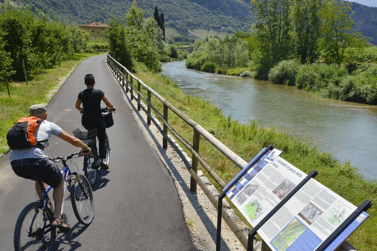
If you are a nature lover and enjoy discovering all the hidden treasures of an area, this is the itinerary for you. The banks of the River Sarca are part of the Sarca River Park and here you will find educational information panels to tell you all about the history and features of the area. And the Marocche nature reserve is a treasure trove for geology and botany enthusiasts. For example, did you know that there are natural bonsais growing there? Get off your bike and stop to explore the “valleys of the Moon”(Valli della Luna)!
The Marocche di Dro are a Site of Community Importance, belonging to the Natura 2000 Network.
- Directions
-
Head off from the car park situated at the bridge in Arco where the cycle path begins. Shortly after, you pass the Climbing Stadium on your left, the venue for the Rock Master championship, one of the most important climbing competitions in the world. Follow the road signs so that you are cycling with the river on your left and the vineyards on your right.
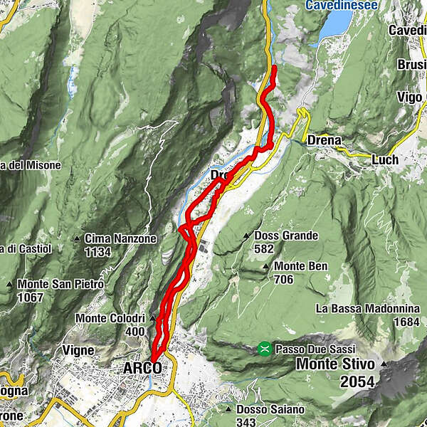
At the end of the cycle path turn left onto a side road which takes you into the little hamlet of Ceniga. Here you turn onto the first road on the right, then take the first left and cross through the centre. Continue on straight through vineyards until you come to a slight rise; turn right and then, at the end of the road, right again. At the stop sign turn right once more and go onto the roundabout where you take the third exit. A sign on the side of the road gives directions for the cycle path. Cycle for a short distance among the houses until you come to the start of the cycle path which is protected and for bikes only.
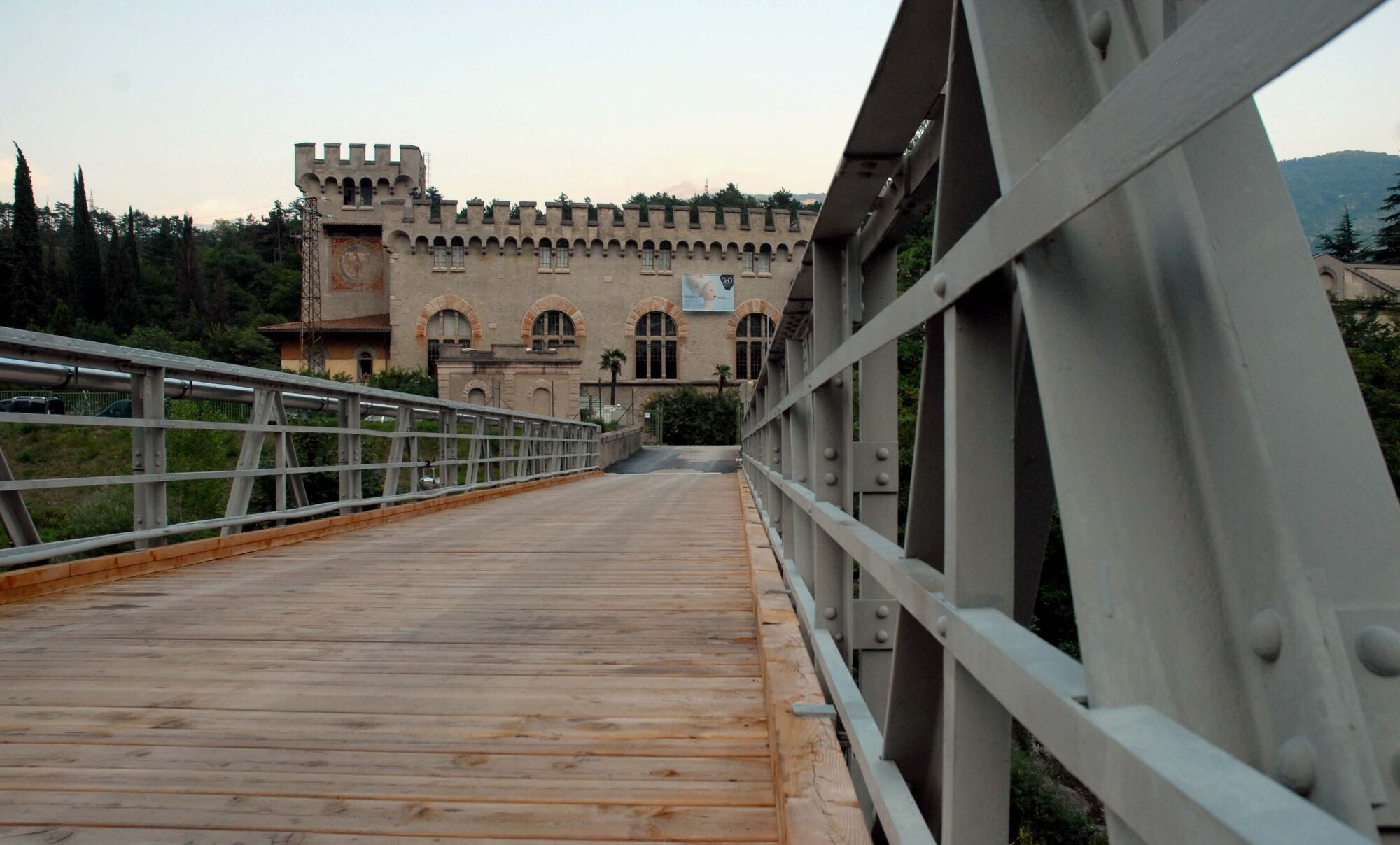
This trail is well signposted and passes through the vineyards. The River Sarca is always flowing on the left of the cycle path which takes you to the Fies power station. Here, against the backdrop of the Marocche, you come to the end of the first part of the itinerary.
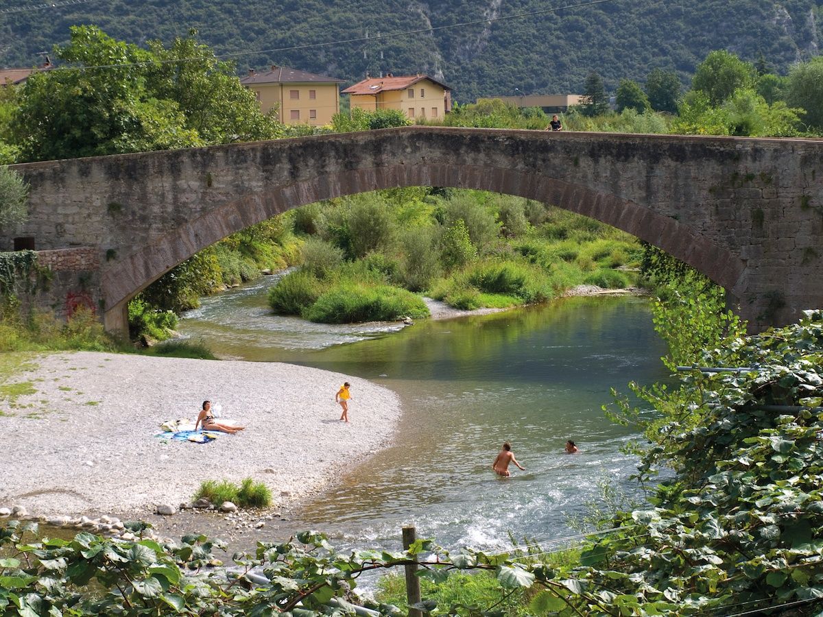
You can go back the way you came on the cycle path to Dro where you turn right at the roundabout. Continue along the main road and in a few minutes you come to the hamlet of Ceniga. Cross through the centre and follow directions to the Roman bridge. Cross the bridge and turn left along the river. On the right you have the sheer rock face of Monte Colodri. Keep going straight until you get back to where you started from.
- Highest point
- 182 m
- Endpoint
-
Fies
- Height profile
-
 © outdooractive.com
 - Safety instructions
-
Give your bike a regular checkup, especially if you've had it for years. Be seen: you must wear a high vis jacket (or sash) in tunnels and on country roads after sunset. Always wear your helmet. Make sure your front and rear lights are working. Put out your arm to give advance warning of your intention to change position and before you do anything, check there are no vehicles coming up behind you. Don't use headphones or your mobile phone handsfree kit: you need all your concentration on the road! Obey the road signs: stop at traffic lights and don't ride on the wrong side of the road. If you are cycling in a group, always go in single file. You've got a bell: use it to let pedestrians know you're there. Don't ride on footpaths. If you have to then get off and push your bike. If there are cycle paths use them. It's your safety that's at stake and the rules of the road say you must.
Note:
The cycle pathe in Trentino are usually closed by the local authorities from November, 15th to April, 15th. Exceptions are the cycle paths along the River Adige and in the Basso Sarca/Garda Trentino, where cycling is prohibited only in case of ice or during a snowfall.
- Tips
-
In summer be sure to bring your swimsuit: underneath the Roman bridge in Ceniga there is a little beach, ideal for cooling down after your bicycle ride
- Additional information
-
The route ends at what used to be Fies hydroelectric power station. This building looks nothing like a traditional industrial building but more like a castle built to defend the river. For some years now it has been the venue for an important festival and a creative hub for contemporary art in all its forms.
For more information on routes and bike services: rentals, workshops, shops and cycling friendly accommodation - APT Garda Trentino Tel. +39 0464 554444
- Directions
- Public transportation
-
The towns in Garda Trentino - Riva del Garda, Torbole sul Garda and Arco – are connected by several urban and intercity bus lines which will take you to the starting point or in the immediate surroundings.
For up-to-the-minute information on timetables and routes
You can also get to Riva del Garda and Torbole sul Garda by the public ferry service.
- Parking
-
Free parking in Caneve (5 min. walk from the town centre).
More Pay parking: Foro Boario parking, via Caproni Maini (Car park near the bridge), Post office (Via Monache).
-
-
AuthorThe tour Along the Sarca cycle path: from Arco to Fies is used by outdooractive.com provided.