


- Brief description
-
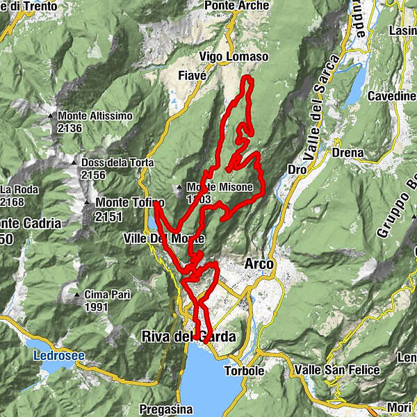
The Ronda Grande of Bike Festival offers a healthy mix of climbs and descents: 59.56 kilometers, 2406 meters of total height difference with the highest point in Prai da Gom at an altitude of 1135 m.
- Difficulty
-
difficult
- Rating
-
- Starting point
-
Centre - Riva del Garda
- Route
-
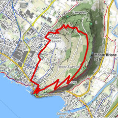
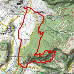
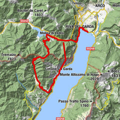
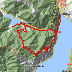
Chiesa di San MicheleRiva del GardaAlboletta0.9 kmChiesetta del Pernone2.6 kmVarone2.7 kmCascata del Varone3.4 kmGavazzo3.8 kmGavazzo Vecchio4.2 kmCologna5.0 kmTeggiole5.4 kmVolta di No5.6 kmFontanelle5.7 kmFrapporta7.3 kmTenno7.5 kmPastoedo9.0 kmCanale9.1 kmVille Del Monte9.3 kmRistorante & Pizzeria9.4 kmFrioc9.7 kmTerra Rossa (690 m)11.6 kmMena13.1 kmBastiani14.2 kmPrà de Vespana (791 m)16.9 kmCostelonghe (650 m)18.5 kmBivio dei Molinei (600 m)19.4 kmPrai da Gom36.6 kmDoss del Clef (769 m)39.9 kmMalga Tovo44.6 kmLanzola (520 m)49.1 kmVandrino (470 m)49.6 kmTenno51.9 kmCologna52.7 kmGavazzo52.8 kmTeggiole52.9 kmFontanelle53.2 kmVolta di No53.2 kmPiazze53.6 kmVarignano54.6 kmPasina56.7 kmRiva del Garda59.4 km
- Best season
-
JanFebMarAprMayJunJulAugSepOctNovDec
- Description
-
From the junction with the Ronda Piccola at Sella di Calino, it continues until Vespana, goes down along the Lomasona and arrives in Prial from where, by setting a low gear, begins the climb to S. Silvestro up to Malga Vigo (1079 m.a.s.l.) where, the panorama of the Brenta Dolomites and the Adamello Mountains is extraordinary.
Up there, Cima Tosa and the Carè Alto glacier (3500 meter high) will block the riders with their incomparable beauty.
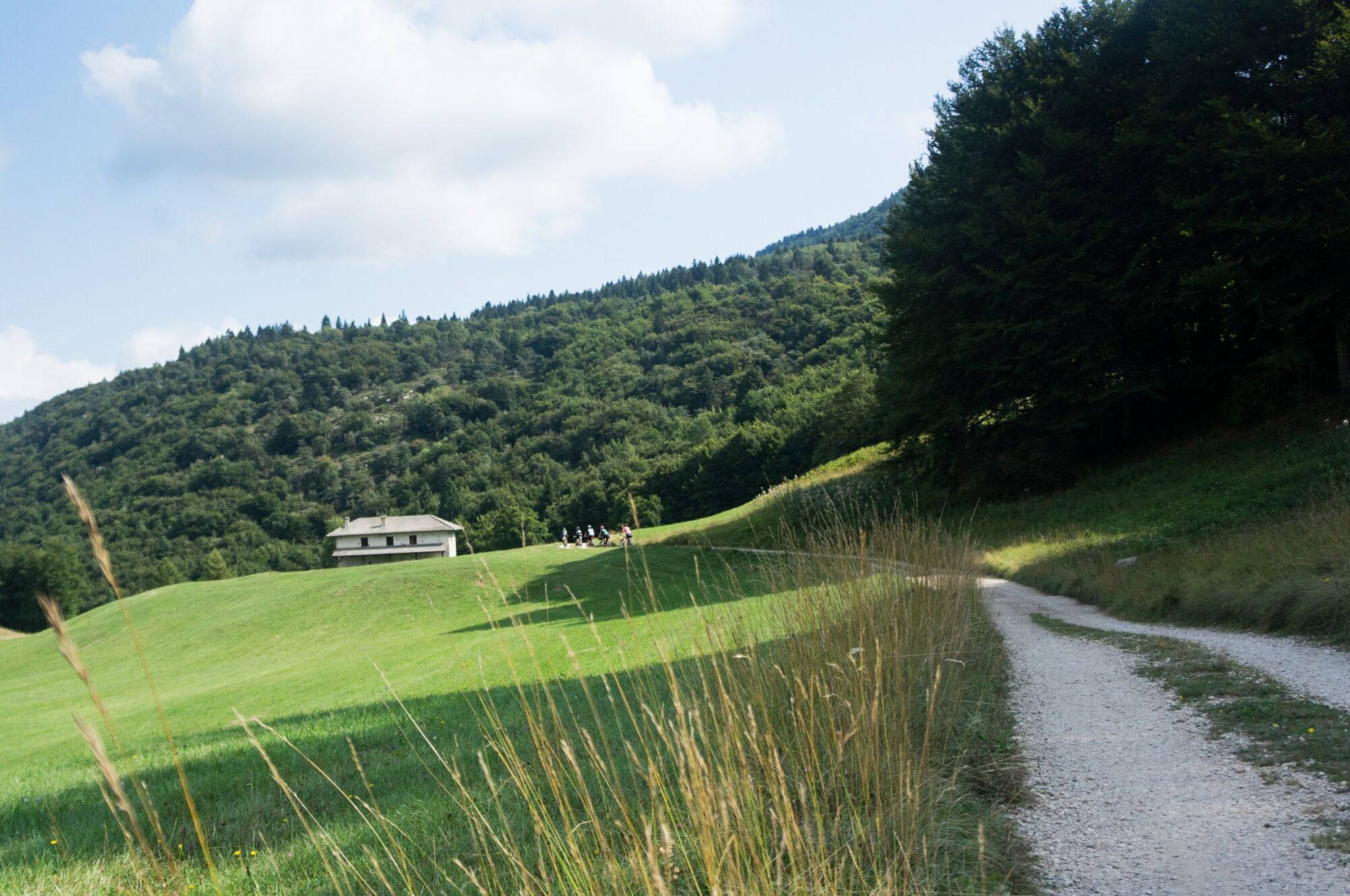
The Ronda Grande offers the opportunity to challenge considerable ascents, descents as well as to test different terrains: from asphalt to gravel sections, pedaling through places such as Dos del Clef and S. Pietro. Once in Novino the Ronda Grande takes the same road as the Ronda Piccola to the finish line.
- Directions
-
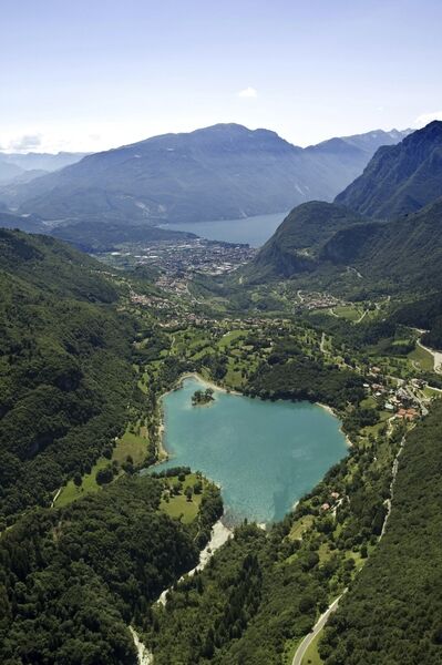
After the start, in the heart of the old town of Riva del Garda, the first few kilometres of the route lead through the picturesque areas of Varone, Cologna and Gavazzo to Tenno. Afterwards it continues on a dirt road to Ville del Monte. From here the route leads along a beautiful gravel road to the unique Lake Tenno, famous for its unspoilt landscape and turquoise blue colour. After the ascent to Monte Calino, after 15.6 kilometres the route divides at Sella di Calino into Piccola and Grande. At this point the Ronda Grande turns onto a dirt road to Vespana and leads via Lomasona to Prial. Now you should shift into a low gear to master the demanding climb to San Silvestro. The path continues on to Malga Vigo (1,079 metres above sea level), where it crosses an archaeological area (S. Martino) until it reaches the beautiful Valdori forest. From Malga Vigo you have an incomparable view of the Brenta Dolomites, including the 3,173-metre-high Cima Tosa and the over 3,500-metre-high Carè Alto.
After crossing Pozza Bella and Gorghi, the route passes Prai da Gom, the highest point of the Ronda Grande at 1,135 metres above sea level. This is followed by a four kilometre descent to Dos del Clef. Afterwards it leads uphill again to Bocca di Tovo on Monte Calino. The descent towards Riva starts on single trails to the town of Novino. From there the last part of the route leads back to the Ronda Piccola and follows the same track to the finish line at the festival area. A great performance has been achieved.
- Highest point
- 1,143 m
- Endpoint
-
Centre - Riva del Garda
- Height profile
-
 © outdooractive.com
 - Equipment
-
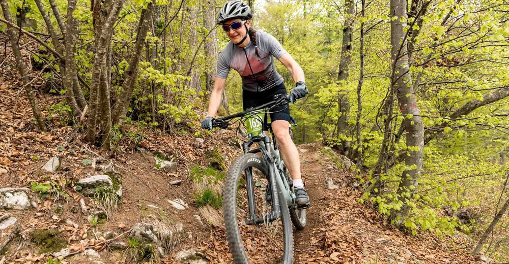
Riding your bike requires specific clothing and equipment, even for relatively short and easy trips. It is always better to be prepared… e.g. for bad weather or a sudden drop in your energy levels. The unexpected things are part of the fun!
Remember to thoroughly evaluate the type of route you plan on doing, the locations you intend to cross and the current season. Has it been raining? Attention: The paths may be slippery and require more caution.
What do I need to bring on my bike tour?
An adequate water supply according to your needs (considering temperature, possibility of refuelling and duration of the route) Plenty of snacks (for example, dried fruit or energy bars) Waterproof / Windproof jacket A spare top / spare socks (Descending in a sweaty garment, will make you cold). Suncream Sunglasses Bike gloves/mitts Map or GPS device Bike lights: best placed on your helmet or handlebars. (It is always best to be prepared) Bike repair kit for punctures and mechanical breakdowns First aid kit Emergency whistleIt is always advised to let someone know where you plan to go and how long you expect to be.
Emergency telephone number 112.
- Safety instructions
-
Safety Tips
Always wear your helmet. Plan your ride. You share the trail with other users. Yield right of way to hikers. Let your speed be determined by your experience. Ride slowly on crowded trails, overtake with politeness and respect. Cycle only on authorized and open trails. Avoid muddy trails in order not to damage them further. Respect public and private property. Always be self-sufficient. Do not cycle solo in remote areas.This information is subject to inevitable variations, so none of these indications are absolute. It is not entirely possible to avoid giving inexact or imprecise information, given how quickly environmental and weather conditions can change. For this reason, we decline any responsibility for changes which the user may encounter. In any case, it is advisable to check environment and weather conditions before setting out.
- Tips
-
The Brenta Dolomites are, in Malga Vigo, in front of you. Stop for a moment to admire them.
- Additional information
- Directions
- Public transportation
-
The main towns in Garda Trentino - Riva del Garda, Arco, Torbole sul Garda, Nago – are connected by several urban and intercity bus lines which will take you to the starting point of tours or in the immediate surroundings.
You can also get to Riva del Garda and Torbole sul Garda by the public ferry service.
Up-to-date information on timetables and routes.
- Parking
-
Parking near the former hospital (Via Rosmini) or the former cemetery (Viale Damiano Chiesa).
Paid parking: Terme Romane (Viale Roma), Vecchia stazione (Largo Medaglie d’Oro), Ex-agraria (Via Lutti), Area ex-Cattoi (Viale Rovereto).


-
-
AuthorThe tour 2024 Bike Marathon Garda Trentino Ronda Grande is used by outdooractive.com provided.


-
Garda Trentino
149
-
Tenno
82