- Brief description
-
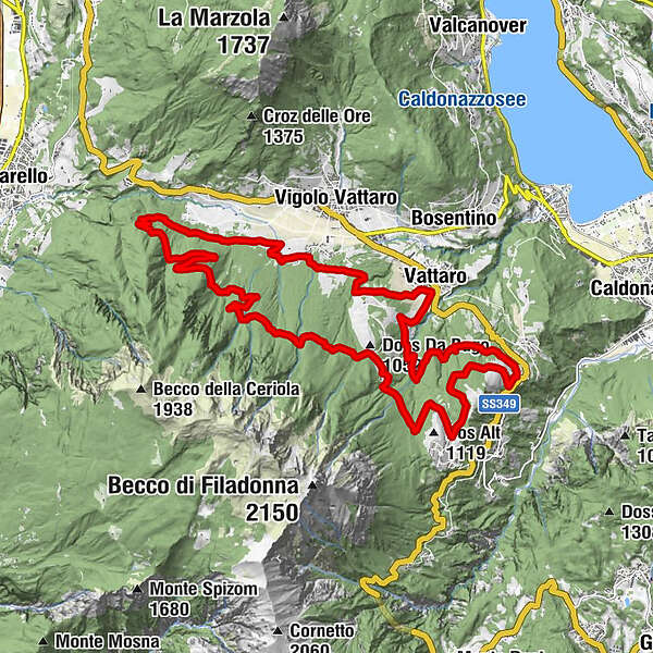
A long ride in mtb towards Forte Fornas and return through the woods of the northern slope of Vigolana da Vattaro along the "street of the soldiers".
- Difficulty
-
medium
- Rating
-
- Route
-
VattaroRistorante TEX0.2 kmMaso Zugolini5.5 kmSenter de le Zete9.8 kmCapitel del Verzer11.9 kmMalga Faé -Malga Doss del Bue14.9 kmDos Alt16.5 kmloc. Comunat17.1 kmPian dei Pradi20.5 kmVattaro25.4 km
- Best season
-
JanFebMarAprMayJunJulAugSepOctNovDec
- Description
-
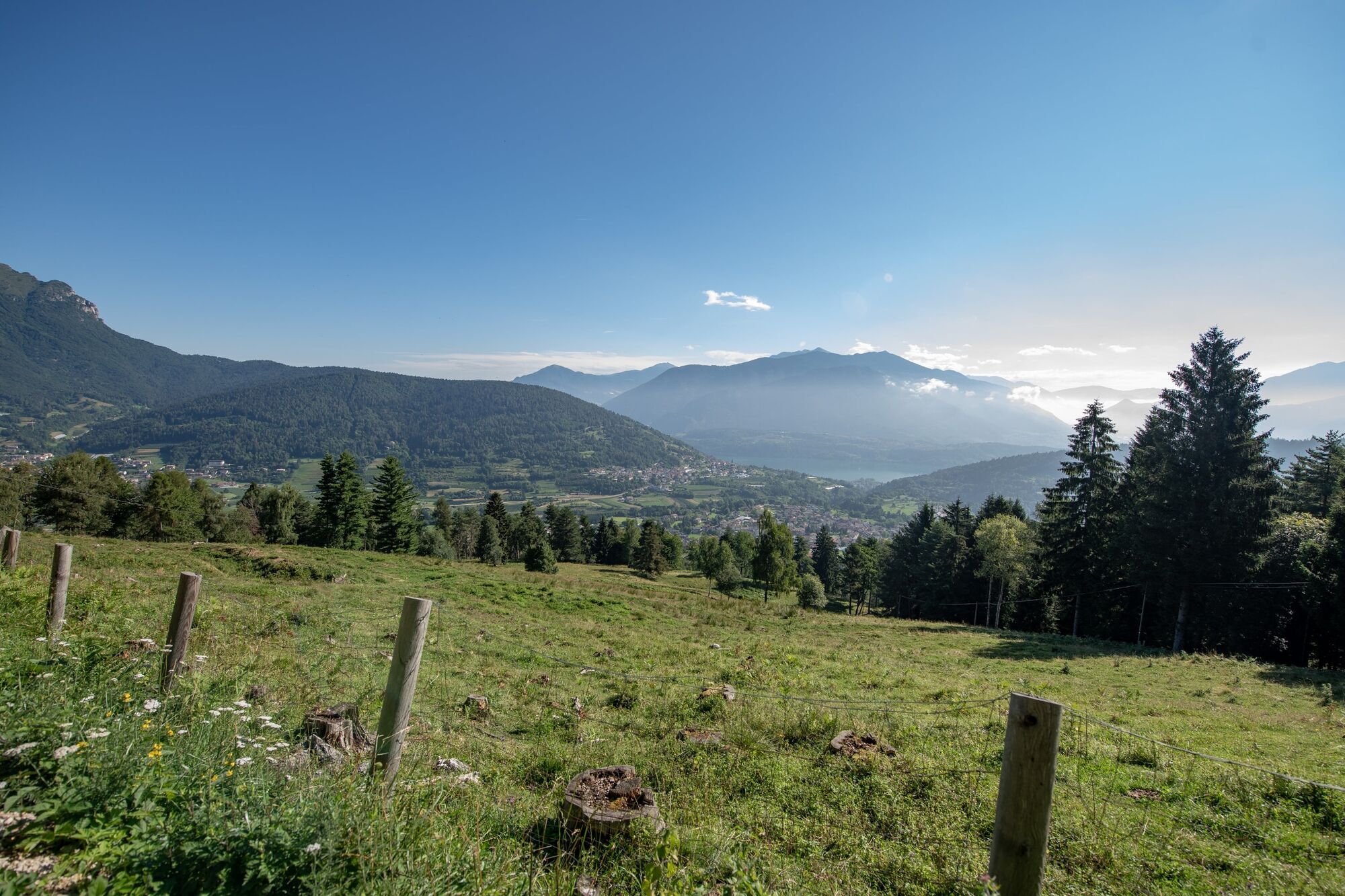
The route mainly offers historical prerogatives, due to the presence of the former Forte Fornas, built by the Austro-Hungarians on the slopes of Vigolana in the late nineteenth century (1878 and 1880). Together with the twin Forte Brusafer, which guarded the other side of the valley, they had the task of controlling the road that goes up from Trento to the plateau. The itinerary also follows the route of an old military road (Strada dei Soldai) which has been specially recovered. Along the route, in addition to the historical peculiarities, there is also the exceptional refreshment point of the Malga Doss del Bue restaurant. The restaurant is located at 1020 meters above sea level and enjoys a spectacular view of the Brenta Dolomites with an extraordinary view of the Cima Tosa at sunset. A unique show to round off the ride with a tantalizing stop!
- Directions
-
Leave the car at the Albio car park, at the intersection of Via Villa and Via el Bue in Vigolo Vattaro, continue on the asphalt road that goes up towards Malga Doss del Bue and at the first bend (1.5 km from the start) turn right on a dirt road that, having crossed the torrent Garzillone and passed a short downhill stretch in the woods, leads us along farm roads and forest roads to Maso Franzoi (5 km from the start). Go past Maso Franzoi and continue on flat ground for about 3.3 km until the steep climb that with two turns reaches the site of the former Forte Fornas. The road continues uphill, with an irregular pattern and a short downhill stretch, up to the Capitel del Verzer, 11.6 km from the start to continue with a more regular ascent which, passing some gullies, leads up to the maximum altitude reached by the itinerary (1135 m asl) at the crossing of the "Lavinella Grande" gully (13.2 km from the start). Then continue downhill to the Malga Doss del Bue (14.6 km from the start) and then always downhill but on a paved road to the starting point at the Albio car park, thus completing the 17.9 km route.
- Highest point
- 1,126 m
- Endpoint
-
Vattaro parcheggio Albio
- Height profile
-
 © outdooractive.com
 - Safety instructions
-
ALWAYS WEAR THE HELMET and follow the rules recognized throughout the world for sustainable biking like the suggestions provided by the NORBA (National Off Road Bicycle Association) and IMBA (International Mountain Bicycling Association) codes of conduct Plan your outing Share the trails with other users Always give way to hikers on footCheck your speed based on your experience Slowly walk the crowded paths, pass with courtesy and respect Never leave the marked paths, do not walk on closed paths Avoid trails in case of mud to avoid damaging them further \ t path, plants and animals Do not frighten the animals Do not abandon the waste Respect the public and private property Always be self-sufficient Do not travel alone in isolated areas Leave light footprints and limit yourself to taking pictures as a souvenir of the exit. Also note that: information contained in this sheet is subject to inevitable variations, so no indication has absolute value. It is not possible to avoid inaccuracies or inaccuracies at all, given the rapidity of environmental or meteorological changes that may occur. In this sense we disclaim any responsibility for any changes suffered by the user. It is advisable, however, to ascertain, before making an excursion, the state of the places and the environmental or meteorological conditions. As you will imagine, the practicability of the itineraries in a mountain environment is closely linked to the contingent conditions and therefore depends on natural phenomena, environmental changes and weather conditions. For this reason, the information contained in this sheet may have changed. Before leaving, find out about the status of the route by contacting the shelter manager on your route, the mountain guides, the visitor centers of the natural parks and the tourist offices.
- Tips
-
The path length and height difference will be a source of satisfaction for already well-trained bikers.
- Author
-
The tour Al Malghet del Doss da Bugo 21 is used by outdooractive.com provided.