Tour 1429 – Ziro del lez: An old irrigation canal used as an MTB trail


- Brief description
-
This short circuit along the foothills of the Maddalene Group includes a narrow trail called “Lez” which back in time was used as an irrigation way.
- Difficulty
-
easy
- Rating
-
- Starting point
-
Rumo, Corte inferiore
- Route
-
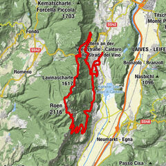
Corte SuperioreScassio0.5 kmMocenigo0.7 kmSorgente ferro-magnesiaca3.8 kmLanza5.8 kmChiesa di Sant'Udalrico10.6 kmCorte Inferiore10.7 kmMarcena12.1 kmCorte Superiore12.9 kmMocenigo12.9 km
- Best season
-
JanFebMarAprMayJunJulAugSepOctNovDec
- Description
-
Rumo is a small municipality formed of a series of districts at the foot of the Maddalene Group, and represents the linguistic divide between Trentino and Alto Adige. In this area the meadows dedicated to hay harvesting are steep and the mountain peaks stand high above. Our tour takes us from Corte Superiore to Mocenigo and then up to Val Lavazzè, where one comes across for the first time the now abandoned “Lez” canals. In dialect the term “Lez” refers to the old irrigation canals which are mostly flat in nature and cross the mountain ridges. This trail continues at the same height and heads west in the direction of Lanza, and then continues on the narrow roads which lead to the characteristic Alto Adige village of Proves. At this point we come on to a fun downhill single trail and then on to the bike and pedestrian path, Rankipino, and first we come to Corte Inferiore, it having a small church visible from afar, and then to Corte Superiore.
- Directions
-
From the Corte Inferiore district we take the main road, it slightly uphill, towards Mocenigo. We follow the road signs for “Bagni” and the uphill road in Val Lavazzè. Keeping on going north, we stay on this side of the torrent. After 2.6 km we keep to the right fork and on the right a way leads us to the “Sentiero del Lez” (indicated on the map as Ziro del Lez). The historic irrigation canal has been out of use for a long time, and the small path at its side is uneven in parts. Even though the path remains at the same altitude level, one still needs to bike carefully and maintain a good sense of balance After 3.7 km the path comes out on a dirt road, and which we take to the right and continue on for a good 200 metres, and then turn sharp to the left to rejoin the still narrow continuation of “Lez” in a northerly direction. After a short while the single trail begins to descend. To the north-east of the Lanza district we go back on a forest path which makes its way east (above the village itself). On arriving at the first fork above Lanza we turn to the right and go downhill, and then, before reaching the inhabitation area we turn to the left, and on to a road called “Giro del Lez”, and which takes us towards Corte Inferiore. After 7.8 km at the “Tre Strade” crossing we come to various forest paths. Warning: a narrow path, once situated along the irrigation canal. After 8.5 km we come out on a main road, which takes us up to Proves. We cross the road and go towards the picnic area which is opposite Plaze basse. Once here we then need to pay attention to the wood-like path in a northerly direction. Note that the path becomes narrower and its surface deteriorates gradually. We need to follow a stream which winds south and after a 9.6 km we come out on the “Rankipino” path. We take the “Rankipino” towads west as far as Corte Inferiore and to its proud church dedicated to S. Uldarico (km 10,4). Following thr district’s roads we carry on on the flat in a westerly direction towards Mione. After 10.9 km the signs for the “Rankipino” indicate to go up to the right. We follow this Marcena trail back to our starting point at Costa Inferiore.
- Highest point
- 1,259 m
- Endpoint
-
Rumo, Corte inferiore
- Height profile
-
 © outdooractive.com
 - Equipment
-
For this tour any type of MTB can be used.
- Safety instructions
-
The trail along the old irrigation canals is a little worse for wear in some parts and it is occasionally necessary to push your bike. There are no refreshment stops along this trail.
Please note that the practicability of the itineraries in a mountain environment is strictly linked to the contingent conditions and is therefore influenced by natural phenomena, environmental changes and weather conditions. For this reason, the information contained in this page may have changed. Before leaving for a tour, make sure the path you will approach is still accessible by contacting the owner of the mountain hut, the alpine guides or the visitor centres of the nature parks, the info offices of the local tourist board.
- Tips
-
Whoever wishes to prolong the tour once arriving Val Lavazzè can continue uphill as far as Malga Lavazzè, and then it is necessary to return on the same forest path. Arriving at Corte Inferiore it is certainly worthwhile to visit the church of Sant’Uldarico.
- Directions
-
Exit motorway A22 at Trento Nord and follow the SS43 towards Val di Non and Val di Sole. Straight after the Mostizzolo Bridge take the right and follow the direction Rumo.
- Parking
-
All the parking spaces in the village are free


- Author
-
The tour Tour 1429 – Ziro del lez: An old irrigation canal used as an MTB trail is used by outdooractive.com provided.