The Rumo – Laurein link: Ride along the bilingual and cultural border – Tour 1422


- Brief description
-
A visit to the neighbouring country – as indicated by the official title of this beautiful tour to the Deutschnonsberg region. Between Rumo in the West and Laurein in the East they speak an undefined language - and cultural borders have been visibly crossed.
- Difficulty
-
medium
- Rating
-
- Starting point
-
Rumo
- Route
-
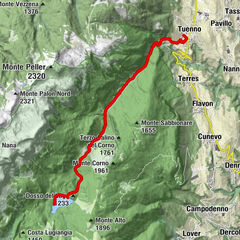
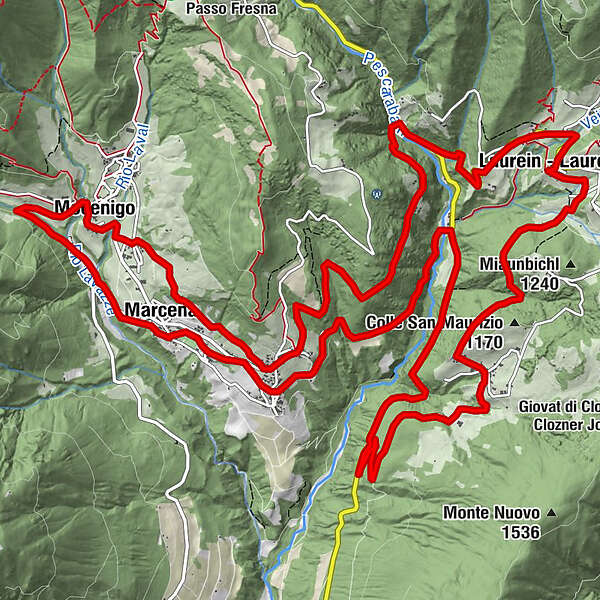
Marcena0.3 kmLocalità Molini1.1 kmMocenigo2.7 kmScassio2.9 kmCorte Superiore3.4 kmMarcena4.2 kmCorte Inferiore5.5 kmLaurein11.9 kmStern - Stella12.0 kmHeiliger Vitus12.1 kmSonne - Sole12.1 kmSan Maurizio15.2 kmTregiovo15.4 kmSchmieden20.8 kmMione23.5 kmPlaceri24.3 kmMarcena24.7 km
- Best season
-
JanFebMarAprMayJunJulAugSepOctNovDec
- Description
-
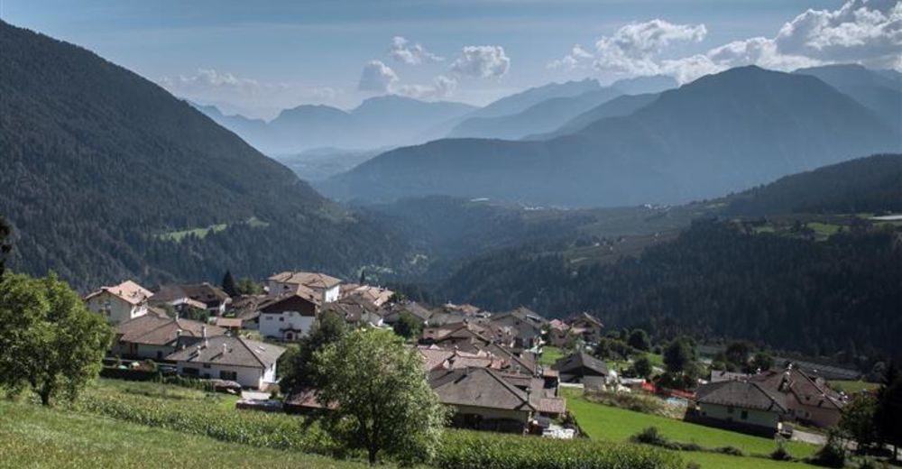
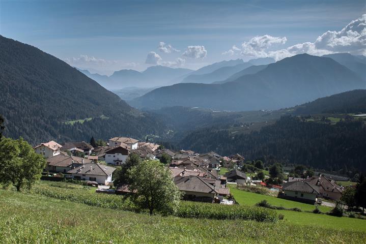
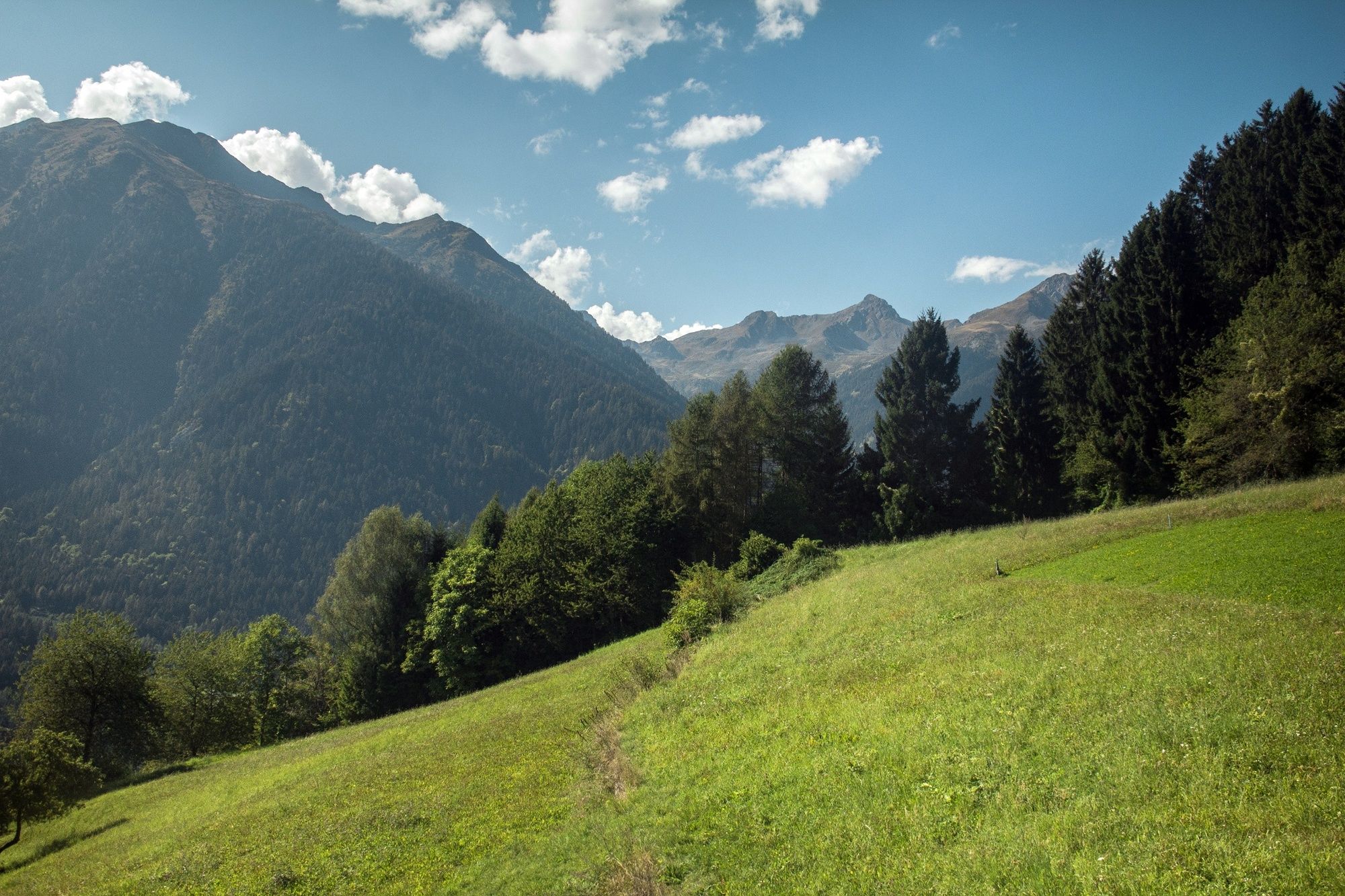
This link between Rumo in Trentino and Laurein in South Tyrol is a tour with views of the northern slopes of the Deutschnonsberg region and the Magdalene Mountain Range. The location offers spectacular views over Val di Non, the Mendelkamm, and the impressively rugged Brenta Dolomites. The Pescara stream flows down the upper Val di Nony and with its fast-flowing water cuts it into two like a sword. The stream water enters the gorge at Cagnò and flows into the Santa Giustina reservoir. It separates the western section of the Magdalene mountains from the eastern one at Mount Ozol. The terrain gets steeper and steeper giving the landscape its character. In order to go from one side to the other from here you need to go further north from the gorge. Geographically, the “Italian” picturesque Rumo with its scattered villages is only a stone’s throw away from South Tyrolean Laurein. However, the river has created an almost insurmountable division between them.
- Directions
-
This tour is also suitable for linking Rumo and its surrounding villages with the parallel route to the east, the TOUR DE NON.
At the Marcena starting point you should decide which village of the municipality of Rumo you’ll want to visit. Now head west towards the cycle route signposted “Rankipino”. After 500 metres you will come across the main road and just 200 metres later turn right on the road leading to the Val Lavazzè, which from this point on is signposted “Rankipinto”. You will come across the Agriturismo Kofler, at km 1.9, turn right at the river Lavazzè and continue uphill towards Bagni, Mocenigo and Corte Superiore (km 3.4). The „Rankipino“ route from now on runs eastwards. You will get to the main road with its splendid views over the valley towards Corte Inferiore (km 5.4), after which you will go into a forest. This is predominantly a dirt track up to the main road SP86 (at km 9.3) connecting the Non Valley with the Ultental Valley over the Hofmahdjoch mountain pass. You now have crossed the border between the provinces going through the woods for the first time. Follow the main road to the right slightly downhill for 200 metres, leave the „Rankipino“-Signposted route and turn left at the fork towards the access road to Laurein, which will take you up to the Village (km 11.8). If you would like to go along the mountain pass road in Laurein, you should reach the Brezer Joch where it joins the TOUR DE NON. However, we will turn right in Laurein and go down towards the church. After passing through the villages of Gassern and Moos you will reach the exit for Buchern (km 12.7) where the paved road ends and you continue on a dirt track into the forest. This route is difficult in places for a good 2 kilometres downhill as far as Tregiovo (km 14.8). Once again, you have crossed the border between the provinces without realising. From the village centre (km 15.0) it's a downhill ride on the main road leading again, after 3 kilometres, to the mountain pass road (km 17.9). Take your time to visit the Pescara Gorge: This time turn right and follow the signposted “Rankipino” route until you get to the crossroads at Schmieden (Frari) (km 20.6). Here is the Wilde Haken border: turn left to return onto the SP6 towards Mione. The first 300 metres on South Tyrolean soil, then back to Trentino. At km 23.7 turn left (turning on the main road at Corte Inferiore) over the walkway onto the alternative downhill route which will take you directly back to the starting point at Marcena.
- Highest point
- 1,155 m
- Endpoint
-
Rumo
- Height profile
-
 © outdooractive.com
 - Equipment
-
The tour can be undertaken with any type of MTB.
- Safety instructions
-
The tour covers public roads, which are hardly used, although they are very popular with motorcyclists. Please do not ride side by side.
Please note that the practicability of the itineraries in a mountain environment is strictly linked to the contingent conditions and is therefore influenced by natural phenomena, environmental changes and weather conditions. For this reason, the information contained in this page may have changed. Before leaving for a tour, make sure the path you will approach is still accessible by contacting the owner of the mountain hut, the alpine guides or the visitor centres of the nature parks, the info offices of the local tourist board.
- Tips
-
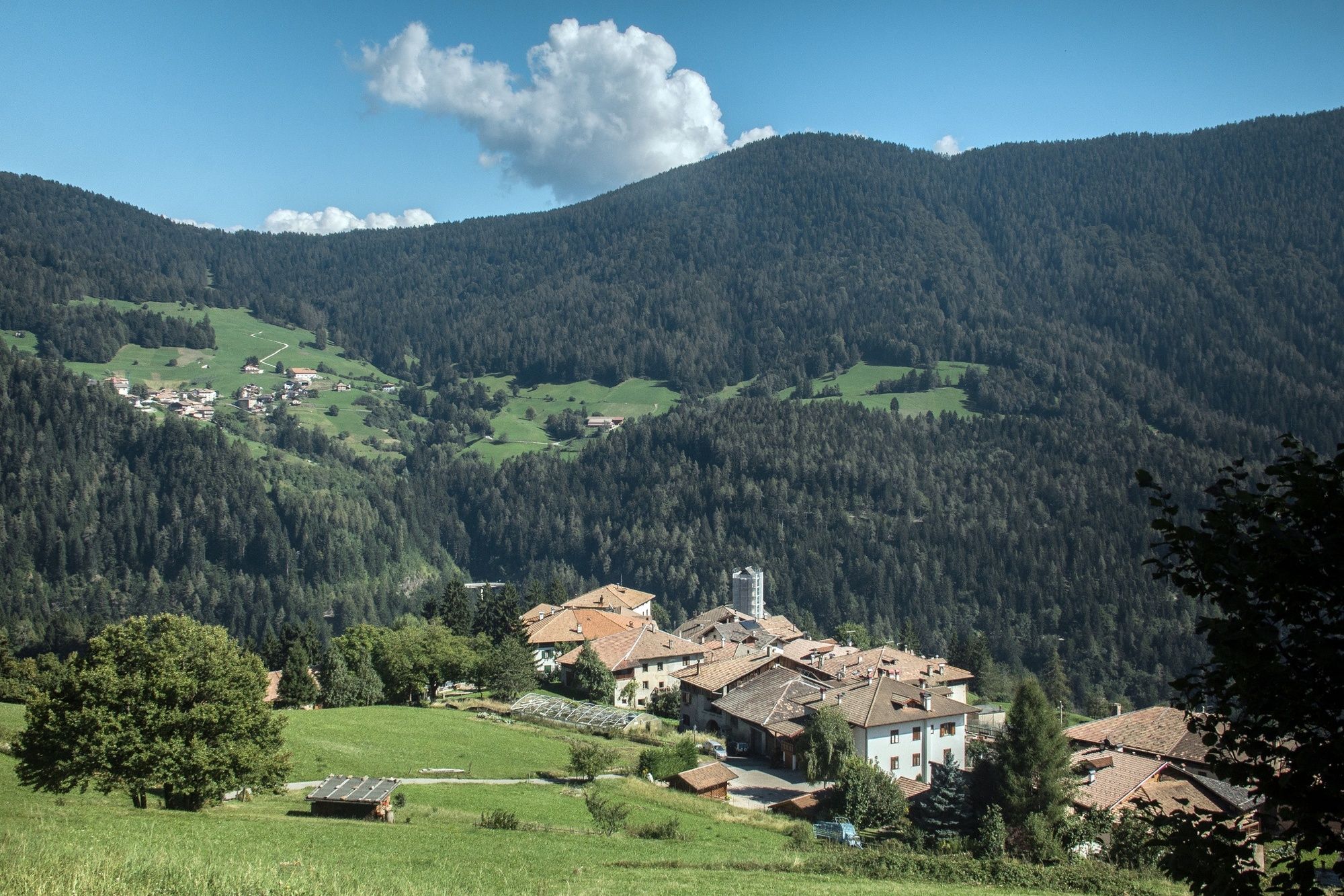
On closer inspection, there are also differences in architecture and cultural traditions in this border region. There are lots of large farms on the South Tyrolean landscape compared to the villages on the Trentino side.
- Additional information
-
On closer inspection, there are also differences in architecture and cultural traditions in this border region. There are lots of large farms on the South Tyrolean landscape compared to the villages on the Trentino side.
- Arrival
-
From the Brenner A22 motorway take the exit to Trento Nord and then follow the SS43 towards the Non Valley. In Dermulo follow the signpost to Cles / Val di Sole. 5 km after Cles by the Mostizzolo bridge follow the clear directions to Rumo.
- Parking
-
Free parking is available by the tourist office in Marcena di Rumo
-

-
AuthorThe tour The Rumo – Laurein link: Ride along the bilingual and cultural border – Tour 1422 is used by outdooractive.com provided.


General info
-
Meraner Land
146
-
Nonstal
132
-
Rumo
23