
- Brief description
-
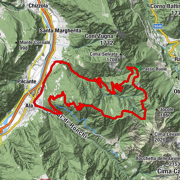
Challenging route of over 1300 meters in altitude, mostly on dirt roads.
- Difficulty
-
difficult
- Rating
-
- Starting point
-
Ala
- Route
-
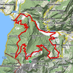
Ala (180 m)Prati (150 m)2.5 kmCumerlotti (155 m)2.8 kmSoini3.1 kmAlbi di Mezzana14.0 kmOspedaletti15.2 kmPasso Buole (1,475 m)16.1 kmCima Perobia (1,358 m)23.1 kmPozzo alto27.3 kmPozzo di mezzo28.4 kmAl caminel32.6 kmBrustolotti (234 m)32.7 kmAla (180 m)33.8 km
- Description
-
The route takes place in a wild and quiet area, where it is not uncommon to meet the typical fauna of the mid-mountain, such as roe deer, hares, chamois. Here silence and peace reign, on the places where the explosion of the bombs of the First World War rumbled a hundred years ago. The climb ends on the crest of the watershed between the Adige Valley and Vallarsa, from where you can enjoy a wide view. The pleasant and long descent completes a very satisfying loop.
- Directions
-
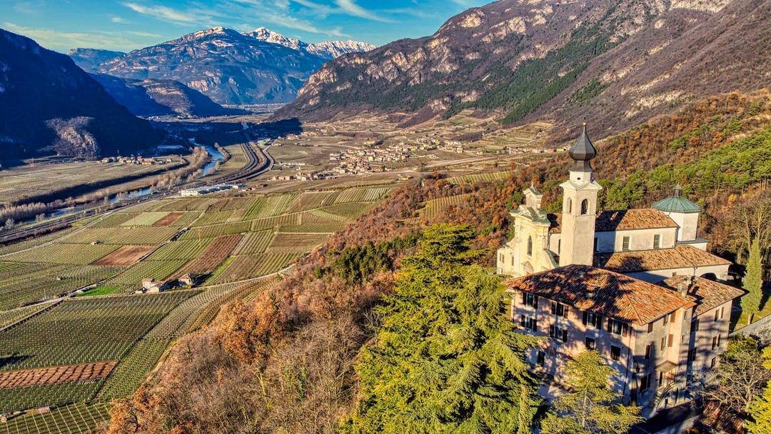
Departure from the center of Ala, towards the bridge that crosses the stream of the same name. Proceed north along via San Martino, then via Alessandro Volta and then along the Strada Romana. Arriving at the beginning of the San Valentino Valley, the road passes under the suggestive cliff that houses the sanctuary. Having climbed the first two hairpin bends, after crossing the bridge over the generally dry stream, take the dirt road on the right that runs alongside the stream, towards Passo Buole where you arrive after about 12 km and 1200 m in altitude. From here the route continues maintaining the altitude to move towards Malga Val di Gatto (ruins) on the opposite side of the valley and then descend along the ridge of Cima Perobia. The descent, always on an easy dirt road, crosses the localities of Pozzo Alto, Pozzo di Mezzo and Pozzo Basso until it enters the Provincial Road Ala - Ronchi at the crossroads at 324m, from which, turning right, you will soon return in the town of Ala.
- Highest point
- 1,543 m
- Endpoint
-
Ala - ring route
- Height profile
-
 © outdooractive.com
 - Equipment
-
An adequate supply of water is recommended, especially in the warmer months. There are no fountains along the way.
- Safety instructions
-
Please note that the practicability of the itineraries in a mountain environment is strictly linked to the contingent conditions and is therefore influenced by natural phenomena, environmental changes and weather conditions. For this reason, the information contained in this page may have changed. Before leaving for a tour, make sure the path you will approach is still accessible by contacting the owner of the mountain hut, the alpine guides or the visitor centres of the nature parks, the info offices of the local tourist board.
- Directions
-
A22 motorway, Ala - Avio exit
- Public transportation
-
Ala railway station and Trentino Trasporti bus stops


-

-
AuthorThe tour Ala - Val San Valentino | 2931 | Esplor-ALA by bike is used by outdooractive.com provided.


-
Verona
40
-
Lessinia
41
-
Valli del Leno
21