- Brief description
-
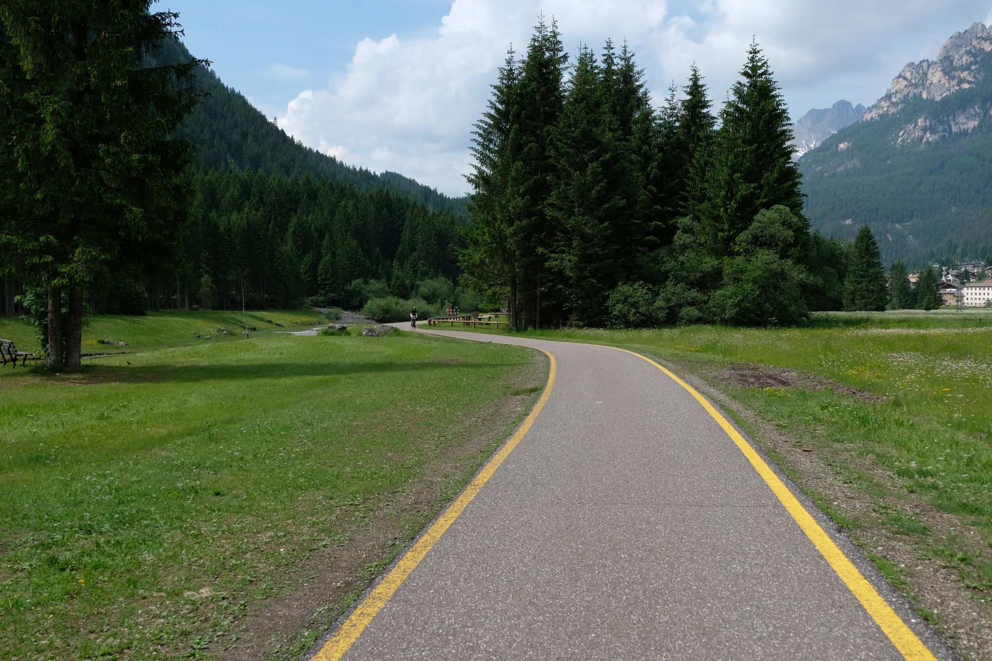
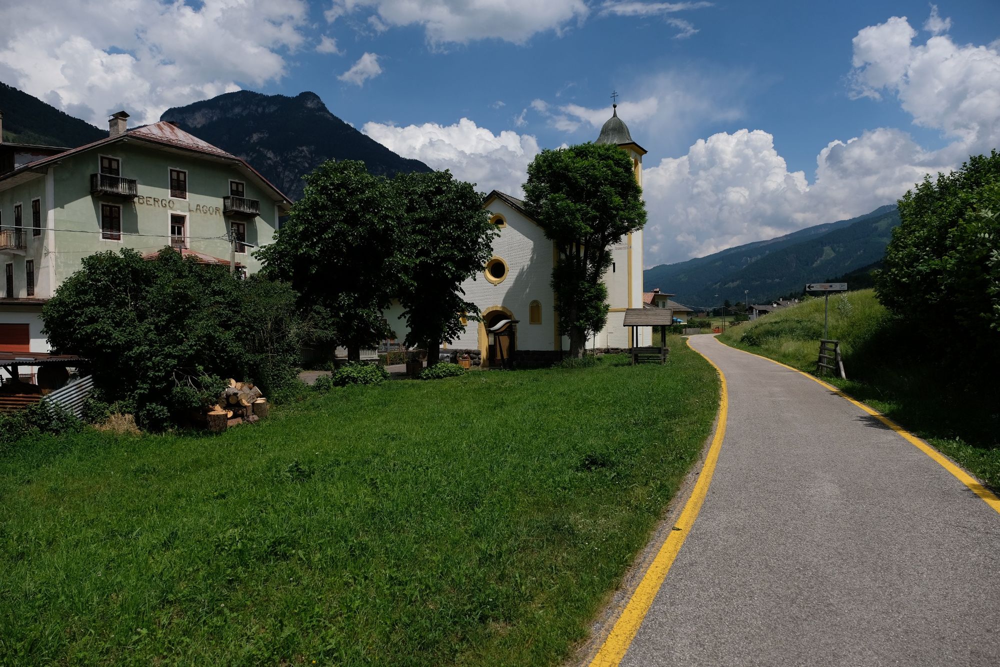
La pista ciclabile attraversa le Valli di Fassa e di Fiemme, ripercorre il tracciato della Marcialonga
- Difficulty
-
medium
- Rating
-
- Starting point
-
Molina di Fiemme
- Route
-
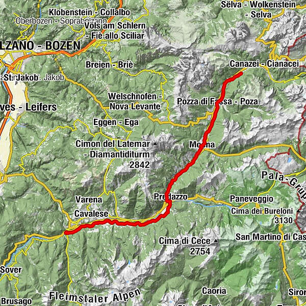
Campestrin1.0 kmMazzin2.5 kmPera di Fassa4.4 kmPozza di Fassa6.1 kmSan Giovanni di Fassa6.9 kmJa Vito10.7 kmÜberwasser10.7 kmMoyen13.2 kmForno (1,165 m)17.4 kmMezzavalle19.5 kmStalimen20.8 kmAl Fol21.7 kmPoz21.9 kmLa Bìra22.1 kmMolìn22.7 kmCoste23.0 kmChiesa di San Nicolò23.4 kmPè de Pardàc23.5 kmPredazzo23.5 kmPizzeria Millenium23.5 kmChiesetta di Sant'Anna27.7 kmRoda27.8 kmBosin28.1 kmZanonberg)28.1 kmZanolin28.9 kmWeißbach30.4 kmRoncosogno31.6 kmL'Osteria dela Nona31.6 kmLa Trattoria32.2 kmLago di Tesero32.3 kmChiesetta di Lago di Tesero32.7 kmMasi di Cavalese35.3 kmSanta36.0 kmMantovane39.9 kmMolina di Fiemme41.7 km
- Best season
-
JanFebMarAprMayJunJulAugSepOctNovDec
- Description
-
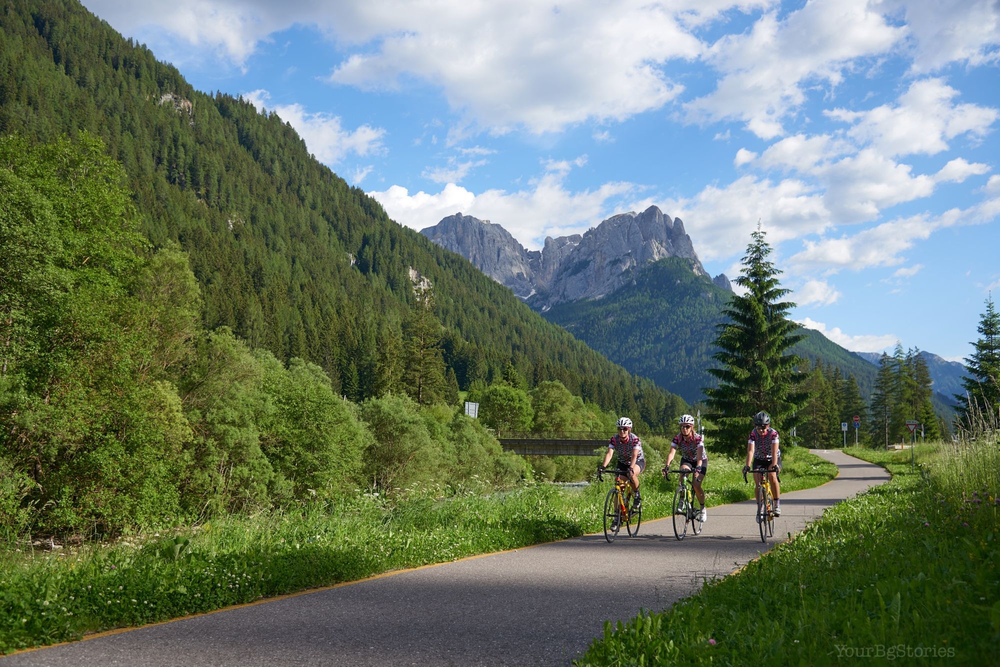
The cycling path crosses the Fiemme and Fassa valleys, following the same route as the Marcialonga.
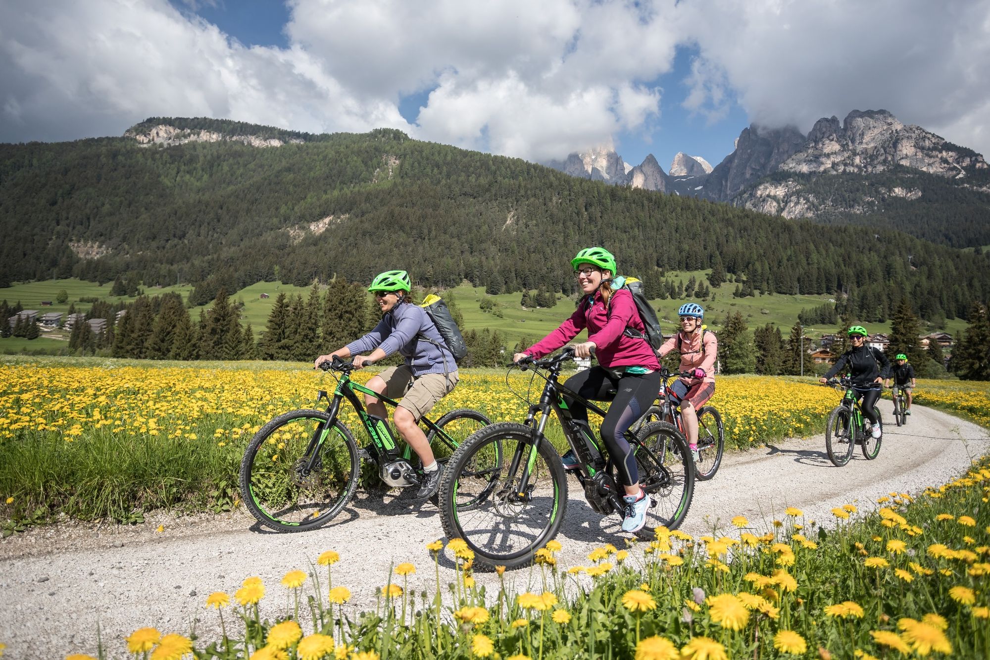
This is the kingdom of snow which, in summer, makes way for green meadows and Dolomite rocks. The backdrop is provided by the majestic Latemar and Catinaccio Dolomites. The cycling path of the Fiemme and Fassa valleys winds over a distance of over 40 km among the woods and dense forests of fir and beech. The route mainly follows the track of the Marcialonga and the route of the ancient Ora - Predazzo railway.
- Directions
-
Leaving behind you the majestic peaks of the Dolomites, at the bottom of the Val di Fassa, you can take the cycle trail that skirts beautiful villages along the valley floor ‒ featuring lovely bell towers ‒ and travel through lush green pastures and woods that surround them: Fontanzazzo, Mazzin and Vigo (of Sen Jan di Fassa), which was recently awarded the title of one of the most beautiful villages in Italy.
Not to mention the larch and fir woods which, despite the devastating Vaia storm at the end of 2018, blanket the slopes of the mountains and have an essential role in preserving the environment.
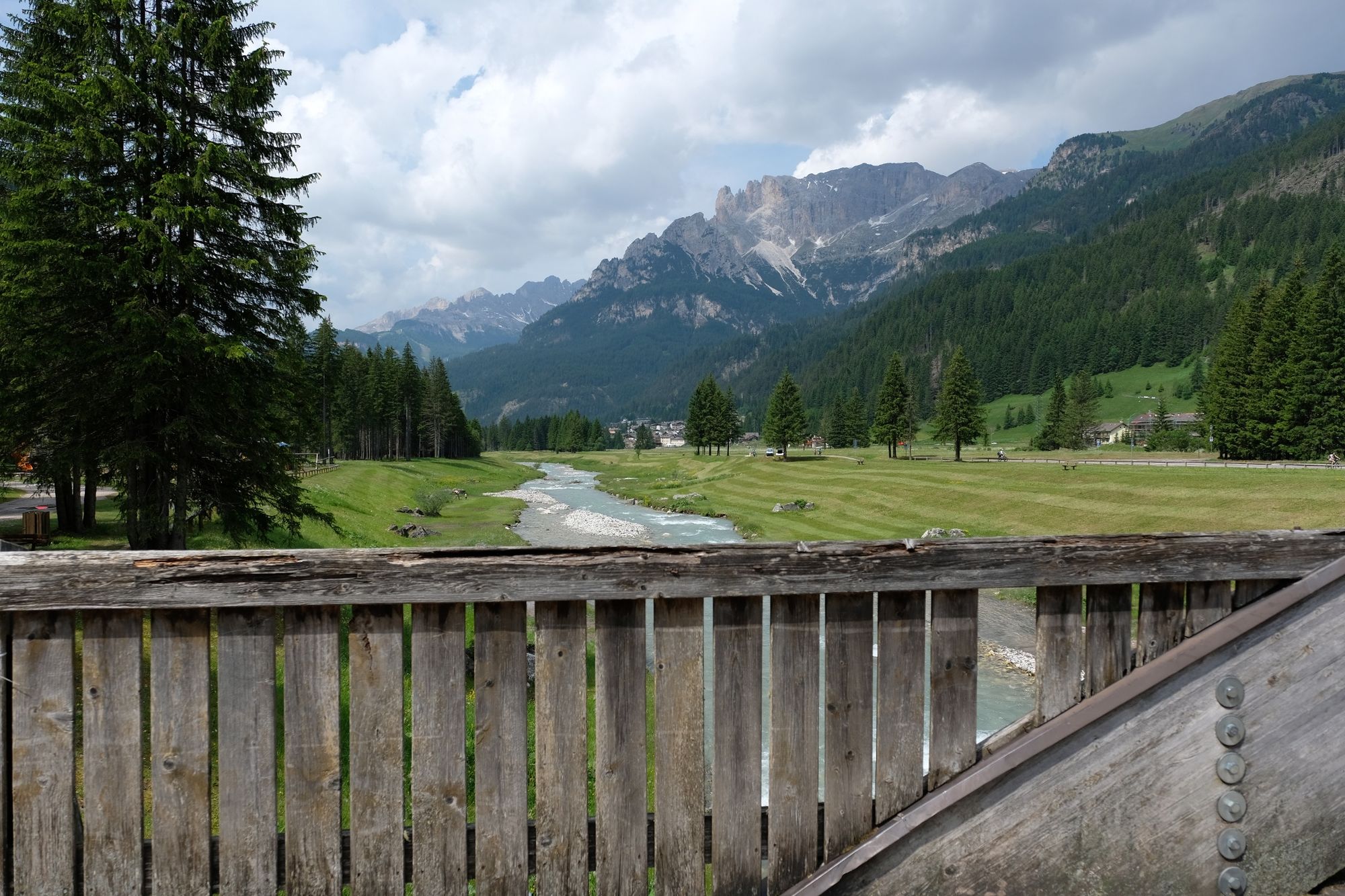
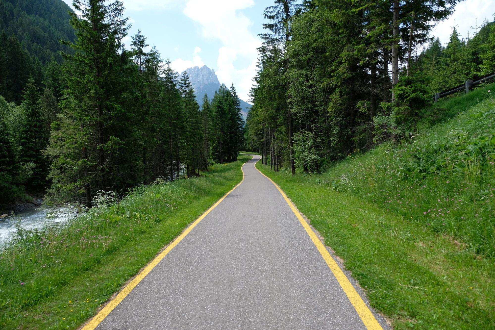
Crossing these valleys on the cycle path that links them together and, for the most part, runs along the Avisio river that rises right on the Marmolada ‒ the Snow Queen ‒ you can admire the jagged Dolomite peaks, first of the Catinaccio and then of the Latemar mountain ranges, or places which have made history in the sporting world, like the ski centre featuring ski jumps near Predazzo and the Centro di Fondo del Lago di Tesero (cross-country skiing centre), which hosted the Nordic Skiing World Championships in 1991, 2003 and 2013.
Finally, near Cavalese, in the small village of Cascata, don’t miss the 25-metre high waterfall that creates a truly magical atmosphere.
Taking the route from Val di Fassa towards Valle di Fiemme allows you to avoid cycling up steep gradients, however, be careful when you ride downhill. For your return trip, look at this page to book the shuttle bus service.
Along the route there are some refreshment points like the Moena and Predazzo “bicigrills”.
Leaving behind you the majestic peaks of the Dolomites, at the bottom of the Val di Fassa, you can take the cycle trail that skirts beautiful villages along the valley floor ‒ featuring lovely bell towers ‒ and travel through lush green pastures and woods that surround them: Fontanzazzo, Mazzin and Sen Jan di Fassa, which was recently awarded the title of one of the most beautiful villages in Italy.
Not to mention the larch and fir woods which, despite the devastating Vaia storm at the end of 2018, blanket the slopes of the mountains and have an essential role in preserving the environment.
Crossing these valleys on the cycle path that links them together and, for the most part, runs along the Avisio river that rises right on the Marmolada ‒ the Snow Queen ‒ you can admire the jagged Dolomite peaks, first of the Catinaccio and then of the Latemar mountain ranges, or places which have made history in the sporting world, like the ski centre featuring ski jumps near Predazzo and the Centro di Fondo del Lago di Tesero (cross-country skiing centre), which hosted the Nordic Skiing World Championships in 1991, 2003 and 2013.
Finally, near Cavalese, in the small village of Cascata, don’t miss the 25-metre high waterfall that creates a truly magical atmosphere.
Taking the route from Val di Fassa towards Valle di Fiemme allows you to avoid cycling up steep gradients, however, be careful when you ride downhill. For your return trip, look at this page to book the shuttle bus service.
Along the route there are some refreshment points like the Moena and Predazzo “bicigrills”.
- Highest point
- 1,385 m
- Endpoint
-
Fontanazzo
- Height profile
-
 © outdooractive.com
 - Safety instructions
-
Please note that the practicability of the itineraries in a mountain environment is strictly linked to the contingent conditions and is therefore influenced by natural phenomena, environmental changes and weather conditions. For this reason, the information contained in this page may have changed. Before leaving for a tour, make sure the path you will approach is still accessible by contacting the owner of the mountain hut, the alpine guides or the visitor centres of the nature parks, the info offices of the local tourist board.
- Directions
-
Molina di Fiemme is comfortable to reach from south and from north along National road 12 del Brennero, or motorway A22 (exit at Egna/Ora, distance 24 Km, Trento Nord, or San Michele), continuing along National road SS 48 delle Dolomiti (from Egna/Ora) to 1 Km before Cavalese, or following SS 612 della Val di Cembra (from Lavis).

- Author
-
The tour Val di Fiemme bike path is used by outdooractive.com provided.