
- Brief description
-
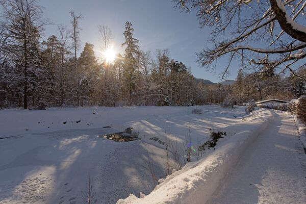
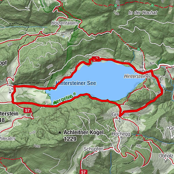
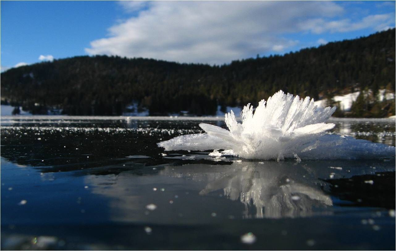
Beautiful circular walk around the frozen Lake Hinterstein.
- Difficulty
-
medium
- Rating
-
- Starting point
-
Hiking starting point Seestüberl, Scheffau (890 m)
- Route
-
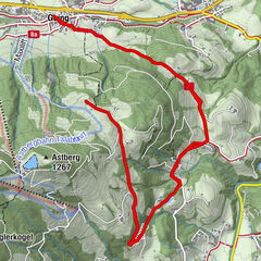
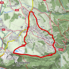
BichlSeestüberl0.1 kmJausenstation Goingstätt1.6 kmGoingstätt1.7 kmPension Maier2.3 kmGreidern4.4 kmMarienkapelle Gut Alte Mühle5.3 kmBichl5.5 km
- Best season
-
AugSepOctNovDecJanFebMarAprMayJunJul
- Description
-
The start of this circular walk is on the eastern shore at Café Seestüberl. Follow the paved road no. 822 along the northern shore to Pension Maier. Shortly before the pension Maier you turn left and follow the signs to Seestüberl (path no. 822) until you come to the forest path on the south bank of the lake. Now it goes through the forest slightly up- and downhill (please note: this section will not be cleared in winter and can be difficult to walk on snow) to the intersection with the signpost "Hintersteiner See South". Here you turn right and follow the road to the farm Greidern and continue towards Seestüberl until you arrive the starting point again.
At this roundhike you will find several cozy restaurants for a break.
In spring, when the snow on the sunny side of Scheffau has already melted, you can admire some snow roses!
- Directions
-
This long, leisurely winter hike takes you close to nature. Start the day at the frozen and glistening Hintersteiner See lake. The hike begins on the northern bank of the lake at the Seestüberl restaurant. Walk along the lake until you reach the Pension Maier guesthouse. From here, climb to the Walleralm. Although the Alpine winter trail is inspected, it is only partially cleared, meaning that much of the landscape is completely unspoilt. In the event of heavy snowfall, the trail may only be accessible with snowshoes. In spring, when the snow on the sunny side of Scheffau has already melted, you can wonder at countless Christmas roses. Although the Walleralm mountain inn in the idyllic Alpine village at 1,200 metres is closed in winter, the “Almbankerl” benches are still perfect for a spot of sunbathing. Return to Seestüberl restaurant through the forest by heading in the direction of the Hintersteiner See.
You can also return via the Rehbachklamm gorge or the Seebachgraben ditch.
What to look out for along the way:
Several cosy refreshment stops can be found on the route beside the Hintersteiner See. These make up for the fact that the Walleralm mountain hut is closed in winter and only offers sunny benches to sit on!
The trail is a great place for stomping through fresh snow! - Highest point
- 923 m
- Endpoint
-
Hiking starting point Seestüberl, Scheffau (890 m)
- Height profile
-

- Equipment
-
Sturdy high mountaineering boots with anti-slip treaded soles (waterproof), weather-appropriate outdoor gear, sun protection, waterproofs, cold protection (hat, gloves), sufficient food and hot drinks, hiking poles (height adjustable) if required, mobile phone, plastic bag for waste, hiking map, route description and information materials (GPX track), ID card, cash
- Directions
-
Heading from Wörgl, Kufstein or St. Johann on the B178 road, take the exit to Scheffau and drive through the village as you continue in the direction of the Hintersteiner See. The hiking starting point and the pay & display car park are located next to the Seestüberl restaurant on the eastern bank of the lake.
- Public transportation
- Parking
-
Car park next to Seestüberl restaurant, Scheffau (889 m) – pay & display


- Author
-
The tour Winter circular walk Hintersteiner See is used by outdooractive.com provided.