
- Brief description
-
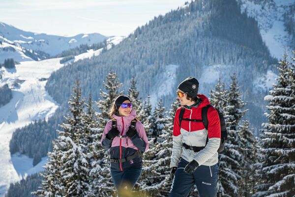
A leisurely circular trail along the sunny side of Ellmau. This is a lovely walk along the picturesque Kaiserloipe with views of the majestic mountains. An easy hike for the whole family.
- Difficulty
-
easy
- Rating
-
- Starting point
-
Hiking starting point Tourist Info, Ellmau (800 m)
- Route
-
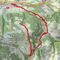
Steinerner Tisch (772 m)4.4 kmEllmau5.8 km
- Best season
-
AugSepOctNovDecJanFebMarAprMayJunJul
- Description
-
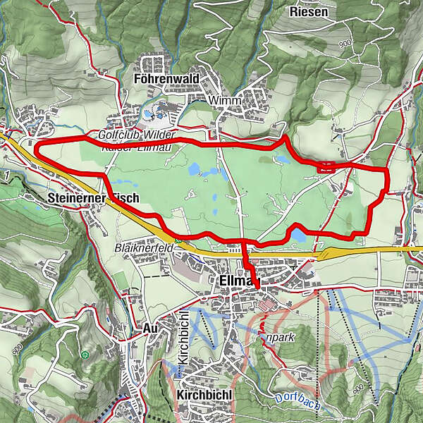
This flat winter hiking route at the foot of the Wilder Kaiser runs parallel to the Kaiserloipe cross-country trail, which fully deserves it's majestic name. The trail is perfect for families with sledges. Start in the village and cross the road heading north at the Ellmau central car park and you're at the hike starting point, which is a popular golf green in the summer. Turn right and the route leads you on a comfortable hike to the two farmhouses near the Hausbach stream. You walk along the edge of the forest on the groomed winter hiking trail back to the KaiserBad and from there follow the signs to Auwald till you reach the beautiful old farmhouse standing alone in the meadow. Once past that, it's back towards the village. You can take a short break or enjoy the fantastic views of Ellmau village or the Kaisergebirge mountain range on one of the many benches along the winter hiking trail.
What to look out for along the way:
You can make for any of the numerous sunny benches on the circular walk: they all offer magnificent views.
If any members of your party are cross-country skiers, they can accompany you for some of the route before rejoining you for a bite to eat. - Directions
-
This flat winter hiking trail at the foot of the Wilder Kaiser runs parallel to the Kaiserloipe cross-country trail, which fully deserves its majestic name. The trail is perfect for families with sledges. Start in the village and follow the signs to the Golfplatz. You’re already on the snowfield, which is a popular golf course in summer. You turn right and follow the gentle trail up to the two farmhouses by the Hausbach stream. You walk along the edge of the forest on the groomed snow meadow back to the KaiserBad and from there follow the signs to Auwald till you come to the beautiful old farm standing alone in the meadow. You pass this and head uphill again following the signs to Dorf up to the Golfrestaurant. From here it’s a stone’s throw back to the centre of Ellmau.
This circuit is about 6 km long and takes a good hour. There are numerous benches along the Sonnenringweg trail where you can take a short break and enjoy the wonderful views of Ellmau village and the Kaisergebirge mountain range.
What to look out for along the way:
You can make for any of the numerous sunny benches on the circular walk: they all offer magnificent views.
If any members of your party are cross-country skiers, they can accompany you for some of the route before rejoining you for a bite to eat. - Highest point
- 807 m
- Endpoint
-
Hiking starting point Tourist Info, Ellmau (800 m)
- Height profile
-

- Equipment
-
Sturdy high mountaineering boots with anti-slip treaded soles (waterproof), weather-appropriate outdoor gear (breathable) incl. a change of clothes, sun protection (sunglasses, sun cream, lip protection, headgear), waterproofs (rain jacket/poncho, pocket umbrella, rucksack protector), cold protection (hat, gloves), sufficient food and hot drinks, hiking poles (height adjustable) if required, first aid kit incl. rescue blanket and bivouac sack, mobile phone with fully charged battery, headlamp, plastic bag for waste, hiking map, route description and information materials (GPX track), ID card, insurance card, cash.
- Directions
-
Heading from Wörgl or Kufstein on the B178 road, take the first exit to Ellmau and then take the first exit at the roundabout. Drive along the bypass, then turn towards the centre of Ellmau when you reach the end (between MPreis and the Sporthotel). Continue straight on until you see the Tourist Info on the right-hand side (short-stay parking zone). The hiking starting point is located opposite this on the left-hand side. Heading from St. Johann on the B178 road, take the first exit to Ellmau and drive straight on through the town until you see the Tourist Info on the right-hand side (short-stay parking zone). The hiking starting point is located opposite this on the left-hand side.
- Public transportation
- Parking
-
Public car parks in Ellmau centre or west - for free.
- Author
-
The tour Wilder Kaiser circuit is used by outdooractive.com provided.


-
Wilder Kaiser
189
-
Ellmau
87