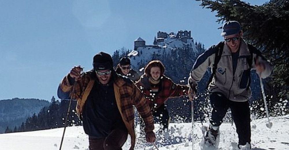
© Panoramahotel Talhof - Tanja Weirather

- Brief description
-
Die Wanderung führt Sie durch die Ortschaften am Fuße der Burgruine Ehrenberg
- Difficulty
-
easy
- Rating
-
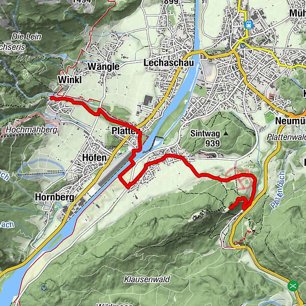
- Route
-
Holz0.1 kmWinkl0.3 kmPlatten1.5 kmGraben1.6 km
- Best season
-
AugSepOctNovDecJanFebMarAprMayJunJul
- Highest point
- 1,068 m
- Endpoint
-
Ruine Ehrenberg
- Height profile
-


- Author
-
The tour Winterwanderung zur Ruine Ehrenberg is used by outdooractive.com provided.
GPS Downloads


General info
Insider tip
A lot of view
Other tours in the regions
-
Allgäu
165
-
Naturparkregion Reutte
140
-
Ehenbichl
73