- Brief description
-
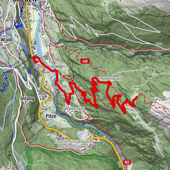
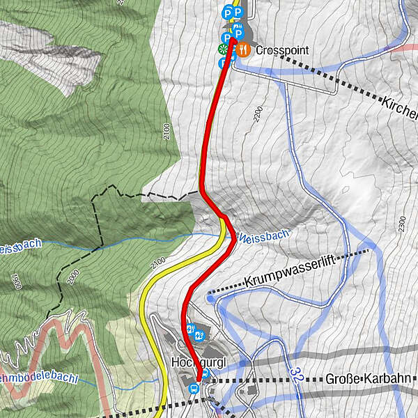
HOCHGURGL -> TOP MOUNTAIN CROSSPOINT
- Difficulty
-
easy
- Rating
-
- Starting point
-
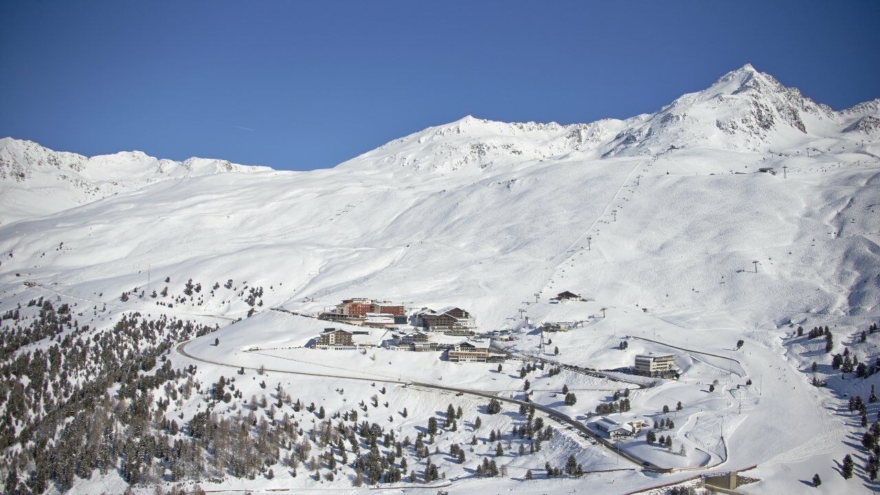
Hochgurgl center
- Route
-
CrosspointHochgurgl (2,150 m)1.1 km
- Best season
-
AugSepOctNovDecJanFebMarAprMayJunJul
- Description
-
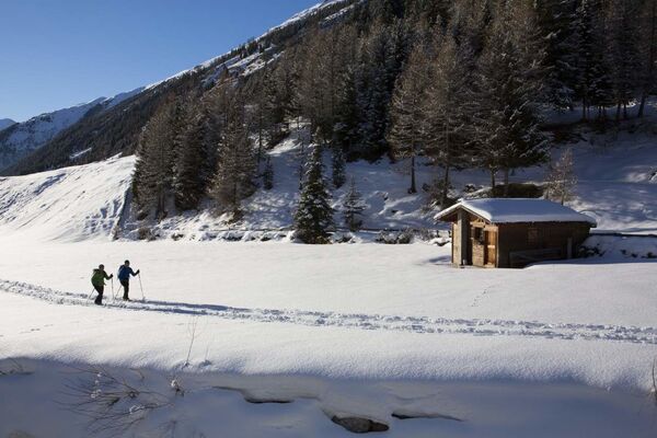
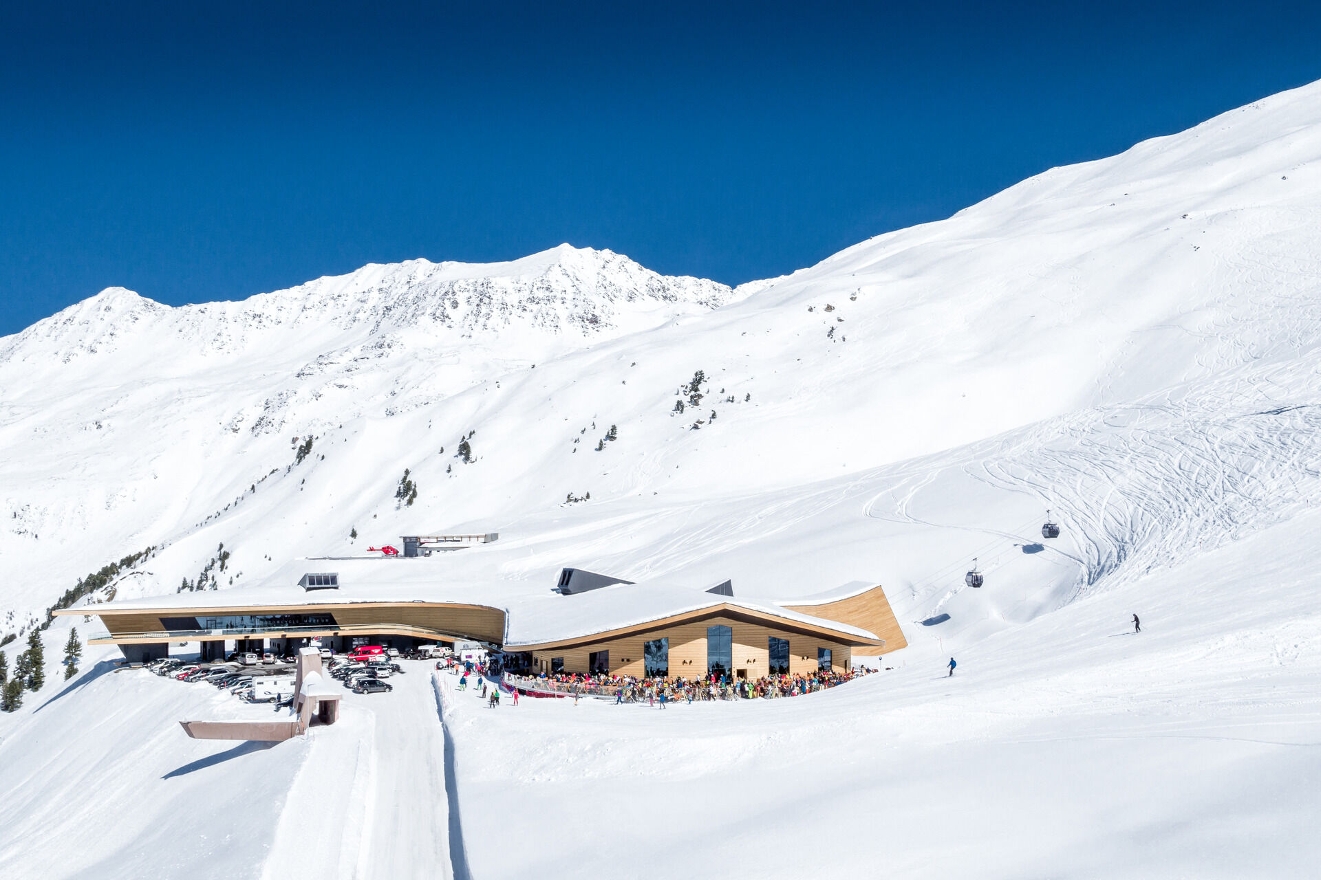
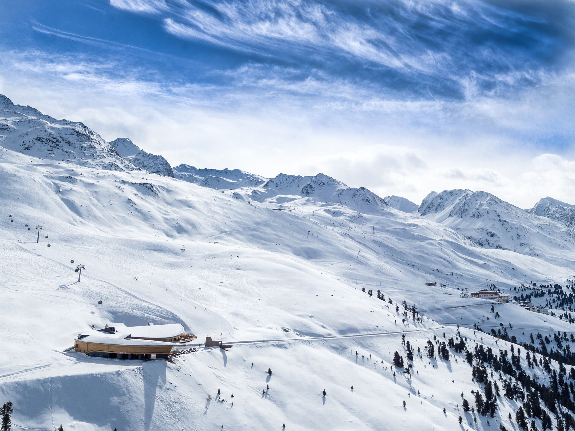
From Hochgurgl a wide trail leads along the federal road towards the Top Mountain Crosspoint. The building hosts the toll booth of the Timmelsjoch High Alpine Pass Road, the Kirchenkar mountain gondola, a restaurant with table service and Europe´s highest motorbike exhibition - the unrivaled Top Mountain Motorcycle Museum.
Along the walking route you enjoy breathtaking views of the snow-topped Ötztal mountain world.
- Directions
-
From Hochgurgl a wide trail leads along the federal road towards the Top Mountain Crosspoint. The building hosts the toll booth of the Timmelsjoch High Alpine Pass Road, the Kirchenkar mountain gondola, a restaurant with table service and Europe´s highest motorbike exhibition - the unrivaled Top Mountain Motorcycle Museum.
Along the walking route you enjoy breathtaking views of the snow-topped Ötztal mountain world.
- Highest point
- 2,167 m
- Endpoint
-
Top Mountain Crosspoint
- Height profile
-

- Equipment
-
Appropriate equipment such as breathable suitable outdoor clothes for the weather, is for all hikes and tours necessary.
- Safety instructions
-
Please pay attention to the current weather- & avalanche report: https://www.oetztal.com/de/ & https://lawinen.report/bulletin/latest.
The Ötztal Tourismus team will be happy to inform you personally about the nature of the winter hiking trails.
Oetztal tourism: T +43 5 72 00 100 | gurgl@oetztal.com
- Additional information
-
More details about winter hiking in Ötztal: www.oetztal.com/winterwandern
- Directions
-
The car drive to the Ötztal valley. Situated in Tirol, the Ötztal valley set off in southerly direction and is the longest side valley in the Eastern Alps. The journey with the car leads you through the Inntal valley to the entrance of the valley and further on through the valley. Among the toll motorways you can also use the country roads. A route planner will show you the easiest and most convenient way: https://www.google.at/maps.
- Public transportation
-
Travel safe and comfortable with the train to the Ötztal Bahnhof train station. Last stop and exit point is the train station Ötztal Bahnhof. Afterwards you can travel smoothly and quick with the public transport or out local taxi companies through the valley to your desired destination. Please find the current bus timetable here: http://fahrplan.vvt.at
- Parking
-
The following parking facilities are available in Gurgl:
- Parking garage (center of Obergurgl), chargeable | € 2,00/hour
- Parking garage - bottom station Festkogl, chargeable | € 2,00/hour
- Parking Hochgurglbahn valley station, free of charge - no parking at night
- Parking Top Mountain Crosspoint, free of charge
- Parking Hochgurgl, free of charge (very small parking)
- Author
-
The tour Hochgurgl - Top Mountain Crosspoint 1 is used by outdooractive.com provided.


General info
-
Meraner Land
104
-
Ötztal
89
-
Obergurgl - Hochgurgl
20