- Brief description
-
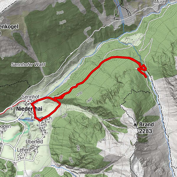
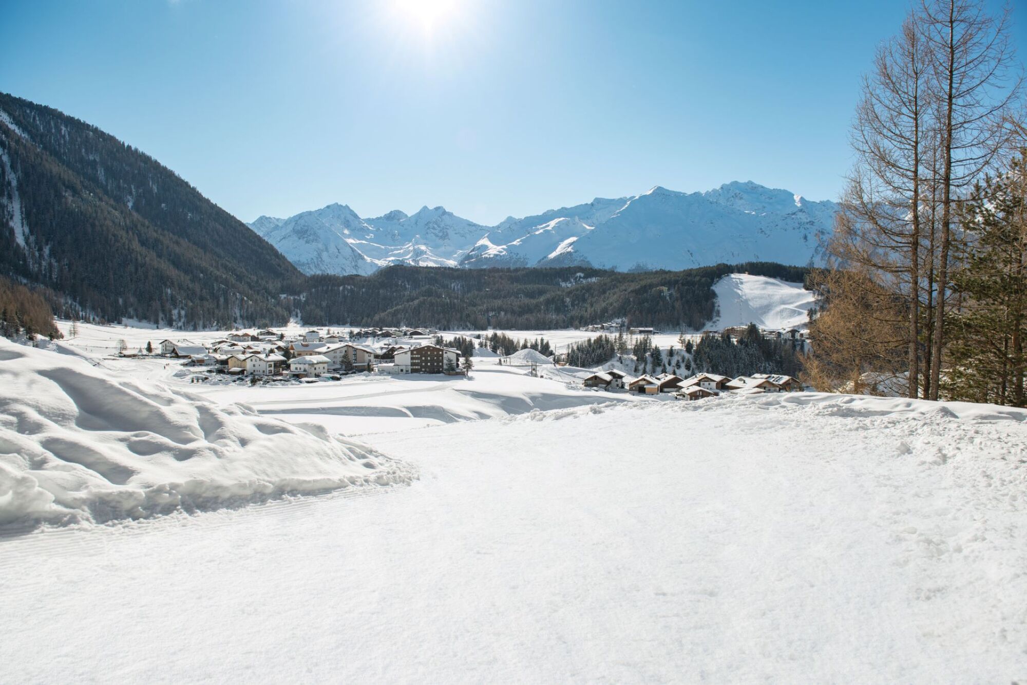
CAR PARK SENNHOF->Grastalweg->hunting lodge->CAR PARK SENNHOF
- Difficulty
-
medium
- Rating
-
- Starting point
-
Car park Sennhof
- Route
-
NiederthaiSennhofEnnebach4.9 kmNiederthai5.1 kmSennhof5.2 km
- Best season
-
AugSepOctNovDecJanFebMarAprMayJunJul
- Description
-
From the car park Sennhof (next to the information office) you follow the wide winter hiking trail towards Hotel Falknerhof until you reach Grastalweg trail which takes you into Horlachtal side valley to the left. Follow Grastalweg until you get to the Grastalsee branch-off (shortcut). Then you climb on a steeply rising, groomed ski mountaineering route to Grastal in the direction of lake Grastal (signposted). If you prefer a less steep ascent you can continue on the regular trail to Grastalfeld meadow and ascend on the forest trail into Grastal to the right. The shortcut leads you back to a wide trail after about 20 minutes walking - continuing up to the hunting lodge. Then you descend back to Grastalfeld on the normal forest trail and return to Niederthai.
- Directions
-
From the car park you follow the wide winter hiking trail towards Hotel Falknerhof until you reach Grastalweg trail which takes you into Horlachtal side valley to the left. Follow Grastalweg until you get to the Grastalsee branch-off (shortcut). Then you climb on a steeply rising, groomed ski mountaineering route to Grastal in the direction of lake Grastal (signposted). If you prefer a less steep ascent you can continue on the regular trail to Grastalfeld meadow and ascend on the forest trail into Grastal to the right. The shortcut leads you back to a wide trail after about 20 minutes walking - continuing up to the hunting lodge. Then you descend back to Grastalfeld on the normal forest trail and return to Niederthai.
- Highest point
- 1,907 m
- Endpoint
-
Car park Sennhof
- Height profile
-

- Equipment
-
Appropriate equipment such as breathable suitable outdoor clothes for the weather, wind-, rain-, snow- and sun protection, hat and gloves is for all hikes and tours necessary. Please bring a first-aid box, a mobile phone, a walking map and if there is no hut on the way a snack and enough to drink.
- Safety instructions
- Additional information
- Directions
-
The car drive to the Ötztal valley. Situated in Tirol, the Ötztal valley set off in southerly direction and is the longest side valley in the Eastern Alps. The journey with the car leads you through the Inntal valley to the entrance of the vallly and further on through the valley. Among the toll motorways you can also use the country roads. A route planner will show you the easiest and most convenient way: https://www.google.at/maps.
- Public transportation
-
Travel safe and comfortable with the train to the Ötztal Bahnhof train station. Last stop and exit point is the train station Ötztal Bahnhof. Afterwards you can travel smoothly and quick with the public transport or out local taxi companies through the valley to your desired destination. Please find the current bus timetable here: http://fahrplan.vvt.at
- Parking
-
The following parking facilities are available in Niederthai:
- car park Sennhof | chargeable € 5,00 per day from 7:00 am to 6:30 pm, more day ticket possible. The car park for people with handicap is free - please deposit your handicap ID apparent in your car. Buses park for free


- Author
-
The tour Grastalweg - Jagdhütte - Niederthai 323 is used by outdooractive.com provided.


General info
-
Ötztal
89
-
Niederthai
53