- Brief description
-
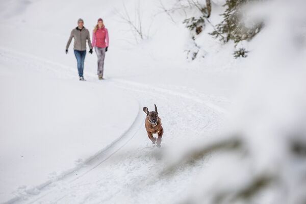
Explore the popular path past the TV backdrop on snowshoes.
- Difficulty
-
medium
- Rating
-
- Starting point
-
Cable car valley station, Söll (725 m)
- Route
-
Stampfanger0.3 kmStampfangerkapelle0.5 kmStampfangerkapelle6.5 kmStampfanger6.7 kmBromberg9.6 kmAlpengasthof Gruberhof9.8 km
- Best season
-
AugSepOctNovDecJanFebMarAprMayJunJul
- Description
-
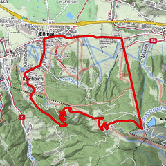
From the Lifthaupt parking lot (just before the lift valley station, Stampfanger 21) you go over a forest path to the Stampfangerkapelle. From there it goes left leading along the Stampfangerbaches up to the Höckenhof / direction Gruberhof. At the Höckenhof you hike down and past the Talern farm in the direction of Köpfing. Downhill it goes across field until you are back at the starting point (ideally follow the ski touring trails or otherwise along the road, then better without the snowshoes).
Alternatively, at the Höckenhof you can also follow the Bromberg Straße right up towards the Alpengasthof Gruberhof and treat yourself a stop there. Then go the way back to the Höckenhof to reconnect with the original tour. The additional detour extends the walking time by approx. 1h15.
- Highest point
- 1,174 m
- Endpoint
-
Cable car valley station, Söll (725 m)
- Height profile
-

- Equipment
-
Snowshoes appropriate for your weight and height, sturdy high mountaineering boots with anti-slip treaded soles (waterproof), weather-appropriate outdoor gear (breathable) incl. a change of clothes, sun protection (sunglasses, sun cream, lip protection, headgear), waterproofs (rain jacket/poncho, pocket umbrella, rucksack protector), cold protection (hat, gloves), sufficient food and hot drinks, hiking poles (height adjustable) if required, first aid kit incl. rescue blanket and bivouac sack, mobile phone with fully charged battery, headlamp, plastic bag for waste, hiking map, route description and information materials (GPX track), ID card, insurance card, cash
- Directions
-
Heading from Wörgl, Kufstein or St. Johann on the B178 road, take the exit to Söll and then take the exit to Hexenwasser theme park (SkiWelt cable car valley station) at the roundabout. Before reaching the cable car valley station, turn left and drive across the bridge. You will then come to the hiking starting point and the cable car parking facilities.
- Public transportation
-
ski bus stop "Lift/gondola station"
- Parking
-
Cable car valley station, Söll (725 m) – free


- Author
-
The tour snowshoe hiking "Bergdoktor" is used by outdooractive.com provided.


-
Region Hohe Salve
175
-
Söll
69