- Brief description
-
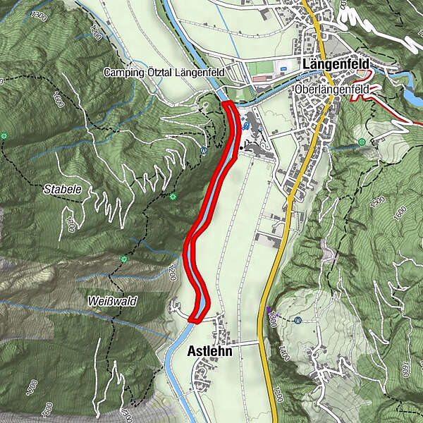
LÄNGENFELD -> Bridge -> Astlehn -> LÄNGENFELD
- Difficulty
-
easy
- Rating
-
- Starting point
-
Bridge near campsite
- Route
-
Astlehn1.5 km
- Best season
-
AugSepOctNovDecJanFebMarAprMayJunJul
- Description
-
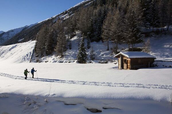
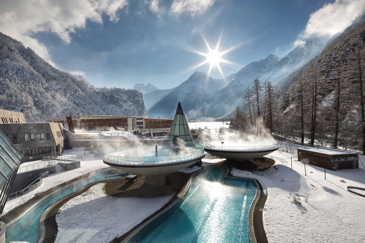
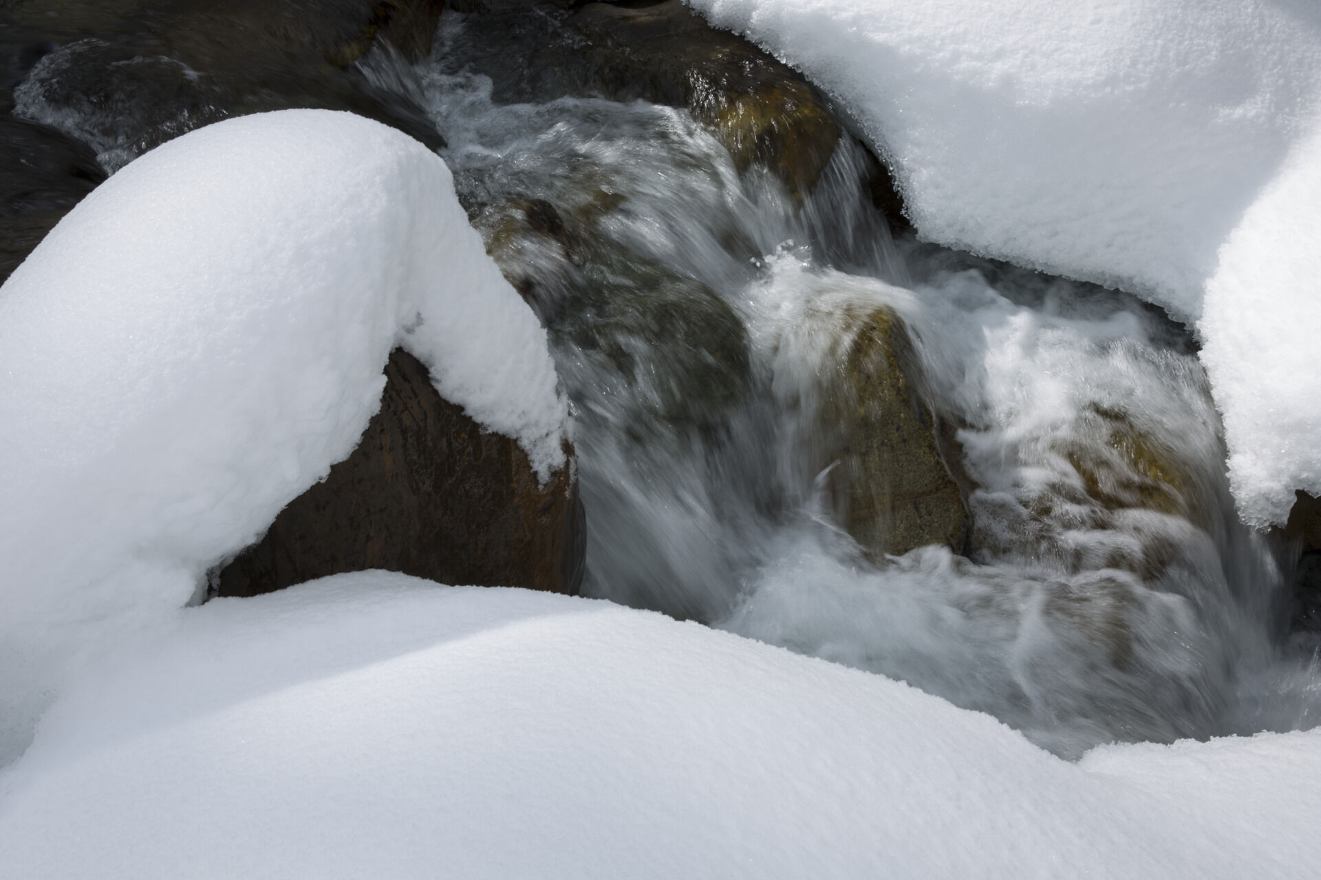
Otherwise, the water splashes calmly. This can be enjoyed to the full in this round. The bridge which spans the Ötztaler Ache near the campsite is the starting point. Immediately follow the river up to Astlehn. Through the trees one always gets a glimpse of the Ötztal mountains as well as of the village. Once in Astlehn, another bridge is crossed. The way back is on the opposite side of the river. You can certainly watch some cross-country skiers while practicing Nordic sports. From far away the thermal bath Aqua Dome is visible which almost reaches the starting point.
- Directions
-
From Längenfeld (near the campsite / Aqua Dome), the Ache leads up the winter hiking trail up to the hamlet of Astlehn. The way back is on the other side of the river.
- Highest point
- 1,179 m
- Endpoint
-
at the starting point
- Height profile
-

- Equipment
-
Appropriate equipment such as breathable suitable outdoor clothes for the weather, is for all hikes and tours necessary.
- Safety instructions
-
Please pay attention to the current weather- & avalanche report: https://www.oetztal.com/de/ & https://lawinen.report/bulletin/latest
The Ötztal Tourismus team will be happy to inform you personally about the nature of the winter hiking trails.
Oetztal tourism T +43 5 72 00 300 - info@laengenfeld.com
- Tips
-
A nice walk before enjoying the wonderfully warm water in the Aqua Dome.
- Additional information
-
More details about winter hiking in Ötztal:
https://www.oetztal.com/winter-hiking
- Directions
-
The car drive to the Ötztal valley. Situated in Tirol, the Ötztal valley set off in southerly direction and is the
longest side valley in the Eastern Alps. The journey with the car leads you through the Inntal valley to the
entrance of the valley and further on through the valley. Among the toll motorways you can also use the country
roads. A route planner will show you the easiest and most convenient way: https://www.google.at/maps
- Public transportation
-
Travel safe and comfortable with the train to the Ötztal Bahnhof train station. Last stop and exit point is the
train station Ötztal Bahnhof. Afterwards you can travel smoothly and quick with the public transport or our local
taxi companies through the valley to your desired destination. Please find the current bus timetable here:
http://fahrplan.vvt.at
- Parking
-
The following parking spaces are available:
Sportzentrum Längenfeld - free
- Author
-
The tour Thermenrunde - Längenfeld 201 is used by outdooractive.com provided.