- Brief description
-
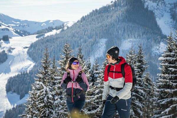
Climb to the best viewpoint in the mountains, where the Wilder Kaiser is within touching distance.
- Difficulty
-
medium
- Rating
-
- Starting point
-
Hiking starting point Going center (former tourist information Going) (764 m)
- Route
-
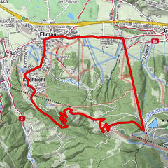
Going0.1 kmGoing10.6 km
- Best season
-
AugSepOctNovDecJanFebMarAprMayJunJul
- Description
-
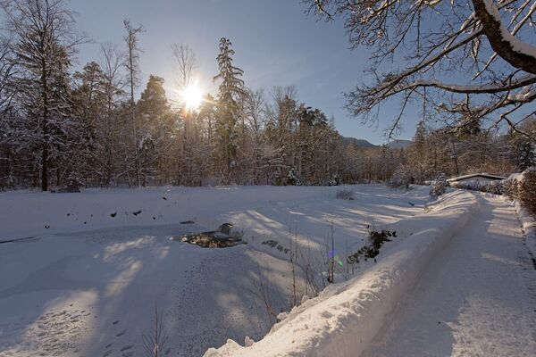
This exciting yet idyllic winter hike starts at the village square in Going, which is a famous filming location for the German-Austrian TV series “Der Bergdoktor” (The Mountain Doctor). Enjoy the view of the picturesque Wilder Kaiser, a towering sight opposite the church with its rugged and prominent peaks. If you exit the square to the east, you will come directly to Söllnerweg. This merges into a footpath that slowly leads you up the Astberg mountain. Can you see the snow crystals glistening? Do you feel the rays of sunshine tickling your skin? And aside from the sound of your shoes crunching through the snow, can you hear anything except the silence of snow-covered nature? On the way, you will pass the Gabelhof and other rustic farms before reaching the Hollenauer Kreuz intersection. Continue on through the wintry forest where the sun shines between the branches. At the Plattenlake keep following the signposts in the direction of the Hollenauer Kreuz and enjoy the sense of calm as you make your way towards your destination.
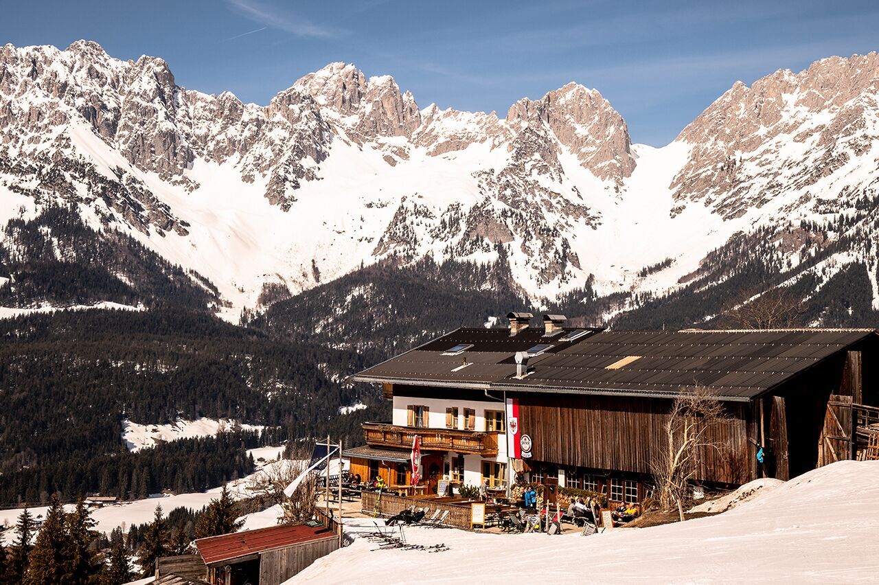
On reaching your destination at 1,030 metres, you will be rewarded with the best natural viewpoint for marvelling at the Wilder Kaiser mountain range, which is within touching distance. Also, don’t miss out on sampling the delicious homemade apple strudel at the Hollenauer Kreuz refreshment stop. It tastes even better from the comfort of a deckchair while soaking up the sun! Tip: as the ski slope runs right past the building, it is a great meeting place for skiers and winter hikers. - Highest point
- 1,029 m
- Endpoint
-
Hiking starting point Going center (former tourist information Going) (764 m)
- Height profile
-

- Equipment
-
Sturdy high mountaineering boots with anti-slip treaded soles (waterproof), weather-appropriate outdoor gear (breathable) incl. a change of clothes, sun protection (sunglasses, sun cream, lip protection, headgear), waterproofs (rain jacket/poncho, pocket umbrella, rucksack protector), cold protection (hat, gloves), sufficient food and hot drinks, hiking poles (height adjustable) if required, mobile phone with fully charged battery, headlamp, plastic bag for waste, hiking map, route description and information materials (GPX track), ID card, insurance card, cash
- Directions
-
Heading from Wörgl, Kufstein or St. Johann on the B178 road, turn off the road in Going and park at the public car park next to the fire station (located east of the centre of the village).
- Public transportation
-
Skibus stop "Hotel Stanglwirt" or "Going Dorf" (depending on your tour start)
Postbus stop “Going Stanglwirt” or “Going Dorf”. (depending on your tour start)
More information at: www.wilderkaiser.info - Parking
-
Public car park center, Going (752 m) – for free


- Author
-
The tour Hollenauer Kreuz winter hiking route is used by outdooractive.com provided.


General info
-
Wilder Kaiser
190
-
Going
88